 Wow – another month has rushed on by. Where does the time go? We rush forward in the present towards the future as we leave the past in our wake. We must take care of what we leave in our wake.
Enough of the philosophy, just something to think about aside from the weather. I do know the older I get the faster the time rushes on and the harder it gets to keep up with it.
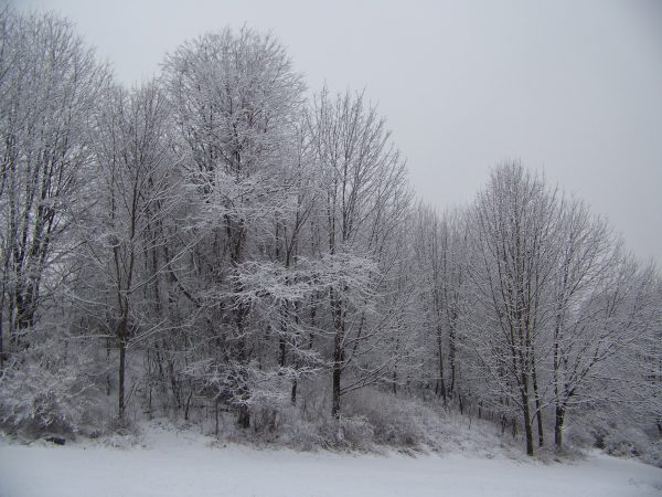
We are entering our final period of fall where we can enjoy the warmer than normal temperatures and sunny weather – I would say it is time to get those Christmas lights up outside if you haven’t done so yet. By the middle of next week it won’t be very pleasant unless you like the cold and snow.
The first significant lake effect will be taking hold of the lakeshore counties as the cold air comes pouring in. The snow accumulations will be dependent of wind direction – a westerly flow would bring the snow further inland. We will see if this pattern will hold through Christmas or the cold air will empty out of Canada then assume a more zonal pattern once again. For the near term low pressure moving across southern Canada will bring a cold front through Michigan with a few rain and snow showers this morning. These will end by afternoon with fair weather into the weekend.
Today: A chance of rain before 8am, then a chance of showers between 8am and 10am. Cloudy through mid morning, then gradual clearing, with a high near 47. South southwest wind 9 to 17 mph becoming west northwest in the afternoon. Winds could gust as high as 26 mph. Chance of precipitation is 50%.
Tonight: Partly cloudy, with a low around 31. West northwest wind 6 to 11 mph becoming light after midnight.
Friday: Mostly sunny, with a high near 46. Southwest wind 3 to 6 mph.
Friday Night: Mostly cloudy, with a low around 32. South wind 6 to 9 mph.
Saturday: Mostly sunny, with a high near 47. South wind 9 to 11 mph.
Saturday Night: Mostly clear, with a low around 32.
Sunday: Mostly sunny, with a high near 49.
Sunday Night: A chance of showers after 1am. Mostly cloudy, with a low around 38.
Monday: Showers likely, mainly before 1pm. Cloudy, with a high near 51.
Monday Night: Showers likely. Cloudy, with a low around 39.
Tuesday: A slight chance of showers. Mostly cloudy, with a high near 45.
Tuesday Night: A chance of snow showers. Mostly cloudy, with a low around 30.
Wednesday: A chance of snow showers. Mostly cloudy, with a high near 36.
…And now a look at our weekly past weather events…
November 26
1896: Record warm temperatures in the 60s occur across Lower Michigan. The warmth does not last long, though. A sharp cold front is followed by plunging temperatures for the end of the month. The high of 64 degrees at Lansing is followed by a low of 18 degrees on the next day, and a low of 8 degrees on November 30th.
1949: Lansing falls to 5 below zero, the lowest November temperature on record there.
November 27
1930: What a difference a week makes. After record highs in the 70s only a week before, temperatures plunge to record low levels with high temperatures only around 15 degrees during the day.
1989: Severe weather strikes Lower Michigan with downburst winds and tornadoes. A tornado did a quarter million dollars of damage as it cut a six mile path south of Portland in Ionia County. Another tornado caused minor damage over a three mile long path south of Durand in Shiawassee County.
November 28
1955: Bitterly cold arctic air is firmly entrenched across Lower Michigan. The high temperature at Lansing is only 15 degrees, after a morning low of 6. Meanwhile, a foot of lake effect snow piles up at Muskegon.
November 29
1929: A month after the great stock market crash, it is the temperature that crashes in Lower Michigan. Record morning cold in the single digits is followed by afternoon highs only in the 10 to 15 degree range.
 1960: A strong cold front moves through dropping temperatures dramatically and setting off lake effect snow showers. The temperature stays in the 20s during the day at Muskegon, after a high of 61 degrees the day before. The freighter Francisco Morazan (left) runs aground off South Manitou Island in northern Lake Michigan during a heavy lake effect snow squall. All aboard are rescued by the Coast Guard in near white-out conditions.
1998: Balmy weather prevails during the final days of November, with lows in the 50s and highs in the 60s. Record highs today include the 65 degrees at Muskegon, Lansing and Grand Rapids.
November 30
1958: November ends on a frigid note with lows in the single numbers and highs only in the lower 20s. From 6 to 10 inches of lake effect snow piles up near Lake Michigan.
1976: One of the coldest Novembers on record ends with a blast of arctic air that drops low temperatures near zero and keeps highs only in the teens. Big Rapids falls to one degree below zero and Grand Haven measures three inches of lake effect snow.
December 1
2006: A snow and ice storm strikes southwest Lower Michigan. From 6 to 12 inches of snow falls from Muskegon to Ludington, while an ice storm causes power outages and treacherous travel conditions from Kalamazoo to Lansing.
December 2
1976: One of the coldest winters of the 20th century gets off to an early start, continuing the persistently cold pattern that began during the autumn. Temperatures plunge to record lows of 11 degrees below zero at Grand Rapids and 2 below zero at Muskegon.
1982: Low temperatures on this day are only in the mid 50s across southwest Lower Michigan, the warmest on record for December. The afternoon temperatures are in the mid and upper 60s. Muskegon hits 64 degrees, a record high for the month of December there.
Latest GFS runs have backed off a little on the arctic air (at least from what it had been showing earlier in the week). You can see in the runs that the coldest air tries to push south to us but gets pushed back each time. Will be interesting to see how this battle plays out.
Right now, it’s looking like highs 25-35 for the coldest stretch. Colder than where we are now, but nothing extraordinary.
http://weather.unisys.com/gfs/loop/gfs_500p_loop.gif
you are showing the 500mb – here is the 2 meter
http://climate.cod.edu/data/forecast/animations/12Z-20171130_GFSMW_sfc_temp-0-384-30-200.gif
Seeing models saying now polar vortex is coming and with a warm lk SNOW OUT!! INDYDOG!!
Can you BINGO!!
http://www.instantweathermaps.com/GFS-php/showmap-conussfc.php?run=2017113018&time=PER&var=ASNOWI&hour=384
Climatology for today November 30th
Average H/L 30 year average 40/28. 120 year average 39.3/2705°
Record high 64° in 1998. The coldest maximum for the date 17° in 1896
Record low +6° in 1958. The warmest minimum 53° in 1913.
The most precip. 0.65” in 1940
The most snow fall 6.8” in 1940 and 1940 also had the most OTG with 14”
Last year the high was 50° and the low was 37°
Slim
Looks like a very pleasant and mild weekend upcoming! Still not seeing any big snow storms on the horizon. The current pattern remains dry.