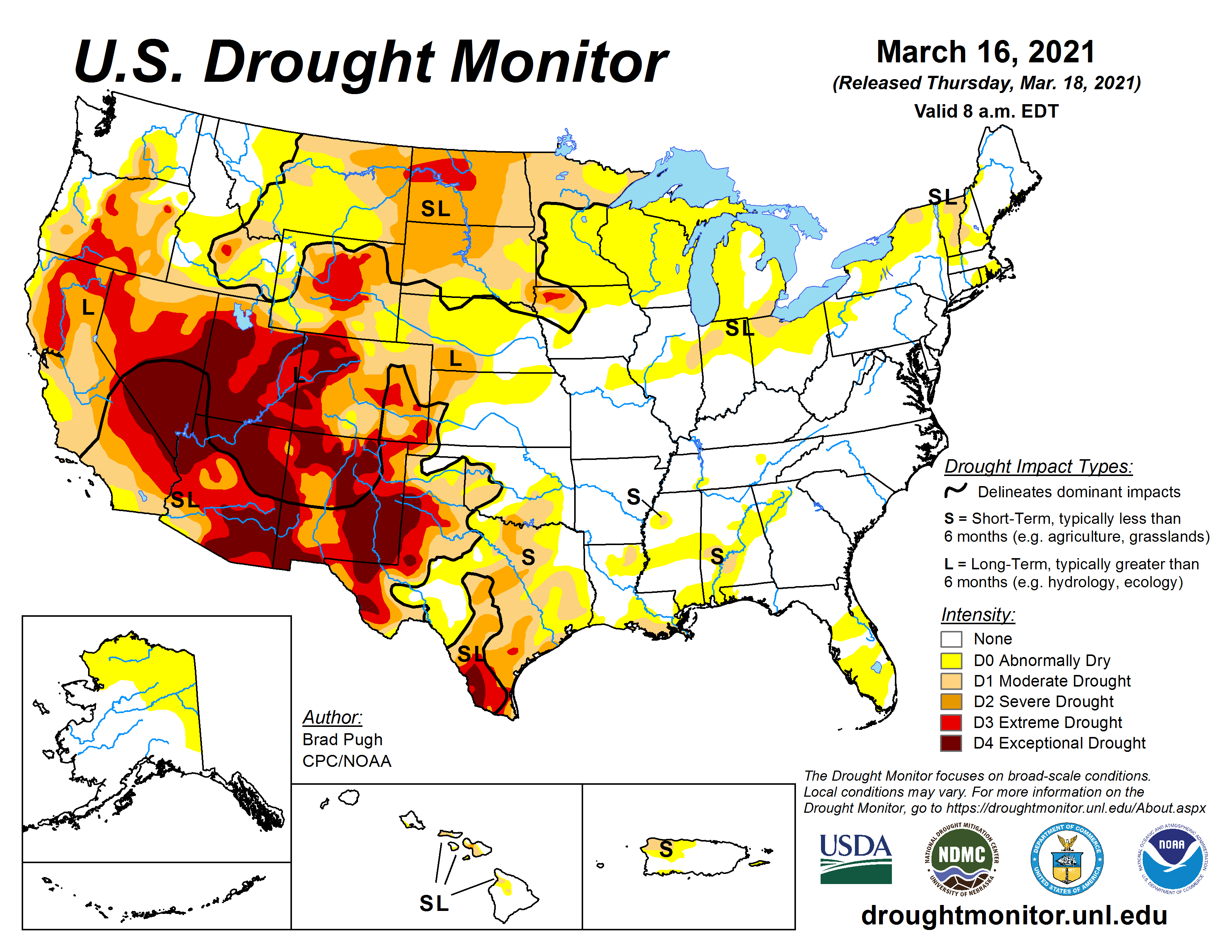
March so far has been warmer than normal, much sunnier than normal, and among the top 5 to 10 driest in the past 120 years of records at Grand Rapids, Lansing, Muskegon, and Kalamazoo. Many areas have seen only around a tenth of an inch of precipitation this month. Dry air and dead vegetation will increase the potential for fires to spread out of control. Nearly 2/3 of the U.S. has abnormally dry to drought conditions due to the lack of season snows and rain.
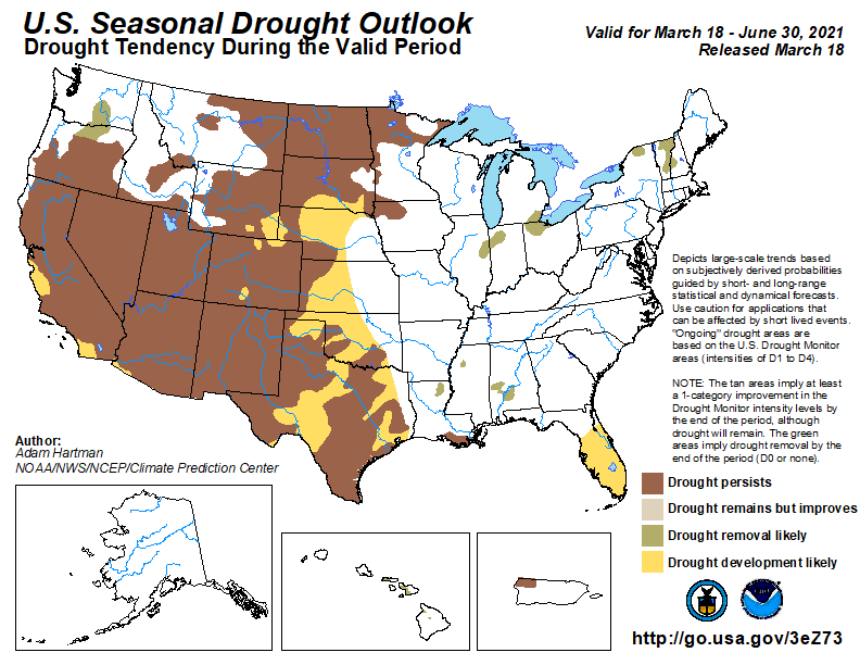
The CPC outlook through June suggests the dry conditions will persist out west. Most of the U.S. is predicted to have above-normal temps with equal chances of rain in the Great Lakes and Upper Midwest for April. I am not seeing any large patterns of persistent rain in the forecast which would make up for our precipitation deficit this month.
Forecast Discussion
-- Hot,dry and windy conditions will continue through Tuesday --

High pressure tends to breed consistency into forecast. The High
pressure ridge that has dominated the forecast will slowly shift
to the east through the day. While the high pressure will shift to
the east coast, it will continue to dominate the pattern over the
next few days. The warm temperatures will continue to increase
through Tuesday. Maximum temperatures are expected to be 15 to 20
degrees above normal today through Tuesday with highs in the 60s.

However due to the tightening gradient from an approaching
frontal system the winds from the south will increase as the day
continues. The warm air will erode any semblance of an inversion
and we could see wind gusts 20 to 25mph this afternoon. This warm
southerly flow will only aid to the warmer and drier conditions we
have seen the last few days. RH/s this afternoon will be in the
upper teens to low 20s. Tomorrow and Tuesday will bring more of
the same. The winds will shift to be more easterly by Tuesday.
However, the winds will still be strong. There is an elevated fire
danger through Tuesday due to these conditions.

-- A wetter pattern shift Tuesday night through rest of work week--

A deepening upper level low will move through the four corners
over the next few days. This low will couple with gulf moisture
and the warm temperatures to bring a decent chance for
precipitation through middle and latter portion of the week. The
dry air will stifle rain formation through daytime Tuesday.
However, there is good agreement in the models that overnight
Tuesday into Wednesday the atmosphere will be saturated enough for
showers Tuesday night into Wednesday. Amounts do not look all
that heavy and will likely be on the order of a quarter to a half
inch with the highest amounts towards Lake Michigan. Not out of
the question to maybe have an isolated rumble of thunder embedded
in the precipitation shield Tuesday evening given 850mb LI`s
dipping to around zero C, along with some CAPE present in the
system.

The afore mentioned system will signify a pattern shift as
another system will swing north through the area Thursday night
into Friday. This system looks to bring a more QPF to the region
as the ECMWF continues to bring the low right into Southwest
Michigan. There is some difference in timing among the models.
Today I will wash, polish, and wax the vehicles. It will gorgeous out today!
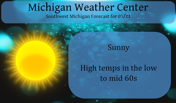
Like NWS said, the next few days will be hot by March standards. I love it!
With clear skies calm winds and low dew points the low dropped down to 25 here overnight. At this time it is clear and 35. On this date in 2012 the temperature soared up to 87 and that is not only the record for the date but also the warmest high of any day in March at Grand Rapids. It has reached 70 or better a total of 6 times on this date. The coldest low and maximum of 18/9 was set in 1965 and there was 9″ on snow on the ground that day.
Slim