Summer Solstice
Meteorological summer, which started June 1, is in full swing. But astronomical season starts June 21. Astronomical seasons are based on the Earth’s position in relation to the sun. The changes of seasons are marked by solstices or equinoxes.
The meteorological start of the season is based on annual temperature cycles and the 12-month calendar. This system is mainly used by meteorologists. The 2023 summer solstice is June 21 at 10:58 a.m. ET. The summer solstice is the longest day of the year, or the day with the most daylight. After the summer solstice, the hours of daylight start to decrease.
Here are some fun weather facts for the 1st day of summer in weather history.
1893 – On the first day of summer the temperature at Dodge City, KS, soared to 106 degrees during the midst of a blistering heat wave. The heat wave initiated a severe three year drought in the Central Plains Region. Ironically, at about the same time, heavy rains in the Mississippi Valley were causing the river to swell to its highest level of record at New Orleans, LA. (David Ludlum) (The Weather Channel)
1972 – Phoenix, AZ, was drenched with 1.64 inches of rain late on the 21st and early on the 22nd to easily surpass their previous June rainfall record of 0.95 inches. The total for the month was 1.70 inches. (The Weather Channel)
1988 – The first full day of summer was a torrid one, with afternoon highs of 100 degrees or above reported from the Northern and Central Plains to the Ohio Valley. Sixty-nine cities in the north central U.S. reported record high temperatures for the date. The high of 110 degrees at Sioux Falls, SD, was an all-time record for that location. Highs of 103 degrees at Des Moines, IA, 102 degrees at Fort Wayne, IN, 109 degrees at Huron, SD, 108 degrees at Sioux City, IA, and 101 degrees at South Bend IN were records for June. (The National Weather Summary)
1989 – The first day of summer heralded snow in the northern and central Rockies. In Colorado, 15 inches of snow was reported at the summit of Mount Evans and, in Wyoming, 18 inches was reported at Dickensen Park, west of Lander. Heavy rain continued in the eastern U.S. Huntsville, AL, reported a record 11.65 inches for the month, compared to the 0.17 inch rainfall total in June 1988. (The National Weather Summary) (Storm Data)
The official H/L at Grand Rapids yesterday was 76/55 there was 54% of possible sunshine. There were 0 HDD’s and 1 CDD’s The overnight low here in MBY so far is 50. For today the average H/L is 80/59 the record high of 95 was set in 1992 and 1994 (it should be noted that 1992 was a very cool summer so even in cool summers there can be some hot days) the record low of 40 was set in 1980. The record rain fall of 2.01” fell in 1996 and 1956. Since May 9th there has been just 0.24” of rain fall at Grand Rapids. 0.31” at Lansing, 0.54” at Holland and 0.57” at Muskegon. This is one of the driest end of Spring and start of summer in west Michigan history.
REA FORECAST DISCUSSION
NATIONAL WEATHER SERVICE GRAND RAPIDS MI
343 AM EDT SAT JUN 17 2023
LATEST UPDATE…
LONG TERM
SHORT TERM
(TODAY THROUGH SUNDAY)
ISSUED AT 320 AM EDT SAT JUN 17 2023
QUIET WEATHER THIS WEEKEND AS SURFACE HIGH AND UPPER RIDGING
BRINGS DRY WEATHER WITH LOW HUMIDITY. RH VALUES WILL DROP TO THE
LOWER TO MID 20S ACROSS THE NORTHERN ZONES WHERE DRY CONDITIONS IN
THE JACK PINE FOREST AREAS WILL HAVE TO BE MONITORED FOR FIRE
WEATHER POTENTIAL. FORTUNATELY WINDS WILL BE RELATIVELY LIGHT,
GENERALLY BELOW 10 KNOTS TODAY AND SUNDAY.
LONG TERM
(SUNDAY NIGHT THROUGH FRIDAY)
ISSUED AT 343 AM EDT SAT JUN 17 2023
THE 30-YEAR NORMAL HIGH/LOW TEMPERATURES FOR NEXT WEEK ARE NEAR
80/60 DEGREES, AND CONFIDENCE REMAINS HIGH THAT WARMER-THAN-NORMAL
CONDITIONS WILL BE PRESENT. HIGH TEMPERATURES MORE SO THAN LOWS,
DUE TO CONTINUED DRY AIR AND GROUND, PLUS MOSTLY CLEAR SKIES.
AFTERNOON RELATIVE HUMIDITY EARLY-MID NEXT WEEK WILL ALSO BE
ABNORMALLY LOW, DROPPING UNDER 30 PERCENT IN MANY LOCATIONS, AND
IN COMBINATION WITH AN OCCASIONALLY MODERATE BREEZE, THIS WOULD
INCREASE THE RISK OF FIRES STARTING AND SPREADING QUICKLY. TUESDAY
AND PERHAPS WEDNESDAY WOULD BE THE MOST LIKELY DAYS FOR WIND
GUSTS TO APPROACH 20 MPH.
WHAT’S DRIVING THIS IS ANOTHER BLOCKED-UP LARGE-SCALE WAVE
PATTERN ACROSS THE CONTIGUOUS US AND CANADA, WITH TROUGHING
ANCHORED OVER THE WEST, AND RIDGING / HIGH PRESSURE / ANTICYCLONIC
FLOW STRENGTHENING OVER THE GREAT LAKES. THE LIKELY PRESENCE OF A
CUTOFF LOW OVER THE SOUTHEAST US WILL BLOCK THE MOST DIRECT ROUTE
FOR RICHER MOISTURE FROM THE GULF OF MEXICO TO BE TRANSPORTED
TOWARD MICHIGAN. AS SUCH, WHILE WE HAVE THE POSSIBILITY OF ANOTHER
HEAT WAVE ON THE WAY WITH A FEW DAYS IN THE 90S, SIMILAR TO A FEW
WEEKS AGO, THE HEAT INDEX MIGHT NOT ACTUALLY EXCEED THE AIR
TEMPERATURE DUE TO THE LOW HUMIDITY. THE CHANCE OF SHOWERS OR
THUNDERSTORMS INCREASES SLIGHTLY VERY LATE IN THE WEEK AS THE
AMPLIFIED AND BLOCKED PATTERN MAY START TO FLATTEN OUT.
Detailed Forecast For Grand Rapids
Today
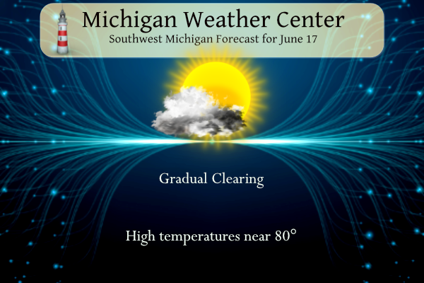
Sunny, with a high near 81. Calm wind becoming north northwest 5 to 9 mph in the morning.
Tonight
Mostly clear, with a low around 52. West northwest wind 5 to 10 mph becoming light north northwest after midnight.
Sunday
Sunny, with a high near 85. Calm wind becoming south southeast 5 to 7 mph in the afternoon.
Sunday Night
Partly cloudy, with a low around 61. Light and variable wind becoming south around 6 mph after midnight.
Juneteenth
Mostly sunny, with a high near 88. East southeast wind 6 to 10 mph.
Monday Night
Mostly clear, with a low around 60.
Tuesday
Sunny and hot, with a high near 90.
Tuesday Night
Mostly clear, with a low around 62.
Detailed Forecast For Lansing
Today
Partly sunny through mid morning, then becoming sunny, with a high near 80. Northwest wind 5 to 9 mph.
Tonight
Clear, with a low around 53. North northwest wind around 6 mph becoming calm in the evening.
Sunday
Sunny, with a high near 85. South southeast wind 3 to 7 mph.
Sunday Night
Partly cloudy, with a low around 58. South southeast wind 6 to 9 mph.
Juneteenth
Mostly sunny, with a high near 87. East wind 6 to 10 mph.
Monday Night
Mostly clear, with a low around 58.
Tuesday
Sunny, with a high near 89.
Tuesday Night
Clear, with a low around 60.
I posted some livestock for sale today. My grass pastures just can’t support even a low livestock load with frequent pasture rotations. The grass is 100% dormant. I have been supplementing hay which I have not done in 10+ years. Even my yard hasn’t needed to be mowed in 2-3 weeks and my sandy soil doesn’t help.
This drought is no joke one of the worst I’ve ever seen. The farm fields are in poor shape. We have a large field across the street from us and they planted it weeks ago and nothing is growing. Other nearby fields are coming up very poor.
Last week a farmer about 1 mile away plowed down his beans. I think he will replant or has already. But it was still sad to see. The next 7-10 days may be brutal.
One good thing is that this fall and next spring I plan on sowing some more drought resistant feed into my grass pastures. I will probably do it yearly to avoid a repeat of this year.
It sure is a nice day out, hope everyone gets out and enjoys it!