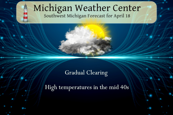
Our high temperature yesterday was 36.5° with wet snow showers most of the day. Snow showers will end this morning, with some clearing possible this afternoon. Highs will be in the 40s.
U.S.A and Global Events for April 18th:
1880: More than two dozen tornadoes were reported from Kansas and Arkansas to Wisconsin and Michigan. More than 150 persons were killed, including 99 people in Marshfield, Missouri.
1906: At 5:12 AM, a magnitude 7.8 earthquake hits San Francisco. A devastating fire soon broke out in the city and lasted for several days. About 3,000 people died, and over 80 percent of San Francisco was destroyed.
Grand Rapids Forecast
4 18 grrForecast Discussion
- Unseasonably cool through tonight -

Brisk wnw flow caa will continue today and result in high temps
only reaching the lower to middle 40s. A few flurries will linger
through the early morning hours before ending as the upper trof
axis continues to move further east. Partial clearing should
develop this afternoon as upper ridging begins to build in from
the west.

Skies will clear tonight as the upper ridge builds overhead.
Favorable radiational cooling conditions will develop overnight as
winds decouple as well. Low temps mainly in the upper 20s to
lower 30s are expected with some colder readings in the mid 20s at
typically colder locations in our north/ne fcst area.

- Chance of showers and storms Wed/Thur -

Isentropic upglide and increasing elevated instability north of a
warm front will bring potential for scattered showers and a few
thunderstorms Wednesday and Wednesday night. The relatively best
chance for pcpn/convection will probably come Wednesday evening
when h8 li/s fall to -1 to -4 along with around 500-750 j/kg of
elevated cape north of the front.

The warm front will be north of our area by Thursday morning and
there is potential for sfc based convection to develop Thursday
afternoon and evening ahead of the strong cold front. Some strong
to potentially severe storms seem possible given favorable frontal
timing and strong deep layer shear. However the svr wx threat
could be mitigated significantly by lack of stronger sfc based
instability.

- Much cooler again for the weekend -

A deep upper level trough will build over our region for the
weekend and bring unsettled wx with unseasonably cool temps and
showers. Thermal profiles will cool sufficiently enough for a
rain/snow mix through most of the weekend.
Frezzing Warnings get out of here its the middle to end of April…
INDY
Facts people! A Cold and snowy Spring so far! GR had below normal temps for March and above normal snowfall and now the CPC says cold the rest of the month and this cool trend will carry right into May! Face reality people, the cool pattern continues! Who would have thought?
Frezzing Warnings come onn man a few on mikess blog say its Summer outside lol!! I been saying this for years now April is such a transition month in Michigan crazy…Turn the furnace up
thats the truth…INDY
What a winter and now a cool Spring! Incredible!
The dead of Winter…
We are still stuck in an overall cool pattern and the CPC keeps it rocking and rolling for a few more weeks!!!!! What a winter, above normal snowfall, cold and snow in April, a freeze warning and a cool Spring! Wow just wow! WOW!
There are so many untruths in that statement I don’t know where to begin. But I’m learning you do that on purpose here.
After an incredibly warm start to April, bring on another warm front! 60’s tomorrow, 70’s Thursday!
After that another big temp tumble back to where we are now.
We are not Florida. Springtime in Michigan. But it sure has been a warm one so far after a warm 10 months.
Welcome to spring 😄
While there was some sun earlier it has now once again became mostly cloudy and it is a very cool 42 here. Also there is a freeze warning for tonight. There is also a chance of more freeze warmings this week end.
Slim
FREEZE WARNING IN EFFECT FROM MIDNIGHT TONIGHT TO 9 AM EDT
WEDNESDAY…
* WHAT…Sub-freezing temperatures as low as 28 expected.
* WHERE…Portions of south central, southwest and west central
Michigan.
* WHEN…From midnight tonight to 9 AM EDT Wednesday.
* IMPACTS…Freeze conditions will kill crops, other sensitive
vegetation and possibly damage unprotected outdoor plumbing.
PRECAUTIONARY/PREPAREDNESS ACTIONS…
Take steps now to protect tender plants from the cold.
Muskegon-Ottawa-Kent-Ionia-Allegan-Barry-Eaton-Van Buren-Kalamazoo-Calhoun-Jackson
Time to get the sleds out. Ugh!! We use them to cover our plants. Lol
GR #3 2023 Snowfall of all time 110 inches!! Wow to the wow!! INDY
Grand Rapids stand at 110.3”. Only 5.7” shy of the 2013-2014 which is very impressive. Only difference is this winter was warmer than 2013-2014 winter. Even with the warmer temps we still manage to gets lots of snow which is quite something.
Definitely a wild, snowy, long winter and now the persistent Spring cool pattern is upon us! Incredible!
Current wind chill in the mid 20’s!!!
More fresh snow on the ground from last night! This is 2 days in row with accumulating as we head towards late April. Wow, wow, wow!
For today the average H/L is 59/38 the record high of 86 was set in 1977,2002 and 2004. The record low of 22 was set in 1926 and 1983. The record snow fall of 3” fell in 1912. Last year it was a cold 37/32 and 0.3” of snow fell. That 37 was the 2nd coldest high for any April 18 so it was cold at this time last year as well. The overnight low here in MBY was 31 and at the current time it is 32 and there is a trace of snow on the ground.
Slim
Yesterday the official H/L at Grand Rapids was 39/32. That 39 was reached just after midnight so much of the day was in the mid 30’s and snow fall off and on all day long. There was 0.19” of precipitation of that .04” was snow fall. There was just 1% of sunshine.
Slim
Yesterdays official high of 39 was the 5th coldest high for any April 17th the snow fall of 0.4” was the 3rd snowiest for the date. And after the record warmth of the week before it felt just that much colder.
Slim
That was a doozy of a cold front. 45 degrees difference between Saturday and yesterday. I’m usually the first in the neighborhood to mow my lawn. Yeah, I’m that guy. However, my next door neighbor Jeff mowed Sunday morning. I should have mowed also but I just wasn’t feeling it. I regret that now. Looks like there’s a chance of rain pretty much everyday the rest of this week.
Have a great Tuesday friends, and make someone smile 😃
I was thinking I should have cut the grass Sunday as well. Oh well it could be a twice or more thing for the next month or so.
Slim
Our wild onions are looking like troll hair sticking up. Lol.
🙂
What a winter and we are still seeing snow and freezing temps! The cool pattern shows no sign of letting up! Wow just wow!