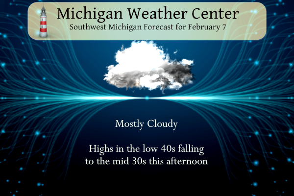
Our strange rollercoaster winter continues today. We have a temperature of 43° at 5 am which is a balmy morning by February standards. Yesterday’s high was 38°. Rain has moved out this morning, we should see dry weather the rest of today and Wednesday. A soaking rain is likely on Thursday, with a wintry mix possible again toward U.S.-10 eventually, changing back to some snow for Fri and Sat with cooler temperatures.
Grand Rapids Forecast
2 7 grrKalamazoo Forecast
2 7 kzoLansing Forecast
1 7 lanForecast Discussion
- Rain Showers with Possible Freezing Rain Early This Morning

A line of precipitation continues to move east through central lower
MI early this morning as a front approaches the state. Prolonged
warm air advection with strong southerly flow starting last evening
has supported warming overnight temperatures and therefore rain
will be the main mode of precipitation. However, there remains a
question of whether the ongoing warm air advection will be strong
enough to erode the cold sub-freezing surface layer across Clare,
Isabella, Mecosta, and Osceola Counties. Therefore, the concern
for a brief period of freezing rain exists for interior parts of
Central MI. This risk is expected to be short lived, with temps
rising above freezing for interior Central MI no later than 7am.
Current temps just to the west in Mason, Lake, and Newaygo
Counties have already risen into the mid to upper 30s, therefore
those counties will be removed from the Advisory. We will continue
the Advisory for Clare, Isabella, Mecosta, and Osceola Counties
for a few more hours where temps are typically colder, and any
wet-bulbing effects of falling precip may result in falling temps
with sub-freezing dewpoints. Any glazing of ice that does occur
should stay to 0.05" or less.

- Thursday System

Quiet conditions are expected this afternoon through Wednesday as
brief high pressure moves in. By early Thursday morning a stronger
system will move northwards from the Southern Plains into lower MI.
Questions exist on the mode of precipitation at the onset. Most
guidance advertises sufficient warm air advection meaning rain for
most areas, but some freezing rain looks possible once again across
Clare, Isabella, Mecosta, and Osceola Counties early Thursday
morning. A fairly similar scenario could play out Thursday morning
as what we`re seeing this morning, where it will almost be a race
between the warm air advection and oncoming precipitation.

Ensemble guidance still suggests heavier QPF with this system with
amounts up to 0.75 to 1.25 inches possible. Periods of heavier rain
will be possible as this system moves through all of Thursday.
Cold air will wrap around the western side of the departing wave,
so a switch to snow will be possible for western counties late
Thursday into Friday.

- Possible Lingering Snow into Friday

Another day of light precipitation will be possible Friday as smaller
vorticity anomalies within a larger trough axis move through the
Great Lakes. Colder 850mb air will drop down from the northwest
Friday, so cooler temps with a period of lingering lake effect
snow will be possible into Friday afternoon.

High pressure moves into the area Saturday and Sunday leading to
quiet and dry conditions with some sunshine possible.
There now looks like there could be a chance of a thunderstorm or two on Thursday.
Slim
I can’t imagine that has happened very often in February. Rain yes, but thunderstorms?!
With this melting our yard is like a skating rink.
Remember when it was mid January and we were in the midst of a 25+ day mild stretch but all we heard about was caution that February could very likely be cold and snowy? Whoops!
Once again, an incredibly fast snow melt. Yard is already down to 50/50 grass and snow. Very odd Winter where we build up a brief snowpack only to see it obliterated a week later. Little something for everyone. Get ready for the February downpours!
All the ice and snow is melting fast. February downpours bring Spring flowers. 🙂
I will admit that if the upcoming warmup is true (the next 10 days have mostly 40s and even some 50s), that is pretty impressive for early-mid February. Definitely has a mid-March feel to the weather pattern
Wow over an inch of rain for GR Thursday. I feel like spring has already arrived!
How could that be?!?!! After all the Cold Weather hype on here that claimed we were going to be entrenched in a Polar Vortex with tons of snow from February thru April?!?!
It does to me too!
Good morning! Yesterday was a very nice early February day with lots of sunshine (77%) and one again mild temperatures with a official H/L of 36/24. There was no rain or snow before midnight and the day started with 3” of snow on the ground. After the temperature dropped to 30 here last evening the temperature rose to the current reading here and at the airport of 43. There was some very light rain fall overnight. For today the average H/L is 32/18 the record high of 52 was set in 2009 and the record low of -15 was set… Read more »