We are now at the half way point of November 2019 and it sure has been a cold one.
Mid month summery. At the half way point one can say this November first half has been cold. At this time the mean temperature at GRR is 32.4° (-10.9°) if this were to hold this would be the 5th coldest November at Grand Rapids in recorded history. The warmest it has been so far is just 52 on the 4th and if that holds that would tie last year for the coldest maximum in any November. The low so far this is month is 15 on the 13th and so far, there has been 6.5” of snow fall.
Back in the day growing up in Bay City and Alpena the start of the regular firearm deer season was always a big day. In Alpena, it was being careful while out in the yard and the hearing of gun shots all day long, In Bay City it was watching the traffic on first US 23 and US 10 and later I 75. In my late teens, I 75 ended at Bay City and there was always the traffic back on the first day of hutting season, and in Alpena in my time there is was be careful when outside. In fact we did not play outside during deer season as there were always a lot of stray bullets flying. Any way here is the weather records for several Michigan locations on the first day of firearm deer season
Grand Rapids…..in Grand Rapids the average high/low for November 15th is 46/33 the record warmest November 15th was 68 in 1990 the coldest Maximum temperature was 18° in 1933 (1933 was a very cold day across Michigan on November 15th) as the record coldest low of 10 also happened in 1933.Also note the winter of 1933/34 was a up and down winter with a cold November -5.1. December was just a little below average at -1.2 and then a warm January at +6.6° and just 1.4” of snow. February to April were cold but dry. And only 38.1” fell that winter. Now back to the start of deer season. The most snow that fell in GR on the 15th was 4” in 1993 and the most on the ground was 5” in 1974 the last time before this year GR had one inch or more was in 1995 By the end of firearm season and the end of November on the 30th the average high/low is 39/28° The warmest end of deer season was 64° in 1998 the coldest maximum was 17° in 1896 as there may not have been deer season then the coldest maximum in a actual deer season was 18° in 1976. The coldest was +6° in 1958. The most snow on the ground was 14” in 1940.
Off to our north at Houghton Lake the average high on the 15th is 43 and the average low is 28 the record high was 63 in 1953 and the coldest maximum temperature was 20° in that cold year of 1933 the coldest was +2° in 1916. The snowiest was 8.5” in 1933 and the most on the ground was 13” in 1933. By the end of the deer season the average high/low at Houghton Lake is 36/23 the warmest end of deer season was 61 in 1998 and the coldest maximum was 12° in 1976 the coldest low was -2° in 1936. The most snow on the ground was 13” in 1995.
Over in Alpena the average high at the start of deer season is 43° and the average low is 28° the warmest day was 65° in 2001 and the coldest maximum was 17 in yes 1933 and the coldest low was a bone chilling -6° in 1933 the most snow fall was 3” in 1976 the most on the ground was 7” in 1916 and this year there was 4″ on the ground at the start of deer season.. At Alpena the average end of deer season high/low is 37/23 the warmest was 63° in 1998 and the coldest maximum was 17 in 1976. The coldest low was +3° in 1958. The most snow on the ground was 17” in 1966.
Up at the Sault the average high is 39 and the average low is 27. The record high is 61 set in 1990 the coldest maximum was 11 in 1933 the coldest low was -2 also in 1933. The most snow fall was 6.7” in 1965 and the most on the ground was 18” in 2014 This year there was 10″ of snow on the ground.. At the Sault the end of deer season average high/low are 32/21 the warmest was 59 in 1998 and the coldest maximum was a bone chilling +6 in 1936 and the coldest low was -10 also in 1936 it was -5° in 1958. As for the most snow on the ground that was 13” in 1933 but there has been 11” on the ground in 2014 and 12” on the ground in 1989 and 1976.
Over at Marquette the average high on the 15th is 42 and the average low is 30 the record high was a warm 69 in 1999 and the coldest maximum was 21 in 1995 the record low was +5 in 1991. The most snow fall was 4.6” was 1938 the most on the ground was 12” in 1993 believe it or not there was just 1″ on the ground this year.. The end of the season average high/low at Marquette is 32/20 the warmest was 57 in 1998 the coldest maximum was 9° in 2007 the coldest low was -2° in 1976 the most snow on the ground was 18” in 1991.
I hope this gives you a idea of how varied the last half of November can be in Michigan.Let us see how this year will play out.
Slim
U of M looked great today!
State is not a good team. Central would beat them this year.
Agreed. MSU is having a very difficult year.
It’s still autumn, right? Sure doesn’t look or feel like it.
Yes it is cold for this early but I still think that one or more of the winter months will be warmer than average.
Slim
9 out of the last 11 months have seen below normal temps! No reason to believe this pattern will be changing in the near future!
Our below normal temp pattern keeps rocking and shows no sign of letting up! This could be a great winter season with lake effect snow, lake enhanced snow, synoptic snow storms, Alberta clippers, Texas hookers, blizzards and below normal temps! Not sure how it could be better!
Well the blizzard drought is approaching 9 years since our last one in 2011. Longest stretch in my lifetime.
Hurry Spring 2020
You will not be seeing any real warm Spring weather till next May!
👍
Here is the latest update from Paul Pastelok who is the long range guesser at Accuweather. I only put up the part of his guess for our area. And broke it down the way he has it broken down. December to February Highlights “Northeast, mid-Atlantic, Great Lakes, eastern Ohio Valley – It will be a stormy pattern with cold periods. There will be the risk for early cold periods by back door fronts in the Northeast, but overall it will still be more back and forth. December and February can be colder than 2019. The storm track will be shifty,… Read more »
Note I might toss this up again next Saturday
Slim
Bring it on! It all sounds great to
me!
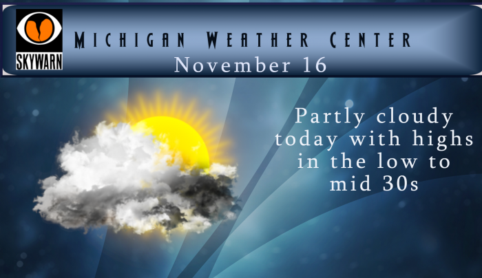
The official H/L at GRR yesterday was 39/28. The over night low both here at my house and at the airport was 22° and at this time it is 25 at both locations with mostly clear skies. The sun yesterday melted most of the snow here at my house and there is now just trace amounts of snow on the ground where the sun reached the snow cover. There is still snow on the north side and in the woods. For today the average H/L is 47/33. The record high is 68 way back in 1869 and the record low… Read more »
thanks Slim – big game today – Go Blue!