Half Inch Snowstorm
Yesterday’s snowstorm dropped about a half inch here in MBY. According to the official snow fall report for Grand Rapids the snow fall amount for yesterday was 2.0” for the season Grand Rapids is now up to 88.8” At Lansing the snow fall amount there was a record 6.5” At Muskegon no snow fall was recorded. To the east at Detroit their snow fall amount was a record 6.2” it was a record 4.9” at Flint and also a reported record of 2.5” at Saginaw. Like I said not sure how much fell here at my house but there is only around a half inch on the ground. The official H/L yesterday at Grand Rapids was 34/28 there was 0.10” of precipitation that led to that 2.0” of snow fall. There was no sunshine yesterday. The overnight low here was 24 but it has now gone up to 29. For today the average H/L at Grand Rapids is 39/24 the record high of 66 was recorded in 1983 and the record low of -3 was set in 1948 and todays record snow fall amount is 8.0” set in 1900.
This past meteorological winter was only the 4th time in recorded history at Grand Rapids that each of the 3 winter months the mean was 30 or better. The others are the winter of 1920/21, 1931/32 and 2001/02. This past winter was the warmest at Grand Rapids since the winter of 2011/12 and will be the 3rd warmest in this century. The warmest winter in this century so far in 2001/02 with a mean of 31.57. In 2011/12 the mean was 31.47 and the mean for this year is 30.87. The all time record warmest winter is the winter of 1931/32 with a mean of 33.9. This past met winter there was 58.8” of snow at Grand Rapids, 31.8” at Lansing and 40.5” at Muskegon Grand Rapids and Lansing were a little below average but Muskegon was much below average. There was 1” or more of snow on the ground at Grand Rapids on just 36 days. 58 is average. At Lansing there was 1’ or more on the ground on only 29 days, 56 is average and at Muskegon the number was 37 days with 58 the average there.
DISCUSSION
(TODAY THROUGH NEXT FRIDAY)
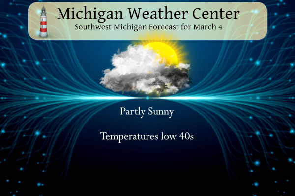
ISSUED AT 330 AM EST SAT MAR 4 2023
..CLIPPER SWINGS THROUGH TONIGHT
THE BRISK COLD AIR IS SHORT LIVED AS HIGHS WILL AGAIN PEAK BACK
INTO THE 40S TODAY. ANOTHER WAVE OF LOW PRESSURE WILL SWING
THROUGH TONIGHT INTO SUNDAY. THIS WILL EMANATE FROM A SHORT WAVE
THAT HAS LITTLE MOISTURE TO IT. ANY PRECIPITATION WILL BE SHORT
LIVED AND GIVEN IT WILL ARRIVE IN THE EARLY EVENING WITH WARMER
AIR IT IS EXPECTED TO BE PRIMARILY RAIN. SNOW WILL BE POSSIBLE
IN THE VICINITY OF AND NORTH OF BIG RAPIDS.
..MORE PRECIPITATION SUNDAY NIGHT INTO MONDAY
THE ABOVE MENTIONED SHORT WAVE WILL FADE AS AN UPPER LEVEL RIDGE
DOMINATES THE WEATHER THIS SUNDAY. THE RESULTING HIGH PRESSURE
WILL BRING BREAKS IN THE CLOUDS, ESPECIALLY ALONG THE LAKE SHORE.
THIS WILL BE SHORT LIVED AS ONCE AGAIN ANOTHER SYSTEM WILL MOVE
THROUGH THE GREAT LAKES REGION SUNDAY NIGHT INTO MONDAY. CURRENT
ENSEMBLES HAVE THE BULK OF PRECIPITATION MOVING IN EARLY MONDAY
MORNING. THE LARGEST OF AMOUNT OF PRECIPITATION CONTINUES TO TREND
THROUGH CENTRAL MICHIGAN IN AREAS NORTH OF I 96, ESPECIALLY ALONG
US 10. WHILE A WINTRY MIX IS POSSIBLE ALONG THE US 10 CORRIDOR,
ELSEWHERE THE PRECIPITATION TYPE WILL MORE THEN LIKELY TO BE RAIN.
A BY PRODUCT THAT WILL BE WELCOMED BY MANY WILL BE WARM AIR
ADVECTION THAT WILL CAUSE DAYTIME TEMPERATURES IN THE 50S, SOUTH
OF THE I 96 CORRIDOR.
..MILD AND MODERATE WEATHER IN THE WEEK AHEAD
WHILE THERE REMAINS SOME DISPARITY IN THE MID RANGE MODELS, THERE
REMAINS A TREND OF MILD TEMPERATURES THROUGH THE DAYTIME AS THE
HIGHS PEAK ABOVE FREEZING, WITH TEMPS DROPPING BELOW FREEZING
AT NIGHTTIME THROUGH THE WEEK. A LACK OF PRECIPITATION IS THE
THEME THROUGH THE WORK WEEK WITH AFTER MONDAY THE NEXT CHANCE
BEING FRIDAY.
Detailed Forecast for Grand Rapids
Today
Increasing clouds, with a high near 44. West southwest wind 5 to 8 mph.
Tonight
A 40 percent chance of rain before 1am. Mostly cloudy, with a low around 31. Southwest wind 3 to 7 mph.
Sunday
Partly sunny, with a high near 46. West northwest wind around 6 mph becoming calm.
Sunday Night
A slight chance of rain before 10pm, then a slight chance of rain and snow between 10pm and 1am, then rain after 1am. Low around 34. Breezy, with an east southeast wind 9 to 14 mph increasing to 19 to 24 mph after midnight. Winds could gust as high as 37 mph. Chance of precipitation is 80%. Little or no snow accumulation expected.
Monday
Rain likely. Cloudy, with a high near 48. Breezy, with an east southeast wind 17 to 25 mph, with gusts as high as 37 mph. Chance of precipitation is 70%.
Monday Night
A chance of rain, mixing with snow after 10pm, then gradually ending. Mostly cloudy, with a low around 32. Breezy. Chance of precipitation is 30%.
Tuesday
Mostly sunny, with a high near 40. Breezy.
Tuesday Night
Mostly clear, with a low around 24.
Wednesday
Mostly sunny, with a high near 38.
Wednesday Night
Partly cloudy, with a low around 24.
Thursday
Partly sunny, with a high near 37.
Thursday Night
Mostly cloudy, with a low around 27.
Friday
A chance of snow showers. Mostly cloudy, with a high near 36.
Detailed Forecast for Holland
Today
Partly sunny, with a high near 43. West southwest wind 5 to 8 mph.
Tonight
A chance of rain between 8pm and 2am. Mostly cloudy, with a low around 32. Southwest wind 5 to 7 mph. Chance of precipitation is 40%.
Sunday
Partly sunny, with a high near 46. West northwest wind around 6 mph becoming calm.
Sunday Night
Rain, mainly after 2am. Low around 36. Breezy, with an east southeast wind 9 to 14 mph increasing to 20 to 25 mph after midnight. Winds could gust as high as 38 mph. Chance of precipitation is 80%. New precipitation amounts between a tenth and quarter of an inch possible.
Monday
Rain. High near 50. Breezy, with a southeast wind 16 to 25 mph becoming south southwest in the afternoon. Winds could gust as high as 37 mph. Chance of precipitation is 80%.
Monday Night
Rain likely, mainly before 8pm. Mostly cloudy, with a low around 32. Breezy. Chance of precipitation is 60%.
Tuesday
Mostly sunny, with a high near 40. Breezy.
Tuesday Night
Mostly clear, with a low around 24.
Wednesday
Mostly sunny, with a high near 38.
Wednesday Night
Partly cloudy, with a low around 24.
Thursday
Partly sunny, with a high near 37.
Thursday Night
Mostly cloudy, with a low around 27.
Friday
A chance of snow showers. Mostly cloudy, with a high near 36.
Detailed Forecast for Lansing
Today
Increasing clouds, with a high near 42. West northwest wind 6 to 8 mph.
Tonight
A 30 percent chance of rain, mainly before 1am. Mostly cloudy, with a low around 31. Southwest wind 5 to 7 mph.
Sunday
Partly sunny, with a high near 43. West northwest wind 5 to 7 mph becoming calm in the afternoon.
Sunday Night
A chance of rain after 1am, mixing with snow after 4am. Mostly cloudy, with a low around 33. East southeast wind 8 to 17 mph, with gusts as high as 26 mph. Chance of precipitation is 50%.
Monday
A chance of rain and snow before 7am, then rain likely. Cloudy, with a high near 48. Breezy, with a southeast wind 14 to 21 mph, with gusts as high as 31 mph. Chance of precipitation is 60%. Little or no snow accumulation expected.
Monday Night
A 30 percent chance of rain before 1am. Mostly cloudy, with a low around 32. Breezy.
Tuesday
Partly sunny, with a high near 37.
Tuesday Night
Mostly clear, with a low around 22.
Wednesday
Mostly sunny, with a high near 36.
Wednesday Night
Partly cloudy, with a low around 22.
Thursday
Partly sunny, with a high near 36.
Thursday Night
Mostly cloudy, with a low around 25.
Friday
A chance of snow showers. Mostly cloudy, with a high near 36.
Zero snow in Northern Kent! Love it!! Winter is deader than dead!
3 to 4 weeks of winter weather coming! I love it!
Look at all those 40’s! Suck it Rocky!!!
https://weather.com/weather/tenday/l/b523690bfd952b86fef3627c919dd9855281a8da16b83c10bdd381c64ae12cbc
Multiple snowstorm chances showing up on the models! Is it Sring yet? Is winter dead yet? Are nice warm Spring temps here yet? I love long winters and bring it on!
Half inch snowstorm. Too funny! Mid 40’s today with snow melting. I love it!
Mid 40s and lots of sun. Maybe I didn’t need to go out this morning? I think 1/2 of the snow has melted already. Our street was not plowed and it’s almost free of snow. Oh well, I got some exercise.
The new snow that fell yesterday is now mostly gone. There is still some in the shade and the old snow/ice areas are still there. There is still that left over snow/ice in the woods here but outside of the woods there is mostly bare ground. At the current time it is 43 here with nice sunshine.
Slim
Just used my boots and snowblower for only the 2nd this winter. Upon further review, I think we received 5 – 6”. Heavy and wet snow. Sun is very warm. It has already melted the residual snow off the driveway and sidewalk. I had to remove my gloves halfway through the job. I’m sweaty and need a shower.
That’s why I switched to a plow for my lawn tractor, it is much easier for snow removal. We had 3.5 inches here.
It would, however, have been “cool” if we wouldn’t have had such wild temp swings this winter. The constant up/down has created some mammoth potholes already.
What a remarkable winter for GR! Heading
towards a 100 inches of snow!
Will Grand Rapids reach 100″ this winter season? the next 3 weeks will tell. Daytime snow events will become harder to have now. But we sure can still get nighttime snow events yet and that can be the case up to the 1st half of April.
Slim
Kent was never under a winter storm warning, I think the advisory called for 2-4 inches. It was actually a very accurate forecast when looking at their snowfall map from yesterday (Kyle I saw you mentioned this on FB, good call out)
Yes, people are complaining about how bad of a forecast job the NWS did. They did very well with the large spread in model data they were dealing with.
+1
They did a lot better than the sensationalist forecasts I saw spreading online. Many were showing 12-18” for my area. NWS was pretty consistent at 3-6” and then downgraded us 2-4”. We got about 2”.
Excellent job!
Thanks Slim. Nice title, “Half inch snowstorm”, made me laugh. That half of an inch won’t last very long with the mild air moving in. Quite a remarkable Winter with so few days with snow on the ground.
I would like to give a shout-out to our local NWS office for giving a pretty darn good forecast with all the uncertainty in modeling. This was a tricky system to forecast and I think they handled it pretty well!
The EURO and NAM models did a horrendous job with this storm! They consistently showed GR getting a big snowstorm right up until the day of the storm! On the other hand the GFS consistently showed the storm to the SE of GR and that is exactly what happened! So much for the trusted garbage EURO model!
Yes most of the models did not handle it well. Considering how horrendous the modeling was I liked the NWS forecast given the large uncertainty.
What a storm and the snow just keeps coming and coming this year! GR is headed for the 100 inch mark! Plenty of snowstorm chances over the next 4 weeks, so don’t be surprised and warm Spring weather is NOT right around the corner! Face the facts! Rock n roll will never die!
It drifted much more than expected. I estimate that we received approximately 7-8”.
This has been one heck of a winter! Like I said probably in my top 5! Something for everyone. Blizzard Warnings, Ice storm warnings, Thundersnow, big lake effect events, warmer temps, the list goes on and on. Doesn’t get a whole lot cooler than that!
Rock on!