On Monday we will flip the calendar to April. Durning April the length of the time the sun is up increases from 12 hours 46 minutes on the 1st to 14 hours 6 minutes on the 30th The average H/L starts out at 52/32 on the 1st and is up to 64/43 by the 30th The mean average temperature for April at Grand Rapids is 47.6° the average precipitation is 3.99” the average snowfall is 2.0”
The top 5 warmest April’s at Grand Rapids are 53.8 in 1915, 53.7 in 2010. 52.8 in 1896 and 1955 and 52.1 in 1921. The top 5 coldest April’s are 37.6 in 1907, 39.6 in 1950, 39.8 in 1975, 40.1 in 2018, 40.4 in 1926. The wettest April’s at Grand Rapids are 11.10” in 2013, 8.29” in 1909, 7.19” in 2011, 6.69” in 1999 and 6.37” in 1947. The dryest 0.39” in 1942, 0.77” in 2009 and 1899, 0.85” in 1915 and 0.98” in 1932. The most snowfall is 15.6” in 1961, 12.4” in 1982, 11.2” in 1926, 10.5” in 1952 and 10.1” in 1936. I lived in Bay City in 1975 and starting around 8PM on April 2nd and 6Am on April 3rd Bay City had over 15” of snow in a big time April snowstorm that had high winds and thundersnow. The record high for April at Grand Rapids is 90° set on April 29, 1899, the record low of 3 was set on April 7th 1982 the low reached 7 on April 8th that same year there was 7” of snow on the ground at that time. There have only been 3 years in where April did not reach 70 or better. In 1950 the high for the month was just 67 in 1961 and 1907 the highest was just 68.
I did not live in Grand Rapids in 1956 but the most destructive tornado in west Michigan hit that year on April 3rd The storm was less than a half mile from were I now live. The afternoon of Tuesday, April 3rd, 1956 was warm and humid. Strong south winds had brought summer-like temperatures and humidity, with record highs in the upper 70°s at Muskegon and Grand Rapids. Holland and Kalamazoo both reached 80 degrees. Dew points were in the 60°s even near Lake Michigan. But a strong cold front was approaching from the west and out ahead of it, a line of violent thunderstorms had formed over Wisconsin and Illinois. By 1 PM, a tornado had roared through Bancroft, Wisconsin, killing two people. Another tornado would level the town of Berlin, Wisconsin an hour later, leaving 7 more dead and 50 injured. Michigan was put on alert. The U.S. Weather Bureau (forerunner of the National Weather Service) office in Grand Rapids began notifying the public and civil defense officials that the risk of tornadoes across western Michigan was increasing. Some schools began letting out early, anticipating the severe weather to come.
The storms crossed Lake Michigan, and when they reached the west coast of Lower Michigan by late afternoon, they immediately began producing tornadoes. Three hours of terror would follow. At least four powerful tornadoes would be spawned, tearing their way across the landscape. When it was over, areas from Saugatuck to Traverse City, and inland to Middleville and Rockford were dealing with unprecedented destruction. Almost 20 people were dead and hundreds injured. Dozens of homes were obliterated. Many people’s lives were irrevocably changed.
The worst hit areas were Hudsonville and Standale, where entire neighborhoods were laid waste. Many people, some of them badly injured, helped in the immediate recovery by searching for neighbors trapped under the debris of what had been their homes. Police and National Guard units were dispatched to make sure roads were kept clear of sightseers, allowing the injured to be evacuated to hospitals. Dozens of seriously injured people were brought to hospitals in Grand Rapids, Holland, and Zeeland.
In the following days, the cleanup and rebuilding began. The Red Cross and Salvation Army would provide much needed supplies, including food, clothing and temporary housing. Homes and farms were rebuilt, even as family members recuperated in the hospital. But the impact of the storms would never be forgotten by those that lived through them.
The official H/L yesterday at Grand Rapids was 52/1 there was no rain/snowfall. There was 91% of possible sunshine. For today the average H/L is 51/31 the record high of 76 was set in 1910 and the record low of 1 was set in 1974. The most rainfall of 1.21” fell in 1974 the most snowfall of 3.0” fell in 1928 the most on the ground was 8” in 1970. Last year the H/L was 46/17.
AREA FORECAST DISCUSSION
NATIONAL WEATHER SERVICE GRAND RAPIDS MI
300 AM EDT SAT MAR 30 2024
KEY MESSAGES
– SHOWERS AND ISOLATED STORMS TODAY
– CHANCE OF RAIN LATER SUNDAY INTO MONDAY FOR SOUTHERN MI
– MORE WIDESPREAD RAIN AND A CHANCE OF SNOW MID WEEK
DISCUSSION
ISSUED AT 300 AM EDT SAT MAR 30 2024
– SHOWERS AND ISOLATED STORMS TODAY
RAIN SHOWERS WILL GRADUALLY DEVELOP ACROSS OUR FCST AREA FROM WEST
TO EAST THIS MORNING AS THE SFC LOW OVER IA MOVES EAST ALONG THE
STATIONARY FRONT DRAPED ACROSS NORTH CENTRAL IL/IN. POTENTIAL FOR
ISOLATED CONVECTION IS MOSTLY CONFINED TO AREAS NEAR TO SOUTH OF
THE I-94 CORRIDOR THROUGH MID TO LATE MORNING ALTHOUGH AN ISOLATED
STORM AS FAR NORTH AS THE I-96 CORRIDOR CANNOT BE RULED OUT. THE
NOSE OF THE 40-45 KT LLJ NOW FAVORS AREAS FURTHER SOUTH ACROSS
NORTHERN IN FOR A MUCH BETTER CHANCE FOR CONVECTION THIS MORNING.
THIS NOTION IS ALSO SUPPORTED BY THE 00Z HREF.
THE FARTHER SOUTH AND SLOWER TREND OF THIS SYSTEM LEADS TO LESS
POTENTIAL FOR PCPN TYPE ISSUES ACROSS OUR FAR NORTHERN FCST AREA.
IT IS NOTED THAT THE 00Z HREF KEEPS ANY MIXED PCPN JUST NORTH OF
OUR FCST AREA. WE STILL CANNOT RULE OUT A BRIEF PERIOD OF LIGHT
FZRA OVER OUR EXTREME NNE FCST AREA BUT WITH VERY MINIMAL IF ANY
IMPACTS BEFORE SFC TEMPS RISE TO ABOVE THE FREEZING MARK. DRY WX
RETURNS ACROSS OUR FCST AREA FROM MID EVENING THROUGH SUNDAY AFTERNOON
IN THE WAKE OF THIS SYSTEM.
– CHANCE OF RAIN LATER SUNDAY INTO MONDAY FOR SOUTHERN MI
NEARLY ZONAL FLOW CAUSES THE DEVELOPMENT OF A QUASI-STATIONARY
WARM FRONTAL BOUNDARY EARLY NEXT WEEK IN THE OHIO RIVER VALLEY.
SYNOPTIC FORCING FROM THE RIGHT ENTRANCE REGION OF A JET STREAK
GIVES CHANCES OF RAIN SUNDAY INTO MONDAY ACROSS THE SOUTHERN CWA.
OPPORTUNITIES FOR SHOWERS ARE AIDED THROUGHOUT THIS TIME PERIOD BY
OCCASIONAL SHORTWAVES THAT PROPAGATE ALONG THE FRONT. LOW-LEVEL
NORTHEASTERLY FLOW FROM A CANADIAN HIGH KEEPS THE NORTHERN CWA
MOSTLY DRY. HIGHS MONDAY WILL BE IN THE 50S AND LOWS IN THE 30S.
– MORE WIDESPREAD RAIN AND A CHANCE OF SNOW MID WEEK
THE PREDOMINANTLY ZONAL FLOW SEEN TO START THE WEEK WILL BE REPLACED
BY THE PHASING OF TWO UPPER-LEVEL LOWS INTO A CLOSED LOW TUESDAY.
ONE OF THESE TROUGHS DIVES SOUTHEAST FROM CANADA AND THE OTHER
EJECTS NORTHEAST FROM THE DESERT SOUTHWEST. GIVEN DEPENDENCE OF THE
FORECAST ON THIS INTERACTION, PLUS OTHER INTERACTIONS EXPECTED TO
OCCUR WITH THIS NEXT EVENT, UNCERTAINTY IS HIGHER THAN NORMAL AT
THIS TIME RANGE.
WHAT WE DO KNOW AT PRESENT IS THE DEEPER WAVE DRIVES A SURFACE LOW
THROUGH THE OHIO VALLEY AND INTO ONTARIO. THE PRECIPITATION SHIELD
FROM THIS LOW WILL EXPAND RAIN CHANCES TO THE ENTIRE CWA TUESDAY,
WITH POPS LIKELY TO INCREASE FOR LATER TUESDAY INTO WEDNESDAY AS
CONFIDENCE GROWS ON EXACT DETAILS. THE INITIAL WARM AIR ADVECTION
AHEAD OF THE LOW (THOUGH THE DEGREE OF ADVECTION IS UNCERTAIN) KEEPS
PRECIPITATION MAINLY RAIN TO START. HOWEVER, COLDER AIR ON THE BACK
SIDE OF THE LOW COMBINED WITH THE PASSAGE OF THE MAIN UPPER-LEVEL
TROUGH MAKES IT LIKELY THE RAIN MIXES WITH OR CHANGES OVER TO SNOW
AT SOME POINT.
GIVEN THE UNCERTAINTY IN THE UPPER-AIR PATTERN AS NOTED BEFORE,
EXACTLY WHEN AND WHERE THE PRECIPITATION CHANGES TO SNOW, AND BY
EXTENSION SNOWFALL AMOUNTS, IS UNCERTAIN. ENSEMBLES SHOW THAT AT
LEAST SOME SNOW IS LIKELY (ENSEMBLE OF THE EPS/GEFS/CMC MEMBERS HAS
A 70-80 PERCENT CHANCE OF MEASURABLE SNOW WEDNESDAY) , BUT
CONFIDENCE IN EXACT AMOUNTS IS LOW AT THIS RANGE. EXACT TIMING AND
AMOUNTS WILL NEED TO BE MONITORED AND FINE-TUNED AS CONFIDENCE
INCREASES CLOSER TO THE EVENT.
AS THE SURFACE AND UPPER-LEVEL LOWS PULL AWAY AS WE GO INTO THURSDAY
AND HIGH PRESSURE TAKES OVER, DRY CONDITIONS ARE EXPECTED TO END THE
WEEK.
Detailed Forecast For Grand Rapids
Overnight
A 40 percent chance of showers. Mostly cloudy, with a low around 36. East southeast wind around 8 mph.
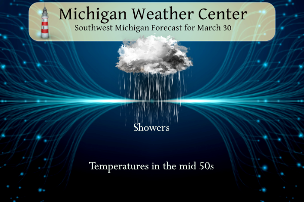
Saturday
Showers likely, mainly before 11am. Cloudy, with a high near 50. East wind around 9 mph. Chance of precipitation is 60%. New precipitation amounts between a tenth and quarter of an inch possible.
Saturday Night
Mostly cloudy, with a low around 34. Northwest wind 6 to 9 mph.
Sunday
A 30 percent chance of showers after 2pm. Cloudy, with a high near 52. East wind 6 to 8 mph.
Sunday Night
Showers likely, mainly after 8pm. Cloudy, with a low around 39. East wind around 8 mph. Chance of precipitation is 70%.
Monday
Showers likely, mainly after 2pm. Mostly cloudy, with a high near 54. Chance of precipitation is 60%.
Monday Night
Showers likely, mainly before 2am. Cloudy, with a low around 37. Chance of precipitation is 70%.
Tuesday
A chance of showers. Mostly cloudy, with a high near 48.
Tuesday Night
A chance of rain showers before 2am, then a chance of rain and snow showers. Mostly cloudy, with a low around 33.
Wednesday
A chance of rain and snow showers. Mostly cloudy, with a high near 42. Breezy.
Wednesday Night
Partly cloudy, with a low around 32. Breezy.
Thursday
Mostly sunny, with a high near 50.
Thursday Night
Mostly clear, with a low around 31.
Friday
Sunny, with a high near 57.
If you add up all the pivotalweather maps predictions of snowfall since November, we should be sitting on about 450 inches of snow this year for this area! But here we are at about 45 inches total! LOLOLLOLOL!!!! What a JOKE!!
Hmmmm…even cold weather crazy Woodtv says nothing much for the snow this week, but the cold weather crazies on here say storm of the century on Tuesday night with their weather prediction maps saying a foot of snow for this area by Thursday! LOLOLOLOL!!! TUESDAY As the frontal boundary slides slightly north, rain showers become a bit more widespread throughout Tuesday. Highs will be cooler, topping off in the mid 40s. As temperatures cool to near freezing overnight, some rain may change over to a wintry mix or light snow. No wintry precipitation is expected to stick. WEDNESDAY A light… Read more »
Too funny and totally ignorant! The only time you would listen to a thing WOOD says is if they agree with your warm weather spin and fantasies! Pathetic display of ignorance!
The below normal temp days just keep coming and coming, yet all we hear about is warm weather hype! We are in a big time cool pattern and next week looks COLD! WOW!
There’s been measurable snow exactly two days this month and one day where we had measurable snowfall in February! WOW!! Helluva winter weather in these past two months!! LOLLOLLOL!!!
I see today was yet another day with zero snow! The snow free pattern keeps rocking
The warm weather fanatics keep saying winter weather is over, but we keep getting SNOW! Here is the latest for the NWS!
Important details such as the track of the low, timing, and
precipitation amounts remain uncertain, but there does seem to be
good ensemble consensus that some amount of accumulating snow will
be likely late Tuesday through Wednesday. Can`t rule out travel
impacts Wednesday due to snow, but as previously stated, forecast
details including snowfall amounts remain uncertain at this time.
I see today was yet another below normal temp day! The cool pattern keeps rocking!
I see that yesterday was yet another day without any snow!
Eeeee Eeeee Blowtorch alert!
I see that yesterday was yet another below normal temp day! WOW!
Check out the latest 5 day snow map! If this happens it will be incredible!
https://www.pivotalweather.com/model.php?p=snku_acc-imp&rh=2024033012&fh=120
Lol!! A foot of snow here by Thursday??? Classic for that trash model you post all the time!
The warm weather fanatics don’t get it! The snow models just show the trends and they are not predictions! Too funny but this has been happening for years! No clue about the weather and models!
Let’s review the facts – a couple weeks ago Andy said no snow for the following week, when I posted a snow map showing the potential of about 8 inches and GR picked up about 7 inches! Last week Andy said no more snow this year! Snow is coming next week! About 2 months ago Andy said winter is over and repeated this bunk for weeks as we kept getting snow and cold! WOW, just wow, WOW!
Will never understand why the cold weather crazies would much prefer a day like today, rainy and cold, in the spring over a nice sunny 60 degree day??
No delusions here, this was one of the greatest winters we have had in decades! 46 total inches of snow, above average temps every month and 95 percent of the winter had zero snow on the ground! This past winter was absolutely fantastic! Whatever flurries we get on Wednesday will be gone by Wednesday afternoon, then glorious spring time weather dominates after Friday! BRING IT!!
100% wrong again. We will end up with more in GR this year than the winter of 21-22! Ridiculous!
Hey Rocky I remember some talk on her that we may not even break 40 inches this winter and look what happened.
We should end up with 50+ inches by the time the winter weather is finally done and yes some people said 30 inches of snow! Ya right!
No one said 30 inches of snow for the season! And even if we get to 50 inches, that’s still 2 feet below normal!
You sure about that??? Grand Rapids had 55 inches of snow for winter 21-22. Got a ways to go for that LOL!!
https://www.weather.gov/grr/Winter20212022summary
Is winter weather over yet? What a joke!
Yes
100% wrong again!
The warm weather delusions are off the charts! Pathetic and predictable!
I see the cold weather crazies desperately wishcasting for that one last flurry of snow on Wednesday. With the lack of cold and snow this winter they go into a frenzy if there is a remote possibility of a snowflake falling from the sky. But being that Wednesday is mid week and I will be at work all day I could not care less what the weather is looking like outside. All I see is the glorious 60 degree temps next weekend and all the great golf weather that brings. So to all the cold weather crazies enjoy your few… Read more »
Ck this out! Chance of accumulating snow next week, just like I predicted days ago! The warm weather fanatics will never learn! Incredible!
https://www.tropicaltidbits.com/analysis/models/?model=gfs®ion=us&pkg=asnow&runtime=2024033006&fh=120
And just like that – 1/4 of 2024 is done 😳
How many more times will the warm weather fanatics tell us winter weather is over and then the next week we see more snow? I tried to warn them last week about snow the first week of April and they never listen! This is mainly due to their delusions and total disdain for winter weather! Rock n roll will never die! Bring it on and let the good times roll!!!!