Our temperature at 5 am is 23°. We reached 46° yesterday with partly to mostly sunny skies. Today we will see mostly sunny skies with highs in the mid-40s and 50s. Rain returns tonight with areas along and north of the Ludington to Mount Pleasant line having a chance to see a period of freezing rain into Saturday morning. A few rumbles of thunder remain possible south of I96.
NWS Forecast
Weather History
1910: Temperatures peak in the upper 70s to lower 80s during one of the warmest months of March on record across Lower Michigan. The high of 82 degrees sets a record for the warmest ever recorded in March at Grand Rapids.
1954: A snowstorm drops from 5 to 10 inches of snow across southern Lower Michigan. Kalamazoo records 8 inches of snow and Grand Rapids a record 7.5 inches.
On March 29, 1967, the daytime temperature rose to only 23 degrees in Detroit, which is 29 degrees cooler than the average high temperature for this day.
1848: Niagara Falls eased to a trickle during the late afternoon and then became “silent” for 30 hours. Most people noticed the silence on the morning of the 30th. This is the only time in recorded history that both Falls stopped flowing. An ice jam at the neck of Lake Erie and the Niagara River entrance between Fort Erie, Ontario Canada, and Buffalo, NY, was caused by the wind, waves, and lake currents. People even ventured into the gorge, discovering relics like weapons from War of 1812.
1886: Rainfall amounts of 6-12 inches occurred over northwest Georgia in a 3-day period from March 29 through April 2. This caused record flooding on the Oostanaula and Etowah Rivers that merged to form the Coosa River. Floodwaters, up to 11 feet deep covered portions of Broad Street in Rome with extensive record flooding. The stage height reached 40.3 feet. The flood stage is 25 feet. This record flood and another major flood in 1892 prompted the citizens of Rome to raise the town by 12 feet. This feat was accomplished by bringing in thousands of wagonloads of dirt. An official rainfall amount of 7.36 inches was recorded on this day in Atlanta. The 7.36 inches is the most Atlanta has seen in one day since record-keeping began in 1878.
1942: A slow-moving low-pressure system brought 11.5 inches of snow to the nation’s capital on March 29, 1942. It still stands as the highest March snowfall on record in Washington, D.C. on a single calendar day. Also, Baltimore, Maryland recorded an imposing total of 21.9 inches of snow on the same day. On the flip side, eight days later, the temperature in D.C. soared to 92 degrees on April 6, 1942, and it remains the highest temperature on record for April 6. Click HERE for a video about the weather conditions during this event from the Weather Prediction Center.
2007: If thunder is heard, one should go to a lightning-safe area. A high school athlete was struck and killed by lightning at a track meet in Carbondale, Illinois. A bolt or 2 had been seen miles away, and a distant rumble of thunder was heard before the deadly strike.
Forecast Discussion
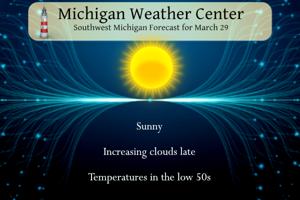
- Rain/isolated storms/freezing rain tonight

Today will start off sunny, but we`ll see high clouds increase
during the afternoon as low pressure moves toward Iowa. As
isentropic lift strengthens ahead of the low rain will develop
over northeast IL/northwest IN this evening and move into the
southwest cwa toward midnight. MUCAPE in the 300-400 j/kg range
and elevated LI`s around -1C suggests a thunder possibility south
of a Muskegon to Lansing line.

Across the northern cwa, a cool feed of easterly air will help to
erode some of the precipitation as well as advect colder air into
that part of the cwa. Once the precipitation overcomes the drier
air, we`ll probably see some light freezing rain develop north of
a Ludington to Mt Pleasant line after midnight. The short
duration of freezing precipitation may negate the need for a
headline, but not out of the question that we may need one at some
point; the short range models have deceased the ice accums
somewhat.

The precipitation will end Saturday morning as the low continues
moving east away from the cwa.

Highs today will range from the upper 40s near US-10 to mid 50s
near I-94. A tighter temperature gradient will exist Saturday with
highs in the lower 40s north to upper 50s south.

- Low Chance of Precipitation Sunday, Better Monday-Wednesday

The long term portion of the forecast begins with surface ridging
within a zonal upper-level pattern across the central Great Lakes. A
few showers are possible Sunday afternoon and evening as moisture
arrives, highest near I94, with weak isentropic ascent ongoing.

More widespread showers are expected Monday into Tuesday as the
zonal flow pattern is replaced by a an upper-level trough with
leading shortwaves. This results in a deep surface low tracking
through the region, with some uncertainties in track remaining at
present. However there is general agreement that West Michigan
remains placed in the warm sector of the system. Warm air advection
looks to bring highs in the 50s Sunday through Tuesday before highs
in the 40s are expected behind the system. This system has the
potential to be a ample rain producer. PWATS early next week climb
into above the NAEFS 90th percentile in the 0.75-1 inch range.
Current NBM probabilities for rainfall over 1 inch from Sunday-
Tuesday are in the 30-50 percent range, highest across the southern
CWA. Thunder chances are low given instability primarily remaining
south of the area.

Wrap-around precipitation behind the surface low then brings the
chance of rain and snow showers Wednesday as the upper-level trough
and associated thermal trough tracks overhead. Given spread in
surface temperatures in the vicinity of freezing (given this is days
in the future) certainty in rain versus snow is low at present. This
precipitation ends later Wednesday into Thursday as the upper-level
trough pulls away with surface ridging moving into the Central Great
Lakes.
Hey Rocky, have you seen the forecast the middle of next week? While it could trend warmer it’s certainly possible we may not be done seeing SNOW yet. How could that be possible?
Yes and this is no surprise! Bring it!
Get your golf clubs and sunscreen ready!! Spring about to be HEATING UP!!!
Yes golf should played in temps at least 60 degrees, not in the 40’s with wind! Ridiculous!
Lol yeah right! Just dress warm and get out there! Isn’t that what you said when the wind chill was 25 below zero?? Today is a perfect day for golf!
Skiing in cold is totally different than a warm weather sport! Give me a break and get real!
Rocky better enjoy his few cool days next week because THE BLOWTORCH IS COMING IN HOT!!!!!
LETS ROCK BABY!!!!
You mean it might finally warm up enough to call it a nice warm Spring day? With all the warm weather hype on here you would think it has been 70 degrees for weeks! What a joke! It has barely made it up to the normal high temp for the day today! WOW!
Lol!! We’ve had like four days in the 70’s this month and tons of days in the 60’s, hell we are still an incredible 6 degrees above average temps for the month!!
Wow!
To the WOW!
WOW WOW!!!
Are you really going to post a CPC map every time it shows above normal temps? Very juvenile! Are you 10 years old? Pathetic!
Breaking News>>>>>it will barely get above 50 degrees all of next week and no 60’s at all, despite the constant warm weather fantasies! Facts people, facts! The word of the week is cold!!!!!
Plenty of 60’s in sight and mid 50’s is great weather this time of year! Who doesn’t love spring time warmth?!?!?
https://weather.com/weather/tenday/l/52aab230ef88e4f2bb12857231a5dd58392e78a71b90e01d57a11d827658eb55
There is a lot of frost this morning and the overnight low here was a cold 21 and at the current time it is 23 with clear skies.
Slim
Cold, cold, cold!!!!
The official H/L yesterday at Grand Rapids was 43/27 there was no rain/snowfall it was yet another windy day with the highest wind gust of 35 MPH out of the W. The sun was out 96% of the time. For today the average H/L is 50/31 the record high of 82 was set in 1910 and the record low of 6 was set in 1970. The most rainfall of 0.83” was in 1973 the most snowfall of 7.5” was in 1954 the most on the ground was 8” in 1970. Last year the H/L was 39/23 and there was 0.6”… Read more »
Warmer today? So it might actually get up the daily normal high temp! Incredible cool pattern and no change is in sight! It will be a cool, rainy, cloudy period starting tomorrow! This despite the constant warm weather hype! Incredible delusions!