Another month has passed in 2024. April begins tomorrow and dreams of future gardens come to mind. I have begun to order my heirloom seeds to start tomato plants inside and my mouth is watering already. Nothing beats the taste of fresh tomatoes rather than the hothouse ones bought in the store.
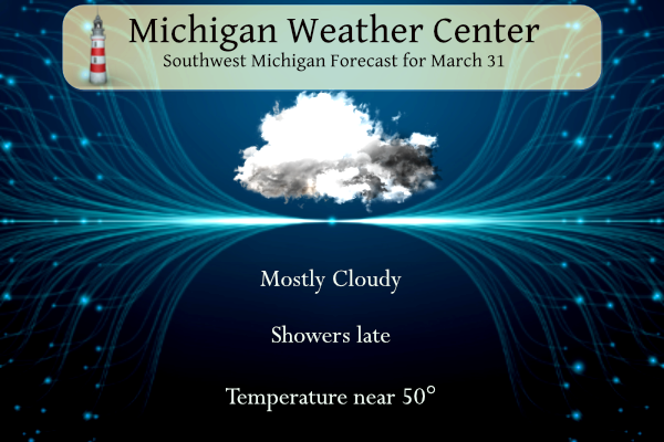
Mostly cloudy skies are expected today. The bulk of the day should be dry. Highs will be near normals for this time of year in the upper 40s to around 50 degrees. Rain will begin to spread into the area from the southwest this evening. Rain is likely near and south of Interstate 96 tonight. Lows tonight will be between 30 and 40 degrees.
NWS Forecast
Weather History
1923: March goes out like a cold lion with record lows in the single numbers and lake effect snow showers.
2006: A tornado hits a few miles east of Jackson, taking down hundreds of trees and causing minor structural damage in the town of Leoni.
On March 31, 2014, an extremely narrow band of accumulating snow developed just south and southeast of Saginaw Bay. The town of Caro measured 8 inches.
Also on March 31, 2014, Flint finished the month with an average temperature of 26.0 degrees, making it the 2nd coldest March on record for the area. This is despite a balmy high of 61 degrees on the last day of the month. Detroit and Saginaw also finished the month with their 11th and 5th coldest Marches respectively.
Also on March 31, 2006, severe weather broke out across much of Southeast Michigan. There were over 30 severe hail and severe wind/damage reports. Some of the one-inch diameter hail in southern Genesee County piled up to several inches.
1942: 107 inches of rain fell during the month at Puu Kukui at Maui, Hawaii to set the U.S. record for rainfall in one month. The same place also holds the annual rainfall record for the United States with 578 inches in 1950.
1962: A tornado struck the town of Milton, Florida killing 17 persons and injuring 100 others. It was the worst tornado disaster in Florida history.
1973: A devastating tornado took a nearly continuous 75-mile path through north-central Georgia causing more than 104 million dollars in damage. Click HERE for more information from Athens Banner-Herald.
Forecast Discussion
- Showers And A Few Thunderstorms Tonight

A sfc high pressure ridge will bring tranquil wx today with mostly
cloudy skies and some patchy early morning fog. A warm front off
to our south will result in isentropic upglide/ascent resulting in
development of rain showers mostly near to south of the I-96
corridor tonight.

There is also potential for a few thunderstorms mainly between
00Z and 08Z Monday primarily near to south of the I-94 corridor as
suggested by the 00Z HREF. This is the result of very weak
elevated instability. However we expect most convection will stay
south of our area tonight where much stronger elevated instability
will be present.

Some mixed pcpn type issues are expected across our far northern
fcst area tonight where thermal profiles will be cooler. Very
little if any impacts from the mixed pcpn are expected however as
the duration of it will be very short lived.

The frontal boundary off to our south will continue to focus
development of more showers mainly across the southern half of
our fcst area on Monday.

- Active Weather Early to Mid Week

A northern stream upper shortwave trough will be diving southeast
into the Northern Plains Monday night while a southern stream upper
wave will be moving northeast from the Central Plains. These two
shortwaves close off into an upper low to our west on Tuesday and
move into the Great Lakes Tuesday night. This feature will be the
driver of our weather early to mid week. At the surface initially a
stationary front will be located off to our south, but as the upper
low moves in a surface low will be deepening and moving in as well.
A moderately strong low will be in place by Wednesday morning near
Lake Huron. Both the GFS and ECWMF have depths below 990mb`s. Mainly
rain will be the precipitation type initially Monday night, but this
will be trending more and more towards snow as we work into mid
week. Very plausible we have accumulating snow near and north of
Interstate 96 Tuesday night and Wednesday. The highest accumulations
should be found across Central Lower Michigan in the coldest air.
Snow showers mixed with rain at times will continue into Thursday
before ending. Bottom line...Monday night through Thursday looks to
have precipitation every 12 hour forecast period. Wednesday highs
look to be the coldest and will not rise much above 40 degrees.

- Drying Out and Warming Up Late Week

A slow moderating trend in temperatures begins on Thursday. Highs on
Thursday will be in the 40s...rising to near 50 on Friday...into the
50s on Saturday and to near 60 on Sunday. Surface and upper ridging
will gradually take over during this time frame and we have a dry
forecast from Thursday afternoon through the weekend.
Furnace is still cranky who said 70’s are here ?? Lol…INDY
The warm weather fanatics have ZERO credibility! They keep talking about winter weather being over and we keep getting tons of cold and snow! Too funny!
Breaking>>>>>>>SNOW chances are increasing for next week! Incredible!
Winter storm watches coming this week?? Isn’t it April yet?? Or is this just a chocolate bunny buzz today ?? INDY!!
Yes snow is coming and the furnace has been cranking for months! Cold, cold pattern!
Yes, April and winter weather is still ,rocking and rolling!
After a string of below normal temp days, we still have a lot coming next week! Amazing cold snap!
Happy Easter! After a two week winter this year, that extended forecast looks spectacular! We are about to enjoy 7 months of the best weather in the country!
Agreed! How’s that possible?!?! I thought we were going to get measurable snow til early June, according to the cold weather crazies!
Happy Easter MV’s best! Have a awesome day! INDY
Too funny March had a whole 2 days of measurable snowfall!!! Just the FACTS!! The way some talked on here, I thought there would have been a foot of snow on the ground for 28 out of the 31 days!! What a joke!
https://forecast.weather.gov/product.php?site=grr&product=cf6&issuedby=grr
BLOWTORCH BULLSEYE over Michigan again! Does not get any better than that!!
I love early springs and summers!!
Who wouldn’t?!?!?
Are you 10 yrs old?
We’re about a week away from Heaven on earth temps dominating our area! Get you lawnmower blades sharpened, as Michael said get your plant seeds ready, shine up those golf clubs and get out and enjoy these next 6 months of spectacular weather!!
https://weather.com/weather/tenday/l/52aab230ef88e4f2bb12857231a5dd58392e78a71b90e01d57a11d827658eb55
Based on the 30 year averages March will end up an ASTOUNDING 5 degrees above normal temperature wise and below average in snowfall! How could that be?!?!! I thought we were going to be pummeled with endless snowstorms and highs in the teens all month??? It’s the same thing every year, all the cold weather hype and we get warmth and no snow! LOVE IT!!
Happy Easter everyone.
AMEN Praise Jesus! Have a blessed day everyone!
Words of the day…..
Drying Out and Warming Up Late Week
A slow moderating trend in temperatures begins on Thursday. Highs on
Thursday will be in the 40s…rising to near 50 on Friday…into the
50s on Saturday and to near 60 on Sunday. Surface and upper ridging
will gradually take over during this time frame and we have a dry
forecast from Thursday afternoon through the weekend.
Words of the day and week! We have seen multiple below normal temp days lately and more to come! Cold and Snow! How could it be? Rock n roll baby! Bring it!
The official H/L yesterday was 45/33 there was 0.20” of rainfall the highest wind gust was 16 MPH out of the NW. There was no sunshine. For today the average H/L is 51/32 the record high of 78 was set in 1986 and 2010 the record low of 6 was set in 1923. The most snow fall of 3.7” was in 1951 the most on the ground was 7” in 1970. Last year set the most rainfall of 2.02” and the H/L was 58/39.
Slim