
Greg at the Calder
Yesterday we had my brother’s (Greg Morris) memorial service (celebration of life) who passed away last December. I would once again like to thank the ladies who set up the potluck pastor Jeremy for opening up their church to us and Jeff Lancaster who helped set up the event. The reason it took so long is that the musicians of Mid-Life Crisis had to clear their schedules so they could all be present. They came from all over the state and as far away as Washington DC. The event was held at the Methodist church here in Otsego. The band played a half-hour or so set at the event which was the loudest music probably to come out of that church. They even had a recording of my brother singing and playing which they played along to. The band had parted ways a few years ago so it was great to see them all come together for this event. I am sure Greg was rocking with them in heaven. Rock on brother, I love you…
NWS Forecast
Weather History
1901: A tornado killed one person and injured four others in Kalamazoo County as it moved from Vicksburg to Scott.
1904: Tornadoes hit Muskegon and Grand Rapids. In Muskegon, five homes were unroofed or torn apart on the lakefront at Harrison Street. In Grand Rapids, ten people were injured as the tornado damaged a church and several barns.
On March 24, 1965, Flint set a record low with -7. Three days later in 1965 Flint fell to -2. These two dates are the latest in a year that Flint has recorded below-zero temperatures.
1912: Residents of Kansas City began to dig out from a storm that produced 25 inches of snow in 24 hours. The snowfall total was nearly twice that of any other storm of modern record in Kansas City before or since that time. A record 40 inches of snow fell during March that year, and the total for the winter season of 67 inches was also a record. By late February of that year, Kansas City had received just six inches of snow. Olathe, Kansas received 37 inches of snow in the snowstorm, establishing a single storm record for the state of Kansas. (23rd-24th)
1929: St. Louis, Missouri soared to 92 degrees; their all-time record high for March.
1975: “The Governor’s Tornado” hop-scotched a 13-mile path across the western part of Atlanta, GA during the early morning hours, causing considerable damage to the Governor’s mansion. Hundreds of expensive homes, businesses, and apartment complexes were damaged. Total losses were estimated at $56 million. Three people lost their lives, and the F3 tornado injured another 152.
Forecast Discussion
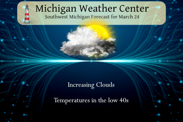
- Weak Clipper will bring light snow to the north later today

 Models are in fair agreement on the passage of a 500 mb low
flattening out as it treks eastward. A negatively tilted ridge
with a large upper level trough over the western US including the
intermountain west will dominate the weather pattern into the work
week. Zonal flow with mid level moisture will move through the
Great Lakes later today. Surface ridging will keep most moisture
to our north. The sole exception will be light snow showers which
will move along the US 10 corridor with only light accumulations
expected. Temperatures will will be 5 to 10 degrees below normal
today with lows this morning in the low 20s to high teens, and Max
temperatures this afternoon into the low 40s.
 Southwesterly winds will increase later today bringing the
aforementioned drier air which will drop RH`s into the 30s along
the I 94 corridor.

- Rain Possible late Monday

 As the previously mentioned upper level low moves through the
intermountain west and through the Great Plains, the negatively
tilted ridge will build over the region with warm air advection
into Michigan along with a boundary of moisture bing the result.
A strong pressure gradient will be the result with increasing
winds expected through the first half of the work week. Wind gusts
tonight through Monday should be 20 to 30 mph.
 As the warm frontal boundary lifts into the Great Lakes it will
bring bands of showers which should be stalled enough to arrive
late Monday though some rain showers could reach the lakeshore
Monday afternoon.
 The incoming system has strong dynamics with copious PWATS and
decent potential instability. This will be discussed in the next
section.

- Perhaps some wind/thunderstorm related impacts Tuesday

An intense 500 mb jet(100 - 110 knots) will be lifting up through MI
during this time. The 850 mb low level jet increases accordingly to
60 to 70 knots. Cross sections Tuesday afternoon suggest a fold in
the Trop may occur.  All this spells an increased risk for high
winds.  Ensemble wind values from the models continue to increase,
showing a potential for 35 to 45 mph values.  It`s possible that a
wind advisory may end up being needed.

Several models like the GFS, NAM, and Canadian are now showing
surface based instability(500-1000 J/kg) during the afternoon
building into the I94 corridor. If this happens, considering the
wind fields through 500 mb, an increased potential for damaging
winds would be possible. We will add thunderstorms to the forecast
mainly for the southern zones and feature gusts topping 35 mph in
the grids.  We will add an mention for high winds/strong storms to
the hazardous weather outlook for Tuesday.
Get ready, after a brief 2 day warm up, BAM another big cold front comes roaring through! Highs in the 30’s and low 40’s and lows in the 20’s! Winter keeps going and going! WOW!
https://www.forbes.com/sites/jamiecartereurope/2024/03/23/double-solar-flare-sees-sun-wake-up-weeks-before-total-solar-eclipse/amp/
Yesterday was yet another of many below normal temp days! Today will be more of the same! Is winter done yet?
Yep
Too funny, you said winter was done months ago! What a joke!
Too funny you said we were going to get around 80 inches of snow this winter! What a joke!!
Rocky (Rockford)
Bring on winter and the RDB says near to above normal snowfall! Rock n roll baby!
October 21, 2023 9:16 am
The overnight low here in MBY was 20 at the current time it is cloudy and 27 and there is just a trace of snow left on the ground.
Slim
The official H/L yesterday at Grand Rapids was 36/23 there was a trace of snowfall. At 7AM there was 6” of snow on the ground. The sun was out 90% of the time. For today the average H/L is 48/29 the record high of 78 was set in 1910 and 1939 the record low of -3 was set in 1974. The wettest and most snowfall was 1.07” that fell as 5.3” of snow in 1947. The most snow on the ground was 15” in 1965. Last year the H/L was 44/31.
Slim
Sorry about your bro, Michael. It’s cool that his bandmates could be there. Yesterday sounded like a nice tribute to him.
That was a nice memorial for your brother.
Slim
Michael,
How special that they all came together. I have been to that church quite a few times… trying to envision where the band was. The ladies at that church are fantastic!!! We had my gparents and friends memorials there.
I hope you and your whole family are doing ok.