We will start the day with sunny skies before the clouds move back in this afternoon. Temperatures will continue to average above normal through the rest of the week. Widespread, soaking rain arrives late tonight and lingers into Thursday. Some locations could see over an inch of rain before the precipitation changes to light snow or mixed rain and snow showers to end the week. A period of gusty winds is also likely Thursday evening.
Weather History for SW Michigan
February 5
1890: Temperatures more like April than February prevail during one of the mildest winters on record in Lower Michigan. Lansing sets a record high of 61 degrees for the second day in a row.
1918: Frigid weather holds on across Lower Michigan with the temperature falling to record lows of 16 below zero at Muskegon and 21 below at Lansing.
February 6
1895: Lower Michigan is in the midst of a week-long siege of arctic air. High temperatures struggle through the single numbers while morning lows fall well below zero. Lansing falls to 14 below zero on this date after lows of 24 below on the 4th and 20 below on the 5th. Grand Rapids hits 9 below after falling to 16 below on the 5th.
1938: The weight of ice and water carried away the west side of the Rogue river dam at Childsdale.The Souffrow bridge near North Belmont was closed to traffic as its footing had been swept away by the river. Several houses along the east bank of the Grand River were flooded.
2008: Near blizzard conditions occur across part of Lower Michigan with snowfall rates of one to two inches per hour. More than a foot of snow fell north of Interstate 96 to Route 10. Further south, a wintry mix of snow, sleet, and freezing rain occurred from Kalamazoo to Jackson. The storm drops more than 8 inches of snow at Grand Rapids, contributing to the snowiest February on record with 41.6 inches.
2019: An ice jam on the Grand River in Portland caused flooding along Water Street in downtown Portland, where about 50 people were evacuated from their homes. The ice jam shifted and thickened a couple of days later, causing additional flooding. Many businesses along Kent Street were flooded, and people along Canal and Market streets were evacuated. The ice jam held for more than three weeks before finally melting and shifting downstream. Some homes on Water Street experienced continuous flooding for most of this three-week period.
February 7
1899: The greatest arctic outbreak in United States history begins a period of extreme cold in Michigan. Grand Rapids hits 15 below zero. During the next week, temperatures will fall to all-time record lows across the state and much of the continental U.S.
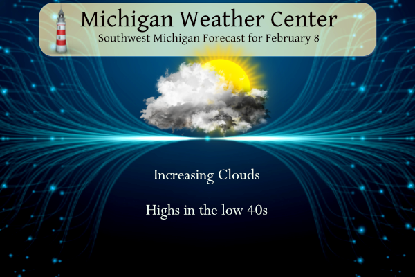
February 8
1925: A four-day warm spell with highs over 50 degrees across southwest Lower Michigan peaks with a record high of 60 degrees at Grand Rapids.
February 9
1875: The temperature tumbles to 32 degrees below zero at Lansing and 20 below at Detroit during one of the coldest months on record in Lower Michigan. The mean temperature for the entire month at Lansing is 4.7 degrees, the coldest month ever recorded there.
1934: The coldest temperature ever recorded in Michigan occurred at Vanderbilt, with a low of 51 degrees below zero.
February 10
1899: Grand Rapids has its coldest day on record with a high of 6 below zero and a low of 21 below. Muskegon had set their record for all-time coldest high temperature on the 9th with a high of 5 below zero.
February 11
1899: Muskegon records their all-time record low of 30 below zero. Grand Rapids falls to 21 below and Lansing to 22 below.
1999: A surge of warm air ahead of a cold front brings all-time record-high February temperatures to much of Lower Michigan. February records include 67 degrees at Muskegon and 69 degrees at both Grand Rapids and Lansing. Battle Creek hits 72 degrees.
Weather History for SE Michigan
February 5
On February 5, 2014, a winter storm 6 to 8 inches of snow to Southeast Michigan. The highest accumulations were measured in Wayne, Washtenaw, and Monroe counties including 8 inches in Detroit. Flint recorded 5.8 inches while Saginaw recorded only 4 inches.
Also on February 5, 1918, the overnight temperature dropped to -23 degrees in Saginaw. This is the record low for this city.
February 6
On February 6, 2008, a hit most of Southeast Michigan. Widespread amounts ranged from 6 inches across central Livingston, Oakland, and Macomb Counties to greater than 10 inches for all of the Flint (11.3 inches at Bishop Airport), Tri-Cities (12.0 inches at Tri-Cities Airport), and Thumb regions. Areas across the southern Saginaw River Valley were dumped with 16 to 18 inches of snow from southwest Saginaw to Birch Run to Vassar.
February 7
On February 7, 1895, the daytime temperature rose to only 2 degrees in Detroit, which is the record daily low daytime temperature. This was also the third day in a row (February 5-7) that daily low daytime temperature records were set.
February 8
On February 8, 1900, the daytime temperature rose to 63 degrees in Saginaw, which is 34 degrees above average.
February 9
On February 9, 2018, a full day of snow, including a period of 1″ per hour rates, led to accumulations ranging from 4 to 9 inches across Southeast Michigan. The heaviest snow fell between the Ohio border and M59. Peak measurements of 9.0″ were taken near the towns of Adrian and Milan.
Also on February 9, 2016, prolonged moderate to heavy snow resulted in significant accumulations in the Thumb. Locations south of Interstate 69 received only 1 to 6 inches, with the lowest amounts closest to Detroit and the Ohio border. However, Sebewaing, Port Hope, and Cass City all measured a foot. The big winner was Deford in Tuscola County where 14 inches fell.
Also on February 9, 2010, a strong low-pressure system passed through the Ohio River Valley and dropped the largest snowfall totals of the 2009-10 season across southeast Michigan during the afternoon and evening hours of the 9th and the early morning hours of the 10th. Most locations received between 5 and 10 inches with the highest amounts observed along the Ohio border, and between Flint and Saginaw, where up to a foot was reported. Some of the higher snowfall reports included Saginaw with 12.4 inches, Burt with 10.5 inches, Samaria with 10.0 inches, and Ann Arbor and Flint received 9.4 inches.
Also on February 9, 2001, a storm produced widespread two-day rainfall amounts from one to two and a half inches across all of Southeast Michigan. With substantial snowmelt thanks to one to two feet of snow on the ground, runoff production was quite large. Numerous rivers flooded over the following few days, and basement and road flooding was widespread. Unfortunately, there were three deaths as a result of the flooding in Monroe county.
Also February 9, 1977, this day marked the last day of a streak of 45 days (December 26, 1976-February 9, 1977) of temperatures at or below 32 degrees in southeastern Michigan.
February 10
On February 10, 1899, the daytime temperature rose to only -1 degrees in Detroit, which is the record minimum daytime temperature for the day. This was also the second day in a streak of five days (February 9-13) that daily minimum daytime temperature records were set.
February 11
On February 11, 1999, the temperature rose to 70 degrees in Detroit. This is the earliest 70-degree day ever recorded in the city of Detroit.
Forecast Discussion
- System Arriving Late Tonight - Thursday

Quiet weather is expected for today, then a compact mid-level
wave with it`s accompanying strong surface low will move into
southern lower MI late tonight and Thursday. This system will be
accompanied by impressive Gulf moisture aided by an impressive 50+
knot Low Level Jet. Precipitation will arrive at the I-94
corridor around 1am, then the rain will become widespread across
the southern half of lower MI by 7am. Mostly rain is expected at
the onset of the precipitation, but a question still exists of
whether or not we see a mix of precip types or freezing rain.
Strong warm air advection will support temps above freezing for
most of the area, but there may be some wet-bulbing potential
that could support a very brief period wintry mix for some areas
at the onset of precipitation. For areas in the central interior
part of the state that are always notoriously colder, there exists
the potential for some freezing rain between 1am to 7am Thursday
morning. Any icing that does occur should stay limited to below a
tenth of an inch.

A continuing surge of warm air advection will support all
precipitation to switch over to rain after sunrise Thursday. Rain is
expected to be steady and at times heavy Thursday morning and
into the early afternoon. Rainfall intensity should subside into
Thursday evening as a dry slot noses into southwest MI. Overall
rainfall amounts of 0.75 to 1.25 inches look likely across the
area between midnight Thursday to midnight Friday.

- Strong Winds Thursday Afternoon and Evening

While the intensity of rainfall decreases Thursday afternoon and
evening, winds will be on the rise. During the afternoon, low-
level lapse rates will increase supporting improved mixing into
strong elevated gusts associated with the Low Level Jet overhead.
The potential for gusts to 40 to 45 mph exits for the afternoon
period, particularly for the I-94 corridor.

Winds then briefly weaken around 7pm Thursday as the center of the
low pivots through the state and moves east. Winds will quickly
shift to the northwest and increase with similar gusts to 40 to 45
mph possible for I-94 and lakeshore counties as far north as
Muskegon. Winds will stay strong into the early overnight hours
then will weaken around midnight. Overall, there is ever
increasing confidence that a wind advisory will be needed in the
future for the I-94 corridor and lakeshore counties south of
Muskegon.

- Quiet and Sunny Weekend Ahead

Broad mid level ridging will move into place late Friday and
corresponding surface high pressure will dominate sensible weather
through this weekend. Temperatures will be slightly closer to
normal Friday and Saturday, then Sunday and Monday will feature
warmer temps in the 40s. Conditions will be dry, and sunshine
looks to return!
It was a nice day to be outside today. My dog loves the sunshine. I am working on walking with the leash with her. Right now she has her nose to the ground with all the smells. I was teaching her to walk and stop and sit. lol!! We have alot of work on that one.
Good luck with your pooch!
Good let’s talk spring. Spring is my 2nd most favorite season (Summer is my most favorite season) But what really is spring? Spring is the time of year when many things change—including the weather. Temperatures can swing back and forth between balmy and frigid. Sunny days may be followed by a week of stormy weather. Sometimes extreme weather changes can occur even within the same day. Early in spring there can be warm days with highs in the 70’s and even 80’s and there can be cold days with highs in the upper 20’s or low 30’s In Michigan frost… Read more »
Hey Slim, our big old sugar maple over our driveway has been spitting sap out the past couple days onto our cars, so it’s starting!
It looks quite mild until at least February 20th. So even if things get cold, we only have about 1 week until March and 4 weeks until spring. Any long sustained cold looks pretty unlikely for the rest of the season to me. But it will definitely snow again, and remain chilly in the 30s and 40 probably for a long while into March
Only 32 days until the clocks spring ahead one hour. 🙂
I have not seen any Maple trees with sap running. I have some early flowers like daffodils and some perennials popping up.
The second season I like is Fall with all the colors of the leaves.
As I predicted a week ago, winter is dead. Now let’s talk spring!
Spring, the best season! It’s when everything springs back to life after the grey death and despair of winter!
Sure lets talk spring.
Slim
That is one of the most ignorant comments that I have ever heard! Wow, just wow!
Spring is almost here.
Good morning! Yesterday was one of those days when the high for the day happened early in the day 7AM Grand Rapids 4 AM Muskegon and the temperature slowly fell during the day. The official H/L at Grand Rapids yesterday was 45/33 There was just a trace of rain fall and no snow. There was a reported 2” of snow on the ground yesterday morning. There was no sunshine. The overnight low and current temperature here in MBY is 22 the last reading at GRR was a warmer 25. For today the average H/L is 32/18 the record high of… Read more »
Our local TV mets are on board with the widespread rain. They’re thinking an inch or more for this area and some areas to our southeast may reach two inches.
From the link below: “If we put the severe winter days together, we probably have about only nine days of Michigan winter so far this season.”
https://www.mlive.com/weather/2023/02/winter-severity-index-quantifies-our-almost-unbelievable-non-winter.html
Nine days sounds about right. Another factor the index doesn’t take into account is how fast the snow has disappeared shortly after it fell. The Christmas mini blizzard was wiped out in 2 days right after it happened. Nine days out of three months, I’ll take that any year!
Wow only 9 days of winter! Sounds about right!
Yep, 9 day winters are fantastic!!
It’s going to get cold again. And probably snow at some point. But “arctic” air coming for a sustained period is probably done.
Slim
If one would use only very “hot” days of 90 or above then most of Michigan would only have around 8 to 15 days of Summer most years. This has been one of the mildest winter seasons here much of the lower Great Lakes and may be the warmest since 2001/02. Note that winter season did have a rather cold and snowy March.
Slim
Sounds good to me.
Hoping some sun today will melt our ice rink of a yard. Lol
The ice and snow are disappearing fast. It’s nice for walking.