What summer was hotter 2012 or 1988. Both years were very hot by Michigan standards. At Grand Rapids, in 2012 the June mean was 70.8 the high for the month was 97 the low for the month was 46. There were 8 days with highs of 90 or better. There was 2.17” of rain fall. July 2012 had a mean of 79.2 the high for the month officially was 104 Here in MBY I had a high of 108 that would have tied the record high for Grand Rapids. The low for the month was just 60, there were 18 days with highs of 90 or better. There was 2.56” of rain fall. For August the mean was 70.8, the high for the month was 93 and the low was 48 There were 4 days of 90 or better and 3.34” of rain fall. As for 1988 the mean at Grand Rapids for June was 68.5 the highest reading was 98 the lowest was a cold 40 there were 10 days of highs of 90 or better. There was just 0.25” of rain for the whole month. For July the mean was 74.6, the highest reading was 100 the low for the month was a cool 46 There were 13 days of 90 or better. There was 3.69” of rain fall. For August the mean was 73.4 The highest reading was 98 and the lowest reading was a cool 46 there was 13 days of 90 or better and there was 3.04” of rain fall. A strong cold front brought heavy thunderstorms on the evening of August 17 and the rest of the month and September were cooler than average. For the summer season of June, July and August the mean for 2012 was 73.6 and 2012 had 30 days of 90 or better for the year there was 32 days of 90 or better. For 1988 the mean was 72.6 there were 36 days of 90 or better for the year there were 37 days of 90 or better. For the year 1988 has the most days of 90 or better with 2012 coming in at 3rd place and 1931 coming in at 2nd place. So along with 1931 both 1988 and 2012 were among the warmest summers in much of Michigan.
AREA FORECAST DISCUSSION
NATIONAL WEATHER SERVICE GRAND RAPIDS MI
328 AM EDT SAT JUN 3 2023
LATEST UPDATE…
SHORT TERM/LONG TERM/MARINE/FIRE WEATHER/CLIMATE
SHORT TERM
(TODAY THROUGH SUNDAY)
ISSUED AT 328 AM EDT SAT JUN 3 2023
THE MAIN FOCUS OF THE WEATHER THROUGH THE SHORT TERM (SUNDAY) WILL
BE ON THE SHOWER/STORM POTENTIAL THIS AFTERNOON AND EARLY THIS
EVENING. OTHERWISE, THE PERSISTENT DRY WEATHER WILL CONTINUE TO
DOMINATE.
EAST/NORTHEASTERLY LOW LEVEL FLOW CONTINUES TO DOMINATE OVER THE
REGION WITH THE UPPER HIGH TO OUR NW IN THE VERY BLOCKY UPPER AIR
PATTERN OVER NORTH AMERICA. WE ARE STILL POISED TO SEE A WEAK COLD
FRONT PASS THROUGH THE REGION TODAY, AS A WEAK SHORT WAVE DROPS IN
FROM THE NE. THE SFC PRESSURE PATTERN IS SUCH THAT IT IS HARD TO SEE
THE FRONT WITH THE GREAT LAKES HAVING A BIGGER EFFECT ON THE
PATTERN. IT CAN BE SEEN HOWEVER IN THE LOW LEVEL THERMAL FIELDS WITH
SLIGHTLY COOLER TEMPS MOVING IN LATER TODAY AND TONIGHT.
THE FRONT ITSELF DOES NOT LOOK TO TOUCH OF THE FEW SHOWERS AND
STORMS EXPECTED TODAY. IT LOOKS TO BE MORE OF THE AREAS OF
CONVERGENCE THAT RESULT MORE FROM THE FLOW OVER THE GREAT LAKES. THE
FAVORED AREAS WILL BE ALONG THE LAKE MICHIGAN SHORE WHERE THE NE
FLOW WILL MEET UP WITH THE LAKE BREEZE COMPONENT, AND TOWARD I-94
WHERE SOME CONVERGENCE DEVELOPS DUE TO THE FLOW PATTERN OFF OF LAKES
HURON AND ERIE. IT IS THESE LOCATIONS THAT MODELS INDICATE ALSO WILL
HAVE THE HIGHEST DEW POINTS.
ML CAPES COULD RISE TO AS HIGH AS 1,000 J/KG IN THESE FAVORED AREAS,
WITH LITTLE TO NO CIN STOPPING A RISING PARCEL. THE EFFECTIVE SHEAR
VALUES ONCE AGAIN WILL BE QUITE WEAK, LESS THAN 15 KNOTS, THAT WILL
SUPPORT MAINLY PULSE TYPES OF STORMS. CAN NOT RULE OUT SOME HAIL IN
THE BETTER UPDRAFTS, AND SOME WIND GUSTS WITH AN INVERTED V
SOUNDINGS, AND MID LEVEL DRY AIR ENTRAINMENT. THE STORMS SHOULD
DISSIPATE/MOVE OUT OVER LAKE MICHIGAN BY 9-10 PM TONIGHT.
MUCH DRIER AIR WILL ADVECT OVER THE AREA, ALONG WITH SOME COOLER
AIR. 850 MB TEMPS FALL FROM AROUND 16-17C THIS AFTERNOON, TO AROUND
14C SUNDAY AFTERNOON. IT WILL STILL BE WARM, JUST NOT AS HOT AS THE
LAST FEW DAYS. WE WILL HAVE LITTLE TO NO CLOUD COVER ON SUNDAY WITH
A VERY DRY AIR MASS EXPECTED THROUGH MOST OF THE COLUMN.
LONG TERM
(SUNDAY NIGHT THROUGH FRIDAY)
ISSUED AT 328 AM EDT SAT JUN 3 2023
– SUCCESSIVE MOSTLY DRY COLD FRONTS ENDS HEAT WAVE –
A DEEPENING POSITIVELY TILTED TROUGH EXTENDING FROM A SOUTHWARD
MOVING UPPER LEVEL LOW WILL FORCE THE HIGH PRESSURE THAT HAS
DOMINATED THE WEATHER PATTERN FOR THIS PAST WEEK TO RETROGRADE
SATURDAY EVENING INTO SUNDAY. LATEST GUIDANCE BRINGS A MOSTLY DRY
COLD FRONT THROUGH LOWER MICHIGAN MID TO LATE ON SATURDAY WITH THE
SLIGHTLY COOLER AIR IN BEHIND IT NOT ADVECTING INTO THE REGION UNTIL
SUNDAY. SO MAX TEMPERATURES ON SUNDAY WILL ONLY BE AROUND 10 DEGREES
ABOVE NORMAL INSTEAD OF 15 TO 20 DEGREES ABOVE NORMAL.
HOWEVER, THE EC/GEFS IS STILL IN FAIR CONSENSUS THAT AS THE HIGH
PRESSURE IS CONTINUALLY PUSHED WESTWARD, A LARGE UPPER LEVEL LOW
WILL MOVE SOUTHWARD ACROSS THE NORTHEAST AND INTO THE MID ATLANTIC.
THIS WILL BRING ANOTHER COLD FRONT THROUGH THE GREAT LAKES MONDAY
INTO TUESDAY. SO BY TUESDAY, TEMPERATURES WILL BE BACK TO AROUND
NORMAL WHICH FOR THIS TIME OF YEAR IS IN THE MID TO UPPER 70S.
THE INSTABILITY CREATED BY THE BOUNDARY MONDAY INTO TUESDAY COULD
SPARK SOME SHOWERS AND PERHAPS A THUNDERSTORM GIVEN THE MID LEVEL
THERMAL ADVECTION AND PRESSURE GRADIENT, HOWEVER THERE REMAINS A
LACK OF MOISTURE. GIVEN THIS DICHOTOMY HAVE LEFT LOW POPS.
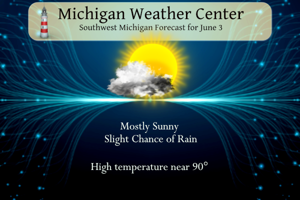
Detailed Forecast for Grand Rapids
Today
A 20 percent chance of showers and thunderstorms after 2pm. Mostly sunny and hot, with a high near 90. East northeast wind 6 to 13 mph.
Tonight
Partly cloudy, with a low around 55. East northeast wind 8 to 11 mph, with gusts as high as 20 mph.
Sunday
Sunny, with a high near 82. East northeast wind around 11 mph.
Sunday Night
Partly cloudy, with a low around 54. East northeast wind 5 to 9 mph.
Monday
Mostly sunny, with a high near 84. Light west southwest wind becoming northwest 8 to 13 mph in the morning.
Monday Night
Mostly cloudy, with a low around 57.
Tuesday
Mostly sunny, with a high near 79.
Tuesday Night
Mostly clear, with a low around 49.
Wednesday
Sunny, with a high near 78.
Wednesday Night
Mostly clear, with a low around 51.
Thursday
Sunny, with a high near 78.
Thursday Night
Mostly clear, with a low around 53.
Friday
Sunny, with a high near 81
We took a day trip to Bay City yesterday and it was much cooler there with a NE wind off of Saginaw Bay the temperatures were only in the upper 70’s on the north side of town and in the low 80’s on the south side of town.
No heat waves are in sight! I love it!
GR officially hit 90 again! 5th straight 90+ day. Wow!
3,600 acre wildfire up in Crawford County near Grayling and growing. Evacuations underway and a section of I-75 closed
https://www.9and10news.com/2023/06/03/michigan-dnr-multiple-counties-battling-100-acre-fire-in-grayling-evacuations-underway/
Well no rain at my house once again so the rainless streak continues here.
Good to see areas south of here getting some much needed rain.
Same here. And the forecast is depressing (at least with respect to moisture).
We know a big farmer up in Sand Lake and he said his wheat crop is essentially going to be junk. Sad.
Yup. I have some around me too. The winter wheat is struggling and unlikely to even be harvested. The corn and beans seem fine (for now).
* Severe Thunderstorm Warning for…
Calhoun County in south central Michigan…
Southeastern Kalamazoo County in southwestern Michigan…
* Until 715 PM EDT.
* At 549 PM EDT, an area of severe thunderstorm was located near
Marshall and Albion, moving southwest at 10 mph.
HAZARD…60 mph wind gusts and quarter size hail.
SOURCE…Radar indicated.
Mason-Lake-Osceola-Clare-Oceana-Newaygo-Mecosta-Isabella-Muskegon-
Montcalm-Gratiot-Ottawa-Kent-Ionia-Clinton-Allegan-Barry-Eaton-
Ingham-Van Buren-Kalamazoo-Calhoun-Jackson-
348 PM EDT Sat Jun 3 2023
…FIRE WEATHER WATCH IN EFFECT FROM SUNDAY MORNING THROUGH
SUNDAY EVENING…
The National Weather Service in Grand Rapids has issued a Fire
Weather Watch, which is in effect from Sunday morning through
Sunday evening.
* Winds…East 10 to 15 mph, with gusts to 20 mph.
* Relative Humidity…As low as 18 percent.
* Temperatures…In the upper 70s to lower 80s.
Four things to be watching over the next 36 hours, in no particular order: 1. Moderate Beach Hazards Anticipating the high-pressure induced NNE winds over Lake Michigan to be pulled NNW this afternoon by the lake breeze circulation, and strengthen enough to result in waves increasing to 2-4 feet along portions of the West Michigan shore. Cold water temperatures aside, the waves and currents should be worthy of mentioning Moderate Swim Risk late this afternoon south of Grand Haven, including Holland State Park and South Haven north beach. Might also get Moderate conditions near and north of Big Sable Point.… Read more »
Sheesh, more smoke? First it was Alberta and British Columbia, and now from Quebec.
Not as hot today, but more uncomfortable. You can tell that the dew point is in the 60s.
Clouds are now starting to build here at this time. The question now is will there be any rain and with the clouds will Grand Rapids officially reach 90 today? At the current time it is partly cloudy here in MBY and 87.
Slim
In the last 26 days there has only been 0.04″ of rain at Grand Rapids. 0.06″ at Fremont, 0.10″ at Ionia, 0.11″ at Muskegon, 0.17″ at Lansing and 0.18″ at Holland. And there is not much if any chance of rain in the next week. This is probably the driest May into the start of June in our area in recorded history.
Slim
I believe it! I hope there is a big pattern change soon.
We are going for our 5th straight 90+ day in a row. This kind of continual heat wave has not been seen this time of year for a long time.
The last time that Grand Rapids, Holland, Lansing, Detroit, Flint and Saginaw had 5 days in a row of 90 at the end of May/start of June was in 1934. Muskegon did not have any reported days of 90 or better at that time. So far in the string of 90 or better days at the current time Grand Rapids is 4 (today would be 5 if it makes it) Lansing is at 3 of 4 (May 31st did not make 90) Holland is at 3 (today would be 4) Muskegon is at 4 they did not have any in… Read more »
We were in Bay City yesterday and it was much cooler there than most other areas. In the north side of town with a NE wind it was just 77 while on the south side of town it was 82. In Midland on the way there it was 90.
Slim
Thanks Slim. 1988 I believe was a lot less humid than 2012, but still just downright hot. This year is starting to remind me more of 1988 because of the lower dew point an no rain,, but still no argument about it being just plain HOT. Heat Wave 2023 continues….
Yes, most days in 1988 were less humid then in 2012. In 1988 we did not have central Air, just a window AC in the bedroom. In June and even July most nights were cool enough to just have a fan in the window. The first half of August was very hot and more humid. Then on the 17th a strong cold front with heavy thunderstorms came from the north one of the few times were the storms were west to east orientated. The line hit Grand Rapids just before midnight and lasted to after midnight. The lightning was spectacular.… Read more »
In 2012 July started out with a true “heat wave” with 7 days in a row of 90 or better with two days in a row of 100 or better. Here in MBY I had 108 on July 6 the official high at GR was 104 it was 103 at Lansing and at Kalamazoo there were 4 days in a row of 100 or better.
Slim
Pattern change in effect stay tuned!! INDY
Get ready – we will be reverting right back to our below normal temp pattern! Rock n Roll will never die!
Well now that GR temperatures dont count anymore this will be by far the hottest week of the Summer according to some!! Lol… I bet you Muskegon temperatures count they had recordeds broken lol…. INDY
Too funny, mookie doesn’t like the weather facts from GR so he simply disregards them! Ridiculous!
Here is a database where you can go back and look at past maps issued all the way back to the year 2000.
https://droughtmonitor.unl.edu/maps/maparchive.aspx
Drought monitor map from 2012 for those interested.
You rock, Slim. I’m glad you did this one. 1988 and 2012 were very hot years. 2012 was hotter overall. However, the MeFeel (yes, I just made this up) was higher in 1988. In 1988, I didn’t have A/C in my car or at home.
I am amazed at how the body can acclimate. 91 yesterday and I wasn’t miserable outside. If/when we get back to normal temps, it will probably feel cool.
Have a great Saturday, friends. Make someone smile. It will lift their spirits and yours. 😀