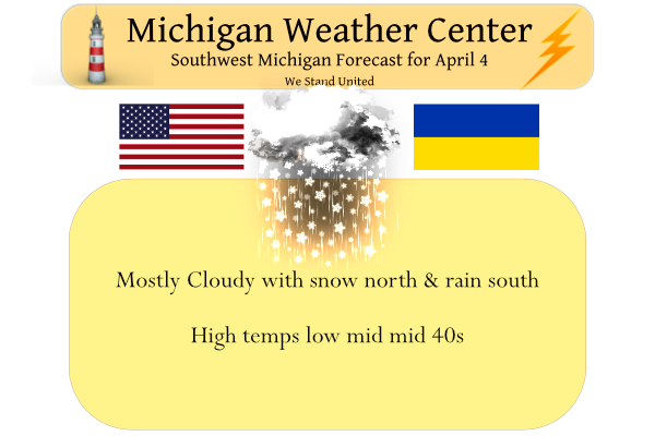
Another round of rain and snow is expected today for much of Lower Michigan. Accumulations of 1–4 inches are expected for areas along and north of I-96, with most snow falling between 7 AM and noon. Where heaviest snow falls, snow-covered/slippery roads are expected. Farther south, snowfall will be considerably less, with mainly wet roads.
Our current Winter Weather Advisories are as follows:
Mason-Lake-Osceola-Clare-Oceana-Newaygo-Mecosta-Isabella-Montcalm-
Gratiot-
Including the cities of Ludington, Baldwin, Reed City, Clare,
Hart, Fremont, Big Rapids, Mount Pleasant, Greenville, and Alma
918 PM EDT Sun Apr 3 2022

...WINTER WEATHER ADVISORY REMAINS IN EFFECT FROM 5 AM TO 3 PM
EDT MONDAY...

* WHAT...Wet, slushy snow expected. Total snow accumulations of
  1 to 4 inches.

* WHERE...Portions of central and west central Michigan.

* WHEN...From 5 AM to 3 PM EDT Monday.
...WINTER WEATHER ADVISORY REMAINS IN EFFECT FROM 5 AM TO NOON
EDT MONDAY...

* WHAT...A period of wet, slushy snow expected. Total snow
  accumulations of up to 3 inches.

* WHERE...Muskegon, Kent, Ionia and Clinton counties.

* WHEN...From 5 AM to noon EDT Monday.
It appears we will have an active weather pattern this week. We have 40° at 5 am in Otsego, the upper 30s in the Grand Rapids area, and the mid-30s in Big Rapids. We had a high of 49° and a low of 33° yesterday.
Forecast Discussion
...Rain and snow today...

Low pressure over western Wisconsin will slowly move across the cwa
today. Rain and snow have developed over Wisconsin in response to
strong isentropic lift ahead of the low. We should see precipitation
spread east to the cwa by sunrise. The precipitation will most
likely begin as rain, but then mix with and/or change over to snow
as wet bulb zero heights fall to less than 1k ft. The GFS and
NamNest differ in how quickly that occurs and exactly where.
Generally, the dividing line between all rain and a mix of rain and
snow looks to be from Grand Haven to around Kalamazoo/Battle Creek.
This line will move northeast this morning as warmer air pushes
north ahead of the low.  However, the rain/snow line looks like it
will be from Ludington to Lansing around 18z. So, north of that
line, we`re looking at mostly snow, which is were we have the Winter
Weather Advisory. Two to three inches of heavy wet snow still looks
reasonable there mainly north of M-46 with lesser amounts south of
there.  The system will move east tonight and away from the cwa.

...Rain Tuesday night and Wednesday...

The next low in the wave train is a larger system and will take
longer to move through. That`s because the system occludes west of
the state and the upper low cuts off. Models are showing a band of
rain along the occluded front that should move across the lake
Tuesday night. It`ll take until Wednesday afternoon before the steady
rainfall moves east and we get into a more showery and cooler
pattern. We`ll be stuck in that pattern from late Wednesday until
the upper low finally clears the state late Friday. The weekend
looks dry at this point as ridging at the surface and aloft moves
overhead.
Got a 10-minute burst of heavy wet snow this morning but what fell, melted by noon. Just a cool, gray day today. Looks like the 60s will finally return early next week.
Currently 87* degrees in Ft Myers Florida muggy feels like Summer down here real heat instead of saying 50’s and 60’s = blow torch… Hope you all enjoying the cold snow up north it is April right?? InDY
Rock on Indy and mookie is getting so bad he is calling low 60’s in mid April a blow torch! Too funny! Enjoy your vacation!
Get ready for lows well below freezing by this weekend! Wow!
Just another typical cloudy, cool Spring day! We are definitely in a cloudy, cool pattern despite all the warm weather hype!
Hoping for great weather for the Talladega Superspeedway race. Coming up in a couple weeks. I’ll be driving down with family. First time ever going there it’s going to be exciting. Hoping no severe weather!
NWS GR doesn’t even mention snow in their latest hourly observation: “light rain/fog/mist”
I love it!
The advisory only goes till Noon and it’s 36 degrees so it’s supposed to be tapering off right now. Lucky it’s not colder otherwise it would probably be freezing mist/drizzle.
Looks to be over. I don’t know if GR will report anything more than a trace.
I have one inch of fresh snow on the ground! Looks great!
I drove home and have a light dusting here. The snow was nice to watch with the really big flake size
+1
We are getting closer to the “warm season” from around April 20-October 20. That is the 6 month period where highs average 60+.
Snow on April 4th is nothing crazy but after April 20th it really starts to get unusual. A lot of recent winters we have had snow the first couple weeks of April so this event is nothing unusual at all. Also I do agree April snow is nice, relatively warm and doesn’t stick to the roads
Most of the overnight the temperature was at 40 or in the upper 30’s the low so far today is the current temperature of 34. At this time there is moderate snow falling but with the temperature of 34 and a warm ground the snow is not sticking.
Slim
So happy it’s not sticking!
Not sticking maybe at your place. Where I’m at the ground has turned white.
Not sticking here only on the cars.
Slim
It never sticks where mookie is and snowfall totals are always low!
So happy we keep getting snow to add to our seasonal totals! This winter has been awesome for sports! Wow!
Getting some very heavy snow where I am currently in Lowell, MI! Ground is white right now.
Rock n roll will never die! Accumulating snow on April 4th! What a winter it has been!
Yes I find April snows enjoyable. Big fat wet flakes that’s stick to the ground but only cause slush on the main roads. Fun to travel around in and look at
According to AWSSI, GR has now dropped to the 38th percentile – meaning 62% of winters were more severe than this last year’s.
Now, we need a chart showing all of our recent long warm summers!
That is of the winters going back to 1950/51 as that is the starting point. The cold season here in Grand Rapids was mostly moderate/average. This is from Melissa Widhalm, Associate Director/Regional Climatologist Midwestern Regional Climate Center. “For AWSSI, I included an image here of the timeseries tracking Grand Rapids over the cold season. The thick black line shows that November was near normal while December eventually dipped into the mild category (we had near-record warmth all across the Midwest in December). Come early January, conditions quickly came back near normal as a more typical winter pattern set in. The… Read more »
So happy this isn’t all snow and that the ground is warm and that temps will be warm enough to melt whatever does stick. April “snow” is the best!
Our last snow over 2″ was almost 2 months ago! Winter has been dead for months just as predicted way back then!
The below normal temp pattern continues this week!
By the end of next week the average high is around 60 degrees, yet mookie calls mid 60’s a blowtorch! What a joke!
False. Next Monday the average high is 56 degrees. 66 degrees would be 10 degrees above average.
You are wrong! I said by the end of next week! Keep your facts straight or don’t bother! You are hopeless!
Why are you talking the end of next week when I mentioned 66 degrees on Monday? Makes zero sense unless you’re just trying to spin…
Currently we are getting absolutely pummeled with heavy SNOW and mookie is talking about a blowtorch! Pathetic!
WOOD has 66 degrees next Monday. The start of yet another blowtorch!
What a joke! It will be the first blowtorch since about October of last year! Get real!
False. GR hit 67, 65 in mid March in a string of 12 consecutive above average days.
Just another below normal temp April day! Cloudy, cool, and wet! Incredible stretch of cool weather! Will we ever have a nice sunny warm stretch of a few days in a row? It has definitely been a cool, cloudy Spring so far!