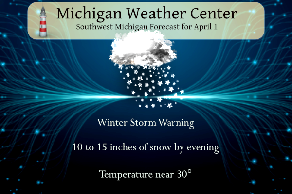
We have expectations of a major winter storm moving into SW Michigan today. Over a foot of snow will fall especially in the lakeshore counties and one county inland. Winds will gust to near 30 mph bringing hazardous driving conditions to those areas. There is an outside chance of thundersnow and a snowado. This will be called Winter Storm Rocky so mark it down!
Inland considerable clouds are expected today with the chance for showers increasing over Western Lower Michigan after 400pm. Highs today will be near 50 but an east wind of 10 to 20 mph will make it feel cooler. Rain will spread across Southern Lower Michigan tonight. Lows tonight will be in the 30s.
Yesterday’s high was 48°. Our rainfall total for March was 3.51 inches.
Happy April Fool’s Day!
Day One SPC Outlook

NWS Forecast
Weather History
1923: Winter persists into April as temperatures fall to a record-cold 8 degrees at Lansing and 9 degrees at Muskegon.
1970: An April Fool’s Day snowstorm drops 10 inches of snow on Lansing. Another 7 inches of snow falls the next day.
On April 1, 2023, a weak EF0 tornado moved through downtown Dundee during the late morning and damaged several historic buildings near Memorial Park.
On April 1, 1923, the overnight temperature dropped to a freezing 8 degrees in Saginaw, which is the daily record low as well as the monthly record low temperature. This day also marked the fifth day in a row (March 28-April 1) of record-low temperatures in Saginaw!
1875: The London Times published the first daily newspaper weather map. The first American newspaper weather map would be issued on 5/12/1876 in the New York Herald. Weather maps would first appear on a regular basis beginning on 5/9/1879 in the New York Daily Graphic.
1960: The first weather satellite, TIROS 1 (Television and Infra-Red Observation Satellite) began sending pictures back to Earth. The TIROS series would have little benefit to operational weather forecasters because the image quality was low and inconsistent. The most critical understanding achieved from the new technology was the discovery of the high degree of organization of large-scale weather systems, a fact never apparent from ground and aircraft observations.
1973: A tornado touches down near Brentsville, Virginia, then travels to Fairfax hitting Woodson High School. This F2 tornado injured 37 and caused $14 million in damage.
Forecast Discussion
 More rain tonight and Tuesday

KGRR/rgnl radar trends corroborated with a consensus of latest
higher res guidance and ensembles all suggest that light to
moderate rain across our southern fcst area early this morning
will be moving out around or a little prior to daybreak. The 00Z
HREF and shorter range CAMs suggest that most of the day will then
be dry before rain returns tonight.

A low pressure system over the southern Plains early this evening
will strengthen as it moves ne to near KSTL by 12Z Tue. This in
conjunction with the west to east oriented stationary front draped
across central IL/IN/OH will continue to focus development of
multiple rounds of rain and convection.

Showers will redevelop tonight mainly over our southern fcst area
as a result of isentropic upglide well to the north of the
boundary. However we expect convection to stay south of our fcst
area in closer proximity to that boundary where decent elevated
instability will be present. There will be very little if any
elevated instability this far north of that stationary boundary
tonight.

The strengthening low will continue to move northeast Tuesday and
bring a better chance for more widespread rain across our area.
The 00Z HREF and other higher res guidance suggest that pcpn may
become mixed with wet snow over our northern fcst area as thermal
profiles cool due to dynamical cooling effects along with
strengthening low level cool air advection as winds back to the
north.

Will also need to monitor potential for convection to just clip
our se fcst area Tuesday afternoon. However overall guidance
consensus favors areas se of our area for significantly better
convective potential Tuesday afternoon along and just ahead of the
cold front and sfc low.

- Active Weather Remains In Forecast Tuesday Night Through Thursday

An upper low will be overhead Tuesday night with a deepening surface
low pivoting into the area. The low drops in pressure into the 980s
mb in both the operational GFS and ECWMF. Precipitation is expected
Tuesday night with both rain and snow in the forecast. By Wednesday
morning we will have cooled to the point where snow should be the
dominant precipitation type. The low is circling over the Lower
Peninsula on Wednesday as the upper low is deepening slightly in the
Southern Great Lakes. A rain and snow mix will continue on Wednesday
given the surface temperatures in the 30s and 850mb temperatures in
the negative single digits C. The trend in tonight`s models is for a
bit further west system overall (more into the GRR forecast area now
vs just off to our east). The heavier snow with this system may be
just to the west and north of the GRR forecast area given the trend,
but some accumulating snow is likely with the system in
our forecast area especially across Central Lower Michigan.

Wednesday night and Thursday the upper low begins to slide off to
the east and the mixture of rain and snow showers will gradually
come to an end. Wednesday looks to be the coldest day with highs of
only about 40 degrees. Normal highs are about 10 degrees warmer than
that.

- Drying Out With Slow Warm Up Late Week Into Weekend

Ridging takes over at both the surface and aloft for late in the
work week and into the weekend. 850mb temperatures only slowly warm
from Thursday to Sunday. Correspondingly our high temperatures will
only slowly warm as well. We warm from the 40s on Thursday to the
mid to upper 50s by Sunday.
The cold and lousy golf days just keep going and going! Rock n roll will never die!
Get ready – the next few days will be COLD, WINDY, WET and SNOWY! How could it be? WOW, just wow, WOW!
It looks like the heavy snow will be tracking to the West? Glenn Bay looms great the next couple days!
https://forecast.weather.gov/showsigwx.php?warnzone=WIZ039&warncounty=WIC009&firewxzone=WIZ039&local_place1=Ashwaubenon%20WI&product1=Winter+Storm+Watch&lat=44.4858&lon=-88.0836
Getting some thunder and lightning….
Today was nicer than I was expecting… got out and enjoyed it.
Same. 55 here. All in all, a pretty nice day.
Beautiful day today! Couple of Rocky special days coming up, then beautiful weather for the weekend!
Eeeeee Eeeee Blowtorch Watch
Bring it and get prepared now!!
Looks like wishcasts for a cold snowy April are going up in flames as well! WHOOPS!
Are you 10 yes old or maybe 6 yrs old! Wow!
You love it!!
Hold on, I thought this week was supposed to be nothing but Cold, Rain, Snow and Wind?? Today has been none of that with sun and mid 50’s now?? Also Friday is looking like Sun and 50 as well then the weekend looks tremendous!!
Pathetic comment!
Who wants to work with me on a screenplay for Snownado? You know that the SyFy Channel would be all over it. 🙂
I will take the place of Al Roker!
Atta boy!
I will play the Snownado storm chaser along with Kyle!
Absolutely! Maybe we can put some thundersnow in there and get a cameo from Cantore.
I will play the skeptical public who doesn’t believe the snow forecast models
Can I be the one prepared for whatever??? Lol… snow pants or sneakers. Lol
SS – I got you down for the role of “Michigander.”
Okay, got Mookie down for the role of Antagonist.
If will be such a cold start to April, maybe we will see accumulating snow multiple times this month! Wouldn’t that be awesome!
Currently on vacation in Miami and we just had a quick snow squall move through. I can never escape Michigan it seems!
It’s been such a mild start to 2024 and that looks to continue in April!
In the long-range summer outlook there now looks to be a couple of extended “Heatwaves” in July one will have several days with highs in the 115 to 122 range and the other will have highs in the 105 to 110 range. One will be called Heatwave Mookie and the other will be known as Heatwave Andy.
Slim
If we ever see a heat wave like that I will move to AK! Horrible!
You know it Slim!! LOL!!!
Don’t jinx yourself Slim- this could happen one day, who knows 😬
And just think there are millions of Americans that still don’t believe in global warming/climate change! Incredible!
I love global warming. Every year, we seem to get milder and milder. If anything, you’re the one that refuses to believe it!
Same here, I love global warming!! It’s been a benefit to our region!
That comment does not deserve a response!
You are 100% wrong as usual. You are wrong a vast majority of the time, so no surprise!
In looking back at March 2024, the mean for the month at Grand Rapids was 40.5 that is a departure of +5.2 there was 3.74” of precipitation that is +1.35” the total snowfall was 7.2” that is a departure of -0.4” The high for the month was 71 there were 3 days with highs of 70 or better. The low for the month was 17.
Slim
The official H/L yesterday at Grand Rapids was 46/37 there was no rain/snowfall or sunshine. The highest wind gust was 14 MPH out of the E. For today the average H/L is 52/32 the record high of 82 was set in 2010 and the record low of 13 was set in 1954 the most rainfall of 1.34” fell in 1954 the record snowfall of 4.8” was in 1972, 1972 also had the most on the ground with 6” Last year the H/L was 57/32.
Slim
I only wish Winter Storm Rocky was real! However we will see plenty of cold and snow shower activity the first week of April! We will not even see a temp of 50 degrees or higher till Saturday! WOW, what a very cold winter week! The warm weather crazies sure didn’t see this coming! Cold, cold, cold, wind, wind, wind, Rain, rain, rain, Snow, snow snow! Incredible week of weather is on tap!
Haha!! I see what you did there Michael!