According to the NWS glossary, an unsettled weather pattern is a colloquial term used to describe a condition in the atmosphere conducive to precipitation. This term typically is associated with the passage of surface or upper-level low-pressure systems, fronts, or other phenomena when precipitation is expected.
An upper-level low will meander over the Great Lakes through most of the rest of the week keeping us cloudy with on-and-off showers and a few light snow showers mixed in. We may have some thunder later today, severe weather will stay to our south and east, especially in Ohio.
SPC Day One Forecast

NWS Forecast
Weather History
1977: A tornado outbreak in southern Lower Michigan kills one person and injures about 50 others. One thunderstorm spawned two violent tornadoes in Kalamazoo and Eaton Counties. Several homes and businesses were destroyed on the southwest edge of Augusta by the first tornado. The second tornado destroyed 21 homes and 28 outbuildings as it moved from near Bellevue to Eaton Rapids. Other tornadoes hit near north of Bath in Clinton County and southeast of Dansville in Ingham County.
On April 2, 1975, a snowstorm hit Southeast Michigan and continued into the 3rd. By the time it was over, Flint had its second-biggest snowstorm when 17.3 inches fell. Saginaw received 14.4 inches, making that storm the 9th biggest in Saginaw history. Even Detroit received 3.6 inches of snow from the storm.
On April 2, 1977, an F2 tornado hit Livingston County at 3:58 PM.
Also on April 2, 2010, record high temperatures were recorded across southeast Michigan including 80 at Detroit, 79 at Flint, and 81 at Saginaw. This was just the start to a very warm April which was the 2nd warmest for Detroit, 5th warmest for Flint, and 3rd warmest in Saginaw.
1936: An estimated F4 tornado cut a 15-mile path through Crisp County, GA. The hardest hit area was the town of Cordele, where 276 homes were destroyed in a five-block swath through the town. The storm was on a course that would have missed the center of town, but it made a left turn toward the end of its path. 23 people were killed and 500 injured. Total damage was $3 million.
1957: An F3 tornado tore through Dallas, TX. 10 people were killed, and 216 were injured. Total damage was $1.5 million. This tornado was among the most photographed and studied in history.
1982: Severe thunderstorms spawned fifty-six tornadoes in the central U.S., including seventeen in the Red River Region of Texas and Oklahoma. The tornadoes claimed thirty lives and injured 383 other persons. A violent tornado near Messer, Oklahoma left only the carpet tack strips on the slab of a house it destroyed and carried a motel sign thirty miles.
Forecast Discussion
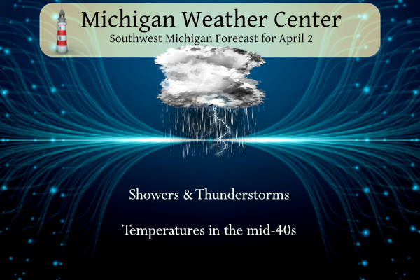
- Showers and thunderstorms today

A low pressure system centered over northern Missouri early this
morning will strengthen significantly as it moves ne to over Lake
MI late tonight. Scattered showers will continue to develop out
ahead of this system this morning followed by some heavier showers
and scattered thunderstorms this afternoon.

An overall consensus of latest CAMs and the 00Z HREF svr wx
parameters all suggest that the main svr wx threat will stay to
our southeast over OH later today. However guidance trends also
suggest that a stronger to marginally severe storm could just clip
our far se fcst area during the mid to late afternoon hours.

There is plenty of shear for convective development but
instability this far north will be minimal with virtually no sfc
based instability and MU CAPE values of only around 100-250 j/kg.
Even elevated instability this far north looks rather weak.
Nevertheless a pretty close call so we will need to monitor this
closely this afternoon. Further north we also expect some
scattered non-severe convection this aftn as suggested by the 00Z
HREF composite Z > 40 dbZ ensemble paintball progs.

Lingering rain showers will become mixed with wet snow flakes
overnight. A mix of mostly light pcpn will linger Wednesday. The
main takeaway here though is that overall short range guidance
trends show less potential for accumulating snow for our fcst area
and fairly minimal impacts from winter wx which would mostly be
confined to our northern fcst area.

- Light precipitation lingers mid to late week

The change in the models tonight is to linger the upper low over the
Great Lakes region a bit longer now. In the end, big impacts are not
expected Wednesday night into Friday as precipitation is light. Last
night it appeared we would dry out on Thursday, but now it looks
like that may take until Thursday night if not Friday as the upper
low is slower to depart. This also impacts temperatures as we now
look to stay in the 40s both Thursday and Friday. We have rain and
snow in the forecast from Wednesday night through Thursday night at
this point, but again precipitation looks light.

- Dry weekend

The weekend looks to be dry with ridging in place both at the
surface and aloft. That said, the upper ridge is not overly strong
and there may be periods of clouds due to the proximity of the
upstream low in the plains states. High temperatures rebound into
the 50s for the weekend.

- Some uncertainty early next week

There is some uncertainty showing up in the global models now in
terms of the upper pattern for Monday and the eclipse. On Monday
afternoon which is the time of the eclipse, the GFS is pushing the
plains upper low into our region, whereas the ECMWF is starting to
rebuild ridging aloft in the Ohio Valley. Two very different
solutions for eclipse viewing obviously with the ECWMF having a more
optimistic outlook for people heading into the path of totality.
Case in point, Monday afternoon the GFS has 80-90 percent RH in the
1000-700mb layer over Central IN whereas the ECWMF has 40-50
percent. For those looking to view the eclipse...monitoring the day
to day trend is the best plan of attack at this point. Too tough of
a call at that range in the forecast as to how the pattern more
likely evolves.
I heard we have warmer temps coming this weekend and really nice weather next week. 🙂
I wish I was in the UP this week! Incredible storm!
https://forecast.weather.gov/showsigwx.php?warnzone=MIZ005&warncounty=MIC103&firewxzone=MIZ005&local_place1=5%20Miles%20NW%20Princeton%20MI&product1=Blizzard+Warning&lat=46.3377&lon=-87.5656
Nothing is stopping you, head up there for a few days!
I have a few prior commitments this week, so I can’t make it up there! But it looks fantastic!
That is going to be an incredible spring storm up there in Ishpeming!
https://forecast.weather.gov/MapClick.php?lat=46.4885&lon=-87.6651
2 to 3 feet of snow! Not bad!
Now that’s a monster of a storm!!
Breaking news>>>>>cold and wet is not good….cold and snow is AWESOME…. Hot and humid is horrible and Hell on Earth>>>>>sun, low humidities and temps in the 60’s and low 70’s is good but not as good as cold and snow! Who would have thought?
Seems like you like cold, rainy, windy weather when you gleefully post stuff like this every day.
Rocky (Rockford)
Warmer today? So it might actually get up the daily normal high temp! Incredible cool pattern and no change is in sight! It will be a cool, rainy, cloudy period starting tomorrow! This despite the constant warm weather hype! Incredible delusions!
March 29, 2024 7:37 am
Those are facts about the upcoming weather and concerning the non stop warm weather hype! Incredible!
I’ll just never understand how Rocky absolutely loves these cold, rainy, windy days??? I mean I would think once you get to April, you’d want sun and 60’s. To each their own I guess! And those mid 50’s and 60’s are now just a few days away!!
Huge April snowstorm in WI! The warm weather nuts better be thankful the storm track moved to the West! Should be great golf weather here the next few days, if you have lost your mind! The words for the week = Cold and Wet! Wow!
That’s why I’m saving my golf and yard work for Saturday and Sunday when it’s gonna be beautiful and I’m NOT WORKING!!
Here’s what I hear you say: “I was dead wrong once again and posted garbage models on here because I like to wishcast about snow that never comes.” Got it.
Are you 10 years old! Really, how many times do we need explain to you what a snow map model means? Never mind – it is lost cause because it is like talking to a brick wall! Incredible ignorance!
Rocky (Rockford)
Ck this out! Chance of accumulating snow next week, just like I predicted days ago! The warm weather fanatics will never learn! Incredible!
You really are clueless!
Those snowfall prediction maps are never right! Proved once again today, when it said our area would have 10 inches of snow today! Have fun snowshoeing and cross country skiing in the rain here the next couple days! LOL!!
Your ignorance is rivaling mookie’s! Wow!
My lawn is starting to green up. I’m looking forward to the first mow of the season. For the record, that’s the only mow I look forward to.
If there is a wet spring we can go through a period of cutting the grass 3 times a week.
Slim
Just got a new Toro mower, looking forward to my first mow too!
Where’s all the snow if winter isn’t dead? I think Rocky’s snow models are broken again…
Well, figured out the reason why we have not seen his snowfall prediction maps today! See link below. Lol!! Just a couple days ago that map predicted around 10 inches of snow for our area!! LOL!!!
https://www.pivotalweather.com/model.php?p=snodpc_acc-imp&rh=2024040206&fh=78
Whoops!
The overnight low here in MBY was 37 I recorded 0.25” of rainfall. While I can not confirm it but my wife was talking to her sister-in-las last night who lives north of Bay City in Linwood and she told my wife that it was snowing there and the ground was covered. At the current time here in MBY there is a mist, and it is 39.
Slim
That is sister-in-law not las LOL
Slim
Winter Storm Warnings in Appleton, WI. Thank The Lord that’s not here, they are looking at a foot of snow with 50 mph wind gusts!
The official H/L yesterday at Grand Rapids was 52/35 there was 0.22” 0f rain fall. Other data is missing currently. For today the average H/L is 52/32 the record high of 83 was set in 2010 the record low of 11 was set in 1965 the record rainfall of 1.16” fell in 1945 the most snowfall of 7.8” fell in 1975 the most on the ground was 6” in 1970. Last year the H/L was 49/24.
Slim
The cold weather crazies better get outside and enjoy these next couple days because the BLOWTORCH is on its way!
At this time it indeed looks to be pleasantly warm.
Slim
You are correct Slim! Looking nice!