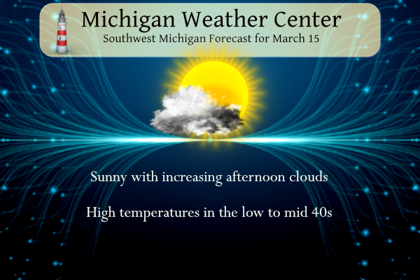
After a cold start to today, the temperature will rebound to near-normal high temperatures in the low to mid 40’s. Clouds will be on the increase this afternoon. Rain is expected to arrive on Thursday afternoon/evening, then continue into Thursday night. Precipitation will change over to snow and it will be windy Friday. A chance of snow showers will continue Saturday.
Weather History for SW Michigan
March 12
1976: A tornado outbreak struck from Michigan to Alabama. At least four tornadoes hit Michigan with nine people injured. Two tornadoes hit Jackson County, with damage to several homes and businesses. One person was injured in Ottawa County as a tornado moved from north of Holland to north of Hudsonville.
March 13
1990: A spell of record warm weather continues across Lower Michigan with temperatures in the 70s. Lansing hits 74 degrees during a string of four straight days in the 70s.
1993: The Superstorm of 1993 dumps three to four feet of snow across the Appalachians and draws down record-cold arctic air across Lower Michigan. High temperatures struggle to reach the lower 20s with gusty winds making it feel even colder.
March 14
1904: A snowstorm drops up to a foot of snow across Lower Michigan with record daily snowfall of 10.5 inches at Grand Rapids, 10 inches at Lansing, and 8.0 inches at Muskegon. This snow would contribute to some of the worst floods on record in southwest Lower Michigan when it melts off during the last week of the month.
2019: Thunderstorms with heavy rain combined with snowmelt and frozen ground bring significant flooding across parts of central Lower Michigan. Newaygo County saw the worst flooding, with more than 150 homes and 9 businesses flooded, as well as the closure of more than 100 roads and the complete washout of more than 30 roads. The flooding continued for several days with damage estimated at nearly 2 million dollars.
March 15
1912: Cold and snow continue during a very wintry month. Lansing sets a daily snowfall record with 11.5 inches and Grand Rapids with 5.2 inches. Lansing falls to one degree below zero the next morning.
1990: Four days of record warmth culminate with highs of 77 degrees at Lansing, 75 at Grand Rapids, and 72 at Muskegon.
March 16
1945: The warmest March on record in southwest Lower Michigan produces record-high temperatures in the 70s.
March 17
1943: Heavy rains and melting snow result in flooding across southwest Lower Michigan. Childsdale Dam on the Rogue River gave way. Several families were evacuated from Comstock Park near Grand Rapids.
1973: A record snowstorm dumps over a foot of snow across southern Lower Michigan. Jackson is buried under 19 inches of snow and Lansing has a record 16.5 inches.
March 18
1925: The Tri-State Tornado kills 695 people and injures over 2,000 along its 219-mile-long damage path through Missouri, Illinois, and Indiana. It is by far the worst tornado in United States history. The weather in Lower Michigan is relatively tranquil with highs in the 50s and rain changing to snow during the night.
Weather History for SE Michigan
March 12
On March 12, 2014, a moisture-laden winter storm tracked across the area bringing a swath of 6 to 10 inches of snowfall to areas along and south of I-69. The heaviest band of snow fell roughly along the M59 corridor where 8 to 10 inches was observed. Driving conditions quickly deteriorated as gusty winds over 40 mph ushered in much colder air resulting in freezing and drifting snow on area roads.
Also on March 12, 2012, thunderstorms produced a rare March tornado just southeast of the town of Coleman. Rated an EF1, it was tied for the second earliest tornado to be recorded in Southeast Michigan since 1950 and only the 10th March tornado on record. It would be the first of four to occur during the month.
Also on March 12, 2009, as a result of heavy rainfall between the 7th and 11th, flooding was observed on several rivers in Southeast Michigan. Three or more inches of rain fell across a good portion of southeast lower Michigan with the River Raisin basin getting hit the worst with 4 to 5 inches in that period. The flooding reached moderate flood stage on the Huron at Hamburg and the reach from Blissfield down to Monroe got to moderate to major flood stage. Dundee recorded its 3rd highest crest ever. Many roads and homes along the Raisin were flooded.
March 13
On March 13, 2017, a clipper brought widespread 1 to 2 inches of snow accumulation to SE Michigan. With the easterly wind off of Lake Erie, lake enhancement led to a small area of 3 to 6 inches in the Detroit Metro area. Thousands of area residents were still without power during this event due to the record March 8th wind storm a few days prior.
Also on March 13, 1990, the overnight temperature dropped to only 59 degrees in Flint, which is the record maximum low temperature for the day. This was also the second day in a string of four days (March 12-15) that record maximum low temperatures were set.
March 14
On March 14, 2019, a tornado outbreak occurred across the I-69 corridor during the afternoon and evening hours. 4 tornadoes developed from a line of severe storms – an EF0 near Corunna, an EF2 near Vernon, an EF0 near Flushing, and an EF0 near Genesee Township. The Vernon EF2 tornado had max estimated winds of 125 mph, was on the ground for 20 minutes, and had a path length of over 18 miles as it tracked northeast. Thankfully no injuries were reported from these storms, but numerous homes suffered damage.
On March 14, 1997, low pressure tracked across Southeast Lower Michigan. The storm brought widespread precipitation, mostly in the form of freezing rain, to Southeast Michigan from late on the 13th into the morning of the 14th. Total precipitation amounts ranged from around an inch to nearly two and a half inches. In the Detroit Metropolitan area, the ice storm resulted in power outages to over 425,000 homes and businesses; one of the largest outages in history. Several thousand residents were without power for as long as 4 to 5 days. In addition to powerlines, falling trees damaged dozens of cars and houses throughout the area.
March 15
On March 15, 1990, the temperature rose to 77 degrees in Detroit, a record high for the day at the time. This marked the fourth day in a row (March 12-15) that record daily highs were set.
On March 15, 2012, thunderstorms produced three rare early-season tornadoes. An EF0 caused minor damage in the town of Ida in Monroe County. In Lapeer County, trees were uprooted and a home was moved off of its foundation when an EF2 struck on the same evening. The most destructive tornado, an EF3, struck the town of Dexter with winds estimated between 135-140 mph, causing extensive structural damage and destroying multiple homes. Of the 13 March tornadoes ever recorded in SE Michigan, 4 of them occurred in March 2012.
March 16
On March 16, 2004, a snowstorm began over Southeast Lower Michigan that dumped 7.0 inches of snow on Port Huron. The storm lasted through the 17th.
March 17
On March 17, 1973, a powerful winter storm hit all of Southeast Michigan. The storm started on the evening of March 16, 1973. Detroit received 9.9 inches, Flint had 13.7 and Saginaw was buried under 21.3 inches. This storm stands as the 3rd heaviest snowfall in Saginaw history and the 4th heaviest in Flint history.
March 18
On March 18, 1959, the overnight temperature dropped to 3 degrees in Flint, setting the record for the lowest overnight temperature for this day in Flint.
Forecast Discussion
- Rain Arrives by Thursday Afternoon or Evening

Little doubt we are in store for a round of steady rain later
Thursday into Friday morning. A deepening upper low will be diving
southeast out of Manitoba during this time frame. From surface to
upper level jet, deep southwest flow will develop Thursday over
Lower Michigan. Model guidance has strengthened the LLJ to over 60
kts now for Thursday/Thursday night, aimed at Lower Michigan,
placing us in an area of 850mb-500mb moisture flux convergence.
Given the forecast low track right over our CWA (potentially the
center crosses right through Grand Rapids), steady rain is likely.
Amounts of 0.50"-0.75" still look on track, with some locations a
bit less and others a bit more potentially. No flooding is expected,
but some nuisance ponding on roads is a possibility.

- Lake Effect Snow and Blowing Snow Late Friday into Saturday

Robust low level CAA begins in earnest after 12z Friday as model
guidance indicates 850 mb temperatures will fall from around +5C at
12z to -10C or colder just 12 hours later. This will allow surface
temps to fall from their highs early in the day. Additionally, this
cold advection will bring gusty winds to the surface, potentially to
around 40 mph or even higher Friday afternoon and Friday night. The
back edge of the low`s precipitation shield will likely turn to snow
Friday morning into the afternoon, but travel impacts are not
certain as temperatures may not get below 32F until after the
evening commute for most locations, except for near and north of M-
46. This timing could change, potentially on the earlier side, so
continue following the latest forecast information to see if travel
impacts become likely for the Friday evening commute.

Pure lake effect snow generation may hold off until later Friday
night as model guidance is showing an unsaturated DGZ over most
of southern Lake Michigan until after 00z Saturday. But once it
does get going, there will be synoptic lift from the upper low`s
vorticity lobes and deep moisture helping create inversion heights
of around 10k ft, combined with model forecast omegas throughout
the depth of the DGZ, at times significant from the lakeshore into
the U.S. 131 corridor. Boundary layer winds should average in the
30 mph- 40 mph range, helping bring snow shower activity well
inland at times, especially Saturday. Surface gusts on Friday
should be very reflective of these boundary layer winds, creating
blowing snow at times.

The predominant low level directional flow over the lake looks to be
~300 deg with this lake effect event at a duration of about 24 hours
from late Friday into late Saturday. Bursts of heavier snow showers
are most likely to occur from 12z Saturday to 00z Sunday. With dew
points in the teens during this period and frequent snow showers,
highs will struggle into the mid to upper 20s on Saturday. Some
impactful winter weather driving conditions may occur. Model QPF
from the coarser medium range guidance is depicting 0.10"-0.20" of
liquid equivalent near and west of U.S. 131 from 12z Saturday to 12z
Sunday, falling as snow. This doesn`t yield much in the way of
accumulated snow (1"-3"), but we may see these amounts go up with
the higher resolution model runs that will be made available as we
get closer to the event, assuming the synoptic setup doesn`t
significantly change.
Just another below normal temp winter day in West MI! Wow, what a winter! Tons of snow and more is on the horizon! You mean winter is not dead yet? How could it be?
Speaking of the record setting March 2012, here is a Storm Team 8 broadcast from the warmest day of the stretch (March 21).
https://m.youtube.com/watch?v=4zL8hEJxxCc
Today is the anniversary of the Dexter, MI EF-3 tornado. The tornado touched town at 5:18pm and lifted at 5:56. It sat nearly stationary for 5 minutes. I drove down to Dexter and followed some of the damage path after the tornado had occurred.
Also to note it was 74 degrees that same day in Grand Rapids. We were in the midst of a record setting March for warm temps.
Over the next eight days the average H/L start out at 44.4/22.8 tomorrow and by day eight it is up to 47.5/28.9 so highs in the mid to upper 40’s for the next 8 days would be just about average.
Slim
Grand Rapids has set 6 snowfall records this winter. They were on November 17, November 19, December 17, December, 23, December 24 and just recently we had our snowiest March 10th on record. According to West Michigan weather stats, the odds of Grand Rapids receiving 6” or more of snow on or after March 9 is only 16% so the event on the 10th was pretty unusual. Not to mention we are around Top 5 for snowiest winters ever. A winter that has been far from “dead”
I thought it was a great winter. We had a decent amount snow (except for the 3″ we rec’d the entire month of February) but it didn’t stick around long because of the “warm” temps. I only used the shovel three times. It never got below zero. Most of the season, I didn’t even need a winter coat. I don’t mind snow, but I despise cold.
+ 1000
Lows it the teens for mid March happy January wow … INDY
WOOD now has temps in the middle to upper 40’s 6 out of the next 8 days.
Good thing I didn’t finish planning my trip to Austin. It’ll be 48 and raining on Monday… I would honestly take our weather over that.
The first “official” day of spring starts Monday. Looks like we finally have more consistent temps in the 40s and 50s next week. It’s definitely been an impressive wintery March so far!
I see yesterday was yet another below normal temp day! Wow to the wow! Keep winter rocking!
Temps in the teens! Cold!
From todays weather history. March 17 On March 17, 1973, a powerful winter storm hit all of Southeast Michigan. The storm started on the evening of March 16, 1973. Detroit received 9.9 inches, Flint had 13.7 and Saginaw was buried under 21.3 inches. This storm stands as the 3rd heaviest snowfall in Saginaw history and the 4th heaviest in Flint history. I would like to add that there was also flooding in the Bay City area as strong NE winds pushed the water from Saginaw Bat into the city along the river and at the shore of the Bay. March… Read more »
Welcome to the Ides of March! Yesterday the official H/L at Grand Rapids was 37/21 there was a trace of snow fall. Grand Rapids is now up to 18.4” of snow fall. This March will be the snowiest March since at least 2002. There was 88% of possible sunshine yesterday and the day started with a reported 2” of snow on the ground. Here in MBY the overnight low so far has been 15 and the current temperature is now at 16 it has been a little warmer at the airport where the low has only been 19 so far.… Read more »