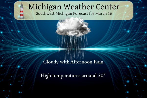
Rain will overspread much of Lower Michigan this afternoon and evening, with steady rain tonight. Temperatures may reach 50° or better today in some areas. As the rain diminishes early Friday, it may mix with or change to a period of snow as temperatures drop. Windy and cold weather is forecast for later Friday through Saturday with occasional snow showers, especially in the lakeshore counties.
U.S. Weather History
1885: On this date through the 21st, Pointe-des-Monts, Quebec Canada, received 98 inches of snowfall.
1942: A deadly tornado outbreak occurred over the Central and Southern US on March 16-17th. The tornado outbreak killed 153 people and injured at least 1,284. The best estimate indicates this event contained 13 F3 tornadoes, 6 F4s, and one F5. The F5 tornado occurred north of Peoria, Illinois, in the towns of Alta, and Chillicothe, before crossing the Illinois River and striking the town of Lacon. A quarter of the homes in Lacon were destroyed, and debris was carried for 25 miles.
1986: A small but rare tornado touched down perilously close to Disneyland in Anaheim, California.
Grand Rapids Forecast
3 16 grrLansing Forecast
3 16 lanKalamazoo Forecast
3 16 kzoForecast Discussion
- Rain This Afternoon into Friday Morning

No change in expectations for rain to move in later today and last
through Friday morning. As previous discussions have mentioned,
there is little to no support for thunderstorms (MUCAPE ~ 0 J/kg),
so just rain is expected. A 60+ kt LLJ will advect plentiful low
level moisture into Lower Michigan from 18z today through
approximately 06z Friday. The 00z HREF guidance is indicating areas
near and west of U.S. 131 are most likely to receive 0.50"-0.75" of
rain while east of there, mainly 0.25"-0.50". This won`t cause river
flooding but river rises are likely for especially the western half
of our CWA. Also, there may be some ponding of water on roads at
times later tonight.

- Breezy with Falling Temperatures Friday

Low level CAA will be underway Friday morning with winds shifting
from southerly to WNW. The 850 mb temperatures will be plummeting
throughout Friday so highs will occur very early in the morning.
Most locations will drop near or below freezing after 18z Friday.
However, it appears precipitation in association with the surface
low will be over by that point as we awake lake effect generation.
Surface wind gusts will likely be in the 30-40 mph range during the
day on Friday.

- Cold and Breezy with Snow Showers on Saturday

Lake effect snow showers might not get going until early Saturday
morning as some guidance is indicating the DGZ won`t get saturated
until we get into the 06z-12z Saturday time frame. I suspect there
will likely be snow showers before this by a few hours but just with
small flake size. It is the period from 12z Saturday through 06z
Sunday when conditions are most favorable for snow showers. GFS/NAM
Bufkit soundings certainly support snow showers with inversion
heights getting as high as 10k ft, and sufficient lift throughout
the DGZ.

However, the duration of a saturated DGZ at any given
location may be only 12 hours or so. A couple other mitigating
factors to more substantial snow shower activity are the boundary
layer winds being fairly significant (around 35 kts) and surface
wind gusts possibly close to that, along with residence time of any
snow bands being cut short given 280/290 deg flow at 12z Saturday
shifting toward 320 deg by 00z Sunday. Given the strength of winds
in the boundary layer and the fact these snow showers will occur
during the diurnal period, much of this activity may be cellular
bursts of snow that get driven inland a fair distance. It will be
interesting to see how the CAMs handle this as we head into today`s
12z model suite and tonight`s 00z updates.

Model QPF remains in the 0.10"-0.20" range near and west of U.S.
131, yielding light snow accumulations, but still potentially
impactful to driving at times given the abnormally cold temperatures
and also the gusty winds. In general, this looks to be a 1"-4" event
from U.S. 131 to the west, plus the addition of Calhoun County.
There should still be some melting on roads but at times the snow
showers may be heavy enough to accumulate on pavement. Any residual
snow showers that linger into Saturday night will certainly cause
snow to stick on roads.

- Quiet Pattern Early Next Week, Then Active Weather Returns

A fair amount of sunshine as well as warming temperatures look to
dominate the first half of next week. Ensemble guidance supports
high temperatures reaching the upper 40s to mid 50s by early to mid
week. ECE/GEFS/CMC membership is highlighting the mid to late week
period as the next chance for precipitation, likely liquid for the
most part, with perhaps the risk for some thunderstorms depending on
how the synoptic pattern evolves.
Let it snow, let in snow, let it snow!
Another WWA! Incredible winter! Is winter dead yet? What a joke!
Get this ground nice and warm so the snow melts immediately on contact!!
Let it rain, let it rain, let it rain!!
It should be another great day for skiing on Sunday! Incredible!
Yeah, if you want to spend 8 hours in your car on Saturday. Nope, staying nice and warm in my house watching basketball all weekend! Then BRING ON SPRING!!!!!
Check out the latest form the GR NWS! incredible March storm – keep your shovels and salt ready! Rock n roll will never die! I love winter! mph. mph. — Lake effect snow Friday night into Saturday — Colder air surges into the area behind the front on Friday with 850mb temperatures dropping to -16/-17 C. Delta T`s will rise to near 20 C which is solid instability to work with. Strong lift is noted in lakeshore BUFKIT overviews and we expect lake effect snow to begin Friday evening and continue Saturday and into Saturday night. The moisture is actually… Read more »
“not impressive regarding snowfall, on the order of an inch or two.”
Why would you need shovels for an inch of snow?? What a joke!!
Get ready for mid winter cold and accumulating snow this weekend! Wow!
“not impressive regarding snowfall, on the order of an inch or two.”
Ahhh….now that winter is over, I can get back out and start sighting in my AR’s with my brother up north! Got some new sights for them.
What a winter! Not only a long winter (accumulating snow started by mid Nov and it is still going strong in mid March) but a record breaking snowfall winter! Wow to the wow! WOW! Incredible winter! I love it!
Hope everyone gets their snow forts and snow angels in that 1 inch of snow we get Saturday because the worst season of the year ends this weekend!!
Everyone is aware that spring starts Monday and it is totally normal to have highs in the 30s-50s from the middle to end of March.
The average is 45-50 for the rest of the month, so anything from the upper 30s to upper 50s I would consider pretty typical.
Also this month has been +0.7F and +13.1″ above average, both warmer and snowier. So both sides win!
Thank God we are having a long winter with record breaking snowfall! I have been skiing and snowshoeing since mid November! What a winter!
Lol!! Yeah but only one ski or snowshoeing outing each month is not that much. What maybe 5 times total this winter! LOL!! And now it’s over.
Wow, 50’s today! Warmer than expected.
Mookie, you going to get in on that bet with Rocky?? He’s showing 32” of snow for metro Detroit on his trusty RDB maps between now and April 1.
haha That was too funny! Winter has been dying for a while now. But apparently to some we are still in the throes of winter when it’s 50’s and no snow on the ground LOL
I love long winters! 3rd week of March and still talking single digit wind chills! Incredible!
One has to wonder with the predicted above normal temps and precipitation for April if any of that is going to translate to some severe weather? Guess we shall see.
Expect some winter tears from Kirkwood this weekend! He’s going to have to call it! Just have to endure a couple more lousy, trash, garbage days this weekend and we can all finally get out and start enjoying the outside again!!
He just said at noon he’s going to enjoy the upcoming 50 degree temps. I find it interesting you and another fellow commentor like to talk about him quite a bit.
Andy and mookie are obsessed with wood and warm weather to the point of delusion!
I love the Kirkwood tears! Have you seen his Twitter posts? He goes crazy for cold and snow. Then we get record warmth and silence from him usually.
Kirkwood tears taste like sugar! When Kirkwood is crying, you know you have some great WARM weather on the way!!
Did someone say winter? Check this out!
https://www.pivotalweather.com/model.php?m=gfs&p=snku_acc-imp&rh=2023031606&fh=384&r=conus&dpdt=&mc=
Detroit metro area looking at 32” of snow from now til April 1?? LOL! I’ll take that bet! That’s your trusty RDB snow prediction map. I’ll put up $50 saying Detroit gets under 32” of snow between now and April 1!
https://weather.com/weather/tenday/l/70494c7767594bd0f192772825162ee2e800c888aca3238795d1d021841e325c7e1afe4362266571f756e53e59f484b7
Wow, look at those temps and wind chills this weekend! Along with snow! No winter is not dead heat! Who knew? Incredible!
Wow, look at all those temps in the upper 40’s and 50’s next week and beyond!! Along with zero snow!! Winter dies this weekend!! I love early Springs!! OUTSTANDING!!
https://weather.com/weather/tenday/l/Grand+Rapids+MI?canonicalCityId=4ae407ee1fd6fc2da14b1db23551dbfc725de102d758c0e22a6fe25d69942ec5
CPC now has us average to above average temps the next 2 weeks – along with a very warm April. I love it!
So you mean next week winter might actually be dead not 6 weeks ago when declared winter is over! What a joke! Oh by the way Spring is not here yet and we will be seeing more snow in March! Wow the wow! Wow! What a winter!
Mild morning out there. Rain and upper 40’s later. WOOD has 57 degrees next week!
Mid-month round up. At the midway point of March the mean at Grand Rapids is 33.5 that is a departure of +0.7 there has been 1.33” of precipitation so far this month and 18.4” of snow fall that is will above the average of 5.3” The highest so far this month is just 51on the 5th and the low so far is 16 on the 15th At Lansing their mean is now also at 33.5 but as it has been cooler there in the past the departure is +1.2 They have had 1.35” of precipitation with 15.6” of snow fall.… Read more »
The official H/L at Grand Rapids yesterday was 44/16 there was no rain or snow fall and the sun was out 81% of the possible time. The overnight low here at my house was 30 and at the current time it is mostly clear and 37. For today the average H/L is 44/27 the record high of 79 was set in 2012 and the record low of 3 was set in 1900. The record snow fall of 10.0” fell way back in 1895. Last year the H/L was 65/28. The still looks to be a good amount of rain later… Read more »
I love winter weather, but with the birds singing at sunrise every morning now, I will be content to see spring “wake up” after this short blast of winter over the weekend.
Yep next week finally looks like early spring weather. Lots of 40s and 50s. And even a chance of thunderstorms :O