We have had 11.6 inches of snow for March thus far which brings us to 70.6 inches since November 1st (these are Otsego totals). Partly to mostly sunny skies are expected today for inland areas. A few flurries could linger near Lake Michigan. It will be on the cool side with High temperatures remaining in the 30’s. Skies clear out tonight and it will be cold, with many locations dropping into the teens. Rain is expected to arrive on Thursday afternoon/evening, then continue into Thursday night.
U.S. Weather History
1933: A deadly tornado outbreak affected the Middle Tennessee region, including Nashville, on this day. The outbreak, which produced five or more tornadoes, killed 44 people and injured at least 461 others. The strongest tornado, F3, cut a path through the center of Nashville. About 1,400 homes were damaged or destroyed. Windows were blown out of the State Capitol Building.
1935: Suffocating dust storms frequently occurred in southeast Colorado between the 12th and the 25th of the month. Six people died, and many livestock starved or suffocated. Up to six feet of dust covered the ground. Schools were closed, and tenants deserted many rural homes.
2008: An EF2 tornado moved through downtown Atlanta, Georgia, shortly before 10 pm, damaging the Georgia Dome where the SEC men’s basketball tournament was underway. Click HERE for more information from the NWS Office in Peachtree City, Georgia.
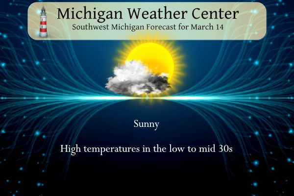
Grand Rapids Forecast
3 14 grrLansing Forecast
7-Day Forecast 42.71°N 84.57°W (Text-Only)3 14 lanKalamazoo Forecast
3 14 kzoForecast Discussion
- Lake Effect Snow Winding Down This Morning, Then Clearing

NNW flow lake effect snow bands have been impacting western portions
of our lakeshore counties early this morning with decent omegas
through the DGZ and adequate inversion heights around 7k ft. Light
additional accumulations of an inch or two through 12z are possible
with trace amounts to a few tenths in the 12z-18z time frame. Watch
out for some slick roads in these areas (especially Ludington to
Pentwater, and also from Holland to South Haven). However, these
bands will be fighting a losing battle throughout the morning as
upper heights build, 850 mb temperatures warm, and the DGZ loses
saturation. Cloud cover may tend to hang on across the western
halves of the lakeshore counties as the snow diminishes, per model
RH analysis. A clearing trend is expected to be slower there
compared to inland locations, which should be getting some sun by
mid to late morning.

- Storm System to Bring Rain for Thursday

Upper heights continue building into mid week and 850 mb temps
should warm into the +3C to +5C range by Thursday. However, GEFS and
ECE ensemble mean 500 mb heights show an anomalously strong upper
low digging on the back side of the ridge, showing 2 to 3 standard
deviations in the negative direction. This anomalous upper low will
be heading toward the Great Lakes, with a deepening surface
reflection right over Lower Michigan as model guidance indicates an
area of low pressure likely dropping into the 980s/990s mb over us
by Friday. A robust LLJ of 50kts will advect low level moisture from
the Gulf into this deepening low. Rain should break out Thursday
into Thursday night. Current expectations are for 0.50"-0.75" of
rain to be the average across our region.

- Colder Air with Lake Enhanced Snow Possible Friday into Saturday

An interesting, mid-Winter like setup may occur Friday into Saturday
as this area of low pressure moves into Ontario. Some model guidance
(GEFS/CMC) is indicating a short period of deep cyclonic flow may
develop over Lower Michigan as 850 mb temps crash to -15C to -18C.
This occurs as the possibility of deep moisture advecting over
Lake Michigan with W or WNW low level flow Friday night into early
Saturday, likely turning NW at some point. Even global
deterministic models like the GFS and GEM are depicting lake-
induced CAPE values of > 100 J/kg impacting lakeshore areas on
Saturday. If the synoptic setup comes together, some heavier snow
showers would be possible with accumulations even during the
daytime as ensemble high temps are suggesting we may not get above
the upper 20s Saturday.
Today was a beautiful mid March day. Hope you all got to go outside and enjoy it for a few minutes.
Just another below normal temp winter day! The
trails were spectacular! Who wouldn’t love snow this time of year! What a winter!
Interesting to note the longer range predictions favor slightly warmer than normal temps and above average precip for March/April/May. Could it be a stormy spring? We shall see. If there’s any time to have cooler temps in from now through April. Michigan’s more “historic” outbreaks have occurred in Early Spring. Not saying that there will be anything big this year because quite frankly no one knows how this severe weather season will play out, but it’s pays to be prepared every single year. I found myself taking a hit from an EF3 last year so always be prepared.

Interesting stuff from “Michigan Storm Chasers” Page:
“A little fun day Monday information for you! Data suggests this year will be more active for tornadoes in Michigan. This is due to the ENSO phase which has just finished 3 years of a La Niña pattern. The current phase has recently flipped to neutral and is trending towards a weak El Niño by late spring. Historically speaking from 1950-2021, the years which were deemed “neutral” had the most tornadoes vs any other ENSO phase, followed by “Weak El Niño”
Apparently, it wasn’t just us. From NOAA:
“The average temperature for the US this winter was 2.7-degrees above average.”
It looks like yet another great winter day! Boy we have had a lot of those lately! It is hard to pass up another snowshoe hike in the woods! Sun and temps in the 20’s and 30’s! What a winter! Wow to the wow, WOW!
Enjoy the snowshoe hike. I’ll be buying a new pair of snowshoes for next winter!
Wow the storm this weekend looks interesting. Winter is really hanging on this year… hopefully this is its last grasp!
Good news is today looks nice and sunny. The mid March sun is about halfway up the sky now during midday
Good morning! The official H/L yesterday at Grand Rapids was 30/23. There was 0.22” of precipitation that came as 2.8” of snow fall. There was just 9% of possible sunshine. At 7AM there was 2” of snow on the ground. The overnight low here in MBY was 20. At the current time it is 23 with some clouds. For today the average H/L is 44/26 the record high of 80 was set in 2012 at the start of that years March heat wave. The record low of 0 was set in 1895. The record snow fall amount of 10.5” fell… Read more »
So far this winter season there has been 105.2” of snow fall at Grand Rapids and that is the most in southern Michigan. At Lansing they are now at 46.2” for the season, at Muskegon they are at 58.9” Most of eastern lower Michigan is in the 36 to 44” range. Up north Alpena is at 59.6”, Gaylord is at 131.5”, Petoskey is at 99.4” Traverse City 96” Sault Ste. Marie 134.7” and Marquette 197.7”
Slim
Very odd with the lakeshore only receiving about half the snow that GR has, usually it’s the other way around. I would think there aren’t to many years that this has happened.
This will be the 5th winter in a row where GR has had more snow fall than Muskegon. The last time Muskegon had more snow fall was in the winter of 2017/18 when Muskegon had 105.3″ to GR 77.7″ It looks like the trend over the last 10 years has been for Grand Rapids to get more snow than Muskegon. It does not help that Holland does not keep snow fall records.
Slim
Yes I have noticed in recent years that Grand Rapids keeps getting more snow than the lakeshore. Maybe because some of the snow falls as rain near the lake? Or it was been windier during most of the recent lake effect snow events? Those are my two guesses
March will be the third month out of the last five with above normal snowfall in GR! What a snowy winter and we have plenty of more chances coming up! Let’s keep this rock roll snow party rolling! Incredible!
We’ve had 15 inches of snow for March. We only had three inches in February. Temps are +2.2 for March and +8.3 for February – which is why the snow just can’t stick around.
Make someone smile and have a great day. 😁
It’s been a rather odd winter across much of Michigan. Here are the snow records for this year in Northern Michigan.
https://www.weather.gov/apx/snow
Note the number of days with 6″ or more on the ground compared to average.
Slim
Good find, Slim. Overall, the amount of seasonal snowfall was pretty average – some areas a bit above average, some areas below average. But, the number of days with 6″ or more on the ground is WAY below average. Kinda coincides with what happened down here – the snow just didn’t stick around long due to higher than average temps. It was a “warm” winter down here, but very “warm” up there. Gaylord temps: +5.7 for March, +6.0 for February, +9.2(!) for January, +3.4 for December, +5.2 for November.
Wow, I didn’t realize it was that much warmer than average for Gaylord. I hope this summer doesn’t have the same trend!