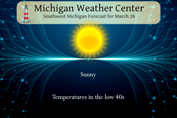
We have 23° at 7 am this morning. Today we will see sunny skies and temperatures in the low to mid-40s, which will be an improvement from yesterday.
We have had quite a temperature range so far this year from -8° on the early morning of January 14 to 75° on February 26.
NWS Forecast
Weather History
1904: Heavy rain and temperatures in the 50s during the last week of March combined with the melting of a deep snowpack caused some of the worst flooding on record along the Grand and Kalamazoo Rivers. About half the city of Grand Rapids is underwater as the river reaches an all-time record crest of 19.6 feet, which was 2 feet higher than the previous record and 4.6 feet above flood stage. Water covered half of the city and flood waters reached 2,500 houses and 14,000 people. Many people suffered from hunger and exposure. Several factories and between 200 and 300 businesses were flooded. Loses totaled $1,800,000. Lansing has the worst flood in 135 years of record. Battle Creek is also inundated by floodwaters.
1920: One of the worst tornado outbreaks in U.S. history strikes from Wisconsin to Georgia, killing more than 150 people. In Michigan, at least a dozen people were killed and hundreds of homes were either damaged or destroyed. The worst hit areas in Michigan included Saint Johns in Clinton County, Maple Grove and Orangeville in Barry County, and Fenton in Genesee County.
On March 28, 1928, an early-season tornado outbreak hit Southern Lower Michigan, Indiana and Ohio. 14 tornadoes were recorded in Michigan from Mason and Oceana Counties in West Central Lower Michigan to Genesee and Oakland Counties in Southeast Lower. Three of the Michigan tornadoes were estimated to be as strong as F4 including one that hit Genesee and Oakland Counties. That tornado started near Fenton and moved 10 miles northeast across far northwest Oakland County. Four deaths were recorded from this particular tornado including one person in an overturned car, probably just the second tornado-related death in a car at that point in U.S. history. Specifically for Southeast Lower Michigan, tornadoes hit Saginaw, Genesee, Oakland, and Shiawassee Counties. In total across the state, there were 13 deaths and 59 injuries.
Also on March 28, 1945, the temperature soared to 82 degrees in Detroit.
1920: The worst tornado disaster of record occurred in Chicago, IL as a tornado killed 28 persons and caused three million dollars in damage. This tornado was part of an outbreak that saw 38 tornadoes hit the Midwest and the Deep South states. Over 380 people died, and at least, 1,215 were injured during the Palm Sunday outbreak.
1935: On this date through March 31st, a great dust storm descended on Amarillo, Texas reducing visibility to zero for a six-hour period.
1963: A decision was handed down in the case of Whitney Bartie vs. the United States of America. Bartie sued the U.S. Weather Bureau for negligence in failing to provide a warning about Hurricane Audrey in 1957. Bartie’s wife and five children were killed after the 12-foot storm surge struck Cameron Parish, LA on the morning of June 27, 1957. It was ruled that the evidence presented did not establish negligence on the part of the Weather Bureau.
Forecast Discussion
- Sunny and warmer

High pressure over the Missouri Valley will nose northward today
resulting in plenty of sunshine. Rising heights from ridging aloft
will also push surface temperatures a bit higher than yesterday.
Highs today will range from the upper 30s near US-10 to mid 40s
near I-94. Tack on 10 degrees for Friday`s highs. Another cold
night expected due to clear skies and light winds; mid 20s
expected throughout the cwa.

The next low pressure system will affect the region Friday night.
However, as warm advection gets underway, clouds will begin
moving over the cwa Friday afternoon, dimming the sunshine a bit.
At this point, we anticipate precipitation holding off until
Friday night.

- Chance Of Precipitation Friday Night into Saturday

The first round of precipitation in the forecast is associated with
a surface low developing ahead of a mid-level wave. Ahead of this
low, precipitation develops on the nose of the low-level jet in
northern Illinois and moves east into lower Michigan. In general, up
to 0.25 inches of precipitation is expected, highest across the
southern CWA. Uncertainty exists at how far north precipitation
extends, however given northeasterly flow off of a canadian high
pressure system, a period of sub-freezing temperatures is possible
across our northeastern CWA Saturday morning. Guidance is spread on
how low temps get, however if precipitation occurs with temps below
freezing a period of light freezing rain is possible. Chances of
both measurable precipitation occuring and temperatures being below
freezing Saturday morning are around 20-30 percent across all 3
guidance suites. In addition, while the warm front will be south of
the area, a period of negative 850mb LIs exists early Saturday near
I94 bringing a low thunder chance. Precipitation ends later Saturday
as the low pulls away. A brief period of surface ridging then occurs
for Sunday bringing dry conditions.

- Additional Precipitation Possible Sunday Night into Tuesday

The approach of another surface low Sunday night brings additional
precipitation chances that continue into Tuesday. Notable spread
still exists in the strength of the ridging across the area Sunday,
the track and tilt of the following wave Tuesday following a period
of zonal flow , and by extension the track of the surface low across
the region. This lends uncertainty as to the overall evolution of
the system which is not uncommon in zonal flow patterns. There are
even some signals (not strong at present given elevated spread) for
snow for at least part of the area. Overall, confidence is high in
precipitation early next week, but evolution of the system,
precipitation types, and temperatures are low confidence due to the
high degree of spread in solutions.
Golf will be PERFECT tomorrow afternoon in the sun, warm temps and light winds! I love it!!
Wonder if anyone will be snowshoeing tomorrow afternoon?!?! LOLOLOLL!!
Today was yet another below normal temp day! Who would have thought?
Wow, low tonight around 26 degrees and wind chills in the 30’s tomorrow till around2 pm! Very cold for the end of March! If anyone is crazy enough to golf tomorrow morning, have fun! The courses won’t even be open till late morning due the greens being FROZEN solid! incredible!
It looks like another cool, cloudy weekend. That will carry right into a cold first week of April! Wow what a cool pattern!
Beautiful Sunny golf day tomorrow afternoon with light winds!
We just had one day of snow last week and it melted two days later and the Cold Weather Crazies think that we’ve had unending snowstorms and temps in the teens for months on end! Please look back at the factual weather data for reality!
DDDD….DDDDD…..DDDDD…..This is a BLOWTORCH WARNING!!!! GET PREPARED NOW!!!
What do you know? Another below normal temp
day with wind! We have seen of those cold, windy days lately! Incredible despite the constant warm weather hype!
We just had a 6.5 inch snowstorm and the warm weather nuts are still saying winter was over months ago! Delusional!
All mainly 50’s and 60’s for the foreseeable future. Winter has been dead for a while, and now we turn the page to consistent spring temps!
Sounds good!!
There is a *potential* warm spell from around April 5th onward, which would probably speed up the vegetation growth. Let’s hope there are no more freezes later this season
With just 4 days to go in March even with the record cold this month with a mean of 41.2 is still +6.2 above average. There has been 3.54” of precipitation that is +1.52 the 7.2” of snowfall is right at average. For the season GR is now at 47.5” of snowfall that is a departure of -27.7” and is the 4 lowest snowfall total in the last 75 years.
Slim
How could that be?!?! The way the Cold Weather Crazies talk, I would think this month has been nothing but highs in the teens and blizzards every other day!
The official H/L yesterday was 36/31 there was a trace of snowfall. It was another windy day with a highest wind gust of 37 MPH out of the W. There was just 26% of possible sunshine. For today the average H/L is 50/31 the record high of 78 was set in 1905 and the record low of 8 was set in 1923. The most rainfall of 1.33” was in 2020 the most snowfall of 3.3” was in 1947 the most on the ground was 10” in 1970. Last year the H/L was 48/28
Slim