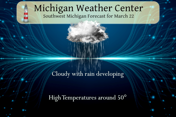
We will see rain developing today with the best chances tonight into Thursday. We might hear a rumble of thunder south of Grand Rapids. Highs will once again be near 50°.
Grand Rapids Forecast
3 22 grrLansing Forecast
3 22 lanKalamazoo Forecast
3 22 kzoWeather History for Southwest Michigan
March 19
1885: Lansing falls to 11 below zero during a string of eight straight days with low temperatures below zero. It is the coldest March on record there.
March 20
1976: A tornado outbreak strikes from Michigan to Mississippi. In Michigan, two people are killed, one each in Oakland and Macomb Counties.
March 21
1983: Spring starts on a snowy note with record daily snowfall of 6 to 8 inches from Muskegon to Lansing.
2008: A record 6.6 inches of snow fell at Grand Rapids on the first day of Spring. Muskegon had a record 7 inches, while 8 to 14 inches of snow fell south of a line from Holland to Jackson.
March 22
1938: Temperatures soar into the 80s during one of the warmest March days in Lower Michigan. Grand Rapids ties their record high for the month at 82 degrees and Lansing sets a record for the date of 81 degrees.
March 23
1956: A snowstorm drops from 6 to 10 inches across southwest Lower Michigan. Jackson picks up 10 inches of snow and Grand Rapids a record 8.4 inches.
March 24
1901: A tornado killed one person and injured four others in Kalamazoo County as it moved from Vicksburg to Scott.
1904: Tornadoes hit Muskegon and Grand Rapids. In Muskegon, five homes were unroofed or torn apart on the lakefront at Harrison Street. In Grand Rapids, ten people were injured as the tornado damaged a church and several barns.
March 25
1954: Heavy rain and high winds occur as a cold front moves through. Grand Rapids measures 2.82 inches of rain for their wettest March day on record. Flooding of streams is widespread and winds gusting over 70 mph cause roof damage and uproot trees.
1974: Grand Rapids falls to one below zero for its latest subzero reading on record.
Weather History for SE Michigan
March 19
On March 19, 1921, the Detroit area experienced a minimum temperature of 32 degrees right after midnight, which rose slowly to 42 degrees at 8 am and then rose very quickly to a high of 76 degrees at 3 pm.
Also on March 19, 2012, Flint and Saginaw saw their high temperature soar to daily records of 80 degrees. Flint has only reached 80 degrees or warmer in March a total of 6 times in its climate record, with most (4) of them coming in March 2012. Saginaw has also done it 8 times, with half of them also occurring in March 2012.
March 20
On March 20, 2012, highs of 82, 84, and 83 were recorded in Detroit, Flint, and Saginaw and respectively. Each temperature tied for the warmest March temperatures ever recorded at the time. However, all records would be broken in the coming days. Ultimately March 20, 2012, would be the third warmest March day ever recorded for Detroit and the second warmest for Flint and Saginaw.
Also on March 20, 1976, an F4 tornado moved through West Bloomfield in Oakland County at 7:15 PM. This tornado was responsible for 1 death, 55 injuries, and over $5 million in damage. This is both the strongest and costliest tornado to ever hit Oakland County.
Also on March 20, many snowstorms hit Southeast Michigan with greater than 6 inches over a large area of the region including in 1967, 1983, 1989, 1992, and 1996. In 1983, the Flint snowfall of 9.6 inches is the tenth heaviest snowstorm in its history.
March 21
On March 21, 2012, high temperatures of 84, 86, and 87 were recorded in Detroit, Flint, and Saginaw respectively. All of these temperatures broke the all-time March records for warmth at each location. Saginaw was particularly impressive, shattering its previous all-time March record of 83 by four degrees. Ultimately, one more record-breaking day in Detroit would relegate this day to be its second warmest March day ever recorded. The records for Flint and Saginaw, however, still stand.
Also on March 21, 2008, a winter storm hit the greater Metro Detroit region. While most of the metro area received 3 to 7 inches of snow, a band of 8 to 10 inches fell from Dexter and the Irish Hills across Saline, Tecumseh, Dundee and into Temperance.
Also on March 21, 1913, powerful winds swept across Southeast Michigan as a strong cold front moved across the state. The wind storm was one of the strongest in the local climate record and caused widespread damage, countless injuries, and several fatalities.
According to the historical record, east winds gusting to around 30 mph during the pre-dawn hours turned to the south, allowing the temperature in Detroit to rise to 57 degrees by 9 a.m. With the passage of the cold front, temperatures fell precipitously through the day, reaching a low of 23 degrees by midnight. As the cold air first began spilling into the area, winds initially turned southwesterly and began gusting to over 60 mph between 9 a.m. and 10 a.m. The average wind speed during the following hour increased to 71 mph with a peak gust of nearly 80 mph. Shortly thereafter, at 11:15 a.m., a peak wind gust of 86 mph was recorded. Altogether, winds gusted in excess of 70 mph for approximately 3 hours while gusts in excess of 60 mph continued for around 6 hours.
Damage was significant, widespread, and conservatively estimated at $500,000 (equivalent to $11,500,000 in 2012 dollars after adjusting for inflation). Buildings were razed, roofs and chimneys were destroyed, and trees were broken and uprooted. In addition, vehicles were overturned and there were accounts of a delivery wagon having been blown through the window of a restaurant on Lafayette Boulevard. In addition to several fatalities, one of which included a Grand Trunk watchman who was blown in front of a moving train, injuries to pedestrians were numerous and included arm, leg, and skull fractures. The strong winds also caused the Detroit River level to fall so low that the water intakes for manufacturing plants were cut off, resulting in their closure. On the Canadian side, thirteen freight train cars were derailed by large waves.
March 22
On March 22, 2012, an unprecedented spring heatwave, and quite possibly the most anomalous weather event in over 130 years of record-keeping in Michigan, came to a close. The high temperature of 86 was the warmest March temperature ever in Detroit, beating by two degrees the record of 84 degrees set the day before. Highs of 84 and 75 in Flint and Saginaw fell short of the all-time March records set the day before. However, the 84-degree high in Flint still tied for the second warmest March temperature on record (Flint also reached 84 degrees on March 20, 2012, and March 22, 1938).
Altogether, SE Michigan shattered all significant records for March warmth. Detroit set 6 records in 8 days, including tying or breaking the monthly record twice. Flint set 8 records in 9 days, including tying or breaking the monthly record three times. Saginaw set 6 records in 8 days, which also included tying or breaking the monthly record two times.
The heat wave also included 10 consecutive days (March 14-23) of 70 degrees or higher in Detroit. This has never happened in March. In fact, it has never even happened in April. The closest competition is a span of 9 days late in the month of April over 125 years ago, in 1886.
Also on March 22, 1938, the daytime temperature soared to 82 degrees in Saginaw county, which ties for the third-highest maximum temperature recorded in Saginaw in the month of March.
March 23
On March 23, 1888, the daily records for both the Lowest Maximum Daytime temperature and Overnight Low temperature were set at 18 and 2 degrees, respectively in Detroit.
Also on March 23, 2011, a snowstorm started on the 22nd and continued into the morning hours as it hit the Flint, Saginaw, and Thumb regions. 4 to 8 inches of heavy, wet snow fell. For areas along the I-69 corridor, a tenth or two of ice fell on top of the snow. The combination of snow and ice lead to over 10,000 customers without power.
March 24
On March 24, 1965, Flint set a record low with -7. Three days later in 1965, Flint fell to -2. These two dates are the latest in a year that Flint has recorded below-zero temperatures.
March 25
On March 25, 1945, record high temperatures for the day were set simultaneously in Detroit (78 degrees), Flint (79 degrees), and Saginaw (80 degrees)!
Just two years later on March 25, 1947, a snowstorm dumped 13.3 inches on Saginaw. This was the 11th heaviest snowstorm in Saginaw history.
U.S.A and Global Events for March 22nd:
1888: Chicago’s morning low dips to one degree below zero, the latest sub-zero Fahrenheit reading in the city’s history. This record still stands today.
1893: The first tornado was recorded in Oklahoma City, Oklahoma, on this date. It destroyed 14 buildings and injured four people as it passed through the center of town. There was minor damage to the Weather Bureau office, which was located at Grand and Robinson in south Oklahoma City.
1920: A spectacular display of the “Northern Lights” was visible as far south as Bradenton FL, El Paso, TX, and Fresno, CA. At Detroit MI, the display was described as “so brilliant as to blot out all-stars below the first magnitude.”
Forecast Discussion
-- Few showers/sprinkles today --

Precip coverage early Wed morning has been limited, with weak
returns on KGRR/regional radar. Low-level warm advection will
increase later today and may support spotty light rain showers or
sprinkles, but transient moisture in the DGZ will limit overall
precip coverage/amounts through evening.

-- Rain showers this evening into Thu morning; thunder possible --

Meanwhile, a surface low will develop over the CO plains today, then
progress eastward as a frontal wave tonight along a tightening
baroclinic zone. In advance of this wave, low/midlevel deformation
and associated frontogenesis will provide forcing for ascent along
the baroclinic zone. This forcing, combined with PW increasing to
around 1" across southern Lower MI, will support precip production
across the region from this evening into Thu.

Steep midlevel lapse rates (7-8 C/km) and associated conditional
instability will tend to yield showery/convective precip, as
suggested by recent CAM guidance. In areas south of I-96, RAP
forecast soundings exhibit MUCAPE of 300-500 J/kg for parcels lifted
from ~800-850 mb. This may support some elevated convection/thunder
from tonight into Thu morning. Given effective bulk shear of around
30 kts and the aforementioned midlevel lapse rates, small (pea-
sized) hail is possible with any sustained updrafts. Rainfall
amounts are expected to range from 0.1-0.7" (highest south).

-- Rain, snow, or mix likely Fri night into Sat --

A mid/upper trough emerging from the SW CONUS will spur cyclogenesis
over the Southern High Plains on Thu. The surface low will
subsequently advance northeastward along a baroclinic zone on Fri
while the associated mid/upper trough becomes negatively tilted. At
18z Sat, the surface low in the EPS mean is near Detroit, with
this position having been fairly consistent in recent runs. The
GEFS mean is near London, Ontario, having recently trended
westward.

EPS median snowfall amounts over 1" (using 10:1 SLR) are confined to
areas north of I-96, with highest amounts (around 2") near US-10.
Given the more eastward position of the GEFS-mean
low, its median snowfall amounts are slightly higher across the
forecast area, with 2-4" north of I-96. It is noted that recent
deterministic GFS solutions have signaled much heavier
accumulations over parts of the forecast area, but its amounts
have been well above the GEFS-median amounts, a manifestation of
considerable uncertainty in the placement of heaviest snowfall.
Regarding p-types, deterministic GFS and ECMWF profiles exhibit an
elevated melting layer centered near 800 mb. This may support an
area of freezing rain and/or sleet across Lower MI, but the
placement of these p-types and related amounts are similarly
uncertain.

Overall, ensemble guidance supports likely precip during this
period. Highest probabilities for 4"+ snow accumulations are over
the north/northwestern forecast area, with mainly rain favored
across the southeast. Later updates will assess any trends in
subsequent guidance.

-- Precip possible Sun night or Mon --

Ensemble guidance continues to suggest that another system will
propagate eastward along the central CONUS baroclinic zone, with
most EPS members indicating precip during this timeframe.
Another snow event on the way for parts of the state. Track not set in stone but could be a decent snowstorm wherever it goes. One of the greatest winters ever continues to roll on!
One of the snowiest winters ever for GR! What a wild and snowy winter!
It has definitely not been “Super warm” and now we are in a cool pattern with snow! Wow to the wow!
The winter was mild but not “supper warm”
Slim
We never reached 55 or higher. But it was one of the warmest winters ever based on departure from average… so again, it depends on how you look at it
The mean temperature of 31.0 (at Grand Rapids) was indeed one of the warmest on record but on the flip side the total seasonal snow fall of as of right now stands as the 3rd snowiest.
Slim
One of the warmest winters on record – especially meteorological winter. Wow!
At Grand Rapids there has only been 3 meteorological winters where the mean was 30 or above all 3 months. 2022/23, 1931/32 and 1920/21. The past meteorological winter with a mean of 31.0 indeed one of the warmest meteorological winters on record 1931/32 is the warmest with a mean of 33.9.
Slim
No sights of any 60’s as far as the eye can see march first 60 on average is March 7th what stretch we have on going…. April 1st is the average 70 degree temperature in GR that probably will be the next stretch starting with this cool Spring we are having great balls of fire .. INDY
LOL that’s a weird to say that it’s been super warm the past few months
Too early to say but barring a major warm up late next week the highest temperatures at Grand Rapids, Muskegon, Lansing, Flint, Saginaw and Detroit are among the coolest far any March on record. The highest so far at all of the locations happened in February.
Slim
Wow no real warm air is in sight! Who knew?
We definitely are in a cool pattern and the CPC keeps it rocking with snow chances in our future! We are in a warm weather drought! Get used to temps in the 30’s and 40’s – no 60’s in sight! Incredible winter!
Just another above normal Snowy month! What a long snowy winter! Wow!!!
Just another above average temp day! It’s been another warm month for Lansing and Detroit (I no longer trust GR’s averages).
Signs of spring:
Birds chirping every morning
The crew is out working on the golf course to get it ready for opening
Our trees are budding
Have a fantastic day everyone, and make someone smile. 🙂
A golf course around us opened today.
Got the dogs groomed today, of course it is going to rain. Lol.
Just dropped off our son at golf practice. 🙂
In todays Detroit Free Press there is a very interesting story on Michigan’s two biggest power companies. In the United States there are 40 powers companies that have over a million customers DTE and Consumers are two of them. Of the 40 very large power companies the two here in Michigan have some of the largest and longest lasting power outages. Of the 40 very large power companies DTE ranked 38th and Consumers 37th in the duration of their power outages. And we here in Michigan pay the highest cost in the Great Lakes states. Our outages are larger and… Read more »
Yesterday was the warmest day so far this March with an official H/L of 53/32. There was no rain or snow fall and the sun was out 52% of the possible time. The overnight low so far this morning is a mild 41 and with cloudy skies that is the current temperature. For today the average H/L is now at 47/29 the record high of 85 was set in 2012 and the record low of 6 was set in 1906 the most snow fall of 6.5” fell in 1965. Last year the H/L was 46/37.
Slim