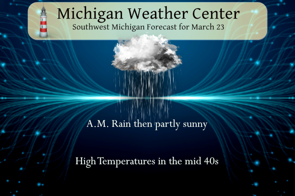
Light rain and some areas of fog are expected this morning. The rain and fog are occurring near and ahead of a cold front. The front will sweep south of the state this morning. The afternoon will feature considerable clouds with a few peeks at the sun developing late. Highs this afternoon: low to mid-40s. What to watch: a system Fri Night/Saturday with the potential for snow/freezing rain (yuck).
U.S.A and Global Events for March 23rd:
1907: Today was the warmest March day ever recorded in Washington, DC with a maximum temperature of 93 degrees. Washington DC has seen three, 90 degrees days in March, all of which occurred in 1907.
1913: A significant tornado outbreak occurred in eastern Nebraska and western Iowa on this day. Seven estimated F2 or stronger tornadoes killed 168 people and caused extensive damage to the area on Easter Sunday.
2007: A tornado obliterates a section of the town Clovis in eastern New Mexico, flattening about 100 homes and businesses, snapping telephone poles, and even heaving a trailer through a bowling alley. At least three schools are damaged. The tornado is one of thirteen that strike a dozen communities along the New Mexico – Texas border, leaving two people critically injured.
1987: Strong winds and heavy snow produced blizzard conditions across South Dakota from March 23rd through the 25th. Snow amounts ranged from 6 to 19 inches. Snow totals included 19″ at Winner (in Tripp County), 15″ at Murdo (in Jones County), and 12″ at Woonsocket (in Sanborn County) and Platte (in Charles Mix County). The wind piled the snow into drifts up to 10 feet deep. The heavy, wet snow broke power lines in several counties in the south-central and east-central parts of the state knocking out power for up to a few days.
2011: A low-pressure system brought a variety of precipitation to central and eastern South Dakota and west central Minnesota on March 22nd and 23rd. Areas experienced rain, hail, sleet, snow, and in some cases thundersnow.
Grand Rapids Forecast
3 23 grrLansing Forecast
3 23 lanKalamazoo Forecast
3 23 kzoForecast Discussion
-- Rain ending today --

A surface cold front has moved into the forecast area from the
west. The front at 300am stretches from near Alpena, southwest to
near Big Rapids and then across Lake Michigan near Chicago. Low
pressure is centered further southwest along the front in Kansas.
This low will sweep northeast up the front today taking the
precipitation with it off to the east and southeast of the
forecast area. Until that occurs though we will see periods of
light rain/rain showers. The rain will be most prevalent across
the south this morning. This afternoon the rain will pretty much
come to an end other than an isolated shower. As for the thunder
threat, instability has not made it this far to the north and we
are we are not expecting much in the way of convection anymore.

-- Friday night / Saturday system --

Models continue to bring a deep low pressure system through the
Great Lakes region Friday night and Saturday. The sticking point
continues to be the path that the low takes through our area. The
path will dictate what we see across our forecast area. The GFS is
further southeast than the ECMWF in terms of both operational and
ensemble runs. The GFS takes the low from near JXN northeast out
onto Lake Huron. The ECMWF is further west, taking the low up Lake
Michigan before turning northeast towards Northern Lake Huron.
Obviously with a spring time system, the track very much affect
thermal profiles and therefore precipitation type.

It has been the case this winter where it seems the ECMWF trends
towards the GFS with time. The GFS ensemble mean low position is
even further to the east than the operational run of the GFS, so
its possible a slight eastward jog in the track is possible from
the GFS. We believe the ECWMF will begin to trend to the east.
What this means in sensible weather instead of the heavier swath
of snow largely missing our area in the ECWMF its squarely in our
northern CWA via the GFS. Our northern two to three rows of
counties will certainly be in play for some heavy wet snow if the
GFS does indeed verify. It is very easy to see the dynamic cooling
that takes place within the heavy snow band in both the GFS and
ECMWF on Saturday as 850mb drop into the -5 to -7C range. There
will likely be a mixy zone in the heart of our forecast where
freezing rain will occur. This should be just south of the heavy
wet snow swath. Freezing rain would be likely based on the GFS
from Fremont northeast towards Mt Pleasant and Alma. We will want
to see a bit more consistency in track before issuing any winter
weather related headlines, but the northern half of the forecast
area appears to the zone of concern.

-- Quiescent weather from Sat night into mid next week --

Precipitation will end Saturday night as the low departs to the
northeast. Surface high pressure builds in and remains in place
much of the time from late in the weekend into the middle of next
week. No major systems are forecast to affect the area.
Temperatures are expected to be near normals for this time of
year.
Ck out the latest HRRR! Can you say snow for GR! Rock n roll baby!
https://www.pivotalweather.com/model.php?m=hrrr&p=snku_acc-imp&rh=2023032318&fh=48
1907: Today was the warmest March day ever recorded in Washington, DC with a maximum temperature of 93 degrees. Washington DC has seen three, 90 degrees days in March, all of which occurred in 1907. Did you know have a “heat wave” in March 1907 the temperature’s fell as cold as 23 on April 3rd and was 29 on the 1st and 3rd Must have been hard on all of the plants that came out too early that year.
Slim
We went to DC in March about 5-6 yrs ago. They said oh blossoms may not be very good. They were just beautiful!!! We wore tshirts and jeans the whole time we were there it was great.
hmmm, not sure what to think about this:

I do! Winter is not dead yet and our snowy winter is is still rocking!
Well as my Dad would say it won’t last long… LOL!!!
I agree with that statement!
I see most ski resort in NW Lower MI are fully opened and the conditions are excellent and more snow is on the way! This is why March is great winter month for skiing! Wow just wow!
I see most of the ski resorts have already closed in Southern Lower Michigan. The last 3 days have been around 50+ degrees. This is why I don’t really consider March to be a very “wintry” month.
Gasping for warmth lol…INDY
I know and it is pathetic! No 60 degree days in sight, and barely any 50 degree days in sight, but we still have snow in sight! Incredible!
A cold front has came thru and the temperature has now dropped down to 37 here in MBY with a cold rain falling.
Slim
What? More snow is coming? Move that low pressure system about 100 miles to the SE and GR will get pummeled again! As of right now Snow country will get hammered! Skiing into April anyone? Wow, just wow, WOW! The winter that won’t end!
If the latest CFSv2 plays out it could be on the cold side well into April. And yes it can still snow in April. Remember the warmest it has been so far this year at Grand Rapids is 54 way back on February 14th. And at this time there are no 50’s in the forecast. The latest 1st day of 55 or warmer at GR is April 8th 1970 GR is on track for a top 5 latest 1st day of 55 or better.
Slim
The good news is that 50 degrees is technically below average in April. So even a cool April can start with highs around 50 and end with highs around 60. As long as it is partly sunny and not windy, those are great temperatures
In looking at cold past April’s the only one that happened in your lifetime was 2018 with last year being one of the colder ones. We will see days in the 60’s in April and should see at least one day in the 70’s as the only years that have not reached 70 in April are 1950, 1961 and 1907.
Hot and cold are just a matter of perspective.
Slim
The same thing was said for March and it turned out warm LOL
Again gasping for warmth lol…INDY
GR has seen multiple daily record snowfalls and near record breaking seasonal snowfall! Wow, what a wild, hard and long winter!
This has been a very mild winter season here in Michigan. Using the AWSSI all locations in lower Michigan have had a “mild” winter season. While Sault Ste Marie and Herman in the UP have had a “moderate” winter and Ironwood has had a average winter and Marquette has had a “severe” winter. Here are the current AWSSI point values. Grand Rapids 579, Muskegon 443, Lansing 433, Ann Arbor 439, Detroit 340. Port Huron 284, Flint 456, Saginaw 482, Houghton Lake 815, Alpena 813, Cheboygan 860. In the UP Sault Ste Marie 1601, Hermon 2109, Ironwood 2111 and Marquette 1952.
Slim
Yesterday was a cloudy day with 0% of possible sunshine. The official H/L was 49/40 and after sundown there was 0.04” of rain fall there was no snow fall. The overnight low so far for today is a mild 42 and that is the current temperature with light rain falling. For today the average H/L is 48/29 the record high of 74 was set in 1907 and 2012 the record low of 4 was set in 1983.The record snow fall amount of 8.4” fell in 1956 (that was the year of the biggest tornado to hit the Grand Rapids area… Read more »