Here are the current spotter training sessions for Spring 2023 for SW Michigan. Check back often as more sessions will be added in the near future. Spotter training is recommended for ages 14 and older. I haven’t seen any scheduled for Allegan county yet which is the one I usually attend. I also have the Skywarn Field Guide onsite.
| Session Date | Session Time | Location | Registration |
| Tuesday, March 21st | 630 to 930 pm EDT | Grandville Middle School 3535 Wilson Ave SW Grandville, MI 49418 |
Registration |
| Saturday, March 25th | 10 am to 12pm EDT | Davidson Auditorium at Kellogg Community College 450 North Avenue Battle Creek, 49017 |
Registration |
| Saturday, April 15 | 10 am to 12pm EDT | Room 113 – Swanson Academic Center – Alma College 614 W Superior St Alma, MI 48801 |
No Registration Needed |
| Saturday, April 22 | 10 am to 12pm EDT | Room 1300 Stevenson Center – Muskegon Community College 221 S. Quarterline Road Muskegon, MI 49442 |
No Registration Needed |
Northern Lower Michigan (NWS Gaylord)
Southwest Michigan/Michiana (NWS Northern Indiana)
Southeast Michigan (NWS Detroit)
Looking for courses held in nearby regions of Michigan?
Please e-mail us with any questions: nws.grandrapids@noaa.gov
U.S.A and Global Events for March 21st:
1801: The Jefferson Flood hit the Connecticut Valley. The flooding was the greatest since 1692. The Federalists named the flood after the new President, who they blamed for the disaster.
1876: More than 40 inches of snow stopped traffic in Montreal, Quebec, Canada. Trains were delayed, and mail carriers resorted to snowshoes.
1932: A tornado swarm occurred in the Deep South. Between late afternoon and early the next morning, severe thunderstorms spawned 31 tornadoes in Alabama, Mississippi, Georgia, and Tennessee. The tornadoes killed 334 persons and injured 1784 others. Northern Alabama was the hardest hit. Tornadoes in Alabama killed 286 persons and caused five million dollars in damage.
1951: Antarctica is the windiest place in the world. Port Martin averaged 40 mph winds throughout the year. On this day, the winds averaged 108 mph.
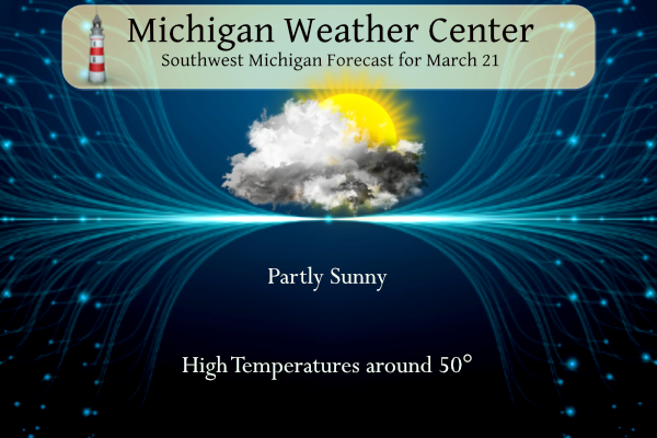
Grand Rapids Forecast
3 21 grrLansing Forecast
3 21 lanKalamazoo Forecast
3 21 kzoForecast Discussion
.
-- Few sprinkles/flurries today, otherwise dry --

A quasi-stationary frontal boundary is currently draped across Lower
MI, extending approximately from MKG-MOP-BAX as of 3 AM. Weak
frontogenesis along the sloping frontal zone has thus far yielded weak
returns on KGRR/regional reflectivity, given meager moisture
profiles in model time-height sections.

A few sprinkles/flurries are possible today, but most areas are
expected to remain dry under mostly cloudy skies.

-- Light precip, mainly rain, tonight into Wed --

A shortwave impulse, currently evident in WV imagery over ID, will
contribute to the development of a modest surface cyclone over the
Northern Plains this evening/tonight. Moisture transport occurring
southeast of this cyclone will result in PW increasing to around
0.6" by 12z Wed. This moisture, along with QG forcing for ascent
accompanying low-level warm advection, should support light precip
from tonight into Wed. Precip amounts in the HREF LPMM, as well as
the EPS median, are generally under 0.15", and thermal profiles
support mainly rain. However, some wet snow or perhaps light
freezing rain are possible near/north of Mt Pleasant prior to
daybreak Wed.

-- Soaking rain Wed night into Thu; thunder possible south --

Models continue to indicate that another surface low will
consolidate over the CO Plains on Wed, then propagate
northeastward as a frontal wave on Wed night. Ahead of this
feature, strengthening low-to-midlevel frontogenesis and
associated ascent should foster widespread precip along the
sharpening baroclinic zone. In areas near/south of I-96, RAP
forecast profiles on Wed evening/night exhibit MUCAPE of 500-1000
J/kg for parcels rooted near 800-850 mb, supporting a chance of
elevated convection/thunder. Some instances of small hail are
possible with elevated convection, given the presence of steep
midlevel lapse rates (~8 C/km), effective bulk shear of around 40
kts, and a CAPE layer that is reasonably distributed within the
hail-growth zone (-10 to -30C). EPS median 24-h precip amounts
range from around 0.3-0.7" across the forecast area.

-- Precip likely Fri night into Sat --

Improved ensemble consensus has emerged regarding the evolution of a
system that is likely to affect the area on Fri night into Sat.
Initial cyclogenesis is expected to occur on Thu night along a
baroclinic zone across the Southern Plains in advance of an
approaching mid/upper trough. EPS and GEFS means suggest that the
surface low will reach the Mid Mississippi Valley by 00z Sat.
Thereafter, the surface low in the EPS mean reaches the vicinity
of MI/Ontario at 18z Sat, well northwest of the GEFS-mean position
in northwestern PA. Members of both ensembles are loosely clustered
around their means, as is typical at this forecast range.

A majority of EPS members now produce measurable snowfall across
at least a portion of the forecast area, with median snowfall
(using a simplistic 10:1 SLR) ranging from 0.1-1.5". Given the
aforementioned positional uncertainty, it is not surprising that
ensemble spread in liquid-equivalent precip (QPF) amounts remains
large. For now, precip looks increasingly likely during this
timeframe in the form of wet snow, rain, or a mix.

-- Precip possible Sun night into Mon --

Global ensembles suggest that another system may bring rain or snow
during the Sun night - Mon timeframe as yet another upper trough and
associated surface low emerge from the Rockies.
Nice to see the CPC has trended back to below normal temps! What a winter! Wild, above normal snowfall and a long winter!
Temps in the 20’s currently in parts of MI! Cold!
Yes it is. And there is a lot of snow on the ground in Norther Lower and in parts of the UP there is over 30″ on the ground.
Slim
I may need to take a trip up there to pay in the snow!
GR first average 60 degree in GR is March 7th the drought is on will it even hit 60 degrees or better in March?? INDY
The range has been from January 4th 1997 to April 17th 1975.
Slim
I love it! A warm weather drought! Who knew?
To answer your question! No not a chance in —— that hits 60 in March! Not even close!!!
I am going to wait a bit longer to get excited, but currently the storm Friday has a lot of potential. It seems like *someone* could hit hard, just depends where it sets up…
As for today, I’ve been enjoying the weather! I went to Meijer Gardens during lunch and there were lots of kids on school trips looking at the butterflies
It no doubt bears watching. Also I saw your comment about blossoms. My general rule of thumb is trees start getting little leaves on them around April 20th or so on average. Sometimes a little earlier sometimes later depending on the year. The woods really doesn’t start the thicken up until the first or second week of May. Only reason I know is it coincides with turkey hunting season and that is how it seems each year goes
If it pans out, Wow to the wow WOW 12Z deterministic ecmwf guidance shows potential for several inches of snow across our far northern counties but is not too concerning in terms of higher end pcpn totals. Conversely 12Z deterministic gfs guidance shows potential for a much more dynamic system and snowstorm for portions of our area with up to a foot of snow possible over our northern counties. The 12Z GEFS is not quite as bullish with snow but still shows potential for significant snow. The 12Z Canadian is more in line with the GEFS as well. Bottom line… Read more »
Mid 50’s in Lower Michigan as of 2pm. So many birds are now back and are very loud. Sure feels like spring!
Does anyone know the average first date of blossoms? I remember in 2017 everything was in full bloom by April 21. In 2012 in March… last year not until mid-May. It seems there isn’t really an “average” date, and it really depends on when we get a week with consistent 65+ temps
It depends on what plants you are talking about. But a good rule of thumb is what is called Growing Degree Days. Some cold weather plants will start growing with colder growing degree days than others that is why many spring flowers are now growing. But for full growth it takes warmer degree days. The NWS keeps track of 50° and 65° growing degree days. On average here in GR March has around 20 GDD days. In 2012 there were 203 days of 50° GDD. Recent years with early growth were 2012, 1998 and 2021. Late years where 2018,2014 and… Read more »
True it does depend on the blossom. I’m sure a lot of the early season blossoms are going to start popping up soon
June 1st!! May has nights with below or around frezzing especially in the first half ….INDY
30’s coming and snow chances! I love long winters! Rock n roll will never die!
50’s the next couple days with soaking rains and possible thunderstorms with hail. I love it!
Good morning! Calendar spring started we as a nice early spring day with the official H/L at Grand Rapid of 49/27 There was no rain or snow fall and the sun was out 80% of the possible time. The day started with a trace of snow on the ground. The overnight low so far was somewhat mild 35 and that is the current temperature. Only old snow piles and snow in the shade is on the ground at this time. For today the average H/L is 47/28 the record high of 87 was set in 2012 that 87 is also… Read more »