The forecast for Las Vegas today is for sunny skies with a high of 54°. Kickoff time is at 6:30.
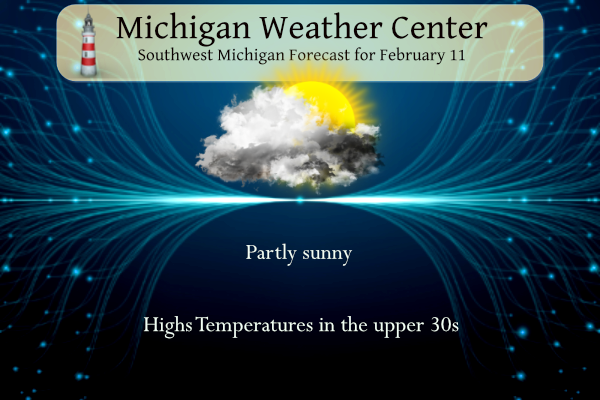
For our area, the NWS forecast is for partly sunny skies with a high of near 40°.
NWS Forecast
Weather History
1899: Muskegon records their all-time record low of 30 below zero. Grand Rapids falls to 21 below and Lansing 22 below.
1999: A surge of warm air ahead of a cold front brings all-time record-high February temperatures to much of Lower Michigan. February records include 67 degrees at Muskegon and 69 degrees at both Grand Rapids and Lansing. Battle Creek hits 72 degrees.
On February 11, 1999, the temperature rose to 70 degrees in Detroit. This is the earliest 70 degree day ever recorded in the city of Detroit.
1895: The low temperature was 11 degrees below zero at Moline, Illinois, marking the last of 16 consecutive days on which the low temperature was at or below zero. During the first 11 days of February, Moline’s highest temperature was only 13 degrees above zero. Their current average high temperature for early February is in the lower 30s.
1935: The lowest recorded temperature on the continent of Africa occurred on this date in 1935. A bitterly cold 11 degrees below zero was registered at the Atlas Mountains village of Ifrane, Morocco. Click HERE for more information from World Meteorological Organization’s World Weather & Climate Extremes Archive.
1962: A powerful F3 tornado struck Holstebro in Denmark, causing devastating damage. More than 100 houses were severely damaged or destroyed, making this event the most devastating tornado in Denmark’s history. The tornado could have been a low-end F4. Click HERE for more information from Berlingske.dk
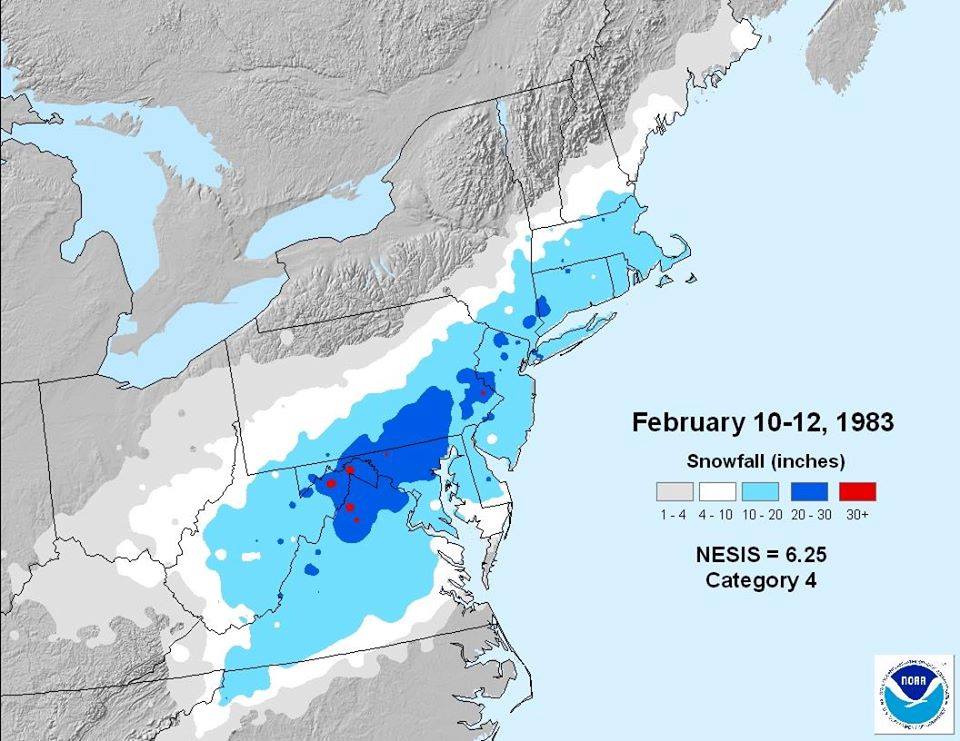
1983: Called the “Megalopolitan blockbuster snowstorm,” this major snowstorm impacted the Mid-Atlantic and southern New England. Snowfall up to 25 inches fell at Allentown, Pennsylvania. Snowfall amount of 35 inches occurred in parts of the Blue Ridge Mountains of West Virginia at Glen Cary. Windsor Locks, Connecticut, recorded a record 19 inches in 12 hours. A ship sunk off the Virginia/Maryland coast, killing 33. There were 46 total storm-related fatalities. New 24-hour snowfall records were set in Philadelphia, Harrisburg, Allentown, Pennsylvania, and Hartford, Connecticut. Five inches of snow in one hour was recorded at Allentown and Hartford.
Forecast Discussion
- Tranquil weather today and Monday

A sfc high pressure ridge over our area will result in tranquil
wx today through tonight. Regional IR sat trends do show rather
extensive cloud cover across our region. So while some partial
sun is expected from time to time we expect a fair amount of
cloud cover to linger today. High temps will reach the upper
30s to lower 40s today with mins tonight in the 20s.

Fair wx will continue Monday. A consensus of latest higher res
computer model guidance and ensembles continues to suggest that
most of the cloud cover and all the precipitation with the TN
valley low pressure system will stay south to se of our area.

In fact time height rh progs across our region suggest we have
potential to see more in the way of sun tomorrow than today.
This should help to boost high temps into the lower to middle
40s across our area.

- Relatively quiet and cool early to mid-week

The first half of the week looks relatively dry and cooler,
especially compared to the warm weather we had this past week. The
bigger system that will organize to our south and east is expected
to entirely miss the area on Tuesday. This system is part of the
southern branch of the upper jet, and the northern branch is helping
to keep it out of our area.

What it will do is draw much cooler air down from the north with a
decent low level flow from the north expected. Some light lake
effect can not be ruled out downwind of Lake Huron once the flow
becomes from the NE. Lake effect parameters are not favorable at
all, other than the colder temperatures moving in. This is because
the northern branch of the jet core will stay north of the area.
This means inversion heights will be fairly low, and keep a lid on
showers.

- Next best chance of precipitation to arrive around Thursday

The area will be in between the northern and southern branches of
the upper jet, so no major systems expected. We will see a piece of
energy in the northern stream brush by close enough to bring a
chance of precipitation to the area. This system will have enough
warm air for the onset of the precipitation to be rain or snow.
Cooler air will then move back in, and turn any lingering
precipitation to snow.

Even with the cooler air over the area by next weekend, we are still
not expecting any major snow accumulation events for the area. The
one system moves through on Thursday. The northern branch of the jet
will stay to our north, keeping the deeper cold air north also. A
few snow showers will be possible, but nothing that will have much impact.
Lake Superior is at an all time record for low ice coverage.
Minneapolis has had less snow this winter than Nashville.
https://www.cnn.com/2024/02/11/weather/midwest-non-winter-el-nino/index.html
It definitely is much lighter now than a month ago. Light by 7:30am until well after 6:00pm
This was the warmest start to February (2/1 – 2/10) on record. Probably no surprise to anyone.
It was nice. I wouldn’t mind these temps…but the sun would be nice!!!
It was absolutely horrible! We should be getting hammered with cold and snow this time of year! It was way too warm! Pathetic!
Absolutely perfect weather to start February! You could not ask for anything better!
The official H/L yesterday at Grand Rapids was 38/29 there was no rain/snowfall and there was no sunshine. For today the average H/L is now up to 33/19 the record high for the date and the month at Grand Rapids is 69 in 1999. The record low of -21 was set in 1899. The most rainfall of 0.79” was in 1998 the most snow fall of 8.8” was in 1985 The most on the ground was 22” in 2014. Last year the H/L was 45/19.
Slim