While we are having one of the warmest starts to any February way back in 1899 it was a different story. Here in Grand Rapids one of the coldest stretches of cold happened. Starting on January 27, 1899 there were 21 days in a row of below average temperatures at Grand Rapids. On 15 of the days it got below zero reaching lows of -20 on January 31st and February 1st -21 on February 10th and 11th -23 on the 12th and -24 on the 13th and 14th Lows were similar in Lansing but at Muskegon lows reached -29 on February 12th and -30 on the 12th To put that into a little perspective the last 3 times it has gotten down to -20 or colder at GR was -22 in 1994, -20 in 1981 and -21 in 1979. With 7 days of -20 or colder 1899 has the most no other winter has more than 1. While 1899 had 15 days with lows of 0 or colder it is not the most at Grand Rapids as 1978 had 19 in recent years 2014 has the most with 11. As for snowfall that February was cold but not very snowy at all as only 3.4” fell at Grand Rapids and 3.6 at Lansing just 5” at Muskegon. There was a total of 75.9” that winter season at Grand Rapids, 47.0 at Muskegon and 49.4 at Lansing.
Here is some more information from the cold outbreak of 1899. Nearly three feet of snow buried the nation’s capital, and ice encased steamboats on Lake Michigan. There’s cold—and then there was the Great Arctic Outbreak of February 1899. The bitter cold first hit the West Coast in the first days of February as temperatures reached lows of 33 degrees Fahrenheit in San Diego and 12 degrees in Seattle. The frigid air then barreled east with freezing temperatures reaching as far south as the Gulf Coast and Florida Panhandle. On February 11, residents of Fort Logan, Montana. Between February 11 and February 14, the Great Arctic Outbreak set record low temperatures in Grand Rapids (-24 degrees), Wichita (-22 degrees), Oklahoma City (-17 degrees), Atlanta (-9 degrees), Fort Worth (-8 degrees) and Baton Rouge (2 degrees). Even in Florida, there was no vacation from the cold. The temperature in Tallahassee fell to an all-time state record of -2 degrees on February 13 as nearly two inches of snow fell from the Panhandle to Jacksonville. Tampa received the first measurable snowfall recorded in the city’s history and trace amounts fell further down the Gulf Coast. Even in tropical Miami, the mercury dipped below freezing as desperate farmers set fires among their orange groves and wrapped their trees for protection from the cold. Note after the cold in Tallahassee the temperature was back up into the 60’s on the 16th and the 70’s by the 20th Here in Michigan March was cold and snowy but it did really warm up in April with it even reaching 90 degrees at Grand Rapids on April 29th it reached the mid to upper 80’s in other parts of West Michigan.
Yesterday was another record warm day across the area. Record highs were recorded at Grand Rapids 55°, Lansing 60, Muskegon 54°. At Grand Rapids the H/L was 55/39 there was no rain or snowfall. The highest wind was 43 MPH out of the SW. For today the average H/L is 32/19 the record high of 61 was set in 2009 the record low of -21 was set in 1899. Record rainfall of 0.99” was in 1966. The most snow fall of 6.7” fell in 1981 the most on the ground was 23” in 2014. Last year the H/L was 37/25.
AREA FORECAST DISCUSSION
NATIONAL WEATHER SERVICE GRAND RAPIDS MI
315 AM EST SAT FEB 10 2024
KEY MESSAGES
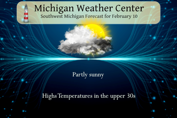
– TRANQUIL WEATHER THIS WEEKEND
– LIMITED CHANCES FOR PRECIPITATION DURING UPCOMING WORK WEEK
– TEMPERATURES BACK CLOSER TO NORMAL THROUGH THE WORK WEEK
DISCUSSION
ISSUED AT 315 AM EST SAT FEB 10 2024
– TRANQUIL WEATHER THIS WEEKEND
WEST TO NORTHWEST WINDS WILL CONTINUE TO ADVECT A COOLER AND
DRIER AIRMASS INTO OUR AREA TODAY. SKIES WILL BE PARTLY SUNNY
WITH HIGH TEMPS MAINLY IN THE UPPER 30’S TO LOWER 40’S. SHORT
RANGE GUIDANCE CONSENSUS TIME HEIGHT RH PROGS SUGGEST SKIES WILL
BECOME MOSTLY CLEAR TONIGHT. THIS IN CONJUNCTION WITH
DIMINISHING WINDS OVERNIGHT WILL RESULT IN LOWS IN THE 20’S.
FAIR WX WILL CONTINUE SUNDAY WITH A BROAD SFC HIGH PRESSURE
RIDGE IN PLACE. A SHORTWAVE WILL APPROACH FROM THE WEST AND WILL
BRING A GRADUAL INCREASE IN CLOUD COVER THROUGH THE DAY. HOWEVER
NO PRECIPITATION IS EXPECTED.
– LIMITED CHANCES FOR PRECIPITATION DURING UPCOMING WORK WEEK
LIMITED CHANCES FOR PRECIPITATION EXIST BETWEEN SUNDAY NIGHT AND
FRIDAY OF THE UPCOMING WORK WEEK. THE POSSIBILITY EXISTS FOR A
LITTLE LIGHT LAKE EFFECT SNOW SUNDAY NIGHT ACROSS NORTHWEST PORTIONS
OF THE FORECAST AREA UP TOWARDS LUDINGTON AND BALDWIN, BUT THIS
THREAT LOOKS TOO SMALL TO INCLUDE. IF ANYTHING IT WOULD BE FLURRIES.
A SYSTEM IN THE MONDAY/TUESDAY TIME FRAME PASSES OFF TO OUR SOUTH
THROUGH THE OHIO VALLEY. IT STILL LOOKS LIKE THIS PRECIPITATION WILL
MISS US TO THE SOUTH.
A ZONAL UPPER FLOW WILL BE IN PLACE FOR MUCH OF THE WORK WEEK, BUT
DIFFERENCES IN THE UPPER HEIGHTS SHOW UP MID TO LATE WEEK. THIS IS
MAINLY DUE TO HOW THE MODELS HANDLE A SHORTWAVE TROUGH DIVING
SOUTHEAST FROM CANADA INTO THE NORTHERN PLAINS MID WEEK. THE GFS IS
FLATTER AND MORE PROGRESSIVE WITH IT, WHILE THE ECMWF ALLOWS FOR
MORE AMPLIFICATION. THE DIFFERENCES END UP BEING A BRIEF CHANCE AT
SOME LIGHT SNOW ACROSS CENTRAL LOWER MICHIGAN ON WEDNESDAY THAT
SHOULD NOT AMOUNT TO MUCH IN THE GFS. THE ECMWF FINALLY BRINGS THE
SYSTEM THROUGH OUR AREA ON FRIDAY, BUT IN THE END THE HEAVIER
PRECIPITATION MISSES US TO THE NORTH ACROSS THE NORTHERN GREAT
LAKES. BOTTOM LINE, A PRIMARILY DRY WEEK WITH LIMITED CHANCES FOR
PRECIPITATION. THE MODEL DISPARITY MID TO LATE WEEK RESULTS IN LOW
CONFIDENCE IN TERMS OF PRECIPITATION CHANCES WED-FRI.
– TEMPERATURES BACK CLOSER TO NORMAL THROUGH THE WORK WEEK
REGARDING TEMPERATURES WE WILL BE MUCH CLOSER TO NORMAL THAN WE HAVE
BEEN. NO MORE RECORD HIGHS ARE IN THE OFFING AFTER A DAY (FRI) WHERE
WE HAD 5, MKG, GRR, LAN, AZO AND BTL. HIGHS WILL MAINLY BE IN THE
30S THIS WEEK COMING UP. NORMAL HIGHS ACROSS THE FORECAST AREA FOR
TODAY’S DATE RANGE FROM 28F TO 33F.
1899 = major polar vortex! 2023/24 = pathetic winter so far! Bring on the next SNOWSTORM!
None in sight and continued above normal temps…
You never know!
https://www.pivotalweather.com/model.php?m=ecmwf_full&p=sn10_acc-imp&rh=2024021012&fh=240&r=conus&dpdt=&mc=