Yesterday we had a high temperature of 63° before the cold front moved through and brought some severe storms through the area prompting a severe thunderstorm warning. We had some high winds and heavy rain.
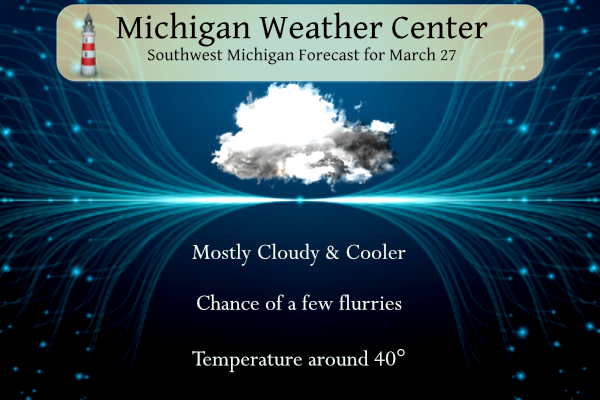
Mostly cloudy skies are expected today with highs around 40. West winds will be in the 12-17mph range with a few flurries along the lakeshore counties. High pressure moves in bringing more sunshine Thursday and Friday with highs in the 40s Thursday and 50s Friday.
NWS Forecast
Weather History
1991: A tornado outbreak hits the Midwest, wreaking havoc from Iowa to Ohio. In Michigan, at least seven tornadoes strike. Eighteen people were injured in Calhoun County as eight homes were destroyed there.
On March 27, 1934, a record low temperature of 3 degrees was recorded at Detroit Metro Airport.
Also on March 27, 1991, one of the largest tornado outbreaks hit Michigan. Fifteen tornadoes moved across parts of the state, making it the third-largest tornado outbreak by the number of tornadoes, and certainly the earliest tornado outbreak in Michigan history. Three tornadoes hit portions of Southeast Michigan including two in Monroe County and one in St. Clair County.
1890: The middle Mississippi Valley saw a significant tornado outbreak on this day with 24, estimated F2 or stronger tornadoes impacting the area. Tornadoes killed at least 146 people. The most notable of the tornadoes was an estimated F4 that carved a path from the Parkland neighborhood to Crescent Hill in Louisville, Kentucky. This tornado destroyed 766 buildings and killed an estimated 76 to 120 people. Most of the deaths occurred when the Falls City Hall collapsed. Click HERE for more information from The Filson Historical Society.
1931: A blizzard struck western Kansas and adjoining states was called the “worst since January 1888”. Twenty children, ages seven to fourteen, were stranded in a makeshift school bus for 33 hours during this blizzard.
1946: Winnipeg, Manitoba Canada thawed out as the mercury soared to 74 degrees, their warmest March temperature on record.
1964: Great Alaskan earthquake left at least 100 dead in Anchorage, Alaska. The magnitude 9.2 quake is the largest in US history and the second strongest worldwide. Waves reached 103 feet above the low-tide mark. Click HERE for more information from USGS.
1994: The Southeastern Palm Sunday Tornado Outbreak occurred on this date. What began as a peaceful Palm Sunday quickly changed to a historic day in weather history when a powerful tornado ripped through southern Alabama and Georgia. By the time the storm was over, 22 people were dead, and 92 were injured. The F4 tornado cut a 50-mile path from Ragland in St. Clair, County Alabama to the Georgia line. The storm touched down near Ragland at 10:51 am. The storm struck Ohatchee then roared across northeastern Calhoun County, passing near Piedmont and hitting Goshen in Cherokee County. The most disastrous damage occurred at Goshen, where the twister struck the Goshen United Methodist Church at 11:37 am. 20 people were killed at the church, which did not hear the tornado warning issued 10 minutes earlier by the National Weather Service in Birmingham. A tornado watch had been released at 9:30 am. Following the tornadoes, Vice President Al Gore pledged to extend NOAA Weatheradio coverage into the areas affected by the twisters, which had previously been unable to receive the alarm signals.
Forecast Discussion
- Cloudy and cooler today, sunshine Thursday

Latest IR loop shows abundant stratocu covering the LP. However,
some clearing was noted over northwest WI and that clearing will
eventually make into the cwa late this afternoon.

Low pressure that pushed a cold front through the cwa yesterday is
now north of Lake Superior and high pressure will nose in from the
south today. Bufkit RH progs show clouds thinning and scattering
out after 20z today, which should lead to a little sunshine before
the day is out.

H8 temps are chilly...near -12c today, so we`ll see highs below
normal...only 35 to 40. As skies clear tonight, temperatures will
fall into the mid to upper 20s. The upper trough axis will swing
through tonight take the core of the colder air with it tomorrow.
Highs tomorrow will still be below normal, around 40, but a bit
warmer than today.

- Multiple Chances For Precipitation Through Mid Next Week

The long term portion of the forecast starts out dry as surface and
upper-level ridging and low-level dry air are in place for Friday.
The first chance of precipitation is expected to center on Saturday
morning as a surface low and associated warm frontal boundary tracks
across the southern third of the state. A few rumbles of thunder are
possible near I94 Saturday morning as 850mb LIs go slightly
negative, while a low chance of snow or freezing rain exists near
US10 due to a Canadian high pressure system brings cooler air in.
Highest QPF, presently looking to be in the 0.25-0.5 inch range,
focuses on the southern half of the CWA with lesser amounts north.
Thermal ridging puts highs into the 50s Friday into Sunday.

A brief period of surface and upper-level ridging then keeps the day
on Sunday dry before the next system arrives Monday morning into
Tuesday. Cluster analysis shows considerable uncertainty remains
with the amplitude and tilt of the expected mid-level wave across
the Central Great Lakes early next week, affecting the strength and
track of the surface low, and extent of temperature advection (to
add a bit of context, there is 10C of spread in the 850mb temps 25th-
75th percentile). A bit of snow mixing in across Central Michigan
can`t be ruled out if solutions trend towards the cooler side of the
envelope but this scenario is unlikely at present. Overall, rain is
likely with this system, with some details still needing to be
ironed out (not uncommon in the day 5-6 timeframe).
Another below normal temp day is on tap! Multiple below normal temp days this month! WOW, winter keeps going and going!
Yup and the furnace is still cranking! Typical cold Spring in west Michigan…INDY
You know it! There is still a lot more cold coming! Rock n roll will never die!!
Today was just another cold windy Spring day! Wow!
CPC is looking fine and beautiful!!
Slim you can flush those CFS maps! The new CPC and the forecasts agree that once the first week of April rolls in gonna be 50’s and 60’s for a nice long while!
https://weather.com/weather/tenday/l/52aab230ef88e4f2bb12857231a5dd58392e78a71b90e01d57a11d827658eb55
The long range CFSv2 continues to hint at a rather cold April. It has been showing this for some time now.
https://www.cpc.ncep.noaa.gov/products/people/mchen/CFSv2FCST/weekly/
Slim
What? Winter weather is done yet! How could it be!
Yes winter weather is done, I agree with you.
We had 1.06 inches of rain yesterday. It is currently 32 degrees.
Wow!
Let it snow, let it snow, let in Snow!
We were supposed to get 8 inches of snow today on your pivotal prediction map. Where is it?? Another fail!
You are 100% wrong as usual. That map showed accumulated total through that date and what do you know we received 6.5 inches! Pretty accurate long range snow map! Clearly you are totally clueless!
Well the good thing is it all melted by Sunday and we’re still snow free today!
Golf Friday after work look’s excellent, mid 50’s and sunny with light winds! Great golfing weather for this time of year!
61 degrees yesterday, 63 degrees the day before! February has been another blowtorch.
Breaking news …….it is late March nor February! WOW!
All the winter months have been well above normal temps with no snow, so it’s easy to lose track!
More excuses! Pathetic!
The weather word of the day is once again. – COLD! Anyone want to golf today with wind chills around 20 degrees? Incredible!
The overnight low and current temperature is 33. At the time it is cloudy and very windy here in MBY. I had a rain event total of 0.38″ of rainfall yesterday.
Slim
The official H/L yesterday was 61/36 there was 0.44” of rainfall it was a windy day with the highest wind gust of 47 MPH out of the S. There was just 5% of possible sunshine. For today the average H/L is 49/30 the record high of 81 was set in 1945 and the record low of 0 was set in 1965. The most precipitation of 1.03” fell in 1908 the most snowfall of 6.9” was in 1948 the most on the ground was 12” in 1970. Last year the H/L was 50/33 and there was 0.13” of rainfall.
Slim