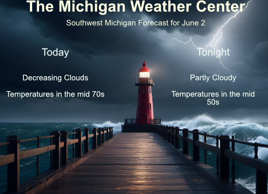
We started the month of June with .44 of an inch of rain. Enjoy today and tomorrow as it will be pleasant with no rain and temperatures in the mid-70s today and the low 80s tomorrow. Chances of rain return Tuesday and will be present through the rest of the week.
NWS Forecast
May Summary

The month of May in our part of the world was the warmest since 2018 and was among the top 15 percent warmest Mays recorded over the past 125 years, despite no dramatic heat waves. Cold days were relatively few compared to warm days.
Spring Summary

The spring of 2024 can be summarized with persistently warm temperatures and near-average precipitation. When all averaged out, the temperatures this spring ranked between 2nd and 5th warmest out of more than 125 recorded.
Weather History
1910: It was a cold day in June as temperatures in the upper 40s in the afternoon were more typical of late March. The high of 47 at Grand Rapids and Muskegon are the coldest high temperatures on record for any day in June. At Lansing, the high was 49 degrees, second only to the 46-degree high on the previous day for being the coldest June day.
1925: Two people were injured as a tornado moved across central Ionia County. A woman was carried 300 feet and left paralyzed and a man was injured in a barn that collapsed.
1950: Thunderstorms dropped one to three inches of rain across the region. Nearly an inch of rain fell in one hour in Grand Rapids, flooding streets and basements. Lansing had a storm total of 2.30 inches, which was a record for the day.
On June 2, 1988 rain was recorded at Saginaw (.11), Flint (.47), and Detroit (.37). This was one of just three days in June 1988 that had rainfall. This led to the driest June on record in Flint (.63 inches total) and Saginaw (.61 inches), and the second driest in Detroit (.97 inches).
On June 2, 1971, an F1 tornado hit Genesee County at 5:12 PM and caused $250,000 in damage.
1889: The same storm that caused the historic dam failure in Johnstown, PA, also affected Washington, D.C. The streets and reservations in the center of the city and all the wharves and streets along the riverfront were underwater. Pennsylvania Avenue was flooded from 2nd to 10th Streets. The Potomac River crested at the Aqueduct Bridge at 19.5 feet on June 2. Additionally, damage occurred on Rock Creek, with the Woodley Lane Bridge washed away. Considerable damage occurred to machinery plants and material at the Navy Yard.
1917: The temperature at Tribune, Kansas dipped to 30 degrees to establish a state record for June.
1998: Frostburg, Maryland on June 2, 1998, at 9:45 PM – This was part of a killer outbreak of tornadoes that moved southeast from Pennsylvania. The storm entered Garrett County, Maryland striking the town of Finzel. It then moved up and over Big Savage Mountain in Allegany County and ripped through the northern portion of Frostburg. It reached its peak strength as it crossed the ridge. Winds were estimated between 210 and 250 mph (F4 on the Fujita Tornado Damage Scale). This was the first tornado to “officially” be rated an “F4” in the State of Maryland. The National Weather Service adopted the Fujita Damage Scale in 1973. The total damage path of the Frostburg tornado was over 25 miles long (8 miles in Allegany County) and up to a half-mile wide. Along most of its path, it was producing winds over 125 mph (F2 or stronger). The damage path was continuous as it moved up and down over 2000-foot mountain ridges. The fact that no one was killed in Maryland was attributed to a 5 to 10-minute warning that was well communicated to people in Frostburg over television, radio, scanners, telephones, and sirens. People took quick action to move to their basements. A mother and child rode out the storm as it destroyed their house hiding under a table in the basement. They were shaken but unharmed. A jacket from a Frostburg home was found 25 miles away. A diploma was found near Winchester, Virginia, 60 miles away, and a bill was found near Sterling Virginia (about 100 miles away).
Forecast Discussion
- Limited chance of showers today through Monday afternoon

Weak surface low pressure over central lower Michigan early this
morning will shuffle east today. Moisture and clouds in the mid to
upper levels will depart but remain in the low levels for some
portion of the day. Areas of light drizzle may linger this morning
over the middle of lower Michigan. Question will be how quickly does
the low stratus mix and scatter into diurnal cumulus. Latest
guidance more aggressive with sunshine this afternoon near/west of
US-131, while some models including the HRRR leave areas near I-69
relatively gloomy where low level wind convergence and troughing
hangs around a little longer on the backside of the low. Will keep
about a 10 percent chance of measurable rainfall there this
afternoon.

Near-normal temperatures today trend seasonably warm on Monday,
while humidity will be a little more noticeable (dew points near
60). Upper level flow over the northern CONUS through Monday is
fairly zonal but weak, with the next shortwave trough of note
approaching Michigan late Monday. Cirro/alto clouds will be
streaming in on Monday from upstream thunderstorms. The chance of
showers and thunderstorms appears low until late in the day when
better 850 mb moisture streams in and instability increases.

- Medium/High Confidence in evolution of upper troughing this week

Shortwave ridging early this week gives way to height falls by
Tuesday as a closed upper low approaches from the northwest. This low
figures in the evolution of persistent troughing across the Great
Lakes by the end of the week with lower 500 mb heights and low level
northwest flow indicating cooler than normal temperatures into next
weekend.

As far as rain chances, they persist from Monday night through
Wednesday in most southerly flow ahead of the upper low and should
peak on Monday night as a shortwave trough minors out and again
Tuesday night into Wednesday as a cold front will focus rain and
embedded thunderstorms. Showery and cool under the upper low for
late week and the weekend.
Hey Slim I was over to Bay city last night for a family wedding first time I ever been there I thought of you I believe that’s your home town it’s cool place downtown is fun especially at night I was telling my wife we need to come back sometime just not a good way to get there lots of country we drove through lol… INDY
Might be the year that both Winter and Summer stayed away.
Keep the heat and humidity away!
Unfortunately we received very little rain in the past 24 hours. Hope to get some in the next few days.
Here in MBY I recorded 0.25” of rainfall yesterday and overnight. The low overnight low here was 60 and at the current time it is 63 and cloudy.
Slim
Picked up .6 inches of rain yesterday and last night! Fantastic!
The official H/L yesterday at Grand Rapids was 74/52 there was 0.23” of rainfall and the day also had 23% of possible sunshine. For today the average H/L is 76/55 the record high of 95 was set in 1934 and the record low of 35 was set in 1956. The most rainfall of 1.42” fell in 2007. Last year the H/L was 91/60 it was the 4th day of 5 days in a row of 90 or better.
Slim
Breaking>>>>>I have not even used my AC once yet this season! I can’t remember the last time I have not needed the AC in May! Incredible Spring so far! Decent temps but no hot air! Keep it rocking! It looks like the warm weather hype is just that! Wow!
I see yesterday was yet another below normal tempo day! I see the latest CPC shows no hot air for weeks on end!