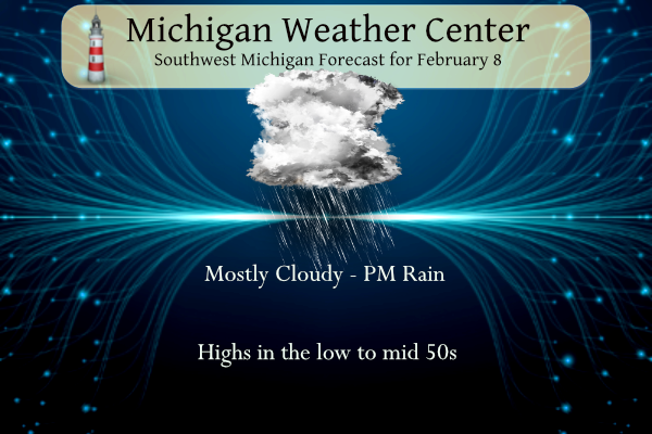
Today and tomorrow will feel more like early spring rather than winter with temperatures in the 50s for southwest Michigan. Chances of rain move in for later this afternoon and continue through Friday night before the passage of a cold front which will drop our temperatures back closer to normal by February standards.
NWS Forecast
Weather History
1925: A four-day warm spell with highs over 50 degrees across southwest Lower Michigan peaks with a record high of 60 degrees at Grand Rapids.
On February 8, 1900, the daytime temperature rose to 63 degrees in Saginaw, which is 34 degrees above average.
U.S.A and Global Events for February 8th:
1956: From February 1-8, heavy snow fell over the Panhandle of Texas. Snowfall amounts include 43 inches in Vega, 24 inches in Hereford, and 14 inches in Amarillo. The storm caused 23 deaths and numerous injuries. It snowed continuously for 92 hours in some locations.

1968: The highest 1-day snow at the Savannah Airport in South Carolina occurred on this date when 3.6 inches of snow fell. Records began in 1871.

1989: Mammoth traffic jams in the Los Angeles area as freak snow struck California. The snow was reported from the beaches of Malibu to the desert around Palm Springs.

The Akron Beacon Journal Akron, Ohio 09 Feb 1989, Thu • Page 3
2005: Snow falls on the Jordanian capital and surrounding regions, blocking roads and closing schools. Parts of northern Iran and Tehran were paralyzed after being hit by several days of record snowfall, with dozens of flights canceled and critical roads also cut off.
2013: A nor’easter produced heavy snowfall over the New England states. In Boston, Massachusetts, total snowfall reached 24.9 inches, the fifth-highest total ever recorded in the city. New York City officially recorded 11.4 inches of snow at Central Park, and Portland, Maine, set a record of 31.9 inches. Hamden, Connecticut, recorded the highest snowfall of the storm at 40 inches.

Forecast Discussion
- Unseasonably Warm; Showers Late This Afternoon/Tonight

It will be unseasonably mild today with high temperatures
reaching the mid to upper 50s in a strengthening southerly flow
warm air advection regime. However we will most likely fall
short of record high temps given extensive cloud cover. It is
also noted that record highs for most climo sites are into the
lower 60s. It is unlikely that high temps will be that mild
today.

The 00Z HREF and consensus blend of most higher res guidance
suggests that light rain showers will gradually move in from the
west late this afternoon and more so for this evening.

We have added mention of isolated convection to the forecast for
this evening given steep mid level lapse rates. Potential for a
few thunderstorms this evening is supported by the 00Z HREF.
Our convective potential is mitigated by weak instability and
timing. Timing for convection is more favorable off to our west
across southern WI/northern IL. Nevertheless we expect at least
isolated evening convection across portions of our area.

It still looks we have a better chance for some record high
temps Friday with the help of some sun in the wake of the
departing shortwave. Record high temps Friday are also several
degrees lower than today. The relatively best chc for some
record high temps will be inland from Lake MI and mainly near to
east of US-131.

- Chances for Rain and Snow This Weekend into Next Week

There are a few chances for precipitation this weekend into next
week. The first is for Friday night into Saturday with a shortwave
trough advecting through the area. There is a decent amount of
frontogenesis both the in the low and mid levels as the front moves
through early Saturday morning. Precipitation will largely be rain,
but areas along US-10 could see some light snow, but chances are
lower for precipitation in this region (around 20 percent). Farther
south there could be an isolated rumble of thunder as there could be
enough instability.

- Temperatures Trend Back to Normal

Behind the front we move more into northwest flow allowing for
various shortwaves to track in from the north. This will also bring
cooler, more seasonable air with highs in the 30s and lows in the
20s. That being said, any precipitation that is seen next week looks
to be in the form of snow. A low pressure system tracks south of the
area Monday with the precipitation shield clipping the area at this
time. A shift north would increase chances, while a shift south
would decrease and potentially eliminate any chances for accumulating
snow. There is a decent spread in the ensemble members that show
this with a large spread in snowfall amounts.
Enjoying the lightning/thunder to the North. Impressive…considering the date 😉
We have some rain with thunder and lightning going on now.
That is some really bizarre/blinding/cool lightning flashing out there tonight! Can’t believe this is February!
Chance of thunder this evening, mild Friday It looks and feels a little Spring-like outside as temperatures nose in on and surpass 60. Additionally, the sky via visible satellite (and a quick peek outside) looks somewhat Spring-like with some altocumulus castellanus clouds which are indicated of some mid level instability. Indeed, local radar shows some light echos to the west from virga, mainly. Surface observations show a frontal boundary over central Iowa connecting to a low in western MN. The northern part of this front is occluded and will move through the cwa later tonight. Ahead of it, impressive mid… Read more »
At 553 PM CST, a confirmed tornado was located near Stoughton, moving
northeast at 40 mph.
HAZARD…Damaging tornado and half dollar size hail.
SOURCE…Weather spotters confirmed tornado.
IMPACT…Flying debris will be dangerous to those caught without
shelter. Mobile homes will be damaged or destroyed. Damage
to roofs, windows, and vehicles will occur. Tree damage is
likely.
Locations impacted include…
Stoughton, Evansville, Brooklyn, Magnolia, and Cooksville.
“To repeat, a large, extremely dangerous and potentially deadly tornado is on the ground. To protect your life, TAKE COVER NOW!”
Word has it this may be the first ever February tornado in Wisconsin. Can’t 100% verify that but that’s what I’m seeing. I know someone near the town of Evansville. Reports are multiple homes hit.
https://www.gazettextra.com/news/local/wisconsins-first-ever-february-tornado-confirmed-in-evansville/article_2751e2e6-c6e3-11ee-a2dc-a3759b639a64.html
And here’s a video of it:
https://www.apg-wi.com/news/state/apparent-tornado-in-evansville-wisconsin/video_c7f11f4c-1ba0-5b87-a087-a460453d96ef.html
Large tornado down in Wisconsin. PDS tornado warning. I know someone that lives right near where the tornado is occurring.
Reached 59 here… so close to 60 but either way, REALLY warm for mid-winter
We had 60 for a bit here – which is 29 degrees above average. Amazing day.
Not a lot of snow left in parts of the UP at this time.
https://www.exploremunising.com/web-cams/
and
https://www.exploremunising.com/web-cams/
Slim
New record highs set. The 3PM readings have set a new record highs at Muskegon and Kalamazoo with a reading of 62. The readings of 60 at Holland 58 at Grand Rapids and 57 at Lansing have not reached records yet but will be the 2nd at Holland and 3rd at Grand Rapids and Lansing. Here in MBY I now have a reading of 60.
Slim
I see 60’s in Michigan as of 1pm. Wow!
As of 3 PM new records have been set at Muskegon and Kalamazoo with 62. I have 60 at this time but the clouds are now moving in.
Slim
58 degrees here at noon. Lots of sun this morning, but clouds now dominate the sky.
https://www.mlive.com/weather/2024/02/tornadoes-possible-today-heres-something-we-dont-see-much-in-february-in-great-lakes-region.html
https://www.mlive.com/weather/2024/02/60-degrees-in-february-here-in-michigan-see-if-you-will-hit-the-magical-mark.html
Looks like we go to ENSO-Neutral in the April-June timeframe with a transition back to La Niña again sometime in June or July.
Winter Weather Warning! The AO will be tanking next week and then a major transition back to some real winter weather! Who would have thought?
While next week looks cooler, it’s not cold. WOOD doesn’t have a single day at 32 degrees or below.
Blowtorch warning for 50’s, maybe 60’s! And possible thunder!
I was reading about how the El Nino is past peak and starting to weaken. So it may have less influence over our spring weather (I think El Nino causes a cooler spring). But we shall see… seems to still be in full effect this month
The official H/L yesterday at Grand Rapids was 48/26 that 48 is the 3rd warmest for the date. There was no rain or snowfall. The sun was out 19% of the possible time. For today the average H/L is 32/18 the record high of 60 was set in 1925 and the record low of -12 was set in 1974. The most rainfall of 0.75” fell in 1900 and the record snowfall of 5.4” fell in 1952 the most snow on the ground was 23” in 2014. Last year the H/L was 43/24.
Slim
For today the top highs at Grand Rapids are 60, in 1925, 59 in 1900, 57 in 1990, 56 in 1937, 53 in 1938. The record warm lows are 49 in 1925, 36 in 1936, 34 in 1938. At Lansing the top record highs are 62 in 1900, 59 in 1869, 56 in 1925, 55 in 1990, 53 in 1937 and 1867. The record warm lows are 39 in 1966, 36 in 2023 and 1898, 35 in 1881
Slim
Yesterday the official high of 48 and the official high of 47 at Grand Rapids and Muskegon were the 3rd warmest on record at both locations. The high of 50 at Lansing was the 4th warmest. It looks like the overnight low at Grand Rapids so far for today is 35 if that holds it will be the 3rd warmest minimum at GRR. Note here in MBY the low was 31 at the current time I have 37.
Slim