Yesterday we reached a record 61.5° in Otsego. We had the slider and windows open to enjoy some fresh air. We have breezy conditions this morning with 48° at 5 am. We even had a couple of thunderstorms move through overnight.
The National Weather Service confirmed that a tornado was spotted last night just south of Madison between Evansville and Edgerton, marking the first time a tornado touched down in the state during February.
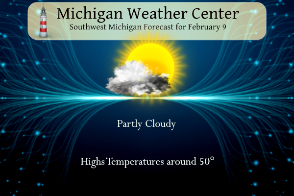
Some warmth will remain today with high temperatures in the 50s across Southern Lower Michigan. A cold frontal passage tonight will bring in cooler air going forward. Highs by Sunday will be back in the 30s for the most part. We are expecting mainly dry conditions from today through the weekend.
NWS Forecast
Weather History
1875: The temperature tumbles to 32 degrees below zero at Lansing and 20 below at Detroit during one of the coldest months on record in Lower Michigan. The mean temperature for the entire month at Lansing is 4.7 degrees, the coldest month ever recorded there.
1934: The coldest temperature ever recorded in Michigan occurred at Vanderbilt, with a low of 51 degrees below zero.
On February 9, 2018 a full day of snow, including a period of 1″ per hour rates, led to accumulations ranging from 4 to 9 inches across Southeast Michigan. The heaviest snow fell between the Ohio border and M59. Peak measurements of 9.0″ were taken near the towns of Adrian and Milan.
Also on February 9, 2016, prolonged moderate to heavy snow resulted in significant accumulations in the Thumb. Locations south of Interstate 69 received only 1 to 6 inches, with the lowest amounts closest to Detroit and the Ohio border. However, Sebewaing, Port Hope, and Cass City all measured a foot. The big winner was Deford in Tuscola County where 14 inches fell.
Also on February 9, 2010, a strong low-pressure system passed through the Ohio River Valley and dropped the largest snowfall totals of the 2009-10 season across southeast Michigan during the afternoon and evening hours of the 9th and the early morning hours of the 10th. Most locations received between 5 and 10 inches with the highest amounts observed along the Ohio border, and between Flint and Saginaw, where up to a foot was reported. Some of the higher snowfall reports included Saginaw with 12.4 inches, Burt with 10.5 inches, Samaria with 10.0 inches, and Ann Arbor and Flint received 9.4 inches.
Also on February 9, 2001, a storm produced widespread two-day rainfall amounts from one to two and a half inches across all of Southeast Michigan. With substantial snowmelt thanks to one to two feet of snow on the ground, runoff production was quite large. Numerous rivers flooded over the following few days, and basement and road flooding were widespread. Unfortunately, there were three deaths as a result of the flooding in Monroe County.
Also on February 9, 1977, this day marked the last day of a streak of 45 days (December 26, 1976-February 9, 1977) of temperatures at or below 32 degrees in southeastern Michigan.
1870: President Ulysses S. Grant signed a law “to provide for taking meteorological observations at the military stations in the interior of the continent.” A petition submitted by Increase A Lapham to Congressman Halbert E Paine in December 1869 began this process. Click HERE for more information.
1899: One of the most significant cold outbreaks to ever impact the United States occurred early to mid-February. From the 8th-11th, the statewide average temperature across Iowa was 14.6 degrees below zero, making it the coldest four-day stretch on record in the state. On the 8th, Sioux City experienced its coldest day on record, with a daily average temperature of 24 degrees below zero. Then on the 11th, they reached their second-coldest temperature on record with a low of minus 31. Overall the coldest readings were obtained on the morning of the 9th when reported low temperatures included -21 at Keokuk, -23 at Des Moines, -33 at New Hampton, -35 at Le Mars, -38 at Estherville, and -40 at Sibley. The cold across the middle of the country was so extreme and persistent that ice floes down the Mississippi River into the deep south, emerging into the Gulf of Mexico near New Orleans on February 17th. This has happened only one other time: February 13, 1784. The temperature dropped to 63 degrees below zero at Norway House, Manitoba, Canada setting the province’s low-temperature record.
1994: A devastating ice storm struck Mississippi, Louisiana, and extreme northwest Alabama. Freezing rain began falling over northern Mississippi during the early morning hours and continued until midday on the 10th. Ice accumulates 3 to 6 inches thick on exposed objects in the affected area. Due to the weight of the ice, power lines, trees, and tree limbs were down. Nearly one million people were without power after the storm, some for a month. Click HERE for more information from the NWS Office in Jackson, Mississippi.
Forecast Discussion
- Unseasonably Mild Today; Tranquil Weather Through The Weekend

Record or near record high temperatures are forecast today
mainly near to east of the US-131 corridor as a result of
continued southwest winds and some sunshine. High temperatures
will reach well into the 50s across much of our area and may
reach the lower 60s across our south to se fcst area. Please see
the climate section below for record high temperatures for this
date.

A couple of upper level disturbance will bring a small chance of
rain showers tonight. Some wet snow flakes may mix in with pcpn
very late tonight as thermal profiles cool. It will be partly
sunny on Saturday in the wake of this weak upper level system
and west to northwest winds will advect a cooler and drier
airmass into our area. High temps Saturday will reach the upper
30s to middle 40s.

- No major systems to affect the area through Thursday

No major systems look to affect Lower Michigan from Saturday night
through Thursday. The upper pattern features zonal flow much of the
time and there are just no consequential systems that are generated
in the models during that time frame. Surface ridging should provide
dry conditions from Saturday night through Monday. A trough will be
in place aloft Tuesday and Wednesday with a weak low at the surface.
The GFS keeps us mainly dry and feel that is the most likely
outcome. North to northwest flow will be in place on Wednesday with
cold enough air for lake effect snow generation. Cannot rule out
some light snow showers on Wednesday and our forecast will have low
chances for snow showers both Tuesday and Wednesday, but again
largely expecting dry conditions. A better chance for precipitation
shows up on Thursday in the GFS, however the ECWMF is dry. We will
continue chance pops (30-50 percent) for some light snow but given
the model disparity confidence is lower than normal. Bottom
line...mainly dry weather with a couple chances for some light
snow.

- Temperatures near normals for this time of year

With regard to temperatures...we move back to normal after a few
days of well above normal. Highs throughout the longer term...Sunday
through Thursday are generally in the 30s. Lows will be in the 20s.
Normal highs are around 30 and normal lows around 20 for this time
of year so we will be close to those numbers. All in all a fairly
benign weather pattern for Southwest Lower Michigan.
I’m seeing temps below freezing and light snow in MI! incredible!
Horrible winter weather! Too warm and no snow! Horrendous!
So one cold day, then right back to near 40 in the two week!! INCREDIBLE!
https://weather.com/weather/tenday/l/52aab230ef88e4f2bb12857231a5dd58392e78a71b90e01d57a11d827658eb55
Fantastic at my place! Just needed a sweatshirt outside and ZERO snow around, piles at the end of the driveway are completely gone now too!!
Ohhhhh……what’s this Mookie??? CPC trending warmer than normal for temps now!!! How could that be?!?!?
Back to back 60-degree days here. Lansing’s high of 60 today shattered the 99-year old record by seven degrees. KZoo’s 62 was also seven degrees warmer than the record set just last year. New record high for BC. GR’s 60 tied the record high set in 1934. Muskegon also tied it’s record high.
I’m seeing freezing temps and light snow in parts of MI! 32 degrees and snow in Houghton! WOW!!
I’m seeing lots of low 60’s in Michigan at the moment. Highest being 63 degrees at a couple reporting stations. Wow!
Preliminary rating for the Wisconsin tornado is EF-3 140mph winds. Impressive.
Fun fact. Since January 23 every day has been above average. In 1931 every day starting on January 23 to February 9th was above average. February 10, 13 and 14 were below average. But the the rest of the days were above average March 1st was also above average. March was colder than average with a little more snow than average.
Slim
Hey slim what’s the average snowfall in March?
So far this month there has been no snowfall. For February at Grand Rapids the average is 17.2″ the most is 41.6″ in 2008 the least is 0.5″ in 1998. Last year there was 5.7″. For March the average is 7.6″ the most is 36.0 in 1965 the least is 0 in 1910 there was a trace in 2021 and 1945. Last year there was 23.3″
Slim
Let’s shoot for a repeat of 2021!
Thundered last night with temps in the 50s. Felt like an early April night. This is a preview of whats to come
Oh you know, just a low to mid 50’s sunny morning in mid February. Crazy!
The lightning was quite impressive, some.of tht thunder shook the house and the hail last night. Have to check out the vehicles that were outside.
I don’t see any major cold air or any big snow. Most of the days will still be above freezing. Our two week winter continues!
NWS GR is still cold weather biased: “With regard to temperatures…we move back to normal after a few days of well above normal.”
Ummm we just experienced one of the mildest 3 week stretches we’ve ever seen this time of year!
I know you feel that way. But here in MBY it just touched 60 so the high of 59 is feasible. And the low here in MBY was 31 and that is colder than the official low of 35.
Slim
This blowtorch for 3 weeks has been way more than just “a few days of well above normal.”
In January it was the nighttime lows that were way above average with starting on the 23 no low below 31. Daytime highs while above average during that time were mostly in the 30’s with one day of 40. That high of 40 was the coolest maximum temperature for any January since 2009. February has had 3 days with highs well above average.
Slim
Temps are a combination of both max and min.
The highs yesterday were kind of rare for our area. For the whole month of February At Grand Rapids has only had 15 years with highs got warmer in February. At Lansing where records go back to 1863 there have been only 13 years when it has gotten warmer. At Holland there have been only 11 years and at Muskegon only in 3 years has it gotten warmer in February.
Slim
Thunderstorms and a tornado? Incredible weather for early February. All of the NWS reporting locations are +11 to +14 for the first eight days of this month.
My brother lives in Arizona – near TPC Scottsdale where this week’s PGA tournament is being played. While it was 60 with sunshine here, it was 55 and lots of rain there. It’s not often that our weather is nicer than his.
I forgot to add that the high of 60 at Lansing was the 2nd warmest for any February 8th
Slim
I was surprised to hear thunderstorms in early February!
New record highs were set yesterday at Muskegon 63° and Kalamazoo 62° It was the 2nd warmest for the date at Holland 61° and Grand Rapids 59° It was the 2nd warmest minimum at Lansing 37° Holland and Muskegon 38° and the 3rd warmest at Grand Rapids with a reported 35° Here in MBY I had a high of 60 yesterday. There was a nice thunderstorm rolled thru around 11PM last night.
Slim
The official H/L yesterday at Grand Rapids was 59/35 there was 0.04” of rain in a nice thunderstorm. The sun was out 30% of the time. The highest wind was 39MPH out of the S. For today the average H/L is 32/18 the record high of 55 was set in 1925 the record low of -16 was set in 1934 the most snowfall was 8.1” in 2010 the most on the ground was 23” in 2014. Last year was the wettest with 1.10” of rainfall and a H/L of 43/33.
Slim