I hope you set your clocks ahead last night. Being a retired person it doesn’t make much difference to me except for the hassle of making sure the clocks are all set ahead. I am sure millions of people growling and snarling about the loss of an hour’s sleep and the government messing with our circadian rhythms. Hopefully, this will be the year they vote to retain one system or the other.
This Day in Weather History
1928: The St. Frances dam near Santa Paula, California, burst before midnight, sending 138,000 acres of water rushing down the San Francisquito Canyon, killing 450 people. The dam was designed and built between 1924 and 1926 by the Los Angeles Department of Water and Power, then named the Bureau of Water Works and Supply.
1976: A massive tornado outbreak spawned tornadoes in the Great Lakes and Midwest, including 9 in northern Indiana and extreme southern Michigan. A tornado missed President Ford’s motorcade by a quarter-mile near O’Hare. The next morning, he got out of his vehicle to view the damage.
1993: An incredible blizzard known as “The Superstorm” struck the eastern United States on this date through the 15th. The storm was described as the most costly non-tropical storm ever to hit the U.S., doing an estimated $6 billion in damage. The storm was as strong as a hurricane regarding winds and low pressure. The pressure dropped to an incredible 28.35 inches of mercury or 960 millibars when then the storm was located over the Chesapeake Bay. Boston, Massachusetts, recorded a wind gust to 81 mph, the most substantial wind they had recorded since Hurricane Edna in 1954. Also, as the storm was intensifying over the Gulf of Mexico, a wind gust of 99 mph was recorded by an offshore oil rig. It dumped incredible amounts of snow from Alabama to New England. The snow amounts were significant everywhere, but for places like Birmingham, Alabama, the 17 inches recorded brought the city to a standstill for three days. Mount Leconte, North Carolina, recorded 60 inches of snow. Practically every weather station in West Virginia established a new 24-hour snowfall record during the event. Syracuse, New York was buried under 43 inches of snow. The storm killed 220 people, and another 48 were lost at sea. The storm also brought a 12-foot storm surge and 15 tornadoes to Florida, where 51 people were killed. Air travel was brought to a halt as every major airport from Atlanta north was closed during the height of the storm. During the late evening into the early morning hours of the 13th, a vicious squall line swept through Florida and spawned 11 tornadoes resulting in five fatalities. Thunderstorm winds gusted to 110 mph at Alligator Point and 109 mph at Dry Tortugas. Exceptionally high tides occurred along the western Florida coast. A 13-foot storm surge occurred in Taylor County, Florida, resulting in 10 deaths with 57 residences destroyed. A 5 to 8-foot storm surge moved ashore in Dixie County. Over 500 homes were destroyed, with major damage to another 700 structures. Click HERE for more information from the University of Illinois.
Grand Rapids Forecast
3 12 grrLansing Forecast
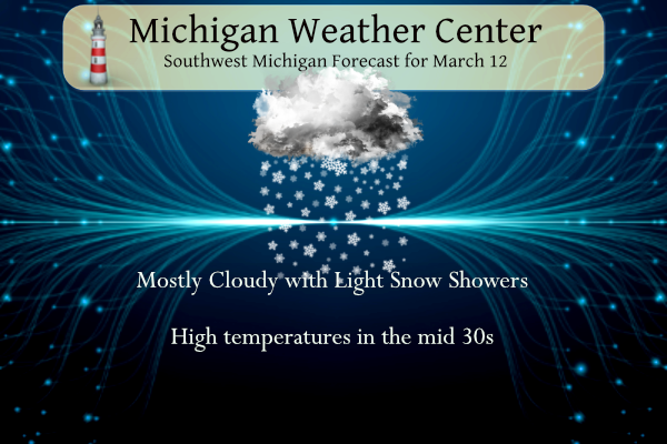
3 12 lanKalamazoo Forecast
3 12 kzoForecast Discussion
...Light snow early, then a lull, then more snow...

Water vapor imagery shows two distinct waves moving toward us. The
first was noted over western IL and was responsible for the light
snow advancing northeastward across the southwest cwa. Initially,
dry air above h8 is resulting in evaporation and that is acting to
suppress the snow a bit over the central cwa, but only for a couple
of hours. Overall, the wave is weak with virtually no surface
reflection and will move through this morning leaving cloudy skies
and perhaps some fog.

The other wave over west central MN will move over the cwa
tonight/Monday and it does have a surface reflection, so a bit
stronger than the current wave moving through. The models have been
fairly consistent in painting a broad total QPF in the tenth to
quarter inch range resulting in a 1-3 inch snowfall across the cwa,
with an enhanced 2-4 inches in a band stretching from near Hart
southeast to Lansing. It`s worth noting that the wave weakens as it
moves through, so this shouldn`t be too big of a deal, but may cause
a slower Monday morning commute.

...Brief lake effect early Tuesday...

A brief shot of colder air on the back side of the departing low
Monday night and Tuesday morning may result in a brief period of
lake effect snow. H8 temps around -14c coupled with boundary layer
RH values aoa 80 percent should result in some lake effect snow
mainly near the lake shore where NNW winds will keep the snow from
traveling much farther inland.

...Larger system late in the week...

After a dry Tuesday afternoon and Wednesday, a larger system that`s
still over the Pacific will develop a lee side low that is expected
to track northeast across Wisconsin. The ECMWF and GFS are in
surprisingly good agreement with respect to track and timing. We
will be on the warm side of the system which means rain. The strong
south flow ahead of it will push surface temperatures into the mid
to upper 40s Thursday ahead of the rain that will develop during the
late afternoon. Thunder chances look limited at best given MUCAPE
values aob 100 j/kg.

Once the cold front comes through around 12z Friday, h8 temps will
fall to -10c by Friday evening and -15c by Saturday afternoon. That
will create good over-lake instability that will result in some lake
effect snow. Strong DCVA will also help the cause, but it won`t last
long as boundary layer temps warm rapidly ahead of the next wave.
What a winter!!!!!!!!!!!!!!!!!!!!!!!!!!!!!!!!!!!!!!!!!!!!!!!!!!!!!!!!!!!!!!!!!!!!!!!!
Taking a dinner break from the slopes and what do I see? Another WWA with accumulating snow! You mean winter is not dead like Andy and mookie said over a month ago! Wow, just wow, WOW! What a winter and the snow just keeps coming and coming! Who wouldn’t love snow this time of year? Breaking news – IT IS STILL WINTER! Who knew? Incredible!
Another Winter Weather Advisory! This winter just keeps on giving!
…WINTER WEATHER ADVISORY IN EFFECT FROM 8 PM THIS EVENING TO 1 PM EDT MONDAY…
* WHAT…Snow expected. Total snow accumulations of 1 to 4 inches. Locally higher amounts possible.
* WHERE…Portions of central, south central, southwest and west central Michigan.
Couple of crappy gloomy winter days, with slop, mud and melting!! Gross!! Majority of days in the forecast in the mid 40’s! It’s getting better!!
Back to the ski slopes we go! Incredible winter!!!!!,
Couple of great winter days! Near perfect ski conditions! More cold and snow in the forecast! Nothing better!
My brother and I will be getting things going at the gun club again soon too! Warm weather and target shooting, nothing better! Got some new AR-10’s and AR-15’s that we have looked forward to shooting all winter! Along with shooting clays with the shotguns!!
Couple of crappy days next weekend but we are definitely making a turn to better! It will be very nice to enjoy the outdoors again soon!
https://weather.com/weather/tenday/l/b523690bfd952b86fef3627c919dd9855281a8da16b83c10bdd381c64ae12cbc
We lost power the other day for a few hours and reset all the clocks. I should have just waited. Lol!!
I slept in this morning due to the time change and a late night last night. Anyway there is a covering of snow on the ground this morning. For yesterday the official H/L at Grand Rapids was 39/22 there was no rain or snow fall before midnight and the day started with officially 2” of snow on the ground. Like I stated there was some light snow fall here overnight and the low here was 28 at the current time there is some light snow falling and it is 32 here. For today the average H/L is now up to… Read more »
So glad the snow just keeps coming and coming! What? More snow is in the forecast and winter is not dead yet! Who would have thought? Incredible snow totals keep going up and up! Wow, just wow, WOW!