It is time to spring forward with the time change tonight. There has been several attempts to make our time stay on one time but for some reason that has not been done yet. So tonight we change the time from “winter time” to “summer time” so don’t forget to change you clocks that do not change automatically .
As we know at Grand Rapids and much of southern Lower Michigan a rather odd winter. At Grand Rapids there have been several major snowstorms but the snow that fell has not been on the ground for very long. This past winter season the most snow on the ground at any one time was 17” at Grand Rapids. The average most-snow on the ground is 11” There so far has been 45 days with 1” or more on the ground the average for a whole season is 70. The most is 124 in 1903/04 and the least was 23 in the winter of 1982/83. According to the AWSSI winter severity index. All locations in Lower Michigan will have a mild winter this winter season. As of yesterday here are some point values and the number of days of “winter” so far. At Grand Rapids the value is now at 520 and there have been 118 days of “winter” At Lansing their value is just 385 and they have had 114 days of winter so far. At Muskegon the value is 397 and the winter has been 118 days long so far. To the east at Detroit the winter has a value of 302 and has been 118 days long so far. At Flint the value is 119 and so far there have been 118 days of “winter” at Saginaw the value is 438 and they have had 114 days of winter. Up at Alpena they have a point value of 700 and so far, 145 days of winter. At Marquette where the winter is considered “average” they have a point value of 1708 and the winter there is 145 days.
As to how you get your points, I will just give you a link to the page and if you want to you can go over it.
https://mrcc.purdue.edu/research/awssi/AWSSI-JAMCpaper.pdf
The official H/L at Grand Rapids yesterday was 37/29 There was 0.36” of precipitation and a record snow fall amount of 8.7” For the season Grand Rapids is now up to 101.5” of snow fall. There was 43% of possible sunshine.
AREA FORECAST DISCUSSION
NATIONAL WEATHER SERVICE GRAND RAPIDS MI
334 AM EST SAT MAR 11 2023
LATEST UPDATE…
DISCUSSION/MARINE
DISCUSSION
(TODAY THROUGH NEXT FRIDAY)
ISSUED AT 334 AM EST SAT MAR 11 2023
..LIGHT SNOW TONIGHT THROUGH MONDAY MORNING
A LARGE LOW OVER THE WESTERN US WILL SPLIT INTO TWO LOWS AS IT MOVES
EAST OVER THE ROCKIES. FOR A LIMITED TIME, THE NORTHERN AND SOUTHERN
LOWS WILL STILL BE SOMEWHAT PHASED AS THEY MOVE ACROSS THE CENTRAL
US LATE TODAY AND WILL SPREAD LIGHT SNOW OVER LOWER MI TONIGHT.
THEN, THE QUICKER SOUTHERN LOW WILL OUT RUN ITS NORTHERN COUNTERPART
AND WE WILL HAVE A LULL IN THE PRECIPITATION SUNDAY BEFORE THE
NORTHERN LOW ACTUALLY MOVES ACROSS LOWER MI AND SNOW DEVELOPS AGAIN.
THE NORTHERN SYSTEM, DESPITE A DECENT SHORT WAVE ACCOMPANYING IT,
WILL BE SOMEWHAT MOISTURE STARVED AND SO PRECIPITATION WILL BE
LIMITED AS IT MOVES ACROSS THE CWA SUNDAY NIGHT.
A HALF INCH TO AN INCH OF SNOW LOOKS PLAUSIBLE TONIGHT/SUNDAY AND 1-
3 INCHES SUNDAY NIGHT/MONDAY MORNING GIVEN LIMITED QPF AROUND 0.15
INCHES. THERE WILL LIKELY BE JUST ENOUGH SNOW TO MAKE THE MONDAY
MORNING COMMUTE SLIPPERY AND SOMEWHAT SLOW-GOING.
..END OF WEEK SYSTEM
THE MIDDLE OF THE WEEK LOOKS DRY AS A LARGE AREA OF HIGH PRESSURE
WILL TRAVERSE THE REGION. TOWARD THE END OF THE WEEK A HIGH
AMPLITUDE TROUGH WILL MOVE ACROSS THE CENTRAL US. AS IS TYPICALLY
THE CASE IN THESE SYSTEMS, A SURGE OF GULF MOISTURE AND WARMER AIR
WILL RACE NORTHWARD AHEAD OF IT. TEMPERATURES WILL CLIMB WELL INTO
THE 40S AND PERHAPS REACH 50. RAIN SHOWERS WILL MOVE ACROSS THE CWA
LATE THURSDAY AND THURSDAY NIGHT, GIVEN PRESENT MODEL TIMING.
LIMITED, IF ANY, INSTABILITY WAS NOTED IN THE MODELS SUGGESTING
THUNDER CHANCES ARE LOW.
ONCE THE COLD FRONT PASSES THURSDAY NIGHT, A SURGE OF ARCTIC AIR
LOOKS POISED TO RACE IN BEHIND IT. ANY LINGERING SYNOPTIC
PRECIPITATION WILL TRANSITION TO SNOW. H8 TEMPS ARE PROGD TO FALL TO
AROUND -15C BY FRIDAY NIGHT WHICH SHOULD LEAD TO SOME LAKE EFFECT
SNOW. MUCAPE OVER THE LAKE REACHES AROUND 100 J/KG WHICH MAY RESULT
IN SOME STRONGER BANDS LATE FRIDAY NIGHT AND SATURDAY.
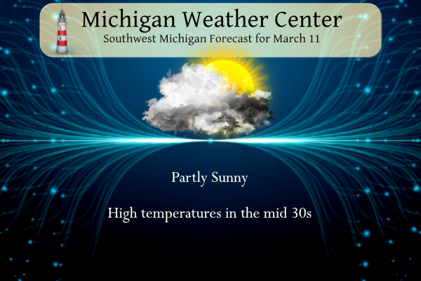
Detailed Forecast for Grand Rapids
Today
Partly sunny, with a high near 37. North wind around 6 mph becoming east southeast in the afternoon.
Tonight
A 40 percent chance of snow after 1am. Mostly cloudy, with a low around 25. East wind 10 to 13 mph.
Sunday
A chance of snow before 4pm, then a chance of rain and snow. Cloudy, with a high near 36. East southeast wind 7 to 11 mph. Chance of precipitation is 40%.
Sunday Night
Rain and snow, becoming all snow after 10pm. Low around 29. East wind 7 to 9 mph becoming west after midnight. Chance of precipitation is 80%. New snow accumulation of less than one inch possible.
Monday
A 30 percent chance of snow, mainly before 1pm. Cloudy, with a high near 34. North northwest wind 9 to 18 mph, with gusts as high as 29 mph.
Monday Night
Mostly cloudy, with a low around 21.
Tuesday
Mostly sunny, with a high near 34.
Tuesday Night
Mostly clear, with a low around 17.
Wednesday
Partly sunny, with a high near 42.
Wednesday Night
Mostly cloudy, with a low around 35.
Thursday
A chance of rain. Mostly cloudy, with a high near 47.
Thursday Night
Rain and snow likely. Cloudy, with a low around 34.
Friday
A chance of rain and snow. Mostly cloudy, with a high near 39. Breezy.
Detailed Forecast For Holland
Today
Partly sunny, with a high near 36. Northeast wind around 6 mph becoming light and variable.
Tonight
A 50 percent chance of snow, mainly after 1am. Mostly cloudy, with a low around 26. East wind 8 to 11 mph.
Sunday
A chance of snow before 4pm, then a chance of rain and snow. Cloudy, with a high near 36. East southeast wind 6 to 10 mph. Chance of precipitation is 40%.
Sunday Night
Rain and snow, becoming all snow after 10pm. Low around 29. East southeast wind 7 to 10 mph becoming west northwest after midnight. Chance of precipitation is 80%. New snow accumulation of less than one inch possible.
Monday
A 30 percent chance of snow, mainly before 1pm. Mostly cloudy, with a high near 34. Breezy, with a north northwest wind 9 to 14 mph increasing to 16 to 21 mph in the afternoon. Winds could gust as high as 31 mph.
Monday Night
Mostly cloudy, with a low around 22. Blustery.
Tuesday
Mostly sunny, with a high near 33.
Tuesday Night
Mostly clear, with a low around 17.
Wednesday
Partly sunny, with a high near 41.
Wednesday Night
Mostly cloudy, with a low around 35.
Thursday
A chance of rain. Mostly cloudy, with a high near 45.
Thursday Night
Rain likely. Cloudy, with a low around 34.
Friday
A chance of rain and snow. Mostly cloudy, with a high near 40. Breezy.
Detailed Forecast for Lansing
Today
Partly sunny, with a high near 36. Northeast wind 6 to 9 mph.
Tonight
A 20 percent chance of snow after 4am. Mostly cloudy, with a low around 24. East wind 6 to 9 mph.
Sunday
A chance of snow before 4pm, then a chance of rain and snow. Cloudy, with a high near 36. East wind 6 to 8 mph. Chance of precipitation is 30%.
Sunday Night
A chance of rain and snow before 7pm, then a chance of snow. Cloudy, with a low around 29. East wind around 6 mph becoming west after midnight. Chance of precipitation is 50%.
Monday
A 40 percent chance of snow. Cloudy, with a high near 34. North northwest wind 8 to 14 mph.
Monday Night
Mostly cloudy, with a low around 19.
Tuesday
Mostly sunny, with a high near 34.
Tuesday Night
Mostly clear, with a low around 15.
Wednesday
Mostly sunny, with a high near 41.
Wednesday Night
Mostly cloudy, with a low around 33.
Thursday
A chance of rain. Mostly cloudy, with a high near 48.
Thursday Night
Rain likely. Cloudy, with a low around 36.
Friday
A chance of rain. Mostly cloudy, with a high near 43. Breezy.
Thank God the snow keeps coming and the CPC keeps us cold for weeks!
So glad we are seeing a record breaking snowfall season this year! Keep the cold and snow rocking! What a huge winter with tons of snow! Wow to the wow!
So glad the snow all melted here in Northern Kent yesterday! Not much of a winter here and Spring is right around the corner!! Glad I don’t have to drive 4 hours north to slide around on man made slop!! SPRING IS THE BEST! SUCK IT ROCKY!!
The skiing up at Boyne is awesome! Sunny, temps in the low 30’s with plenty of Snow! Incredible winter and incredible skiing conditions! Wow the wow, WOW!
What a pretty day. Only 37 degrees but the warm (higher angle) sun has melted the 5” of snow we received yesterday – minus a couple of shaded areas.
It was beautiful outside today. The sun helped. My daughter came over and we went for a walk with my dog. I noticed the pond was mostly melted and alot of the snow has melted. 🙂
An update on Grand Rapids AWSSI point value it is now up to 539. At Muskegon it is now at Muskegon 408 and at Lansing 399. The winter season is now at 118 days at Muskegon and Grand Rapids and 116 days at Lansing. So in the last year almost a third of the year has been “winter”
Slim
Well Grand Rapids is now at its 7th snowiest winter. Pretty remarkable. As a matter of fact it will only take another 2.1” to reach 5th place. Another 0.4” on top of that would put us in 4th. If we can make it to 107” inches we will be in 3rd place. I find it interesting despite the warmer temps we have seen this winter we have managed to still get a rockin and rollin winter for snow.
I was just reading some random Facebook commenters on a post about the record snowfall for Grand Rapids. Most people are completely oblivious to it and talk about how mild of a winter it’s been. I think a lot of that sentiment comes from the rapid snow melts following a storm. This last storm was probably the biggest gradient of the winter. GR got 12” and 1 hr north got 2”. Haha.
If this winter had been colder and there was this much snow then it would have been a very severe winter. Just back in the winter of 2013/14 when GR had 116.0″ of snow fall and much colder temperatures that winter was by AWSSI index as a “extreme” winter while this winter with over 101.5″ will be a “mild” winter.
Slim
It’s the best combination- warm but with lots of snow. Now hopefully spring hurries up, im ready for outdoor activities and thunderstorms!
Agreed it would have felt like a worse winter if it stayed colder and we kept snowpack around.
Hey Jesse have you been able to get in and do any more tree cutting? Or still too muddy to get the equipment in there?
Too muddy to do much tractor work. But I did drop the trees I needed to. That way they are on the ground and don’t have any leaves. Once the ground dries up I can drag them out. This winter was a warm one, but at least enjoyable. The highlight being thunder snow. Now, even as a winter lover, I am ready for spring and seeing new growth.
Skiing here I go! I am heading North for a great winter weekend of fresh air, exercise and skiing! Who wouldn’t love cold and snow and skiing in March? I absolutely love it! Now let’s see another snowstorm next week and keep this rock n roll party cranking for many more weeks! Forget nice warm Spring weather!
The Time Change = one of the dumbest things we’re subjected to 2 times per year? Pick a damn time and never change it again! This is just so ridiculous it is incomprehensible!