

On March 13, 1989, the entire province of Quebec, Canada suffered an electrical power blackout. Hundreds of blackouts occur in some part of North America every year. The Quebec Blackout was different because this one was caused by a solar storm!
On Friday, March 10, 1989, astronomers witnessed a powerful explosion on the sun. Within minutes, tangled magnetic forces on the sun had released a billion-ton cloud of gas. It was like the energy of thousands of nuclear bombs exploding at the same time. The storm cloud rushed out from the sun, straight towards Earth, at a million miles an hour. The solar flare that accompanied the outburst immediately caused short-wave radio interference, including the jamming of radio signals from Radio Free Europe into Russia. It was thought that the signals had been jammed by the Kremlin, but it was only the sun acting up!
On the evening of Monday, March 12 the vast cloud of solar plasma (a gas of electrically charged particles) finally struck Earth’s magnetic field. The violence of this ‘geomagnetic storm’ caused spectacular ‘northern lights’ that could be seen as far south as Florida and Cuba. The magnetic disturbance was incredibly intense. It actually created electrical currents in the ground beneath much of North America. Just after 2:44 a.m. on March 13, the currents found a weakness in the electrical power grid of Quebec. In less than 2 minutes, the entire Quebec power grid lost power. During the 12-hour blackout that followed, millions of people suddenly found themselves in dark office buildings and underground pedestrian tunnels, and in stalled elevators. Most people woke up to cold homes for breakfast. The blackout also closed schools and businesses, kept the Montreal Metro shut during the morning rush hour, and closed Dorval Airport.
The Quebec Blackout was by no means a local event. Some of the U.S. electrical utilities had their own cliffhanger problems to deal with. New York Power lost 150 megawatts the moment the Quebec power grid went down. The New England Power Pool lost 1,410 megawatts at about the same time. Service to 96 electrical utilities in New England was interrupted while other reserves of electrical power were brought online. Luckily, the U.S. had the power to spare at the time…but just barely. Across the United States from coast to coast, over 200 power grid problems erupted within minutes of the start of the March 13 storm. Fortunately, none of these caused a blackout.
In space, some satellites actually tumbled out of control for several hours. NASA’s TDRS-1 communication satellite recorded over 250 anomalies as high-energy particles invaded the satellite’s sensitive electronics. Even the Space Shuttle Discovery was having its own mysterious problems. A sensor on one of the tanks supplying hydrogen to a fuel cell was showing unusually high-pressure readings on March 13. The problem went away just as mysteriously after the solar storm subsided.
Twenty years later, the March 1989 ‘Quebec Blackout’ has reached legendary stature, at least among electrical engineers and space scientists. It is a dramatic example of how solar storms can affect us even here on the ground. Fortunately, storms as powerful as this are rather rare. It takes quite a solar wallop to cause anything like the conditions leading up to a Quebec-style blackout. Typical solar activity ‘sunspot’ cycles can produce at least two or three large storms, so it really is just a matter of chance whether one will cause a blackout or not. As it is for hurricanes and tornadoes, the more we can learn about the sun’s ‘space weather,’ the better we can prepare for the next storm when it arrives.
Weather History
1953: An F4 tornado cut an 18-mile path through Haskell and Knox counties in Texas. 17 people were killed, and an eight-block area of Knox City was leveled. Click HERE for a 60th Anniversary story from Abilene Reporter-News.
1989: Residents of the southern U.S. viewed a once-in-a-lifetime display of the Northern Lights. This solar storm also caused the entire province of Quebec, Canada, to suffer an electrical power blackout.
1990: Thunderstorms produced severe weather from northwest Texas to Wisconsin, Iowa, and Nebraska during the day and into the night. Severe thunderstorms spawned 59 tornadoes, including twenty-six strong or violent tornadoes, and there were about two hundred reports of large hail or damaging winds. There were forty-eight tornadoes in Kansas, Nebraska, and Iowa, and some of the tornadoes in those three states were the strongest of record for so early in the season, and for so far northwest in the United States. The most powerful tornado of the day was one that tore through the central Kansas community of Hesston. The F5 tornado killed two persons, injured sixty others, and caused 22 million dollars in damage along its 67-mile path. The tornado had a lifespan of two hours. Another tornado tracked 124 miles across southeastern Nebraska, injuring eight persons and causing more than five million dollars in damage during its three-hour lifespan. Click HERE for more information from the NWS Office in Wichita, Kansas.
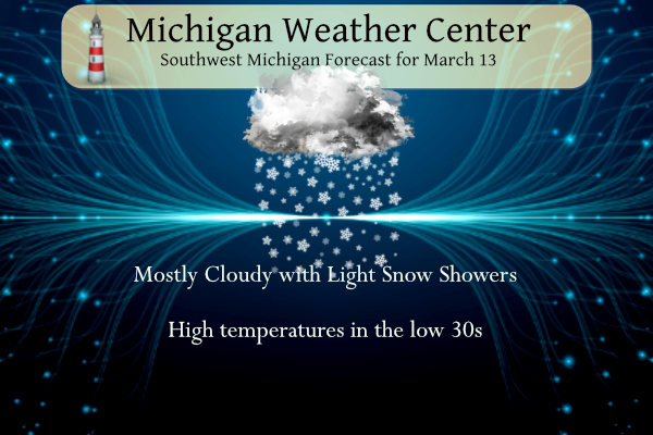
...WINTER WEATHER ADVISORY REMAINS IN EFFECT UNTIL 1 PM EDT THIS
AFTERNOON...

* WHAT...Snow. Additional snow accumulations of 1 to 3 inches.

* WHERE...Portions of central, south central, southwest and west
  central Michigan.

* WHEN...Until 1 PM EDT this afternoon.

* IMPACTS...Plan on slippery road conditions. The hazardous
  conditions could impact the morning commute.
Grand Rapids Forecast
3 13 grrLansing Forecast
3 13 lanKalamazoo Forecast
3 13 kzoForecast Discussion
...Light snow today/lake effect tonight and Tuesday along the
lakeshore...

Radar continues to show light snow moving northeast through the cwa.
Visibilities have been consistently down around 2 miles, but flake
size has been small, which has limited accumulations. Some higher
reflectivities are starting to move across Ottawa/Kent counties and
now that surface temperatures are in the mod to upper 20s, we`re
beginning to see some slow downs on roadways. This will continue
through the morning commute and result in slower than normal travel
times.

The surface low is near MKG and the bulk of the snow is north of the
track of the low as is typical. Regional radar shows a nice
deformation depiction of the snow that stretches northwest to near
GRB. I`d expect this area from our northwest cwa southeast through
Lansing/Jackson to continue to see snow develop this morning.
However, given several model depictions of omega superimposed over
the DGZ, the smaller flake size seems to be the result of the max
omega being located just below the DGZ. We normally see the larger
flake size when the max lift is located within the DGZ, not below.
Thus, this system won`t likely overperform. Total accums of 1-4
inches seems plausible, but 4 inch totals may be isolated.

The synoptic snow with the low will diminish this afternoon and so
we won`t change the end time of the Winter Weather Advisory.

Colder air will flow into the cwa behind the low and lake effect
snow will develop as h8 temps fall to -14c. However, boundary layer
flow from 340 degrees will likely mean that much of the snow will
fall along the lake shore, and if the flow goes more northerly, then
perhaps only the Points and parts of Van Buren County see the snow.
It`s possible we`ll need another Advisory along the lake shore, but
I`d rather wait on that until the current Advisory expires. The lake
effect snow will end Tuesday afternoon.

...Rain/Snow to end the week...

Satellite shows a storm over the eastern Pacific that the ECMWF/GFS
show crossing the Rockies and redeveloping over the Plains Thursday.
An upper ridge over Michigan will result in much warmer temperatures
with highs in the mid to upper 40s. We`ll also see rain develop
ahead of the low. The track of the low takes it over Wisconsin, so
we`ll be on the warm side initially. Thus we`re looking at rain
Thursday and Thursday night before colder air wraps in behind the
system Friday and the rain mixes with and changes to snow.

Friday evening into Saturday could be interesting as there is a punch
of colder air...h8 temps near -14c...that advect in from the
southwest. This could provide lake effect snow to the west central
CWA including Grand Rapids if the model trends hold.
Yesterday was yet another below normal temp day and for March and the season we are well above normal for snowfall! What a month and what a winter! Incredible!
Possible a nother Wimter storm Friday for west Michigan we haft to watch the track the snow totals are adding up … INDY
Bring it!
I find it interesting noreasterns storms are starting to happen and its the middle of March the GFS shows another big one next week along the east coast they are finally getting winter …INDY
We ended up with two, maybe three inches. The cool thing was that it did not accumulate on the concrete and asphalt. I didn’t have to shovel because it melted as it hit the driveway and sidewalk. The roads remained snow-free and just wet all day.
Get ready for a major cold front to roll through on Friday! Ice box coming!
Supposed to be Spring and we have temps in the 20’s currently great balls of fire ….INDY
I picked up a good 3” from this latest event. Definitely good call on the advisory. I have now had over a foot of snow for the month of March at my house so far. Definitely above average for this area. Rocky that deserves a wow to the wow WOW!
More winter records being broke crazzy Winter we have on going who would of thought snow storm after snow storm though mid March and temps in the 20’s wow to the wow …INDY
It’s been a mild March in GR through the first 12 days. And it looks like a nice warm up is coming.
Beautiful Spring Day outside!! Im thinking what Robins showed up paked up and went back south lol Our March snowfall is continuing more records being broke what a wild Winter…INDY
You mean you can get accumulating snowstorms in mid to late March? You mean winter is not dead yet? You mean warm Spring temps are not right around the corner? You mean we have set multiple daily snowfall records? You mean we have over 100 inches of snow and still counting? You mean this has been an Incredibly snowy winter? You mean we both predicted above normal snowfall this year! Wow to the wow, Wow!
Yes we did … we have several more chances of snow on the way for March the way this Winter is going we maybe seeing snow in April… who knew….INDY
Mother Nature really trying to up our snow totals. It is snowing the hardest it has all morning right now…an hour before the WWA expires. LOL!!!
Just returned from Boyne and what do I find! Temps in the 20’s and 3 plus inches of fresh SNOW! Another great winter day and I think I will go snowshoeing this afternoon! Wow to the wow Wow! I love it!
Wednesday looks like a nice day, 45 and sunny. Hopefully the snow melts by then so I can play tennis
Good post! In todays electronic world most people don’t realize that we are one solar storm away from losing our power grid. What would everyone do without having their phones and computer screens to stare at?
Agreed. If we lost the grid and/or internet, chaos would ensue. I don’t even want to think about what would happen.
Scary thing is if we start to depend on electric for our cars… UGH!!!
Interesting post today. I remember that outage but for some reason forgot all about it.
Slim
The overnight snow continues this AM and there is just under 3” of new snow on the ground here in MBY. With yesterdays official snow fall amount at Grand Rapids the seasonal snow fall is up to 102.4” and there will be more after the overnight snow fall is added. The official H/L yesterday at GR was 32/26 there was 0.06” of precipitation of that 0.9” was snow fall. There was just 2% of possible sunshine. For today the average H/L is 43/26 the record high is 75 set in 1990 and the record low of +3 was set in… Read more »
The snow just keeps coming! Let it Snow, let it Snow, let it Snow!
What an incredible winter! Another WWA! Great call by the NWS – some school closings, very slippery roads, multiple accidents and slow expressway travel! Wow the wow!
Great post! I vaguely remember this event. I was a year out of high school and my focus was on things more attuned to a knuckle-headed 19 year old.
About an inch of new snow this morning. Thinking that this WWA was not snow-worthy but travel may be a be tricky, so I guess it was warranted.
Have a great day, my friends. Make someone smile. 😁
Not sure about the WWA but here in my yard I have just under 3″ of new snow. The snow that was on the ground yesterday morning all melted so this is all new snow fall. It is still snowing here with a temperature of 30.
Slim
We have just a tad over 3” of new snow. A good call for a WWA for my area.