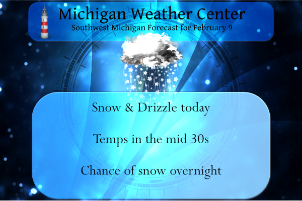
Today will feature near steady temperatures for much of Southwest Lower Michigan as a wave of low pressure moves into the state. Precipitation will be on the increase through the day with snow and rain showers expected. Locally slick travel conditions are possible, especially where the temperature does not top the freezing mark. Through the daylight hours, any snow accumulations should remain under an inch.
Yesterday we had a high of 33° with mostly sunny skies and the low was 19°.
Weather History for SW Michigan
February 6
1895: Lower Michigan is in the midst of a week-long siege of arctic air. High temperatures struggle through the single numbers while morning lows fall well below zero. Lansing falls to 14 below zero on this date after lows of 24 below on the 4th and 20 below on the 5th. Grand Rapids hits 9 below after falling to 16 below on the 5th.
1938: The weight of ice and water carried away the west side of the Rogue river dam at Childsdale.The Souffrow bridge near North Belmont was closed to traffic as its footing had been swept away by the river. Several houses along the east bank of the Grand River were flooded.
2008: Near blizzard conditions occur across part of Lower Michigan with snowfall rates of one to two inches per hour. More than a foot of snow fell north of Interstate 96 to Route 10. Further south, a wintry mix of snow, sleet and freezing rain occurred from Kalamazoo to Jackson. The storm drops more than 8 inches of snow at Grand Rapids, contributing to the snowiest February on record with 41.6 inches.
2019: An ice jam on the Grand River in Portland caused flooding along Water Street in downtown Portland, where about 50 people were evacuated from their homes. The ice jam shifted and thickened a couple days later, causing additional flooding. Many businesses along Kent Street were flooded, and people along Canal and Market streets were evacuated. The ice jam held for more than three weeks before finally melting and shifting downstream. Some homes on Water Street experienced continuous flooding for most of this three-week period.
February 7
1899: The greatest arctic outbreak in United States history begins a period of extreme cold in Michigan. Grand Rapids hits 15 below zero. During the next week, temperatures will fall to all-time record lows across the state and much of the continental U.S.
February 8
1925: A four-day warm spell with highs over 50 degrees across southwest Lower Michigan peaks with a record high of 60 degrees at Grand Rapids.
February 9
1875: The temperature tumbles to 32 degrees below zero at Lansing and 20 below at Detroit during one of the coldest months on record in Lower Michigan. The mean temperature for the entire month at Lansing is 4.7 degrees, the coldest month ever recorded there.
1934: The coldest temperature ever recorded in Michigan occurred at Vanderbilt, with a low of 51 degrees below zero.
February 10
1899: Grand Rapids has its coldest day on record with a high of 6 below zero and a low of 21 below. Muskegon had set their record for all-time coldest high temperature on the 9th with a high of 5 below zero.
February 11
1899: Muskegon records their all-time record low of 30 below zero. Grand Rapids falls to 21 below and Lansing 22 below.
1999: A surge of warm air ahead of a cold front brings all-time record high February temperatures to much of Lower Michigan. February records include 67 degrees at Muskegon and 69 degrees at both Grand Rapids and Lansing. Battle Creek hits 72 degrees.
February 12
1967: Temperatures plummet to 24 below zero at Lansing and 16 below at Grand Rapids as arctic high pressure moves across Lower Michigan.
Weather History for SE Michigan
February 6
On February 6, 2008, a hit most of Southeast Michigan. Widespread amounts ranged from 6 inches across central Livingston, Oakland and Macomb Counties to greater than 10 inches for all of the Flint (11.3 inches at Bishop Airport), Tri-Cities (12.0 inches at Tri-Cities Airport), and Thumb regions. Areas across the southern Saginaw River Valley were dumped with 16 to 18 inches of snow from southwest Saginaw to Birch Run to Vassar.
February 7
On February 7, 1895, the daytime temperature rose to only 2 degrees in Detroit, which is the record daily low daytime temperature. This was also the third day in a row (February 5-7) that daily low daytime temperature records were set.
February 8
On February 8, 1900, the daytime temperature rose to 63 degrees in Saginaw, which is 34 degrees above average!
February 9
On February 9, 2018 a full day of snow, including a period of 1″ per hour rates, led to accumulations ranging from 4 to 9 inches across Southeast Michigan. The heaviest snow fell between the Ohio border and M59. Peak measurements of 9.0″ were taken near the towns of Adrian and Milan.
Also on February 9, 2016, prolonged moderate to heavy snow resulted in significant accumulations in the Thumb. Locations south of Interstate 69 received only 1 to 6 inches, with the lowest amounts closest to Detroit and the Ohio border. However, Sebewaing, Port Hope, and Cass City all measured a foot. The big winner was Deford in Tuscola County where 14 inches fell.
Also on February 9, 2010, a strong low-pressure system passed through the Ohio River Valley and dropped the largest snowfall totals of the 2009-10 season across southeast Michigan during the afternoon and evening hours of the 9th and the early morning hours of the 10th. Most locations received between 5 and 10 inches with the highest amounts observed along the Ohio border, and between Flint and Saginaw, where up to a foot was reported. Some of the higher snowfall reports included Saginaw with 12.4 inches, Burt 10.5 inches, Samaria 10.0 inches, and Ann Arbor and Flint received 9.4 inches.
Also on February 9, 2001, a storm produced widespread two-day rainfall amounts from one to two and a half inches across all of Southeast Michigan. With substantial snowmelt thanks to one to two feet of snow on the ground, runoff production was quite large. Numerous rivers flooded over the following few days, and basement and road flooding were widespread. Unfortunately, there were three deaths as a result of the flooding in Monroe county.
Also on February 9, 1977, this day marked the last day of a streak of 45 days (December 26, 1976-February 9, 1977) of temperatures at or below 32 degrees in southeastern Michigan!
February 10
On February 10, 1899, the daytime temperature rose to only -1 degrees in Detroit, which is the record minimum daytime temperature for the day. This was also the second day in a streak of five days (February 9-13) that daily minimum daytime temperature records were set.
February 11
On February 11, 1999, the temperature rose to 70 degrees in Detroit. This is the earliest 70-degree day ever recorded in the city of Detroit!
February 12
On February 12, 2019, the Tri-Cities and Thumb regions saw 3 to 6 inches of snow while areas south of Metro Detroit saw persistent freezing rain. Tens of thousands of residents lost power during this storm.
On February 12, 2003, the city of Port Huron received 5 inches of snow due to a passing snowstorm.
Forecast Discussion
-- Low Pressure System Today and Thursday --

The first of two clipper systems over the next few days will
begin to affect us today. Model consensus is for temperatures to
climb into the mid 30s for much of the day. Moisture will be
shallow and cloud temperatures warmer than -10 C until late in the
afternoon. Where 925-850 mb lift increases mainly north and west
of GRR toward mid-day, expect a mixture of drizzle or light snow.
Not anticipating impacts for well-traveled roads during the day,
though can`t rule out side roads being slick due to cold soil
temps.

A cold front moving through late in the evening will drop
temperatures back below freezing. Moisture will increase in the
mid-level DGZ while the lower levels rapidly cool and become
weakly unstable for moist parcels. The higher-res HREF members are
depicting showery bursts of snow after dusk which could quickly
reduce visibilities and slush up the roads.

Low-topped lake effect snow showers continue through most of
Thursday, shutting off late in the evening as inversion heights
plummet via warm air advection. Generally a 1 to 2 inch event for
the west-northwest flow favored locations of west Michigan, though
can`t rule out locally higher amounts where bands persist.

-- Stronger Low Pressure System Thursday Night Into Friday --

The clipper on Friday will be a little deeper, faster-moving, and
farther south. This low pressure system will also have greater
baroclinicity and stronger wind fields at all levels. In the
warm-advective conveyor of the cyclone, a burst of moderate to
heavy snowfall rates is expected between the middle of Thursday
night into daybreak Friday. The NAM and GFS have been signaling a
thermodynamically driven enhancement of lift in the mid levels
downstream of Lake Michigan which tends to happen in these setups.
As a result, areas near and especially northwest of Grand Rapids
toward Ludington/Baldwin could see about 4 inches of snow in
short order along with some blowing and drifting before
temperatures warm above freezing during the day. Friday morning`s
commute could be rather challenging for parts of West Michigan.
Wet snow showers possibly mixing with rain may continue through
the day.

-- Cold Weekend --

A shot of Arctic air featuring 850 mb temperatures around -20 C
and high temperatures in the teens to around 20 degrees F will
arrive on Saturday and stick around into early next week. There
could be north-northwest-flow lake effect on Saturday, but by
Sunday high pressure at the surface should shut it down while
winds relax. Some ensemble members track a compact and fast-moving
shortwave trough (another clipper) through Sunday night while
other members have it miss us. If it hits, it may provide another
light coating of snow.

-- Outlook for Middle of Next Week --

Ensembles are in decent agreement that the cold air begins to
move out on Tuesday and there is a good chance of Wednesday being
above freezing. This is as a longwave trough digs into the western
US and large surface high develops along the east coast. Ensemble
members diverge from there in terms of realized weather but the
setup is there for us to possibly receive substantial
precipitation (in the ballpark of an inch of QPF) of some type
(frozen or not) Wednesday night into Thursday.
Get ready! We will be getting hammered with snow tonight!!
We are having some freezing drizzle here. I had the dog out for last call and it is slippery.
Nice 10 day snow map despite the constant warm weather propaganda! How could it be?
https://www.pivotalweather.com/model.php?p=snku_acc&fh=240
Cool! I marked down your 24” snow prediction over the next 10 days according to your trusty map! We’ll circle back and review the GRR CF6 on the 19th to see how that pans out!
Let it rain, let it melt, let it melt!!
Let it snow, let it snow, let it snow!
Breaking News>>>>5 more weeks of winter!
The snow just keeps coming, then back into the deep freeze this weekend! What a winter! Fantastic!
http://wxcaster.com/gis-gfs-snow-overlays.php?STATIONID=GRR
Big changes well in sight!! BRING IT!!!
Kirkwood also said that the 1 to 3 inch snow fall on Friday will melt pretty quickly during the day as highs reach near 40 again!! Who knew?!?!!?
Lol!!! You should have seen Kirkwood, he was nearly in tears when he showed the 8 day forecast!!
Just a little blip on the radar and then a snowstorm and colder weather the week after! I love it!
Nope!!
https://weather.com/weather/tenday/l/b4ea0280869baa46799dc75eacef8904785ec43ad2f6fb098355fbc208a55e2c
Thank you for confirming my point, back down to highs around30 degrees lows around 20 degrees! Perfect temps for snowstorms!
Thank you for ignoring the fact it goes back up in the 40’s right after that, perfect temps for melting!!
Too funny the cold weather crazies say we’re going to get 100+ inches of snow every season, but we always end up with like half that every season! Heck last year was like a third of that! Get real!!
Too funny! Every year about this time the warm weather fanatics start saying warm Spring weather is on the way and every year we have a solid 5 to 6 weeks of cold and snow! Wow?
Keep dreaming!!! Snow pack is gone at my house!! That’s ROCKIN!!
Quiet day on the board, must be Rocky’s reign of weather terror is coming to an end soon! Better get out and enjoy that couple inches of snow we’re getting on Friday, pattern change coming up soon!!! Bring on the Early Spring!!!
https://weather.com/weather/tenday/l/b4ea0280869baa46799dc75eacef8904785ec43ad2f6fb098355fbc208a55e2c
Wow I’m seeing 40’s in Lower Michigan already! Let it melt!
I love that the sun angle and daylight is now comparable to October. It’s starting to feel like spring is ready to pop!
The sun angle is the same as it is on Halloween Day. We will be up to 11 hours of light on Feb 24… we are definitely past the darkest period of the year
It reached 43 here with lots of sun. We lost 1/2 of snow today. We only have approx 5″ left on the ground.
Nice, boring day today. Breezy, but sunny and 39.
What? Snow is in the forecast, today, tonight, Thursday, Thursday night, and Friday! How is that possible! The great cold and snowy winter keeps rocking with no change in sight! Incredible!