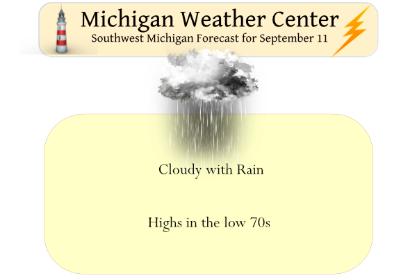
After an extended period of sunny dry days, we will see the clouds move back in and rain developing across the area which may last through Monday evening. Many areas could see around an inch of rain between today and tomorrow. Temperatures will be in the low 70s today and the mid-60s tomorrow. We have had only .11 of an inch of rain so far this month in Otsego. Yesterday our high was 84° and the low 59°.
I found an interesting article written by Matt King and Christopher Watson on the increasing length of days and what effect it could have on technology.
Atomic clocks, combined with precise astronomical measurements, have revealed that the length of a day is suddenly getting longer, and scientists don’t know why.
This has critical impacts not just on our timekeeping, but also things like GPS and other technologies that govern our modern life.
Over the past few decades, Earth’s rotation around its axis – which determines how long a day is – has been speeding up. This trend has been making our days shorter; in fact, in June 2022 we set a record for the shortest day over the past half a century or so.
But despite this record, since 2020 that steady speedup has curiously switched to a slowdown – days are getting longer again, and the reason is so far a mystery.
While the clocks in our phones indicate there are exactly 24 hours in a day, the actual time it takes for Earth to complete a single rotation varies ever so slightly. These changes occur over periods of millions of years to almost instantly – even earthquakes and storm events can play a role.
It turns out a day is very rarely exactly the magic number of 86,400 seconds.
Over millions of years, Earth’s rotation has been slowing down due to friction effects associated with the tides driven by the Moon. That process adds about 2.3 milliseconds to the length of each day every century. A few billion years ago an Earth day was only about 19 hours.
For the past 20,000 years, another process has been working in the opposite direction, speeding up Earth’s rotation. When the last ice age ended, melting polar ice sheets reduced surface pressure, and Earth’s mantle started steadily moving toward the poles.
Just as a ballet dancer spins faster as they bring their arms toward their body – the axis around which they spin – so our planet’s spin rate increases when this mass of mantle moves closer to Earth’s axis. And this process shortens each day by about 0.6 milliseconds each century.
Over decades and longer, the connection between Earth’s interior and surface comes into play too. Major earthquakes can change the length of the day, although normally by small amounts. For example, the Great Tōhoku Earthquake of 2011 in Japan, with a magnitude of 8.9, is believed to have sped up Earth’s rotation by a relatively tiny 1.8 microseconds.
Apart from these large-scale changes, over shorter periods weather and climate also have important impacts on Earth’s rotation, causing variations in both directions.
The fortnightly and monthly tidal cycles move mass around the planet, causing changes in the length of the day by up to a millisecond in either direction. We can see tidal variations in length-of-day records over periods as long as 18.6 years. The movement of our atmosphere has a particularly strong effect, and ocean currents also play a role. Seasonal snow cover and rainfall, or groundwater extraction, alter things further.
Since the 1960s, when operators of radio telescopes around the planet started to devise techniques to simultaneously observe cosmic objects like quasars, we have had very precise estimates of Earth’s rate of rotation.
A comparison between these estimates and an atomic clock has revealed a seemingly ever-shortening length of day over the past few years.
But there’s a surprising reveal once we take away the rotation speed fluctuations we know happen due to the tides and seasonal effects. Despite Earth reaching its shortest day on June 29, 2022, (in the southern hemisphere) the long-term trajectory seems to have shifted from shortening to lengthening since 2020. This change is unprecedented over the past 50 years.
The reason for this change is not clear. It could be due to changes in weather systems, with back-to-back La Niña events, although these have occurred before. It could be increased melting of the ice sheets, although those have not deviated hugely from their steady rate of melt in recent years. Could it be related to the huge volcano explosion in Tonga injecting huge amounts of water into the atmosphere? Probably not, given that occurred in January 2022.
Scientists have speculated this recent, mysterious change in the planet’s rotational speed is related to a phenomenon called the “Chandler wobble” – a small deviation in Earth’s rotation axis with a period of about 430 days. Observations from radio telescopes also show that the wobble has diminished in recent years; the two may be linked.
One final possibility, which we think is plausible, is that nothing specific has changed inside or around Earth. It could just be long-term tidal effects working in parallel with other periodic processes to produce a temporary change in Earth’s rotation rate.
Precisely understanding Earth’s rotation rate is crucial for a host of applications – navigation systems such as GPS wouldn’t work without it. Also, every few years timekeepers insert leap seconds into our official timescales to make sure they don’t drift out of sync with our planet.
If Earth were to shift to even longer days, we may need to incorporate a “negative leap second” – this would be unprecedented and may break the internet.
The need for negative leap seconds is regarded as unlikely right now. For now, we can welcome the news that – at least for a while – we all have a few extra milliseconds each day.
Matt King is the Director of the ARC Australian Centre for Excellence in Antarctic Science at the University of Tasmania. Christopher Watson is a senior lecturer at the School of Geography, Planning, and Spatial Sciences at the University of Tasmania.
Forecast Discussion
- Locally Heavy Rain Today -

A large-scale mid-level trough will become cutoff early today
resulting in its corresponding surface low to retrograde over
southern Lake Michigan this afternoon and evening. A broad swath of
showers with embedded storms will begin to spread north this morning
before the dry slot noses into southwest lower MI steadily pushing
the main swath of rain northwards overnight into Monday morning.

As noted in the previous AFD, latest WPC QPF guidance continues to
highlight the I-96 corridor with the highest rainfall amounts, with
HREF 24 hour Probability Matched Mean signaling localized swaths of
up to 3 inches suggesting much of the heavier rain will be
convective. Heavy rain may result in localized flooding,
particularly for areas further north and west where more persistent
rain is expected on the northern fringe of the dry slot.

- Dry By Mid-Week -

Dry conditions will return for most areas by Monday evening, but
a few lingering patches of light rain may last into Tuesday as the
last influences of the surface low pass to the east. Sharp upper
ridging originating from the Central Plains will migrate into the
Great Lakes region resulting in persistent dry conditions with a
good amount of sunshine to end the week. Temperatures to start off
this week will be in the low 70s today following the passage of a
cold front late last night. As an 850mb thermal ridge approaches
from the west, tempeatures will gradually climb through this
week, landing in the upper 70s by weeks end.
64 degrees and rain outside nother grest Fall day in early September…. INDY
71 here. 15 degrees cooler than yesterday thanks to the front.
Just had a heavy burst of rain move through here. I stand at 0.40” currently.
Good read MV! Definitely a lot of variables in play, can’t imagine trying to understand all of them at work.
0.35” of rain here so far. Looks like the heaviest rain has been moving over the lake heading straight North. We were at the beach in Grand Haven yesterday and it felt/looked like mid July. Temps in the 80’s, water temp at 70, and piles of people and boats out. Wind was so calm the only waves were from the boats.
With a break in the rain fall I have recorded 0.88″ of rain fall so far here in MBY. At this time it is cloudy and 65.
Slim
An overwhelming 1/10 of an inch today…
I stand close to 1” of rain so far for the month of September at my house. Official total is at 0.95”. We shall see how much we tally on today. Light rain at my house currently.
There are some isolated spots in Ionia, Barry and Eaton Counties that have had 2-3” so far this month. Those areas would stand the best chance for a little flooding if heavy rain sits over these same areas.
Cool article. Thanks for sharing.
I got my new water-winter wonderland license plate. Looks much better than the old one that I had that had become very faded.
Slim
I ordered that plate the first day it was released. I really like it.
Yesterdays official H/L at Grand Rapids was 83/62 that was more typical of a mid July day instead of a mis September day. There was no rain fall and the sun was out 79% of the possible time. The overnight low so far both at GRR and here in MBY was 61 and that is the current temperature. For today the average H/L is now down to 76/55. The record high of 94 was set in 1931 and the record low of a frosty 32 was set in 1943. Today dose not look to be very nice day with a… Read more »
Wow interesting write up MV.
Slim