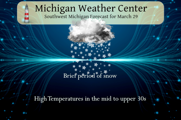
A brief (2-3 hours) period of snow or mixed rain and snow can be expected this morning as a cold front moves in. Even though it will be short-lived it could bring a quick accumulation of snow to grassy areas. Fair weather returns later today through Thursday before a strong system brings the potential for rain and thunderstorms Friday into Friday night.
SW Michigan Weather History
March 26
1934: A record snowstorm began across southeast Lower Michigan with around a foot of snow falling at Jackson, Lansing, and Battle Creek. Snow totals dropped off quickly to the northwest with Grand Rapids getting only about an inch.
1993: Dense fog caused a fatal airplane crash at Ludington. The pilot was trying to land in near zero visibility and collided with trees and terrain on his second approach to the airport. The pilot was seriously injured and his wife, the only passenger, was killed.
March 27
1991: A tornado outbreak hits the Midwest, wreaking havoc from Iowa to Ohio. In Michigan, at least seven tornadoes strike. Eighteen people were injured in Calhoun County as eight homes were destroyed there.
March 28
1904: Heavy rain and temperatures in the 50s during the last week of March combined with the melting of a deep snowpack caused some of the worst flooding on record along the Grand and Kalamazoo Rivers. About half the city of Grand Rapids is underwater as the river reaches an all-time record crest of 19.6 feet, which was 2 feet higher than the previous record and 4.6 feet above the flood stage. Water covered half of the city and flood waters reached 2,500 houses and 14,000 people. Many people suffered from hunger and exposure. Several factories and between 200 and 300 businesses were flooded. Loses totaled $1,800,000. Lansing has the worst flood in 135 years of record. Battle Creek is also inundated by floodwaters.
1920: One of the worst tornado outbreaks in U.S. history strikes from Wisconsin to Georgia, killing more than 150 people. In Michigan, at least a dozen people were killed and hundreds of homes were either damaged or destroyed. The worst hit areas in Michigan included Saint Johns in Clinton County, Maple Grove and Orangeville in Barry County, and Fenton in Genesee County.
March 29
1910: Temperatures peak in the upper 70s to lower 80s during one of the warmest months of March on record across Lower Michigan. The high of 82 degrees sets a record for the warmest ever recorded in March at Grand Rapids.
1954: A snowstorm drops from 5 to 10 inches of snow across southern Lower Michigan. Kalamazoo records 8 inches of snow and Grand Rapids a record 7.5 inches.
March 30
1977: A tornado struck four miles north of Hart in Oceana County, injuring three people as it destroyed four trailers and damaged a business
March 31
1923: March goes out like a cold lion with record lows in the single numbers and lake effect snow showers.
2006: A tornado hits a few miles east of Jackson, taking down hundreds of trees and causing minor structural damage in the town of Leoni.
April 1
1923: Winter persists into April as temperatures fall to a record-cold 8 degrees at Lansing and 9 degrees at Muskegon.
1970: An April Fool’s Day snowstorm drops 10 inches of snow on Lansing. Another 7 inches of snow falls the next day.
SE Michigan Weather History
March 26
On March 26, 1968, an F2 tornado hit Monroe County causing approximately $250,000 in property damage.
Also on March 26, 2007, the temperature soared to 81 degrees in Detroit breaking a record for the date. Flint and Saginaw both hit 76 degrees. On the next day, Detroit once again hit 81 degrees to set a record. Detroit has only reached 80 degrees or higher 12 times in the month of March, twice in March 2007.
March 27
On March 27, 1934, a record low temperature of 3 degrees was recorded at Detroit Metro Airport.
Also on March 27, 1991, one of the largest tornado outbreaks hit Michigan. Fifteen tornadoes moved across parts of the state, making it the third-largest tornado outbreak by the number of tornadoes, and certainly the earliest tornado outbreak in Michigan history. Three tornadoes hit portions of Southeast Michigan including two in Monroe County and one in St. Clair County.
March 28
On March 28, 1928, an early-season tornado outbreak hit Southern Lower Michigan, Indiana, and Ohio. 14 tornadoes were recorded in Michigan from Mason and Oceana Counties in West Central Lower Michigan to Genesee and Oakland Counties in Southeast Lower. Three of the Michigan tornadoes were estimated to be as strong as F4 including one that hit Genesee and Oakland Counties. That tornado started near Fenton and moved 10 miles northeast across far northwest Oakland County. Four deaths were recorded from this particular tornado including one person in an overturned car, probably just the second tornado-related death in a car at that point in U.S. history. Specifically for Southeast Lower Michigan, tornadoes hit Saginaw, Genesee, Oakland, and Shiawassee Counties. In total across the state, there were 13 deaths and 59 injuries.
Also on March 28, 1945, the temperature soared to 82 degrees in Detroit.
March 29
On March 29, 1967, the daytime temperature rose to only 23 degrees in Detroit, which is 29 degrees cooler than the average high temperature for this day.
March 30
On March 30, 1922, 1.76 inches of precipitation fell in Detroit. This is the maximum daily precipitation record for the month of March in Detroit.
On March 30, 2012, 0.1″ of snow fell in Flint giving the city a grand total of 0.9″ for the month and making it the 4th lowest March snowfall total on record. No snow fell in Detroit that day, where the March total of 0.2″ was the 5th lowest on record.
March 31
On March 31, 2014, an extremely narrow band of accumulating snow developed just south and southeast of Saginaw Bay. The town of Caro measured 8 inches.
Also on March 31, 2014, Flint finished the month with an average temperature of 26.0 degrees, making it the 2nd coldest March on record for the area. This is in spite of a balmy high of 61 degrees on the last day of the month. Detroit and Saginaw also finished the month with their 11th and 5th coldest Marches respectively.
Also on March 31, 2006, severe weather broke out across much of Southeast Michigan. There were over 30 severe hail and severe wind/damage reports. Some of the one-inch diameter hail in southern Genesee County piled up to several inches.
April 1
On April 1, 1923, the overnight temperature dropped to a freezing 8 degrees in Saginaw, which is the daily record low as well as the monthly record low temperature. This day also marked the fifth day in a row (March 28-April 1) of record-low temperatures in Saginaw!
Grand Rapids Forecast
3 29 grrForecast Discussion
-- Quick burst of snow with some rain through early this afternoon --

The latest sets of data regarding the frontal passage and burst of
snow coming through the area this morning remain in good agreement,
and with good run to run consistency. There has been a slight change
over the last 24 hours, with a little bit more rain on the leading
edge of the precipitation shield. This seems to be a factor of
temperatures being a slight bit warmer ahead of the front and upper
wave responsible for this.

The better chance of some rain on the leading edge of the
precipitation field will be the further SE you go. This is two fold,
with NW areas seeing the precipitation coming in earlier with less
diurnal heating, and just cooler air in general the further NW you
go.

This is also the case with potential impacts from the system. There
is a little better chance that snow will cause some slick spots to
the NW where it comes in just prior to daybreak. Most of the
accumulation will be in the grassy areas with the road temps seeing
warm conditions from the last two days of mild temps and the
stronger sun angle. As you head SE, the warmer temps ahead of the
precipitation will warm the pavement a bit more today. It is also
more difficult to accumulate snow during the daylight hours at this
time of the year without heavy snow rates.

The snow will only last generally 2-4 hours at any one location
before moving out quickly this afternoon. We should see mostly sunny
skies return by late afternoon. It will be a bit blustery though
with the gusty NW winds behind the system bringing in colder air.

-- Wet conditions beginning Thu evening going to snow/wind Sat --

We will see a dry break from this afternoon until late Thursday when
precipitation will move back in. Some areas up north could see some
light precipitation break out as early as just before midnight
Thursday night. Just about all of the area should see precipitation
occur by 12z Friday.

This all occurs at the leading edge of the low level jet out ahead
of the next stronger system moving into the region. Models have been
in good agreement showing that areas north of I-96 would have a
chance for a wintry mix of snow, and freezing rain at the onset.
Areas along and south of I-96 would be all rain. This all has to do
with the thermal profile that is in place as the precipitation moves
in. Plenty of warm air will be advected over the area, and will
change over precipitation to all rain by mid-Friday morning.

As for thunder potential, it does look like some elevated
instability could arrive over the area as early as midnight Thu
night. This instability is weak, and based above 850 mb. Maybe some
small hail out of any storms then, but no real concerns. Thunder
will remain possible throughout the day on Friday and much of Friday
night.

The biggest concern with regards to convection for our area will be
Friday evening. This is when the initial front will be moving
through. Plenty of elevated instability remains, but the models
indicate that most of the lower sfc based instability that would
increase the threat for severe weather only gets to the eastern
portions of WI and IL before diminishing. This seems to be at least
some, if not mostly associated with better diurnal heating that
would take place out there in the warm sector of the system. For
now, it looks like the best chance for severe weather will stay
mainly just W?SW of the area, but will be close. We will have to
keep an eye on trends if it gets closer to our area.

The front will move through overnight, and then the colder air will
arrive via the cold conveyor belt after 12z Sat. The majority of
precipitation will have moved east of the area by that time. We will
still see some light snow wrapping in on the backside of the low. It
doesn`t look like that will be a big deal, especially with temps
likely in the 50s just hours before, that will keep the ground warm.
The bigger deal at that point will probably be the stronger winds
that will move overhead. Wind gusts of 40+ mph are likely for much
of the area late Friday night and Saturday. The snow and wind should
diminish by Saturday evening.

-- Next potential storm system around Tue of next week --

As mentioned before, once the system for Fri/Sat moves out, we
actually get into a semi-zonal upper air pattern for a couple of
days. This will allow for mild temps to return quickly after the
cold surge on Saturday.

It was looking like we could see a couple of weak systems affect the
area later Sun and Mon with some light precipitation. Now, it looks
like the latest trends are for the precipitation to stay just north
of our area through Monday.

It does look like that we have the potential for another larger and
stronger system to affect the area around next Tuesday. Lots of
details have to be ironed out yet, but this has the potential to
bring lots of wind, warmth, rain, and even some severe weather to
the area depending on the evolution and track of the system. There
is plenty of jet dynamics potentially there to really strengthen
this system. Definitely something to watch.

One last thing too, is that with the system coming in later this
week with a soaking rain, and possibly more soaking rain next
Tuesday, we may start to see some hydro issues crop up with rivers
running high from recent rain, and more rain coming.
Still no 60’s for March now April is in the blue whats new INDY
Get ready for temps near 20 degrees tonight! Very cold late March temps!
Whenever I need a good laugh I go back and look at mookies posts about winter being dead and then getting a major snowstorm a few day later! I love it!
As of today the RDB winter analysis = above normal temps, above normal snowfall, above normal winter weather alerts, a lot of bad roads, 4 months of downhill skiing, cross country skiing about 8 times, used the snowblower about 6 times; so all of this adds up to a GREAT WINTER season with plenty of outdoor winter fun! Wow to the wow, WOW, WOW, WOW!!!!!!
As of yesterday the AWSSI point value for Grand Rapids was 586 GR is on the border of mild/moderate winter for this season. So far this winter season has been 135 days long. Lansing is at 433 points and is will within the mild winter range. The winter there is 124 days long so far. At Muskegon the point value is 443 and so far winter is 127 days long. To the east where all the locations also have a mild winter Flint has 456 points, Saginaw 490 and Detroit is at just 390 points. This has been a rather… Read more »
With the snow that came thru there is now enough snow to cover the grass. The roads are just wet. At this time it is 32 with light snow falling.
Slim
Heavy snow in GR. Let the good times roll!
We picked up about one inch so far, along with a cold wind! Is this mid winter?
April ski trip to the UP anyone?
https://www.pivotalweather.com/model.php?p=snku_acc-imp&rh=2023032906&fh=384
We are getting absolutely plastered with snow! Nice late March snowstorm! The ground is totally white and coming down in buckets! Is winter dead yet? Too funny! Multiple snowfall records broken and some are saying not much of a winter! Wild and snowy winter and it was great! Numerous WWA, WSW, Blizzard Warnings, and horrible roads!
Great above normal season for snowfall and I have been skiing for over 4 straight months! Doesn’t get better than that! Wow to the wow, WOW!
From February 8th on, GR recorded only 2 days where there was more than 2″ of snow on the ground. Essentially, the main part of winter has been dead for 7 weeks.
After an extremely mild and weak winter, March has a good chance at being our 11th straight warm month. It continues to look as if April will be warm too! After last year was so mild and sunny from May onward, we sure have been getting spoiled lately.
Mid 30’s with snow! Is winter dead yet? We have been told winter is dead for the last 7 weeks and it keeps snowing every week! How wrong could they be? Multiple snowfall records this winter and still snowing! Incredible long and snowy winter! Rock n roll will never die!
Today is definitely cold (about 13 degrees below average)… but the CPC finally has us in above average for the 6-10 and 8-14 day outlooks finally! I’m personally excited to have spring-like weather arrive… 110 inches of snow is enough for me 😀
Next week we actually start turning the corner not 7 weeks ago!
Correct, the halfway point of winter (in terms of temperature) is actually late January. So groundhogs day is around the midpoint of the cold season. Which was just over 7 weeks ago
Whenever I need a good laugh, I go back to your snow model posts that showed GR would pick up 15″+ of snow the last week LOL
In the weather history above for March 29th the record high for March is now 87 set on March 21, 2012.
Slim
With a good amount of sun (86% of possible sunshine) yesterday was a somewhat pleasant late March day. The official H/L was 48/28 and there was no rain or snow fall. With clear skies the overnight low here in MBY fell to 28 before the clouds moved in at the current time it is 36. For today the average H/L is 50/31 the record high of 82 was set in 1910 and the record low of 6 was is 1970 the most snow fall of 7.5” fell in 1954. Today the sun angle is the same as on September 14th
Slim
With clear skies last night I went out and could see of course Venus, Mars and Jupiter but could not see Mercury nor Uranus.
Slim