We have the dubious interest of the first time in modern history of having two tropical storms heading for the Gulf states at the same time. This is not good news for the folks in the southern states which surround the Gulf of Mexico as this is double trouble for them in regards to damaging winds and heavy rains.
The intensity forecast remains tricky with Marco due to its small size and marginal environment. There are some models that briefly relax the shear today, which will likely be enough of a change to allow Marco to reach hurricane strength. Later on, while the cyclone is near the coast of Louisiana, the shear is forecast to increase, but it is unknown exactly how close to landfall this will occur. Our best forecast at this time is that the strongest winds will be confined to the coast, and that Marco will then weaken faster than most hurricanes do over the swamps of Louisiana due to the shear. No significant changes were made to the intensity forecast, which is very close to the model consensus. The new forecast necessitates the issuance of hurricane warnings for portions of southeastern Louisiana.
Laura is forecast to strengthen over the Gulf of Mexico and could bring storm surge, rainfall, and wind impacts to portions of the U.S. Gulf Coast by the middle of next week. This could result in a prolonged period of hazardous weather for areas that are likely to be affected by Tropical Storm Marco earlier in the week.
[columns] [span6]
[/span6][span6]
[/span6][/columns]
[columns] [span6]
[/span6][span6]
[/span6][/columns]
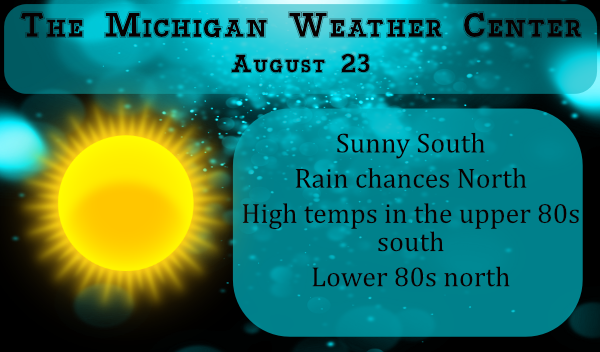
Here is the current outlook from the SPC for tomorrow. The NWS is giving us (SW Michigan) a 40% chance of rain and storms tomorrow night.
Forecast Discussion – SW Michigan
-- Rain chances increasing Monday night --

Water vapor imagery shows a well defined short wave dropping south
across northwest Wisconsin and a weaker wave moving across the
Straits. Convection has been spotty ahead of these waves with
scattered echos over central Lake Michigan that have tended to
dissipate prior to moving onshore over the northwest CWA. Extensive
cloud cover over norther Lower looks like it`s about to thin out in
the ridging ahead of the wave. Given the dry atmosphere overhead, we
are not anticipating much precipitation to develop ahead of the
short waves today. Highs will be mostly in the upper 80s and pushing
90 in the eastern CWA.

A cold front separating temperatures in the 40s over northern
Ontario from 60s in the southern portion of the province will move
south Monday and Monday night setting up a baroclinic zone overnight
Monday from southern Wisconsin into southwest Lower. LLJ is progd to
develop late Monday and interact with the h8 frontal boundary which
will likely result in showers/storms developing in Wisconsin and
riding southeast along the boundary. The 00z ECMWF/GFS/NAM/UKMET all
develop precipitation along the this boundary Monday night. Shear is
a little lacking initially, but strengthens late in the period and
so we`ll keep an eye out for the potential for a few strong storms.

Another chance of rain will come Thursday night and Friday as the
aforementioned frontal boundary becomes active again in response to
a developing low over the upper Mississippi Valley. This low will
help to pull some moisture north from the remnant tropical systems
and also get an assist from a short wave moving southeast across
Lake Superior.

-- Hot through Thursday, then cooler --

Highs in the upper 80s today through Tuesday will warm to around 90
Wednesday and Thursday before the Upper Mississippi Valley low moves
east and cooler air move south again. Highs fall to the lower 80s
Friday and mid 70s Saturday and Sunday.


Well I’ll take sunny weather over hurricanes any day. I don’t like the heat, but it’s better than being flooded out and rebuilding my house. Our yard is now almost completely brown from weeks and months of sun and heat. I gave up sprinkling back in early July because our yard is to large and it takes a ridiculous amount of water. Looks like yet another steamer of a week coming up. Feels like Fall? Nope.
This summer has been sunny and very warm and some what dry. With 9 more days to go at Grand Rapids. The mean so far is 72.1° the 30 year average is 70.6 so this summer is +1.5° For rain fall so far this summer there has been 8.93” of rain the 30 year average is 11.14” Note the 30 averages are for the whole summer season ( June thru August) there will be a summer summery in early September.
Slim