For the past couple of years, we haven’t seen many lake effect events, we are making up for it with the snow showers pouring in off Lake Michigan yesterday, today, and tomorrow. We are closing in on nine inches so far in the Otsego/Plainwell area, we had six inches by dusk yesterday. For current school closings, you can go here.
Our high was 33° and the low was 25° yesterday with periods of moderate to heavy snowfall.
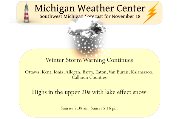
Current Warnings & Advisories
...WINTER STORM WARNING REMAINS IN EFFECT UNTIL 7 AM EST
SATURDAY...

* WHAT...Heavy snow. Snow accumulations of 3 to 6 inches through
  tonight. Additional snow accumulations of 3 to 6 inches likely
  Saturday and Saturday night.

* WHERE...Ottawa, Allegan and Van Buren counties.

* WHEN...Until 7 AM EST Saturday.

* IMPACTS...Travel could be very difficult due to snow and ice
  covered roads and visibilities reduced to near zero at times.
  The hazardous conditions will impact the morning and evening
  commutes.
...WINTER STORM WARNING REMAINS IN EFFECT UNTIL 7 AM EST
SATURDAY...

* WHAT...Heavy snow. Snow accumulations of 2 to 5 inches through
  tonight. Additional snow accumulations of 3 to 6 inches likely
  Saturday and Saturday night.

* WHERE...Kent, Ionia, Barry, Eaton, Kalamazoo and Calhoun
  counties.

* WHEN...Until 7 AM EST Saturday.

* IMPACTS...Travel could be very difficult due to snow and ice
  covered roads and visibilities reduced to near zero at times.
  The hazardous conditions will impact the morning and evening
  commutes.
...WINTER WEATHER ADVISORY REMAINS IN EFFECT UNTIL 7 AM EST
SATURDAY...

* WHAT...Snow. Snow accumulations of 1 to 3 inches through
  tonight. Additional snow likely Saturday and Saturday night.

* WHERE...Portions of central, south central and west central
  Michigan.

* WHEN...Until 7 AM EST Saturday.

* IMPACTS...Plan on slippery road conditions. The hazardous
  conditions will impact the morning or evening commute.
Forecast Discussion
- Significant lake effect snow through Saturday night -

Westerly flow les will continue today with very favorable
conditions for les including high delta t/s and inversion heights
up in the 7-9 kft range along with cyclonic upper flow. Several
weaker shortwaves will enhance the les bands from time to time
with brief boosts to inversion heights and enhanced omegas through
the dgz.

Potential for significant les accumulations is a little less than
yesterday and tomorrow mainly due to lack of stronger upper level
forcing. Nevertheless several additional inches of snow
accumulations are expected particularly in our west flow snow
belt regions near to west of US-131.

Significant and fairly widespread lake effect snow is likely
Saturday as a strong shortwave moves in from the nw with a
significant boost to inversion heights to around 10-12 kft.
Extreme lake induced instability is fcst as h8 temps down to -15 C
will yield delta t/s in the mid 20s.

Very robust low to mid level omegas are noted tomorrow in 00Z
guidance consensus time height x-sections. Upstream rh in the
850-700 mb layer looks very impressive as does mid to upper level
forcing and divergence.

Snow ratios will also be a little more favorable with an even
colder airmass in place. Several inches of additional snow
accumulations are likely. Southwest winds will veer to the
northwest and increase through the day and carry bands well
inland.

Near whiteout conditions at times are likely mainly near the Lake
MI shoreline where gusts should reach around 30-35 kts. It is
possible that the direction shift in winds and increasing wind
speeds may limit snow accums just a bit as compared to what they
would potentially be with lighter wind speeds and a unidirectional
wind profile. All things considered though - overall conditions
look very favorable for significant les/impacts tomorrow.

- Tranquil wx return late in the weekend into early next week -

The upper trof will finally move out of our area Sunday and will
be followed by moderating h8 temps. As a result we expect any
lingering light snow showers or flurries Sunday to taper off and a
moderating trend of temps early next week. Overall guidance max
temps look a bit too mild Mon/Tue given the expansive snow cover
across our area. Temps will probably moderate sufficiently enough
to eventually melt much but perhaps not all of our snow cover by
late next week as suggested by the 00Z ECMWF snow depth prog.
Im thinking Blizzard warnings coming especially for the inland Countys today for part of the day we will see definitely going to have white out conditions and Blizzard conditions this morning….INDY
GREAT SCOTTY it has been snowing since Thursday .. indy
GR has seen 14.6 inches of snow since the event started! This could be a record breaking 3 day event! Wow, just wow! What happened to the above normal temp month! We are now well above the seasonal average for snow! Incredible!
Wow to the wow …INDY
We now have over 12 inches of snow…
Location?
Possible Blizzard tomorrow?? Definitely Blizzard conditions we are going to haft to track it im thinking tomorrow will be the worst day of the weekend with lots of wind and heavy lake effect snow as the winds go sourhwest ahead of the cold front look for another 10+ inches of snow for Grand Rapids like I said Thursday 20+”inches is not out of the question be safe everyone….INDY
Incredible!
With the winds I was wondering the same thing. We shall seee.
Slim
Not sure how this will work out but if it does here are the snow fall totals as of 5PM in and near Buffalo. Looks good …Cattaraugus County… Little Valley 12.0 in 0700 AM 11/18 COOP Cattaraugus 3W 10.5 in 0700 AM 11/18 COOP Perrysburg 10.2 in 1100 AM 11/18 CO-OP Observer Ischua 0.4 SSE 7.3 in 0700 AM 11/18 COCORAHS Franklinville 0.5 NNE 6.8 in 0721 AM 11/18 COCORAHS Allegany State Park 5.5 in 0700 AM 11/18 COOP Olean 3.5 in 0730 AM 11/18 COOP …Chautauqua County… Kennedy 2.6 SE 12.1 in 0800 AM 11/18 COCORAHS Gerry 0.8 N… Read more »
Winter…
Snowfall totals south of Buffalo have now reached 4 feet in at least one location. Blasdell, New York, about 8 miles south of Buffalo, has received 48 inches of snow, including 6 inches in a single hour, between 1 p.m. and 2 p.m. Heavy snow will continue falling the remainder of the day and through the night.
My niece lives in Watertown,NY and is expecting at least 3ft of snow.
That’s crazy! We have maybe 4″ on the grassy surfaces. It hasn’t snowed here since midday. The sun has come out a couple of times this afternoon. The wind has become really cold.
…WINTER STORM WARNING NOW IN EFFECT UNTIL 7 AM EST SUNDAY…
* WHAT…Heavy snow. Additional snow accumulations of 7 to 10
inches. Winds gusting as high as 40 mph. Wind chills dropping
into single digits by Saturday night.
* WHERE…Kent, Ionia, Barry, Eaton, Kalamazoo and Calhoun
counties.
* WHEN…Moderately heavy snow this afternoon, tapering off early
tonight. Then, heavy snow quickly begins early Saturday
afternoon and continues through Saturday night.
* IMPACTS…Travel could be very difficult from Saturday morning
through Saturday night.
* ADDITIONAL DETAILS….Blowing snow will greatly reduce
visibility and some drifting is possible.
…WINTER STORM WARNING NOW IN EFFECT UNTIL 7 AM EST SUNDAY…
* WHAT…Heavy snow. Additional snow accumulations of 7 to 10
inches. Winds gusting as high as 40 mph. Wind chills dropping
into single digits by Saturday night.
* WHERE…Ottawa, Allegan and Van Buren counties.
* WHEN…Moderately heavy snow this afternoon, tapering off early
tonight. Then, heavy snow quickly begins early Saturday
afternoon and continues through Saturday night.
* IMPACTS…Travel could be very difficult from Saturday morning
through Saturday night.
* ADDITIONAL DETAILS….Blowing snow will greatly reduce
visibility and some drifting is possible.
…WINTER STORM WARNING IN EFFECT UNTIL 7 AM EST SUNDAY…
* WHAT…Heavy snow. Additional snow accumulations of 4 to 7
inches. Winds gusting as high as 40 mph. Wind chills dropping
into single digits by Saturday night.
* WHERE…Mason, Oceana and Muskegon counties.
* WHEN…Moderately heavy snow this afternoon, tapering off early
tonight. Heaviest snow quickly begins around 9 AM Saturday and
starts to diminish around midnight Saturday night.
* IMPACTS…Travel could be very difficult from Saturday morning
through Saturday night.
* ADDITIONAL DETAILS….Blowing snow will greatly reduce
visibility and some drifting is possible.
I cleared the driveway with the snowblower and I took a update on the snow on the ground and here in my yard I have 9.2″ of snow on the ground. There was just 4″ on the driveway but it was rather wet and heavy.
Slim
I plowed with the lawn tractor again this morning, we had another 5 inches of snow by 8 am – we have had 15 inches of snow this week so far. Luckily I can bank up the snow on the opposite side of the road (I live on a dead-end road). The chains on the back wheels come in handy.
Issued at 1029 AM EST Fri Nov 18 2022 We are expanding the winter storm warning both northward in area and to 12Z Sunday in time to account for our next wave of lake effect snow. The advisory for our easternmost counties will also be extended in time to 12Z Sunday. This is to address the growing threat Saturday morning that will continue through the day and Saturday night. We are in a relative lull today and early tonight and will try to express that in the forthcoming warning and advisory products. In addition to snow Saturday, we are concerned… Read more »
That is rather interesting. We will have to see just how that plays out. Been getting on and off moderate snow fall today in the “lull”
Slim
An additional 7-10” in the warned area :O
I’m already at 7” from this event.
Lots of lightning yesterday at the east end of Lake Erie. Big numbers south of Buffalo:
Hamburg, NY 8:44am
33.9 inches so far
21.5 inches fell between 2a-8a this morning
A little over 7” at my house. Currently
Just measured where I have been measuring…we are at about 8.5 inches… And snowing pretty good right now!!
The snow is picking up here again. Looks like the heaviest banding last night was to my north and south, but we still got a couple inches last night
A new record snow fall amount for November 17th was set at Grand Rapids with 7.6” of snow fall. The official H/L yesterday was 32/26 to go with that record snow fall 0.43” of total precipitation fell. There was just 1% of sunshine. For today the average H/L is 46/32 the record high of 70 was set in 1958 and 2016 the record low of 11 was set in 1959. The record snow fall for today is 9.6” set in 2014. Here at my house I now have a temperature of 27 with light snow falling there is now 6.4”… Read more »
Slim the GR NWS shows 7.6 inches yesterday breaking the old record of 7.1 inches!
Good catch Rocky. I changed to to that 7.6″ and that will bring the November total up to 11.6″
Slim
Rock on Slim!
Wow, I wasn’t expecting this. 3.5″ on Thurs. and 10.5″ overnight. So, 14″ so far with more on the way.
Wow is right! We’re supposed to go to Kazoo this evening. If you have a chance later this afternoon, would you mind posting a road condition report?
I live on a county road and so far no sign of a county plow. Snowfall has slowed down and only additional inch after my A.M. post. Very little traffic compared to normal. However, I’d bet the main roads are being taken care of pretty well. Temps are reasonably warm so salt trucks will eliminate any icing.
Thanks Jim.
Yes that sounds great. I have picked up 9 inches since it started!
Woke up to approximately 3” of snow. Looks like nearly every school west of Ingham county is closed – much to the dismay of our son.
Let’s review the facts!
1. GR saw a record snowfall for the date yesterday!
2. Virtually all schools are closed today! Who knew?
3. This could be an all time record breaking event!
4. Winter is by far the best season in MI!
5. The MI Weather Center is awesome!
6. Rock n roll will never die!