The theme for today will be the warmth and humidity. This is one of those days I do my chores in the morning and stay inside the rest of the day in my air-conditioned house. This year I have had an overabundance of chipmunks and red squirrels I have had to put out live traps to capture and release them down in the woods. We have a lot of flies but no mosquitoes so far this year (what’s up with that?) and of course those nasty tent caterpillars. I have been spraying the trees for those so we don’t have them as bad as others.
NWS Forecast
SPC Outlook

Weather History
1925: An early June heat wave began and lasted through the 6th with record highs in the mid and upper 90s.
1860: Powerful thunderstorms moved across Lake Michigan in the evening. Sailors reported seeing a very large waterspout moving across southern portions of the lake. The storms eventually reached West Michigan, causing damage in the Grand Haven area.
On June 4, 2010, a severe thunderstorm developed over southwest Oakland County. The storm produced hail up to 2 inches in diameter and downed numerous trees in Novi and Northville.
Also on June 4, 1998, the latest record low for Flint for the month of June occurred on this day. The temperature dropped to 33 degrees, which ties a record set on June 1, 1966.
1825: A severe storm of tropical origin swept up the Atlantic Coast during the first week of June 1825 with reports of significant damage from Florida to New York City. Shipping logs told of a disturbance at Santo Domingo on May 28th and Cuba on June 1st. Gales were reported at St. Augustine, Florida on the 2nd. The Norfolk and Portsmouth Herald reported “undiminished violence” from the gale force winds for 27 hours, ending on June 4th. The effect of the storm reached well inland. Washington had cold, heavy rain all day on the 4th with high winds laying the crops in the vicinity. The wind also tore up trees by the roots in front of the State House in Philadelphia. This storm impacted the New Jersey Coast and the Long Island area as well with high winds and a two-foot storm surge. A Columbian frigate was driven ashore as were many smaller boats. The largest loss of life occurred along the Long Island shore when a schooner capsized. The entire crew of seven was lost.
1877: A tornado of estimated F4 intensity touched down just west of Mt. Carmel, Illinois, and moved east-northeast, devastating the town. 20 businesses and 100 homes were damaged or destroyed. At least 16 people and as many as 30 were killed, with 100 others injured.
Forecast Discussion
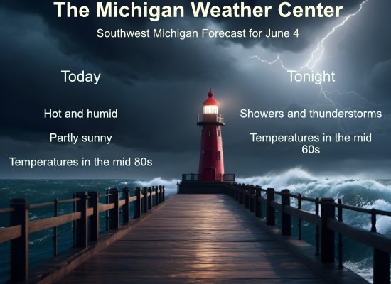
Three main atmospheric features will provide chances for isolated
storms today and tonight and a likelihood of at least scattered
thunderstorms early morning to mid afternoon Wednesday.

First, affecting west-central Lower Michigan today, is ongoing
elevated convection in WI associated with narrow 850 mb moisture
transport across IL/WI and a midlevel effective front extending
west of a remnant mesolow near Muskegon county. Convection has not
been making it into Michigan yet as 850 mb moisture transport is
much weaker and instability is low. CAMs suggest the focus of
isolated shower/thunderstorm development during the morning will
shift northeast into west-central/northwest Lower Michigan, as a
transition to diurnal surface-based mixing with southerly winds
occurs, and broad upper-level ridging amplifies over the lower
Great Lakes which will lead to warming midlevels and increasing
convective inhibition with southeastward extent. Any storms that
develop will exist in a weakly sheared environment. Today should
be a very warm and somewhat humid day for many, easily the warmest
day until at least mid June.

Next, affecting west/southwest Lower Michigan late this evening
through tonight, a compact 500 mb low over Missouri will move
toward southern Lake Michigan tonight while weakening as it
becomes incorporated into the flow ahead of the main feature, an
advancing Upper Midwest trough. Southerly flow at 850-700 mb will
increase during the night with some moisture transport, though our
area will be in the divergent part of the developing speed max.
HREF MUCAPE mean of 250-500 J/kg may support some convection,
though not all member models develop storms before the early
morning hours of Wednesday.

The highest chance of scattered thunderstorms for the whole area
will be Wednesday morning through mid afternoon, as a sharp upper-
level trough over the Upper Midwest approaches and a surface cold
front passes through. The timing of this, relatively early in the
day, does mellow the threat, but growing surface- based CAPE to
500-1000 J/kg and 25 knots of 0-3 km shear by mid day could
support a marginal severe wind threat for mid-southern to
southeastern Michigan (including Lansing-Marshall areas and east).
Briefly heavy rainfall rates may occur as deeper environmental
moisture will be present through the potential convective layer.

- Cooling down for the end of the week and possibly through the
weekend

Persistent cold air advection is advertised by the models through
Friday as low pressure stalls out over northern Lake
Huron/southeast Ontario. Ensemble temperature trends are lower in
most models for Thursday and Friday and the mean max temp values
support several degrees below normal for these two days. With
several mid level vort maxes arriving Wednesday night and into
Thursday, we could see at least scattered showers.

As we go through the weekend, the models are showing some spread
with the duration and strength of the stalled out low over the
Great Lakes Region. The ECMWF has mid level heights rising as we
go through the weekend, but the GFS actually deepens the low and
sinks it southward into Lower MI. The Canadian is sort of in
between the two. We will continue to feature below normal
temperatures as that is supported by the latest ensemble
forecasts.

With an unseasonably deep low over the northern Great Lakes
Region and a tight pressure gradient on the south side of this
feature, gusty winds can be expected at times into the weekend.
It sure has been a hot one today!
You’re not kidding. Humid too.
First day all year I turned on the AC! Incredibly late this year and we will almost need the furnace cranking for this weekend! Major cold front is lurking! Get prepared now!
Nah, 50s is good sleeping weather. 🙂
Phew 87 degrees before 2pm
What a weekend coming up! Sun and below normal temps! Who would have thought? Incredible pattern!
I have slapped at a few mosquitos…
Lightning bugs are back noticed those a few nights ago!!
I have seen a few of them too. My hands got bit up by a few.
Interestingly, I have yet to see a mosquito, as well. Plenty of the caterpillars, though. A relative in Illinois shared a photo of the cicadas on his sidewalk. Countless numbers of them. Looks like a plague.
I have not seen any caterpillars yet.
The overnight low here in MBY was 67 there was no rainfall overnight the current temperature is 68 with cloudy skies.
Slim
The official H/L yesterday at Grand Rapids was 81/53 there was no rainfall. The highest wind gust was 21 MPH out of the S. The sun was out 83% of the possible time. For today the average H/L is 76/55 the record high of 93 was set in 1925 the record low of 32 was set in 1945 that is also the record low for the month of June. The record warmest low of 72 was set in 1925. The most rainfall of 1.09” fell in 1911. Last year the H/L was 82/57.
Slim