Yesterday was a warm and humid 85°.
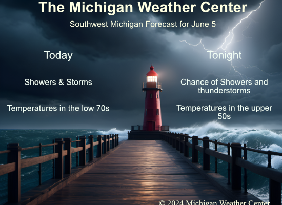
We have a warm 72° at 5 am with a 68° dewpoint. The rain is moving in from the southwest. We expect showers and scattered low-level storms throughout the day.
SPC Forecast

NWS Forecast
Weather History
1905: Torrential rains soaked much of the region. From four to six inches of rain on June 5th and 6th caused widespread flooding. Both Lansing and Grand Rapids set records for daily rainfall in the month of June with 5.47 and 4.22 inches, respectively.
1930: A tornado moved across southern Clinton County from near Eagle to seven miles north of Lansing. One farm home was torn to splinters and scattered.
On June 5, 2005, widespread severe weather hit Southeast Michigan. Thirty-four warnings were issued with 52 distinct severe weather events reported including one F0 tornado near Hemlock. Hail was up to golf ball size, and wind gusts up to 80 mph were estimated in Bay City, Hemlock, New Hudson, and Monroe.
On June 5, 1998, the high temperature only rose to 53 degrees in Detroit. Scattered showers during the afternoon forced temperatures into the 40s, and spotters reported sleet with some of them.
In 1953, tornadoes hit both Wayne and Saginaw Counties. An F0 tornado hit Wayne County at 5:05 PM and an F2 tornado hit Saginaw County at 7:00 PM and caused $25,000 in damage
Also on June 5, 1905, an estimated F5 tornado moved through Tuscola and Sanilac counties in the middle of the afternoon. The tornado moved from Colling to McGregor. The worst of the damage was near Shabbona in Sanilac County where at least three farms were destroyed. Five deaths and 40 injuries resulted from this tornado.
1976: When water began leaking from Idaho’s new Teton Dam, there seemed to be no cause for alarm. On this date, warnings were frantic that the dam was about to break. As workers tried to shore up the crumbling dam, it crumbled shortly after 11 AM, sending 180 billion gallons of water pouring through Teton Canyon. 11 people lost their lives, but the toll would have been much higher if the dam had failed at night and residents had been asleep. Click HERE for more information.
Forecast Discussion
- Several Rounds of Showers/Storms Today and Thursday

The first round of showers and storms is associated with a vorticity
maximum visible on Satellite near Chicago that will move into lower
Michigan in the next few hours. Rain will arrive by 4 am across
the southwest part of the CWA. That lifts northeast with the wave
providing morning showers, and some embedded thunderstorms given
elevated instability. Strong MLCIN and no shear means these storms
will be garden variety thunderstorms.

Attention then turns to the second round of storms associated with a
shortwave driving a cold-frontal boundary through the CWA today.
The question is how much does instability redevelop behind the
morning storms given cloud cover and marginal mid-level lapse
rates. However, consensus does suggest the area from Lansing to
Marshall and southeast (including Jackson) may develop around 1000
J/kg of CAPE by late morning and combined with 25-40 knots of
0-3km shear supports a chance of a few strong to severe storms.
Primary concern would be for water- loaded downdrafts given PWATS
climbing north of 1.5 inches, and isolated hail to around quarter
size can`t be ruled out in any severe storms. The other concern is
for locally heavy rainfall and flooding. Cloud-layer winds
suggest northeasterly storm motion along the front with high PWATS
and a deep warm cloud layer. This suggests storms will be
efficient rain producers, and there is a potential for several
storms to train over an area. If training occurs, localized areas
could see 1-2+ inches of rainfall, a scenario supported by high-
resolution guidance. These thoughts align well with the current
SPC and WPC marginal risks.

Round two ends by 22z-00z as the front exits the area. Round
three comes after midnight tonight as another shortwave/vorticity
maxima is driven across the CWA triggering scattered showers.
MUCAPE around 500 J/kg supports an isolated thunder threat with
these showers. Then the main trough and associated cold pool move
overhead Thursday with 500 mb temperatures falling to -15C to
-20C. This should be enough to trigger isolated to scattered
diurnal instability showers. The best chance for this will be
across Central Lower Michigan where the heart of the 500mb cold
pool resides. Highs fall from near 80 today to the low 70s
Thursday.
All rain SE of Ada…enjoy.
Below normal temps as far as the eye can see! Rock n roll will never die!!!
Pouring rain and thunder at my house. Quite breezy.
Lots of thunder here but no rain yet. Fingers crossed.
Looks like you got some moving in now. Still lightly raining at my house. Nice soaking.
We ended up getting some rain but not much. It rained steadily for about ten minutes.
Looks like the bulk of this morning’s rain is going to miss us here. Seems to be a regular occurrence as of late, unfortunately.
Have a great day, friends.