Our frost advisory ends at 8:00 am We have 46° in Otsego so I am not seeing any danger from frost this morning for this area. Some passing high clouds over Lower Michigan will give way to sunny skies later today. Cool temperatures again tonight will yield some areas of frost. Otherwise, a stretch of dry weather is likely into the foreseeable future — at least well into next week. Temperatures will begin their rise into the 80s to near 90° next week. The GEFS model is trying to bring in some rain next Wednesday and Thursday, it is still too far out and may be a fleeting dream – we shall see.
U.S.A and Global Events for May 25th:
1896: An estimated F5 tornado hit Oakwood, Ortonville, and Thomas, Michigan. Forty-seven people were killed, and 100 were injured. Trees were debarked “even to the twigs, as though done by the careful hand of an experienced artisan.” Parts of houses were found up to 12 miles away.
1955: An estimated F5 tornado moved north and NNW through the heart of Blackwell, Oklahoma. About 400 homes were destroyed, and many were leveled and swept away. About 500 other homes were damaged. The tornado dissipated just over the Kansas border, as the Udall, Kansas tornado was forming to the east. The Blackwell tornado was accompanied by unusual electrical activity, with up to 25 discharges per second recorded on sferics equipment. The funnel was said to glow and have “arcs” of glowing light. The Udall, Kansas tornado was estimated to be an F5 as well. Over half of the population of Udall was killed or injured as the tornado completely devastated a large portion of the town. Seventy-five people were killed, and many of the 270 injuries were serious.
1975: On Raccoon Lake, Indiana, lightning struck the motor of a speedboat and traveled up the control wires, killing the driver. The 38-year-old man was knocked into the water by the bolt. His wife and two children, also in the boat, were not injured.
2008: A rare, large, and destructive EF5 tornado created a 43-mile-long path across Butler and Black Hawk counties in Iowa. This tornado killed eight people, injured dozens, and caused several millions of dollars in damage. The tornado was nearly three-quarters of a mile wide as it moved through the southern end of Parkersburg. A third of the town was affected by devastating damage with nearly 200 homes destroyed. This storm produced the first EF5 tornado in Iowa since 6/13/1976 and was only the third EF5 tornado to occur in the United States in the past ten years.
Grand Rapids Forecast
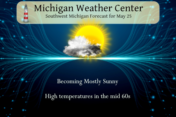
5 25 grrForecast Discussion
Very quiet weather pattern continues into next week as omega block
transitions to a rex block then quasi zonal flow regime with
little moisture transport available.

For today and tonight the surface high builds in and another
headline for frost or freezing temperatures may be needed for
roughly the northern half of the forecast area.

Dry soundings for the next few days plus dry ground will mean
large diurnal temperature ranges, on the order of 40 degrees F.
Moderation of airmass with warmer temperatures for the weekend
into next week. Still no measurable rain seen through the end of
the month.
It looks like May in GR may finish with another below temp month! A truely incredible cool pattern and more of the same tomorrow!
Just another below normal temp day! We sure have seen a lot those lately! The overall cool pattern may finally break next week! Wow, just wow!
I’m off to the UP this afternoon to go hiking. Looks like beautiful weather the next few days and a calm Lake Superior. Always love exploring the coves and cliffs up there! Just hope the bugs aren’t out yet.
Enjoy. The UP is a fun place, but I only go there in the summer and fall.
Great snowmobiling in the winter!
Have a great time!!
Looking at some nice hot 90’s next week!! The question is now, will that be enough for Rocky to finally shut his furnace off for the season?? We shall see and WOW!!
No frost here. I believe that this is the 3rd consecutive frost advisory where we did not have frost. Our row of counties always seem to be at the southern end of the advisory area, so that’s not a surprise.
Had fun on the course yesterday. It was breezy and chilly in the morning, but the sun came out about 1pm and the afternoon was nice. Last year, we got soaked. A lot of money was raised, and that’s the important part.
Eeeee Eeee Blowtorch alert!
WOOD has 90 degrees in their forecast – and plenty of upper 80’s too!
We are above average temps for May with a big blowtorch coming! Should be our 13th straight warm month.
What happened to all this talk about frost and possible 30 degree temps? Low last night in GR was 41.
The forecast low for Grand Rapids was 41, so that was expected
Yesterday was yet another well below normal temp day! More of the same today! Incredible!
Great to see we escaped frost last night. One more night with that threat and it looks much more likely tonight. After that looks smooth sailing.
We have been locked into an overall cooler pattern for months! It does finally look like we will break out of this long term cool pattern with a dose of above normal temps! Let’s hope for low humidity and temps well under 90 degrees!
Looks like those lingering clouds helped most of us avoid a frost. Tonight looks like it could be colder, with clear skies and lighter winds
The official H/L yesterday was 67/45 there was no rain fall. There was a reported 47% of possible sunshine with some clouds and a still white smoky sky. There were 0 Cooling Degree Days and 9 Heating Degree Days.
Slim
For today the average H/L is 73/52 the record high of 91 was set in 1977 and the record low of 31 was set in 1991. The record rain fall amount of 1.22” fell in 1970.
Slim
The overnight low here in MBY so far is 43 it was a cooler 41 at GRR. There are several locations across Michigan in the 20’s this AM. So of the coldest reading are 26 at Marquette, 27 at Grayling, 28 at Iron Mountain and 30 at Pellston. So while our area did not get frost or freeze that was not the case in areas to the north.
Slim
It looks to stay dry for the rest of the month. And as is the case with a dry airmass and a dry ground there can be some big swings in the daily temperature. We look to start off on the cool side today with days warming up from the upper 60’s today and reaching the upper 80’s to maybe 90 by next week. Lows should be in the order of the upper 30’s up to maybe the low 60’s by mid next week.
Slim
Great sleeping weather, then nice hot afternoons to enjoy!