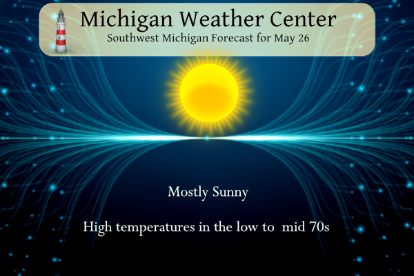
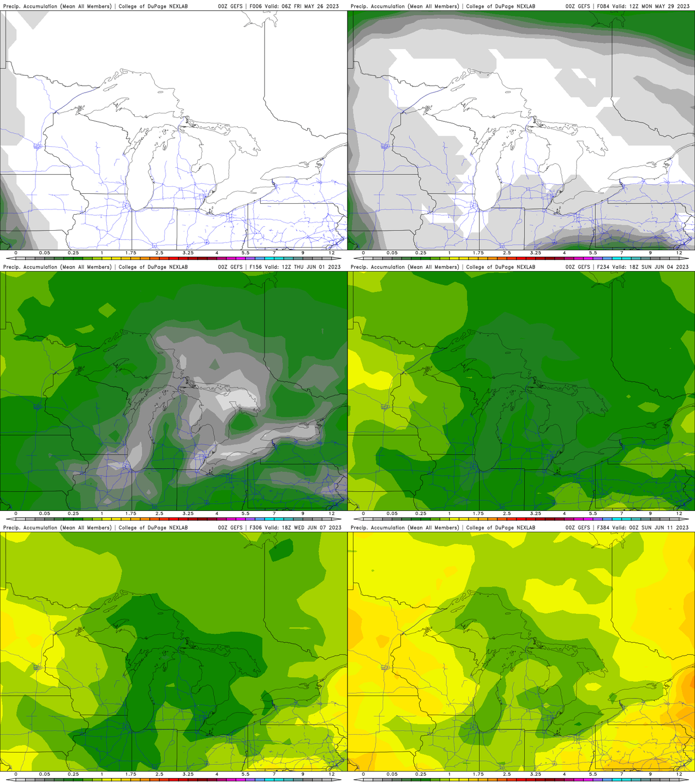
Our overnight temperatures dropped to 35° which is a bit cool for late May. We have had only .14 of an inch of rain in the last 17 days and 1.15 inches for the month here in Otsego. Our stretch of dry weather will continue over Memorial Day weekend and likely well into next week. A pronounced warming trend will also begin this weekend. By Tuesday, daytime highs will likely reach into the mid-80s to near 90° across many inland locations—normal highs are in the mid-70s. Our sunny dry weekend will be thanks to a meander high pressure cent over the state exacerbating our continued dry spell.
U.S.A and Global Events for May 26th:
1771: Thomas Jefferson recorded the greatest flood ever known in Virginia. The great Virginia flood occurred as torrential rains in the mountains brought all rivers in the state to record high levels. Click HERE to read Jefferson’s entry in his Garden Book.
1917: A major tornadic thunderstorm took a 293-mile track across parts of central Illinois and Indiana. Once believed to be a single tornado, the later study indicated it was likely at least eight separate tornadoes. The first touchdown was about 50 miles south-southeast of Quincy, Illinois. The tornadic storm tracked due east, before beginning a northeast curve near Charleston; separate tornadic storms then curved southeast from Charleston. The towns of Mattoon and Charleston bore the brunt of the tornado. Damage from this severe tornado in Mattoon was about 2.5 blocks wide and 2.5 miles long, with over 700 houses destroyed, while the Charleston portion was 600 yards wide and 1.5 miles long, with 220 homes damaged. Dozens of farms were hit along the path, and at least three farm homes were swept away between Manhattan and Monee. Another estimated F4 tornado touched down 6 miles south of Crown Point and devastated a dozen farms. A total of 7 people died, and 120 were injured. 53 people were killed in Mattoon, and 38 were killed in Charleston. Overall, 101 people in Illinois were killed during the tornado outbreak, with 638 injured.
2003: A BMI Airbus bound for Cyprus from Manchester, England encountered a violent thunderstorm over Germany. The plane bounced and twisted violently as it ran into severe turbulence with huge hailstones pounding the exterior. A football-sized hole was punched in the aircraft’s surface. None of the 213 passengers or eight crew members was seriously hurt.
2009: Northeast of Anchorage, Alaska, two hikers climbed a ridge to see a developing storm better. Lightning knocked the couple unconscious. Regaining consciousness, they called emergency services as the woman was unable to walk. The man’s shoes looked as though they had melted.
Forecast Discussion
- Dry pattern to continue into Saturday

The strong high pressure system over northern Lower Michigan
remains in place through Saturday. This feature will continue to
provide subsidence through a deep layer, limiting the RH values.
The 00z KDTX soundings captured the dry atmosphere nicely and it
also shows an inversion just under 850 mb. Satellite imagery does
show some high clouds drifting down from the northeast. Model
forecasts suggest we will see a potential for mainly scattered
upper level clouds into Saturday.

- Temperatures will start warming up

The flow remains easterly for much of the period. This usually
leads to the warmest daytime readings near and west of US 131.
Models show the 00z 850 mb temperatures rising a couple of
degrees each day, from 6 deg C on Thursday to 8 deg C today and
around 10 deg C Saturday. The afternoon mixing heights are
forecast to rise slightly each day and that will also support a
slight warming trend as well. During each afternoon, an onshore
flow will set up along the lakeshore and that will act to lower
the afternoon temperatures within a mile or two of the lakeshore.
The Holland Pier weather sensor showed this drop in the afternoon
temperatures on Thursday as the lake breeze advanced inland. The
temperatures fell about 13 degrees in just under 20 minutes as the
wind shifted.


.LONG TERM...(Saturday night through Thursday)
Issued at 226 AM EDT Fri May 26 2023

-- Turning much warmer; precip chances late next week --

The recent amplification of the upper ridge across the interior of
North America has resulted in anticyclonic Rossby wave-breaking on
the dynamic tropopause. In tandem with this process, a PV streamer
over the eastern CONUS will continue to elongate/thin today, then
deposit a positive PV anomaly over the southeast CONUS. The outcome
of these events will be the formation of a Rex block this weekend,
consisting of an upper-level cutoff low over the southeast CONUS and
an upper high over the northern Great Lakes.

EPS and GEFS ensemble means suggest that this block will likely
persist into Mon, then gradually erode as the upper low moves
eastward and the longwave ridge over eastern Canada begins to
retrogress and re-amplify. By Thu, longwave ridging will likely
encompass much of the CONUS and the interior of Canada. Within this
regime, ensemble guidance indicates little prospect for rainfall in
the forecast area through Wed. Meanwhile, confidence is increasing
for a period of much-above-normal temps, with broad support in the
EPS and NBM for highs in the mid 80s / low 90s F across most inland
areas from Tue into Fri.

The likely establishment of a broad high at 850 mb over the
southeast CONUS during the Thu-Fri timeframe should foster an
increase in low-level moisture across the region late in the week,
with surface dewpoints perhaps climbing into the 60s F on Fri. This
moistening should begin to support daytime boundary-layer
destabilization, with low-end chances of showers/t-storms on Thu.
Deterministic ECMWF and GFS guidance suggests that a frontal boundary
may approach the region around Fri, providing the best overall
chance of showers / t-storms in the area.


Breaking News>>>>it was yet ANOTHER below normal temp day with near record lows! WOW!!
Yikes. Two 90 degree days on the forecast for next week. It’s too early for that kind of heat. I guess the bright side is that the lake water will warm sooner than usual.
The beat goes on! No rain and cool temps! Wow!!
Incredible low temps for late May! Lows in in mid 30’s! Incredible!!
Slim,
I know you are the weather man… but I hope you can help me out. I was looking for what number of soldiers served in both World Wars. We were volunteering out in the cemetery yesterday and came across a man who had a marker that he served in both of them. We were curious to find a number of how many did. This man was born in 1894!
I was looking but not finding much.
I’d like to know too. The only stat I found is of the 12 million that served in the Second World War, just under one million of those served in the Korean Conflict. There was only five years between WW2 and Korea. There were 21 years between WW1 and WW2, so I wouldn’t think there are as many. Patton and MacArthur are the only two I know.
It would be an interesting Stat I am sure. I was amazed at the year he was born, that he served in both and came home. I may have to do some more digging. Glad I took a pic of it. LOL!!
It is quite a learning experience. Our girl found a military marker for a woman who served in WW2… now I know some did, but not a lot and to be able to have a military marker. Let’s just say our girl was very impressed and we took a pic of that one too!!!
I am not sure if I can find any information on this or not.
Slim
That’s ok. I just thought I would ask. He was a Commander US Navy.
This current and extended cool pattern is AWESOME! Rock n roll will never die!
Looks like a lot of next week will feature winds mostly light and variable (my favorite). It’s possible the wind speed could be 10mph or less from now till next weekend here in West MI making for great boating conditions as well. Nothing better than warm afternoons with very little wind.
No frost here. I think the story for this month is the lack of precip and sun. For the month, Lansing has had 15 sunny days, 8 partly cloudy days, and just 2 cloudy days. GR has had 3 clear days, 18 partly cloudy days, and 4 cloudy days.
Yes it has been a very dry and sunny month with wildfire smoke. Almost feels like we are in a desert climate (in May!)
The noticeable difference when I moved from Ottawa County about 15 miles from the lake to over here is more sunshine. Is amazing the difference in weather sometimes just traveling from GR to here.
I had a low of 36 here in MBY but there was no frost. In fact there was no dew.
Slim
Got down to 35 here. It is supposed to be a high of 75- that’s 40 degrees of warming today. Pretty impressive
I went to let my chickens out at 7, and to my dismay, discovered frost on my grass! I got my propane torch and ran to the garden tomato plants (which we covered on Wed, but not last night). As I feared, there was frost on them. I’m not sure how long, but I gently warmed each one until the white turned to little water beads. My efforts are probably be in vain, but my wife asked me yesterday morning, “are we going to have frost tonight? ” I told her “no”, but in my absent mindedness, failed to check… Read more »
I woke up to a frost layer. Looks like it is the last of the year (hopefully).
It should be the last frost until fall.
Slim
The official H/L yesterday at Grand Rapids was 67/41. There was no rain fall and for the month there has been just 0.84” Yesterday had 92% of possible sunshine and for the 1st time in many days the sky was not white from smoke. There were no CDD’s and 11 HDD’s
Slim
Here in MBY the overnight low so far has been 36 with the dry air there is no frost or dew. The official low at Grand Rapids so far is 38 that 38 is the 5th coldest low for any May 26th at Grand Rapids. For today the average H/L is 73/52 the record high of 90 was set in 2010 and 2020 the record low of 34 was set in 1897 and 1974.The record rain fall amount of 1.32” fell in 2022.
Slim
Today we look to start a nice warm up and it should become very summer like for most of next week. Highs could reach near 90 by Tuesday. The Holladay weekend looks to be sunny and warm. There is really no chance of rain for the rest of the month so this month will end up with just 0.84” at Grand Rapids and 0.96” at Lansing Muskegon will have 0.86” and Holland will end up with 1.03” This May should be the 2nd driest at Grand Rapids, The 5th driest at Lansing and Muskegon.
Slim