Today is Veterans Day so please take a moment to say thanks to all of our vets.
They have been called many things – “November Gales”, “White Hurricanes”, and “Freshwater Furies.” Whatever you call them, they are powerful Great Lakes storms, sometimes with hurricane-force winds, that feed off the relatively warm Great Lakes water. Since the mid-1800s there have been around 24 of these storms, many of them in November, Here`s a brief list of some of the worst:
The 1905 Mataafa storm. A storm system moving through the Great Basin on November 26 and 27 was forecast to bring “fresh easterly winds” to the Great Lakes during the afternoon and evening on November 27. Storm warning flags were flying by the morning of November 28th. The wreck of the Mataafa. At five o’clock in the afternoon on November 27, 1905 the Mataafa left Duluth. The ship only reached Two Harbors MI by 4 PM the next day. The captain gave the order to turn about, and she turned back toward Duluth. The ship did not make it back to Duluth. In all 29 vessels were damaged or sunk, killed three dozen seamen, and caused more than $3 million in damage along Lake Superior. Winds were estimated at 60 to 70 mph. Here in Grand Rapids a strong warm front must have came thru as the high on the 27th reached 67 there was 0.89” of rain. By the 30th the high was just 24.
The 1913 storm from November 7th to the 13th has been given several names “The big Blow” “White hurricane” and “Freshwater fury” The storm was the deadliest and most destructive natural disaster to hit the lakes in recorded history. More than 250 people were killed. Shipping was hard hit; 19 ships were destroyed, and 19 others were stranded. About $1 million of cargo weighing about 68,300 tons—including coal, iron ore, and grain—was lost. Like the 1905 storm GR was on the warm side with a high of 64 on the 7th then falling to a high of just 29 on the 10th
The Armistice Day storm of 1940. This was a Blizzard like winter storm that occurred on November 11–12, 1940 which brought heavy snow and winds up to 80 mph. 3 ships sank off the coast at Pentwater. The William Dacock with 33 lost. The Anna Minch with 22 lost and the Novadoo with 2 lost. Two smaller boats also sank, bringing the total death toll on the Lakes to 66. Once again GR was on the warm side at the start with a high of 64 on the 11th but only reaching 25 on the 13th
The 1975 Edmund Fitzgerald storm. Once again it was a November storm that took the lives of men and their ship. The Fitzgerald left Superior, Wisconsin, at 2:15 p.m. on the afternoon of November 9, 1975. The weather forecast was not unusual for November and the (NWS) predicted that a storm would pass just south of Lake Superior by 7 a.m. on November 10. Around 5 PM another ship the Arthur Anderson joined Fitzerald. The two captains of the two ships decided to take the regular Lake Carriers’ Association route. But with the 7PM NWS update the captains changed course to get closer to the protection of the north shore. At 2:00 a.m. on November 10, the NWS upgraded its warnings from gale to storm warnings. Shortly after 3:30 PM the captain of the Fitzerald radioed that they were taking on water and lost two vent covers. waves increased to as high as 25 feet by 6:00 PM At approximately 7:10 p.m. the captain of the Fitzerald radioed “We are holding our own.” No distress signal was received, and the Anderson lost radar contact. All 29 men on board were lost. The start of November 1975 was very warm here in GR with 9 days in row of highs in the 60’s and even reaching 77 on the 6th It did not get cold after that storm.
The 1998 storm almost to the same hours and following practically the same track as the November 1975 storm, a more intense storm system tracked northeast from the central U.S. through the Great Lakes region during the period of November 9-11, 1998. On the morning of November 9, a low pressure system was organizing in eastern Colorado. Its pressure at that time was 29.41 inches (996mb). The system tracked east and then curved northeast, reaching northwest Iowa on the morning of November 10. It had rapidly intensified with its pressure dropping to 28.70 inches (971mb). The storm system further strengthened to an unusually low 28.55 inches (967mb) as it tracked just east of Duluth, MN early in the evening of the 10th. By the morning of November 11th, the low was located in north central Ontario. Its pressure at that time was 28.58 inches (968mb). The temperature shot up to 60 on November 10th before storms rolled through. It was very windy here and there were widespread power outages.
November 18 1958 Carl D. Bradley storm. The Carl D. Bradley was based out of Rogers City. The ship was crewed by men from Rogers City. Many of crew were friends, neighbors, or familial relatives. As the boats often departed and returned every few days, many of the crew made their homes and raised their families in Rogers City. Captain Roland Bryan was known as a “heavy weather captain” who took pride in delivering his cargo on time. Bryan’s usual course up Lake Michigan was quicker and ran closer to the Michigan shore. On November 18, he avoided the brunt of the building seas by instead traveling 5 to 12 miles off the Wisconsin shore. At 5:35 p.m. the ship was 12 miles SW of Gull Island At this moment a loud thud was heard followed by a vibration. The ship broke in two. A life boat was able to be lowered but only 2 crew were able to survive. This was a much colder storm here in Grand Rapids with highs in the 20’s and several inches of snowfall.
It has been quite a while since we have had a supper storm in November. But it has been rather windy on several occasions this month. With the first third of the month in the mean at Grand Rapids so far is 44.7 that is a departure of +1.0 the highest for the month so far is 62 and the lowest so far is 24. There has been 0.71” of rain fall and just a trace of snow fall. At Lansing the mean there so far in 44.0 that is a departure of +0.8 there has been 1.00” of rain fall and there has also been just a trace of snow fall there high and low for the month is also 62 and 24.
The official H/L yesterday at Grand Rapids was 50/34 there was no rain or snow fall. The sun was out 26% of the time. For today the average H/L is 49/34 the record high of 73 was set in 1909 and the record low of 18 was set in 1987. The record rain fall of 1.19” fell in 1911 the record snow fall of 5.8” fell in 1995 the most snow on the ground was 3” in 1933. Last year the H/L was 59/34.
.
AREA FORECAST DISCUSSION
NATIONAL WEATHER SERVICE GRAND RAPIDS MI
312 AM EST SAT NOV 11 2023
LATEST UPDATE…
SHORT TERM/LONG TERM/MARINE
SHORT TERM
(TODAY THROUGH SUNDAY)
ISSUED AT 312 AM EST SAT NOV 11 2023
— BENIGN NOVEMBER WEATHER FOR VETERANS DAY —
LIGHT LAKE-EFFECT RAIN SHOWERS THIS MORNING WILL TEND TO DIMINISH
AS LOW-LEVEL RIDGING AND SURFACE HIGH PRESSURE MOVE THROUGH THE
REGION. IT APPEARS THAT AT LEAST PART OF THIS VETERANS DAY WILL
FEATURE SUNSHINE, ESPECIALLY AWAY FROM LAKE MICHIGAN, THOUGH JUST
ENOUGH MOISTURE REMAINING IN THE LOWER LEVELS WILL KEEP OUR AREA
ON THE CUSP OF DEVELOPING PATCHES OF STRATOCUMULUS BY AFTERNOON.
TEMPERATURES WILL BE A TOUCH COOLER THAN NORMAL.
— SLIGHT CHANCE PRECIP NORTHWEST TONIGHT THEN BREEZY SUNDAY —
SOUTHWESTERLY LOW-LEVEL FLOW STRENGTHENS TONIGHT IN THE GRADIENT
BETWEEN THE EASTERN GREAT LAKES HIGH AND TROUGHING UNDER AN UPPER-
LEVEL PV ANOMALY OVER THE NORTHERN MINNESOTA BORDER. MID- LEVEL
CLOUDS WILL INCREASE AND MAY PRECIPITATE LIGHTLY FROM ISENTROPIC
LIFT OVERNIGHT NORTH OF WHITEHALL AND BIG RAPIDS. HAVE SLIGHT
CHANCE POPS THERE, AND IT MAY BE COLD ENOUGH IN THE HIGHER
ELEVATIONS OF OSCEOLA COUNTY FOR SNOW FLURRIES.
SUNDAY WILL BE WARMER BUT BREEZIER THAN SATURDAY, AND MOSTLY
SUNNY SKIES ARE FAVORED IN SOUTHERN MICHIGAN. WINDS FROM THE SOUTH
WILL GUST TO ABOUT 15 MPH AROUND JACKSON AND 30 MPH AROUND
LUDINGTON.
LONG TERM
(SUNDAY NIGHT THROUGH FRIDAY)
ISSUED AT 312 AM EST SAT NOV 11 2023
— ABOVE NORMAL TEMPS AND DRY MOST OF NEXT WEEK —
POSITIVE HEIGHT ANOMALIES PREVAIL NEXT WEEK, WITH UNEVENTFUL
SPLIT FLOW PATTERN ALOFT AND RIDGING GENERALLY DOMINATING. THIS
SUPPORTS A STRETCH OF UNSEASONABLY WARM TEMPS WITH HIGHS OF 55-60
AND DRY WEATHER. PWATS ARE SHOWN TO BE QUITE LOW, OFTEN BELOW
0.25″, SUPPRESSING RAIN CHANCES AND OFFERING SEVERAL OPPORTUNITIES
FOR SUNSHINE. THE DRY AIR MASS WILL LIKELY ALSO PROMOTE CHILLY
OVERNIGHT LOW TEMPS WITH DIURNAL TEMP SWINGS OF 20-30 DEGREES
POSSIBLE.
— RAIN SHOWERS POSSIBLE TO END THE WEEK —
RAIN CHANCES RETURN THURSDAY NIGHT INTO FRIDAY AS THE NRN BRANCH
OF THE UPPER JET BUCKLES SOUTHWARD AND SENDS A TROUGH AND SFC COLD
FRONT THROUGH THE GRTLKS REGION. WILL KEEP POPS IN THE CHANCE
CATEGORY FOR NOW GIVEN UNCERTAINTY IN THE MAGNITUDE OF THE UPPER
TROUGH/SFC FRONT AS WELL AS QUESTIONABLE MOISTURE AVAILABILITY.
Detailed Forecast for Grand Rapids
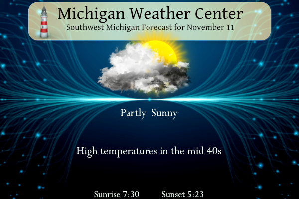
Veterans Day
Partly sunny, with a high near 47. Calm wind becoming east southeast around 6 mph in the morning.
Tonight
Mostly cloudy, with a low around 34. South southeast wind 3 to 6 mph.
Sunday
Mostly cloudy, then gradually becoming sunny, with a high near 51. South wind 9 to 14 mph, with gusts as high as 22 mph.
Sunday Night
Mostly clear, with a low around 42. South wind 13 to 16 mph becoming west southwest after midnight. Winds could gust as high as 25 mph.
Monday
Sunny, with a high near 54. West northwest wind 8 to 16 mph, with gusts as high as 25 mph.
Monday Night
Mostly clear, with a low around 32.
Tuesday
Sunny, with a high near 54.
Tuesday Night
Partly cloudy, with a low around 39.
Wednesday
Mostly sunny, with a high near 56.
Wednesday Night
Partly cloudy, with a low around 42.
Thursday
Mostly cloudy, with a high near 57.
Thursday Night
A chance of showers. Mostly cloudy, with a low around 47.
Friday
Thank You to our Veterans and their families.
I had a teacher who used a slide projector and had a great tribute to the Edmund Fitzgerald…he would play it every year…now I wish we had it so it could be shared! He had it set to the song.
Rock on SS!