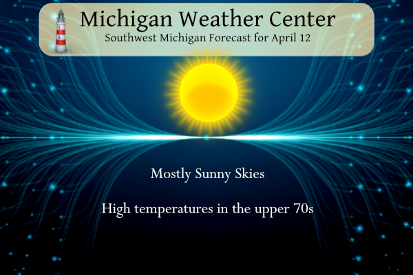
Yesterday was downright pleasant with a high here at the station of 74°. Today will be even warmer with highs in the upper 70s with low dewpoints and breezy. A Fire Weather Watch will be in place today:
...FIRE WEATHER WATCH IN EFFECT FROM WEDNESDAY AFTERNOON THROUGH
WEDNESDAY EVENING...

The National Weather Service in Grand Rapids has issued a Fire
Weather Watch, which is in effect from Wednesday afternoon
through Wednesday evening.

* Winds...Southwest 15 to 25 mph with gusts up to 40 mph.

* Relative Humidity...As low as 22 percent.

* Temperatures...In the upper 70s inland from Lake Michigan.

* Impacts...Burn restrictions may be in effect.
Weather History for SW Michigan
April 9
1969: A brief tornado damaged a house near Loomis in Isabella County.
1973: A snowstorm dumps 3 to 8 inches of snow across much of Lower Michigan. Record snowfall for the date includes 6.5 inches at Muskegon, 5.2 inches at Lansing, and 4.4 inches at Grand Rapids.
2008: A tornado hit from near Plainwell in Allegan County to Doster in Barry County at 1:40 a.m. It did significant damage to a horse barn, lifted a trailer adjacent to the barn, damaged gravel yard equipment, lofted a tank, and uprooted numerous large trees.
April 10
1977: A three-day spell of 80-degree temperatures begins across Lower Michigan. Record highs included 81 degrees at Lansing, where temperatures would hit records of 82 degrees on the 11th and 83 on the 12th.
April 11
1965: The second worst tornado outbreak in United States history struck from Iowa to Ohio, killing 256 people. In Michigan, the worst damage is near the Indiana state line as two violent tornadoes moved on parallel tracks about a half hour apart, killing 44 people and injuring hundreds. A tornado struck northwest of Grand Rapids, killing five people in Comstock Park. One person was killed by a tornado that moved from near Dewitt in Clinton County to Bennington in Shiawassee County.
2001: Severe thunderstorms produced large hail, flash flooding, and two weak tornadoes. The tornadoes briefly moved through rural areas near Coopersville in Ottawa County and Cloverville in Muskegon County.
April 12
1972: A tornado put down an intermittent damage path about four miles long southeast of Ludington in Mason County. A barn was destroyed, but there were no injuries.
1974: A tornado brief tornado damaged a building in Vicksburg in Kalamazoo County.
2014: Severe downbursts with winds over 80 mph struck from near Muskegon to Big Rapids. Damage to trees was widespread along with some structural damage. Heavy rains and melting snow resulted in severe flooding along the Muskegon and Pere Marquette Rivers following the storms.
April 13
1941: Temperatures reach the 80s across Lower Michigan. Record highs set on this date include 87 degrees at Detroit, 82 at Lansing, and 80 at Grand Rapids.
1950: High temperatures struggle to reach the mid and upper 20s across Lower Michigan after morning lows in the teens. At Lansing, the high temperature is only 24 degrees after a morning low of 17.
2018: Wind and air pressure change from lines of thunderstorms across northern Lake Michigan generated meteotsunamis that affected the coast at Ludington and Manistee. Several docks near the mouth of the Manistee River and the Ludington pier were submerged during the height of the water rises.
April 14
1953: It is a cold morning across Lower Michigan. Record low temperatures include the 20 degrees at Muskegon and the 21 degrees at Grand Rapids.
April 15
1943: Temperatures plunge into the teens as snowflakes swirl in the arctic winds. Record lows included 16 degrees at Muskegon and 18 degrees at Grand Rapids.
2002: A four-day stretch of record warm weather peaks across Lower Michigan with Grand Rapids hitting 86 degrees and Lansing 84.
2018: A late-season winter storm brought up to 4 inches of snow, 2 inches of sleet, and almost half an inch of icing along with strong winds across Lower Michigan from the 14th to the 17th. Almost half a million people lost power.
SE Michigan Weather History
April 9
On April 9, 2016, a late-season snowstorm that begin the night before produced significant snowfall over southern portions of the area. Adrian measured 7.2 inches and 6 to 7 inches fell in Temperance, the Irish Hills, and Manchester.
Also on April 9, 2001, Ann Arbor, Manchester, Saline, and Belleville had reports of golf ball size hail during the morning hours. Other areas in Metro Detroit reported 2-3 inch diameter hail.
April 10
On April 10, 1977, the temperature rose from a pre-dawn low of 35 degrees to an afternoon high of 86, or a 51-degree rise, the greatest daily temperature rise ever recorded in Detroit.
April 11
On April 11, 1965, the Palm Sunday Tornado Outbreak occurred. This outbreak mostly affected Michigan, Indiana, and Ohio and produced 47 tornadoes that killed 271 people and injured 3,400 people in just a 12-hour span. Two F4 tornadoes that were a part of this Outbreak affected southeastern Michigan quite severely. These two tornadoes were responsible for 44 deaths, 612 injuries, and over $32 million in damage in Hillsdale, Branch, Lenawee, and Monroe counties.
April 12
On April 12, 2014, showers and thunderstorms were prevalent along a warm front in Southeast Michigan. One storm, in particular, grew strong enough to produce damaging winds to 70 mph from Flint to Detroit. The damage included uprooted trees, downed power lines, and some building damage. The storm was also a prolific hail producer, covering the ground with hail up to a couple of inches deep.
Also on April 12, 1976, the overnight temperature dropped to 18 degrees in Detroit, which is the record-low temperature for the day. The very next year, in 1977, the daytime temperature rose to 89 degrees, which is the record-high temperature for the day.
April 13
On April 13, 1977, the temperature soared to 87 degrees in Detroit, which is the record high for the day. This marked the fourth day in a row (April 10-13) that record daily high were set, including the record high of 89 degrees on April 12, 1977, which is the record high for the entire month of April in Detroit.
April 14
On April 14, 2018, a mid-season Spring storm spanning April 13th-15th reached its peak. After widespread rain, the night of April 13th ended as freezing rain and accumulating sleet the morning of the 14th, precipitation wound down, and strong marine winds continued for the remainder of the day. Wind gusts over 50 mph were common in Saginaw Bay and the shoreline of Bay County where storm surges inundated coastal communities. Severe coastal flooding was also observed in Monroe County along the Lake Erie shoreline. Freezing rain and sleet redeveloped early on the morning of the 15th before ending as rain that afternoon. All told, Southeast Michigan had observed 2-3″ of heavy rain, 2-3″ of sleet, and 1/4″ to 1/2″ of ice from freezing rain. DTE and Consumers Energy reported power outages for nearly 500,000 customers due to the event.
In addition, the 0.6″ snow measurement, which was mostly sleet, made on the 15th tied Flint for its snowiest winter on record at 83.9″. This tied the record set just 4 winters prior in 2013-2014.
Also on April 14, 1967, Saginaw County reported an F1 tornado around 7:20 pm. Property damages were recorded at $250,000.
April 15
On April 15, 2014, light snowfall, the last of the season, blanketed Southeast Michigan. Detroit and Flint received 3.2″ and 1.3″, setting a new record for the snowiest winter at each location. Detroit recorded 94.9″ for the 2013-2014 winter season while Flint finished with 83.9″. Saginaw would eventually finish the season at 60.3″, its 15th snowiest winter.
Also on April 15, 1904, a two-day snowstorm ended in Saginaw. The storm left the city with 12.5 inches of snow.
Also on April 15, 1976, the county of Midland was hit by an F1 tornado at 3:30 PM causing $25,000 in property damage.
Grand Rapids Forecast
4 12 grrForecast Discussion
...Warm, dry and breezy today...

A large upper ridge over the Great Lakes will produce sunny skies,
low humidity and very warm temperatures. Many locations will see 80
degrees today thanks to h8 temperatures climbing to 14c. Bufkit wind
profiles indicates we`re likely to mix down gusty winds today in the
30-35 MPH range. Southwest winds blowing off of Lake Michigan will
result in significantly cooler conditions adjacent to the lake shore.

Temperatures in the mid to upper 70s will continue through Saturday,
although the pressure gradient and corresponding wind speeds will
decrease a bit through that time.

...Showers and thunderstorms possible Saturday...

ECMWF and GFS are in pretty good agreement in showing a low pushing
a cold front across the CWA Saturday night. The trend has been to
slow down the timing of FROPA, which means a delay in the arrival of
the precipitation.

Model instability has backed off a bit Saturday compared to
yesterday`s runs. SBCAPE is progd around 6 and the combination of
the three will result in hazardous fire weather conditions00 j/kg,
less than the 1100 j/kg in yesterday`s runs. LI`s are not as
impressive either. So, instead of moving across the cwa during peak
heating, it now appears the front won`t move through until Saturday
evening. This should result in decreased thunderstorm activity.

...Colder Sunday/Monday...

It`s not summer yet and there is a decent punch of colder air behind
the cold front. Instead of the 14C air at 850 mb we`ll see today, h8
temperatures around -8C are progd for Sunday and Monday. Mixed rain
and snow is expected Sunday night and Monday. Temperatures in the
mid to upper 50s Sunday will only reach the mid 40s Monday.

Temperatures will warm well into the mid 50s by the middle of the
week as the deep upper trough moves east and is replaced by short
wave ridging.
Red Flag Warnings are not rare for Michigan. I’ve seen them issued before and will be issued again.
Spring fire hazards are common in the spring before the green up. Also warm days in April are not that rare either.
Slim
I see temps in the 50’s in MI! Wow!
Temp of 80 and dew point in the 40s? This is my kind of day. Feels like the weather out west.
Grand Rapids forcast for Monday April 17th snow showers and cold high of 38 degrees crazy… That will be BIGGER news then todays firstly 70 degrees of the year for GR ….INDay
I see 80’s in Michigan as of 245pm. Wow!
I missed the Red Flag Warning for today. Those are rare! Weird to see!
Red Flag Warnings are usually only issued during the spring and fall fire weather seasons,
February 15 – April 30 and October 1 – December 15. When warnings are issued, officials
know to curtail planned burns and to be on the lookout for wildfires
https://www.weather.gov/media/lmk/pdf/what_is_a_red_flag_warning.pdf
Slim
Get ready – wind chills in the 20’s on Monday! Very cold for mid April! Get your winter coats, hats and gloves out of the closet and be ready for
bitter cold!
After a long, snowy winter we have a big COLD front coming through on Sunday! Wow just wow!
Just asking… do you think you could plant some green bean seeds. We love them so much and would love to get them out in the garden!!!
No, it is too soon! We still frost and freezing temps coming!
I would wait until mid May. If the oak trees have leaved out than it should be OK to plant.
Slim
Thanks Slim and Rocky… Just can’t wait for fresh veggies.
CPC has the 3-4 week, the one month, and the three month all trending warmer than average!
It will be interesting how these may change with any updates.
45 day outlook through the end of May near normal temps like last Summer no major heat waves in sight I will take it ….INDy
Last summer was long, mild, and sunny. We are starting warmer so far.
Rock on Indy and keep the facts rolling! This brief warm up will be over Sunday and then it is right back to our persistent cool pattern! Incredible!
I know this weather is absolutely beautiful, but *wow* I really am not adapted to anything over 65 yet. It is probably a personal thing, but the gym has been way too hot the past couple days for me. Give me a week and I’ll love the 70s though 😀
Fire Weather Watch in early April? It’s going to be a long summer!
Here is a quote from Global Forest Watch
” In Michigan the peak fire season typically begins in late March and lasts around 15 weeks. There were 11 VIIRS fire alerts reported between 11th of April 2022 and 3rd of April 2023 considering high confidence alerts only. This is low compared to previous years going back to 2012.”
Slim
Thanks for the facts! Mookie has a habit of embellishing any all things related to warm weather! Keep the facts rolling!
So many golfers out yesterday and today is even warmer! Our continual warm weather pattern keeps marching on.
It’s always a treat when you wake up and the temp is already warmer than the average high. Another windows open kinda day.
My lawn is green and has started to grow. The first cut of the season will be very soon.
Enjoy another beautiful day and make someone smile 😃
Yes windows have been open for days. It is nice to not bundle up to take the dogs out!! Have a great day!!!
The next 4 days look to be much warmer than average with highs in the upper 70’s and there may even be a 80 or so. It will be windy so the western areas near Lake Michigan may be cooler than areas to the east.
Slim
Good morning! Yesterday was another nice mild mid April day with a H/L of 72/51 there was no rain fall and with a lot of high clouds there was 59% of sunshine. So far the overnight low here in MBY is several degrees cooler than the official reading at GRR. My low and current reading is 55 while at GRR is 60. For today the average H/L is 56/36 the record high of 82 was set in 1997 and the record low of 19 was set in 1939 and 1950.
Slim
Enjoy the summer temps and the.pm get ready for the COLD and SNOW!