We are now about to jump into June and the start of meteorological summer. Before we do just a short note on the anniversary of the 1998 derecho that blew thru here on May 31st Note this is the 25 anniversary not the 23rd
https://www.woodtv.com/weather/bills-blog/the-famous-derecho-of-may-31-1998/
JUNE
June is of course the start of meteorological summer it has the most hours of daylight and the average H/L at Grand Rapids starts out at 75.3/54.1 on the 1st and rises to 82.3/61.5 on the 30th The average 30 year mean is 68.1 and the new 15 year average mean is 69.1. The warmest 5 Junes are 74.2 in 1919. 74.0 in 1933. 73.4 in 1921. 73.2 in 1934 and 72.8 in 2005. The coldest 5 are 61.8 in 1969. 61.9 in 1928. 62.0 in 1958. 62.3 in 1926 and 62.5 in 1945. The record highest day is 102 on June 20th 1953 the all time low is 32 on June 4th 1945. The average number of days with highs of 80 or better is 14. The most days of 80 or better is 25 in 1919 the June with the least was 1916 with just 2 days of 80 or better. The average number of days with highs of 85 or better is 8 the most is 18 and that happened on 4 years. There have been 5 years when there we no days of 85 or better. The average number of days of 90 or better is just 3 the most is 14 in 1894 and there have been a total of 37 years when the high did not reach 90 or better in June. The record low for June is 32 on June 4th 1945 it was just 33 on June 11th 1972. The warmest low (for the whole month) was 52 in 1934 in 1938 it did not get any colder than 51 and in 2008 and 2005 it did not get below 50. The wettest June was in 1892 when a reported 13.22” of rain fell. Last year June had a mean of 69.2 the high for the month was a hot 95 on the 21st there were 3 days of 90 or better. The coolest high was 65 on the 8th. The low for the month was 45om the 4th and the warmest low was a very warm 77 on the 15th There was 1.42” of rain fall last year in June.
Meteorological Summer
Meteorological summer starts on June 1st. At Grand Rapids the average mean for meteorological summer is 68.9 using the 30 average and 69.1 using the 15-year average. The warmest summer in recorded history at Grand Rapids is 74.7° in 1955. The 2nd warmest is 73.6 in 2012. The coldest is 1992 with a mean of 65.5. Last year the mean was 71.1. The wettest was in 1994 with 22.63” and the driest was way back in 1894 with 3.03” Last year Grand Rapids recorded 9.22”” of rain fall. On average Grand Rapids has a little over 60% of possible sunshine. On average the hottest day of the year is 92. There have only been two summers when the temperature did not reach 90 or better. The current 30 year average number of days of 90 or better is 9. The most was 36 in 1988 and the least was 0 in 1951 and 2014. Last year there were 7 days of 90 or better at Grand Rapids 6 at Holland and Muskegon and a whopping 17 at hot Lansing. The Summer solstice this year will be on June at 10:57 AM on June 21st After that date the number of hours of daylight will start their decline towards fall and then winter.
Yesterday the official H/L at Grand Rapids was 75/37 there was no rain fall and 98% of possible sunshine. For May the official rain fall remains at 0.84” at Grand Rapids, 0.96” at Lansing and 0.86 at Muskegon. There were no Cooling Degree Days yesterday and 9 Heating Degree Days. For the month there have been just 4 Cooling Degree Days that is a departure of -27 and there have been 207 Heating Degree Days that is a departure of +2. So based on Degree Days May so far has been cooler than average. For today the average H/L is now up to 74/52 The record for today is 93 set in 2018 and the record low of 30 was set in 1960 the record rain fall amount of 1.12” fell in 1960.
AREA FORECAST DISCUSSION
NATIONAL WEATHER SERVICE GRAND RAPIDS MI
339 AM EDT SAT MAY 27 2023
SHORT TERM
(TODAY THROUGH SUNDAY)
ISSUED AT 248 AM EDT SAT MAY 27 2023
– QUIET PATTERN CONTINUES THROUGH SUNDAY
HIGH PRESSURE REMAINS STATIONARY OVER NORTHERN PARTS OF LOWER MI.
BEING ON THE SOUTH SIDE OF THIS FEATURE, WE WILL SEE EASTERLY FLOW
TODAY AND TOMORROW. THIS WILL FOCUS THE WARMEST TEMPERATURES JUST
EAST OF THE LAKE BREEZE. SLIGHT DOWNSLOPING MAY ALSO ENHANCE THE
TEMPERATURES. THUS THE REGION NEAR AND WEST OF US 131 WILL ONCE
AGAIN FEATURE THE HIGHEST TEMPERATURES IN THE FORECAST AREA. THE
TEMPERATURE AT 925 MB IS FORECAST TO CLIMB A DEGREE OR SO EACH
DAY. THIS ALONE SUPPORT SURFACE TEMPERATURES MODERATING A DEGREE
OR TWO EACH DAY. HOWEVER GIVEN THAT WE ARE CURRENTLY RUNNING 3 TO
8 DEGREES WARMER THAN 24 HOURS AGO, WE WILL LIKELY SEE TODAY’S
HIGH TEMPERATURES IN THE UPPER 70’S TO NEAR 80 DEGREES. UPPER 70’S
TO LOWER 80’S LOOK LIKELY FOR SUNDAY, EVEN WITH SOME HIGH CLOUDS
SPREADING IN FROM THE SOUTH. THE WARMING TREND IS ALSO SUPPORTED
BY NEARLY ALL THE MODEL ENSEMBLE FORECASTS. THE GFS FOR SOME
REASON HAS LOWER TEMPERATURES FOR TODAY AS COMPARED TO YESTERDAY.
LONG TERM
(SUNDAY NIGHT THROUGH FRIDAY)
ISSUED AT 248 AM EDT SAT MAY 27 2023
MUCH OF THE COMING WEEK FAVORS UPPER-LEVEL RIDGING OVER THE GREAT
LAKES AND BROAD SURFACE HIGH PRESSURE GENERALLY CENTERED EAST OF
MICHIGAN. THE REX BLOCK CONFIGURATION OVER THE HOLIDAY WEEKEND,
FEATURING A HIGH OVER THE GREAT LAKES AND LOW OVER THE CAROLINAS,
SHOULD LOSE ITS CHARACTERISTICS AROUND MIDWEEK AS THE LOW WEAKENS.
HOWEVER, REMNANT RIDGING WILL PERSIST OVER GREAT LAKES WITH ONLY
WEAK UPPER-LEVEL FLOW PRESENT IN THE WIDE SPAN BETWEEN THE
SUBTROPICAL JET AND POLAR JET. LATE IN THE WEEK, THE POLAR JET
AMPLIFYING OVER CANADA WITH RIDING CENTRAL AND TROUGHING EAST MAY
BRING ANOTHER NORTHERLY OR BACKDOOR COLD FRONT INTO MICHIGAN.
THE DRY PATTERN IS LIKELY TO CONTINUE WITH ONLY SLIGHT CHANCES FOR
DIURNAL SHOWERS FROM ABOUT WED/THU ONWARD. PERSISTENT EAST FLOW IN
THE LOWER LEVELS WILL KEEP SUPPLYING AIR WITH FAIRLY LOW DEW POINTS
UNTIL MIDWEEK, THEN A BIT MORE MOISTURE (BUT STILL NOT MUCH — DEW
POINTS IN THE 50S MOST LIKELY) MAY BE TRANSPORTED TOWARD MICHIGAN AS
MODEST 850 MB FLOW TURNS MORE SOUTHERLY. ONLY A MINORITY OF MEMBERS
IN THE ECMWF ENSEMBLE PROVIDE ANY PRECIPITATION BY THE END OF THE
WEEK.
A SEVERAL DAY PERIOD OF MUCH ABOVE NORMAL HIGH TEMPERATURES IS ALSO
FAVORED, CENTERED AROUND THE MIDDLE OF NEXT WEEK, WITH HIGHS IN THE
RUNNING FOR 90 DEGREES. FROM THE DTX SOUNDING CLIMATOLOGY FOR THE
END OF MAY AND BEGINNING OF JUNE, 850 MB TEMPERATURES JUST OVER 15.5
C WOULD BE IN THE 90TH PERCENTILE, AND THESE TEMPERATURES SHOW UP IN
THE MAJORITY OF MEMBERS OF THE ECE AND CMC. WITH FAIRLY WEAK EAST OR
SOUTHEAST SURFACE WINDS, THE LAKE BREEZE FRONT EACH DAY SHOULD WAVER
INLAND TO SOME DISTANCE BETWEEN US-31 AND US-131, KEEPING THE
LAKESHORE AREAS COOLER.
Detailed Forecast for Grand Rapids
Today
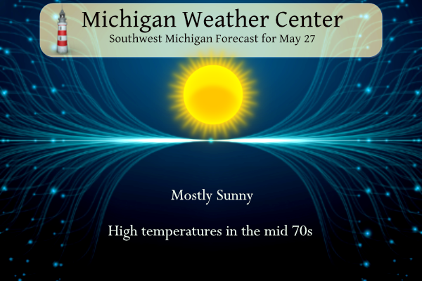
Sunny, with a high near 79. East wind 3 to 8 mph.
Tonight
Partly cloudy, with a low around 51. East wind around 6 mph.
Sunday
Mostly sunny, with a high near 82. Light east northeast wind increasing to 5 to 9 mph in the morning.
Sunday Night
Partly cloudy, with a low around 54. East wind 6 to 8 mph.
Memorial Day
Sunny, with a high near 86. East wind 6 to 9 mph.
Monday Night
Mostly clear, with a low around 59.
Detailed Forecast For Lansing
Today
Sunny, with a high near 78. Calm wind becoming east 5 to 8 mph in the afternoon.
Tonight
Partly cloudy, with a low around 51. Southeast wind 3 to 5 mph.
Sunday
Mostly sunny, with a high near 80. Light northeast wind becoming east northeast 5 to 9 mph in the morning.
Sunday Night
Partly cloudy, with a low around 53. East northeast wind 6 to 8 mph.
Memorial Day
Sunny, with a high near 85. East northeast wind 6 to 9 mph.
Monday Night
Mostly clear, with a low around 57.
Another 80 degree day. Worked up a sweat putting the dock and the boats in. Going to take a twilight cruise and hopefully catch a bunch of fish. Hope everyone is enjoying this amazing weather.
Another below normal temp day! Incredible!
Surprise, surprise – today will end up as another of many below normal temp days! Funny we have consistently had below normal temps this month, yet some keep telling we are above normal! Wow!
Yea today is technically below average due to the cold start. But looks like we turn above average for the next 10 days (possibly back to below average 10+ days out)
Yes, the below temp streak may come to an end tomorrow! It has been an amazing cool pattern!
Great weather. Reminds me of southwest US spring. Dry, but pleasant. I am really hoping for a wet June to make up for this record dry may. The fields are powder and my pastures are essentially going dormant already.
If we could have it rain at night and stay sunny during the day, that would be great!
I’m all for that
“ END OF MAY AND BEGINNING OF JUNE, 850 MB TEMPERATURES JUST OVER 15.5C WOULD BE IN THE 90TH PERCENTILE”
That is incredible.
Sitting on the deck enjoying coffee with my beautiful wife. Heading to the lake later. I hope everyone has a great weekend. Don’t forget the sunscreen!