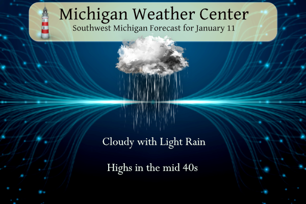
Most areas will remain dry today, but a few sprinkles or light rain showers are possible. Daytime highs will be mild for January with temperatures rising into the mid-40s. The next system will bring rain to parts of the area on Thursday, with snow possible on Thursday night into Friday morning.
For January 18 to 24, 2023 the latest outlook favors warmer-than-normal temperatures in Michigan and is leaning toward above-normal precipitation. This would translate to daytime temperatures often being above 32 degrees, and based on those temperatures, any precipitation that falls could be a mix of rain or snow. We may see above normal temps through the rest of the month before we go to normal by the end of the month into the first week of February.
Weather History for SW Michigan
January 8
1880: Temperatures remain above freezing for the fifth consecutive day during the warmest January on record at Lansing.
1965: Temperatures soar to record highs of 59 degrees at Grand Rapids and Lansing and 55 degrees at Muskegon. A cold front moves through and temperatures will only reach the 20s the next day.
January 9
1930: A snowstorm drops from 4 to 8 inches of snow across southwest Lower Michigan.
1977: Record cold prevails during one of the most severe winters in Michigan’s history. Records include 17 below zero at Lansing, 14 below at Grand Rapids, and 8 below at Muskegon.
2015: Temperatures in the single numbers and lake effect snow showers create icy roads resulting in a 193-car pileup on Interstate 94 and both east and westbound lanes are shut down between Battle Creek and Galesburg.
January 10
1982: Extreme arctic outbreak brings record cold temperatures and massive lake effect snow totals. Muskegon has its snowiest calendar day on record with 22 inches. This contributes to the all-time record monthly snowfall of 102.4 inches (8 and a half feet!) at Muskegon for January 1982.
January 11
1890: Temperatures reach a record high of 63 degrees at Lansing during one of the warmest Januarys on record.
1979: Arctic air and a deep snow cover combine to drop the temperature to a record low of 21 below zero at Grand Rapids.
January 12
1912: Muskegon sets their all-time record low for the month of January at 21 degrees below zero during their coldest month on record.
1918: Record cold is experienced at Lansing with 18 degrees below zero and Grand Rapids at 14 below during one of the coldest winters on record.
2005: On January 12, 2005, dense fog blanketed lower Michigan. Numerous highway accidents near Lansing killed two people and damaged almost 200 vehicles. At least 37 people were injured. One pileup involved 50 vehicles and necessitated the closure of 12 miles of Interstate 96 between Okemos and Webberville.
January 13
1952: Dense fog with visibility near zero leads to a number of auto accidents across southwest Lower Michigan. The fog persists for three days from the 12th to the 14th.
1979: A massive storm dumps heavy snow across southern Lower Michigan. Temperatures in the teens and strong winds lead to heavy drifting of the powdery snow, causing travel to come to a halt. The snow, at times falling at more than an inch an hour, caused power outages due to broken tree limbs. Snow accumulations were up to 3 feet, causing some roofs to collapse. South Haven had 21 inches of new snow added to 24 inches already on the ground. Grand Rapids saw 13.5 inches of snow and 2 to 4-foot drifts with wind gusts between 25 and 35 miles an hour.
January 14
1893: A long siege of arctic cold drops the temperature below zero for 15 out of the first 19 days of January at Lansing. This is the coldest day of the month with a low of 16 below zero.
1932: Grand Rapids is in the midst of a stretch of six days with temperatures above freezing during the warmest January on record.
2005: Two days of heavy rain and high temperatures in the 50s are followed by a stretch of arctic cold, causing massive ice jams to form on the Grand River. The ice jams result in the devastating flooding of Robinson Township in Ottawa County. Flooding also occurs on stretches of the Muskegon, Thornapple, Flat, and Kalamazoo rivers.
2015: Arctic air and clear skies allow temperatures to drop well below zero. Grand Rapids sets a record low for the second consecutive day with a low of 13 degrees below zero.
Weather History for SE Michigan
January 8
On January 8, 2005, the city of Samaria in Monroe County received 6.0 inches of snow when a snowstorm hit the area.
January 9
On January 9, 2004, a band of lake effect snow formed over Lake Huron and dropped 4-6 inches of snow across the northeast tip of the thumb.
Also on January 9, 1997, significant ice accumulation on the wings of Comair flight 3272, crashed in a field outside Detroit near Ida, Michigan. The plane was en route from Cincinnati, Ohio. All 29 people, including 26 passengers and three crew members, were killed.
January 10
On January 10, 2009, a strong low-pressure system tracked east along the Ohio River, producing 6 to 9 inches of snow along and south of M-59. Snowfall totals quickly tapered off north of M-59. Some of the higher snowfall totals reported included Ann Arbor at 7.9 inches, Brighton at 9.0 inches, Carleton at 8.5 inches, Ferndale at 9.0 inches, and South Lyon at 9.0 inches.
On January 10, 2004, the temperature in the cities of Bad Axe and Richmond dropped to -9 degrees. This turned out to be the coldest air of the season.
January 11
On January 11, 2005, the city of Maybee in Monroe County received 7.2 inches of snowfall from a passing snowstorm.
January 12
On January 12, 1918, the Detroit area experienced a severe cold wave. The temperature was 26 degrees at 1 am and 2 am and continued to fall. It was 23 degrees at 4 am, 0 at 6 am, -9 at 8 am, and -16 at 10 am and 11 am.
January 13
On January 13, 1932, the lowest the temperature fell in Detroit this day was a warm 50 degrees.
On January 13, 1979, a snowstorm dropped 12.5 inches of snow on Flint and 16.1 inches on Saginaw. The snowstorm carried into the 14th.
January 14
On January 14, 2009, the region was in the middle of a five-day arctic outbreak. Flint set a record reaching -19 degrees. Detroit was as low as -3, while Saginaw was -10.
Also on January 14, 2004, a “super-clipper” brought heavy amounts of snow across portions of Southeast Lower Michigan. Heaviest amounts included Port Huron 12.0″, Grand Blanc 11.0″, and 10.9″ at the NWS White Lake. Other areas across the northern/western suburbs of Detroit saw between 7.0″and 10.0″, while Detroit Metro Airport received just 4.7″.
Forecast Discussion
-- Threat for impactful snow trending down for Thu pm - Fri am--

Looks like fairly quiet weather into Thursday, before the system of
interest affects the area. We do see some small light rain chances
coming in today for a few hours at any one site. We have a zonal
flow in place, and a couple of weak short waves will move through.
This will be mainly a virga event as moisture below 6k ft is pretty
much non-existent. If any precipitation reaches the ground, most if
not all guidance indicates that it will be warm enough in the lower
levels and the sfc by the time it gets here to support just
sprinkles/light rain.

We are getting much better consensus amongst the models and ensemble
members for snow potential with the phasing system for Thu-Fri. The
consensus is focusing on SE Michigan as the most likely place for
snow accumulation after pcpn being rain initially, with only lighter
amounts for the SE portion of the area. This trend comes as the srn
stream system seems to stay a little further South, and there is
agreement that the northern stream phases with it when it is near
the OH/PA border area. A couple of days ago, the phased system was
forecast to be possibly toward Toledo, which is a more favorable
track for SW Lower.

So, we are not expected to get much snow with this system now, and
lake effect potential behind the system continues to look rather
minimal with marginal cold air, and a flow from the NNE which would
take any lake effect snow showers offshore from Michigan. We could
see a few peaks of sun on Friday as the deep moisture from the
system moves out.

-- Dry and seasonable this weekend --

The whole upper low complex over the area for Thu and Fri is
expected to exit the state by 12z Sat. The upper air pattern
featuring two higher amplitude lows on both coasts, will support a
high amplitude ridge in between over the Plains. We will be under
the strong subsidence ahead of the ridge, allowing for quiet, and
maybe even sunny weather for at least Saturday.

It will be cooler behind the system for the weekend, but this cooler
weather will still be seasonable by mid-January standards. SW flow
will really pick up on Sunday out ahead of the incoming system for
Monday. This will help to bring warmer air over the area by Monday.
With this SW flow, we will see an increase in the cloud cover
through the day.

-- Good confidence in a mild and wet system early next week --

The higher amplitude low coming in over the West Coast this weekend
will emerge over the Plains by Monday. This will set up a deep flow
from the SSW, and begin to tap Gulf moisture and bring it north to
the area. This low is forecast to stay to our West, likely because
the pattern downstream over the East Coast and Atlantic is a log jam
with the closed low holding the pattern up upstream.

The jet energy/primary wave will slowly lift NE through the state,
and exit later Tuesday. This will keep rain chances in for Monday
and Tuesday, before ridging moves back in for Wednesday.
RIP Jeff Beck –

yet another rocker gone.
Slim
Pure talent, greatness.
Hit 50 degrees here, 51 in Holland. Almost unbelievable for mid January playing pickleball in shorts. Not sure if this is a real January thaw as it really hasn’t frozen yet.
We got a few sprinkles this morning but it cleared off nicely this afternoon. Beautiful day.
Down near Gobles in Van Buren County and it was sunny for several hours today. The temp has risen to 50 and it is cloudy now. Amazing wearing a t shirt in mid January
clouds have now moved in and the temperature here in my yard is at 47. Just to the SW of here temperatures are now in the lower 50’s and up to the north they are mostly in the 30’s with rain and snow being reported.
Slim
Almost 50 degrees and raining in Northern Michigan. This is mid January?
What a simply stellar January day! Light winds, sunny, closing in on 50 degrees, simply amazing. Or to use the words of choice this Winter, Wow! Just WOW! We are off to the pickle ball courts.
The iPhone weather app shows 46 and partly cloudy at 3PM… that would be fantastic for January 11th
“1918: Record cold is experienced at Lansing with 18 degrees below zero and Grand Rapids at 14 below during one of the coldest winters on record.”
For perspective, today may be more than 60 degrees warmer.
To put that in a even more perspective that -14 at Grand Rapids was at the old downtown site. The “old” Grand Rapids airport did not have its ground breaking until 1919. The old airport was just off 36 street west of Kalamazoo Ave. The “new” airport did not open until November 1963.
Slim
Response from NCEI regarding GR temp issue:
“Thank you for contacting NCEI. As it happens, a week ago NCEI was contacted by NWS Grand Rapids about this issue. We do not have an answer yet, but central to the matter is the site change in the last 30 years and what homogenization may have taken place in the record to account for it.“
Kudos to NWS GR for reaching out to NCEI.
I wonder if me and Slim writing them again the past week had anything to do with it or just pure coincidence haha Anyway, I’m glad they have finally acknowledged the issue after months of saying nothing is wrong.
I would like to think that your and Slim’s efforts bore some fruit.
The question I would have…..if some error or flaw is discovered, would they then go back and rewrite the past couple years stats? Or would the numbers stay as they are now?
Hopefully past numbers will be accurately updated.
I am not sure if they will “update” the numbers or not. The reporting sites have moved several times in the past. It has moved at least 3 times for Grand Rapids and at least once at Lansing. In Grand Rapids it has moved from downtown to the “old” airport and to the new airport and it looks like the station has moved within the airport complex. At Lansing the older location was much colder than the current location at least for nighttime lows. The site also has moved at Flint and I am sure at many other locations across… Read more »
For now, I will continue to avoid GR temp data when talking about the averages. There is a clear issue that even NWS GR is aware of.
As for the current 30 year averages for Grand Rapids it should be made clear that the local offices do not put out the 30 averages. The NCEI does that and the NICE has a process they use to determine station normals is a peer-reviewed, published work in the AMS journal, and is quite complex. We don’t create the 30-year normals locally. NCEI is the final authority on these matters. The important line here is that the NCIE has the final authority over the 30 year averages. That data is peer reviewed.
Slim
As has been the case for the nearly the last two years it has been cooler compared to average at Grand We now have 10 days of the month in the record books and it has been a very mild 10 days. As has Rapids but warmer compared to average at Lansing. For the 10 day period at GR the mean is 34.7 that is a departure of +8.7 the high for the month so far is 43 and the low so far is just 28 Officially there has been 0.6” of snow fall. (here in my yard there has… Read more »
Happy hump day. This mild January continues and yesterday the official H/L at Grand Rapids was 39/30 there was a trace of snow fall (more like a few flurries here at my house) the sun was out a reported 5% of the time. The overnight so far has been mild with temperatures holding between 32 and 33. 33 is the current temperature here in my yard. For today the average H/L is 31/19 the record high of 58 was set in 2018 and the bone chilling low of -21 was set in 1979. The record snow fall on 6.9” fell… Read more »