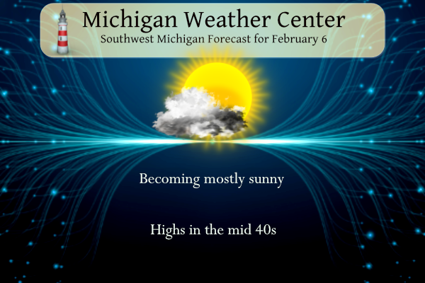
Yesterday we reached 48° with mostly sunny skies which is warm by February standard. We have a similar day in store today. Dry conditions continue through Thursday. Mostly cloudy skies will be present at least through the morning hours today, with more clouds expected for Wednesday and Thursday. Temperatures during this time will gradually warm with highs likely in the 50s Thursday. The next chance for rain holds off until late Thursday afternoon.
Forecast
Weather History
1895: Lower Michigan is in the midst of a week long siege of arctic air. High temperatures struggle through the single numbers while morning lows fall well below zero. Lansing falls to 14 below zero on this date after lows of 24 below on the 4th and 20 below on the 5th. Grand Rapids hits 9 below after falling to 16 below on the 5th.
1938: The weight of ice and water carried away the west side of the Rogue river dam at Childsdale.The Souffrow bridge near North Belmont was closed to traffic as its footing had been swept away by the river. Several houses along the east bank of the Grand River were flooded.
2008: Near blizzard conditions occur across part of Lower Michigan with snowfall rates of one to two inches per hour. More than a foot of snow fell north of Interstate 96 to Route 10. Further south, a wintry mix of snow, sleet and freezing rain occurred from Kalamazoo to Jackson. The storm drops more than 8 inches of snow at Grand Rapids, contributing to the snowiest February on record with 41.6 inches.
2019: An ice jam on the Grand River in Portland caused flooding along Water Street in downtown Portland, where about 50 people were evacuated from their homes. The ice jam shifted and thickened a couple of days later, causing additional flooding. Many businesses along Kent Street were flooded, and people along Canal and Market streets were evacuated. The ice jam held for more than three weeks before finally melting and shifting downstream. Some homes on Water Street experienced continuous flooding for most of this three-week period.
On February 6, 2008, a hit most of Southeast Michigan. Widespread amounts ranged from 6 inches across central Livingston, Oakland and Macomb Counties to greater than 10 inches for all of the Flint (11.3 inches at Bishop Airport), Tri-Cities (12.0 inches at Tri-Cities Airport), and Thumb regions. Areas across the southern Saginaw River Valley were dumped with 16 to 18 inches of snow from southwest Saginaw to Birch Run to Vassar.
U.S.A and Global Events for February 6th:
1958: The Munich air disaster occurred when British European Airways Flight 609 crashed on its third attempt to take off from a slush-covered runway at Munich-Riem Airport, West Germany. On the plane was the Manchester United football team, nicknamed the “Busby Babes,” along with supporters and journalists. Twenty of the 44 on the aircraft died at the scene. The injured, some unconscious, were taken to the Rechts der Isar Hospital in Munich, where three more died, resulting in 23 fatalities with 21 survivors. Click HERE for more information from the BBC.
1978: A massive nor’easter buried the northeastern U.S. Storm totals’ cities, including 18 inches in New York City, 16 inches at Philadelphia, and 14 inches in Baltimore. The Boston MA area received 25 to 30 inches in “The Great New England Blizzard.” The mayor outlawed travel in the city for an entire week. Click HERE for more information on the History Channel. Click HERE for more photos from CBSNews.

2010: On February 5-6, a severe nor’easter, commonly referred to as Snowmageddon, impacted the east coast from North Carolina to New York. Some snowfall amounts include; 32.9 inches at Washington Dulles International Airport; 28.5 inches at the Philadelphia International Airport; 21.1 inches at the Pittsburgh International Airport; 18.2 in Atlantic City; and Trace in Central Park.


2020: The Esperanza Base, the northern tip of the Antarctic Peninsula, 63°23′S, reached 18.3°C (64.94°F), on February 6th, 2020. The 18.3°C sets a new, all-time high temperature for the continent of Antarctica. The previous record was 17.5°C in 2015, also at Esperanza. Please Note: A verification process needs to be done before certifying as a new record.
Forecast Discussion
- Low clouds and fog expected again this morning and tomorrow

 The back door cold front spurred on the westward spread of
another round of overnight low clouds. The biggest question
today is as upper level high clouds move in from the west and
the low clouds move from the east, where and when clearing will
occur.
 The HREF cloud ceilings seem to be doing a decent job compared
with current satellite. The best clearing and warming for us
should be around Jackson this afternoon. Low clouds should
persist through most of the morning and into early afternoon. Those
clouds will limit the spread of early morning patchy fog. While
there remains possible fog right around sunrise, any reduced
visibilities will improve by mid morning. Clouds will linger
into early afternoon before finally starting to clear out.
There should be some sunshine but not as prevalent as the last
few days. The sunniest region could be along the US 127 corridor
as dry air filters in behind the front from the east.
 Another round of low clouds with patchy fog will greet the
region Wednesday morning. High pressure moving eastward should
allow for warm air advection and warmer temperatures Wednesday.

- Rain Returns Late Thursday Afternoon into Friday

Not much has changed in the extended. It does look like western
portions of the area could see rain move in during the late
afternoon with the initial round of positive vorticiy advection,
otherwise Thursday evening into Friday morning looks to be the best
chance (60 to 80 percent) for rain. This is due to the added support
from the upper level jet and the low level convergence from warm air
advection along with the low level jet. The low level jet will also
cause some breezy conditions with southwest winds gusting to around
30 mph on Thursday and 35 mph on Friday. Total rainfall amounts look
to be a quarter of an inch or less.

- Colder Temperatures, Chances For Rain and Light Snow Into Next Week

Saturday is trending drier with the next round of precipitation
chances (30 to 40 percent) moving in Sunday night with a round of
positive vorticiy advection within a shortwave trough. With this
trough we`ll see temperatures decrease with 925mb temperatures
falling below 0C and 850mb temperatures cold enough for dendrites to
develop. Before this colder air works in precipitation will likely
be rain and then transition to snow Monday. With the northwest flow,
we`ll continue the slight chances (20 to 30 percent) for snow into
Tuesday. At this time any accumulations look light.
Maybe I will post the CPC temp map everyday for the next 2 weeks, like Andy does anytime the CPC shows above normal temps! No, I will not resort to something that ridiculous! Bottom line is the pattern will be changing next week to a colder regime! Now all we need is SNOW! Bring it!
I like the way things are trending. Bring on some snow along with it!
This is totally not weather related… looking for my people who work with photos. I am taking pix out of old sticky books. Pix are coming out well, but have dried glue on back… any ideas how to get that off without destroying pic? I want to run them through a self feed scanner?? Thanks for your help!!!
A good way to get the photos out of the album is peel one corner and then use dental floss to slide between the photo and the page.
For the adhesive on the back of the photo, I would try a warm, not hot, hair dryer to soften the adhesive and then gently peel/scrape it with your finger. I might even try Goo Gone too. I’d use just a small amount on one section to test it out first.
Thanks .. I have used the blow dryer to get ones that are stuck out of book. It works great. The pix are coming out, just dried glue on it for being there for like 30 yrs.
I have a great scanner it even takes out the pinking/orange colors from the pix.
Horrible winter weather this week! Bring on the cold and snow!
The official H/L yesterday at Grand Rapids was 43/23 there was no rain/snowfall. The sun was out 99% of the possible time. The 1st 5 days have now had a mean of 34.0 at GR that is a departure of +9.6 at Lansing their mean is 31.9 for a departure of +8.3. For today the average H/L is 32/18 the record high of 54 was set in 1938 and the record low of -9 was set in 1895 and 1977. The record snowfall was 8.1” in 2008 the most on the ground was 21” in 2014. Last year the H/L… Read more »
Wow, 50 and 48 degrees the past two days. Should be even warmer later this week!