We have another snow event approaching from the west which will cause hazardous travel conditions for tomorrow morning’s commute.

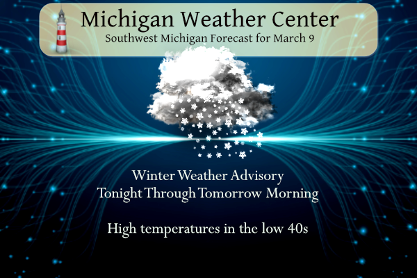
Winter Weather Advisory
...WINTER WEATHER ADVISORY IN EFFECT FROM 7 PM THIS EVENING TO
11 AM EST FRIDAY...

* WHAT...Snow expected. Total snow accumulations of 4 to 6
  inches.

* WHERE...Portions of central, south central, southwest and west
  central Michigan.

* WHEN...From 7 PM this evening to 11 AM EST Friday.

* IMPACTS...Plan on slippery road conditions. The hazardous
  conditions could impact the morning commute.
...WINTER WEATHER ADVISORY IN EFFECT FROM 10 PM THIS EVENING TO
11 AM EST FRIDAY...

* WHAT...Snow expected. Total snow accumulations of 4 to 6
  inches.

* WHERE...Portions of northern Indiana, southwest Michigan and
  northwest Ohio.

* WHEN...From 10 PM this evening to 11 AM EST Friday.
...WINTER WEATHER ADVISORY IN EFFECT FROM 7 PM THIS EVENING TO
9 AM EST FRIDAY...

* WHAT...Snow expected. Total snow accumulations of 4 to 6
  inches.

* WHERE...Cass MI, Northern Berrien and Southern Berrien
  Counties.

* WHEN...From 7 PM this evening to 9 AM EST Friday.

* IMPACTS...Travel could be very difficult. The hazardous
  conditions could impact the morning commute.
...WINTER WEATHER ADVISORY IN EFFECT FROM 1 AM TO 8 PM EST
FRIDAY...

* WHAT...Snow expected. Total snow accumulations of 3 to 6
  inches. Winds gusting as high as 35 mph.

* WHERE...Huron, Sanilac and St. Clair Counties.

* WHEN...From 1 AM to 8 PM EST Friday.

* IMPACTS...Plan on slippery road conditions. The hazardous
  conditions could impact the morning or evening commute.

* ADDITIONAL DETAILS...A period of snowfall will begin early
  tonight and end early Friday afternoon. The heaviest snowfall
  rates of a half inch to an inch per hour are expected to occur
  during the morning commute which would lead to reduced
  visibility and snow covered roads. Northerly winds may then
  lead to a period of lake effect snowfall during the evening and
  into the overnight leading to additional light accumulations.
...WINTER WEATHER ADVISORY IN EFFECT FROM 10 PM THIS EVENING TO
2 PM EST FRIDAY...

* WHAT...Snow expected. Total snow accumulations of 3 to 6
  inches.

* WHERE...Portions of southeast Michigan.

* WHEN...From 10 PM this evening to 2 PM EST Friday.

* IMPACTS...Plan on slippery road conditions. The hazardous
  conditions could impact the morning commute.

* ADDITIONAL DETAILS...A period of snowfall will begin early
  tonight and end early Friday afternoon. The heaviest snowfall
  rates of a half inch to an inch per hour are expected to occur
  during the morning commute which would lead to reduced
  visibility and snow covered roads. Snowfall will taper off in
  the early afternoon.
Grand Rapids Forecast
3 9 grrLansing Forecast
3 9 lanKalamazoo Forecast
3 9 kzoForecast Discussion
Forecast concerns deal with the approaching snow event across
southwest Lower MI.

...Dry today, plowable snow develops this evening...

A short wave passing over the central Rockies is inducing weak
cyclogenesis over western OK early this morning. Short range models
indicate this developing low will move ENE throughout the day and
track across southern IN/central OH tonight and Friday. This is
typically a track that keeps heavier snow south of the cwa. However,
the track of the upper supporting wave moves right over southern
Lower and will help support snowfall production.

Regional radar shows weak echos west of the lake slowly moving east.
These are the result of mid level isentropic lift associated with
some 700mb temperature advection but due to the fairly dry
atmosphere ahead of it, the echos are resulting in ceilings lowering
and we`ll continue to see that today.

A better feed of moisture from the Gulf and more robust isentropic
lift ahead of the low sets up late this afternoon and evening. Lift
is progd nearly perpendicular to the pressure surfaces resulting in
efficient lift and quicker saturation as we get closer to 00z.

ECMWF/GFS/NamNest/HRRR show snow developing around 01z in far
southwest Lower and moving east during the evening. Collaborated QPF
coupled with SLRs around 11:1 yield snow totals in the 4-6/7 range
over the southern cwa and 3-5 inches across the northern half. The
snow falls in roughly a 15 hr period. Thus, this looks like a solid
advisory versus warning for our cwa. As such, we have issued a
Winter Weather Advisory from 7 PM tonight through 11 AM Friday.
Solid upward omega exists throughout the DGZ from 9PM tonight
through 8 AM Friday and snowfall rates around a half in/hr are
possible. Surface temperatures around freezing will result in a wet
heavy snow, once again. The snow will diminish Friday afternoon.

...Weaker system Sunday/Monday...

A split jet across the CONUS late in the weekend will result in a
couple of lows moving east across the country. The northern low will
move across the state Sunday night. Meanwhile, the stronger southern
low will move east over the TN Valley and feed off of the Gulf
moisture instead of the moisture flowing farther north. As a result,
snow totals will be held down and should remain in the 1-2 inch
range.
Snowstorm performed well above expectations in some areas. What a big snowstorm! Let the good times roll.
I might be skiing into April this year! What a winter!
Our wild , snowy record breaking winter keeps rocking! Incredible!
There are snow totals being reported near a foot. Way over performing monster storm and still snowing!
What a storm, what a winter, snow, snow and more snow! We are headinG for a record breaking winter! Who would have thought! Wow to the wow!!!!!!
Wow this definitely over performed here! Lots of 6-12 inch reports
Yes it even performed better than the RDB predicted! This is about the 3rd overproduced GR gas seen this year!
Here’s the latest from our boy, Blake:
https://www.wlns.com/top-stories/weather-aware-day-snow-expected-thursday-night-into-friday/
I just saw something from Kalamazoo County Emergency Mgt and they have the sweet spot of 5-7 over southern Allegan, Barry, East Van Buren & Kalamazoo counties. Blake has it more towards the middle of the state… it will be interesting.
Found the link from the NWS…https://twitter.com/NWSGrandRapids/status/1633839932879028225?ref_src=twsrc%5Egoogle%7Ctwcamp%5Eserp%7Ctwgr%5Etweet
Blake is right in line the RDB! Good job Blake! As for school closings, there will be lot in the rural areas and some in the Immediate GR area but not GR Public! Mark it down!
Even GR Public closed! What a storm!
The snowstorm is looking great and with low temps in the 20’s next week and highs barely above freezing , this snow will stick around for awhile! Get out your sleds and snowshoes ready! I love it! Who wouldn’t love a snowstorm in mid March!
Winter storm warnings acoss the pond wow! INDY
You mean it is still winter and you can get a big snowstorm in mid March? Who would have thought?
In the NAM we trust! Bring it!
https://www.pivotalweather.com/model.php?m=nam&p=snku_acc-imp&rh=2023030912&fh=84
Rolling toward another 100+ inch Winter, in the Southern Arctic.
Check out the latest HRRR! It looks great for the GGR area!
https://www.pivotalweather.com/model.php?m=hrrr&p=snku_acc-imp&rh=2023030906&fh=48
I wish I was as enthusiastic as Rocky and INDY about snow in March. I’m definitely ready for spring… but Mother Nature can’t be controlled so I had might as well try to enjoy the WWA. Looks like we have about ~10 days or more of cool weather… probably several more snow chances :O
I’m not that excited about this system. Whatever does fall, won’t last. I’m more psyched about the B1G hoops tournament and March Madness. 🙂
Michigan is looking terrible!! INDY
Depending on how much we get, it might last until next Wednesday. Highs will be in the 30s until then
One of the coolest winter continues on. Let the good times roll!
Let the March snow party begin woo to the woo woo !!! INDY
Winter = awesome!
Snowstorms = incredible!
Rock n Roll = Eternal!
I want to start buying my coffee where Rocky and Indy are getting it. WOW TO WOW!!
Hey Bernie, winter is awesome, but having good cup of quality coffee in the morning helps! I recommend a high quality coffee and keep your machine very clean! Rock n roll will never die!
You are part of MV’s best you are in lol…its coffee that keeps you going going and going with a spash of snow … DDDDDD….INDY
What More snow in March for GR I love it!! Cant wait to get home and feel temperatures in the 30’s so refreshing better then this heat in Florida…LET IT SNOW LET IT SNOW LET IT SNOW! INDY
Is winter dead yet? Are accumulating snowstorms done yet! Are nice warm Spring temps right around the corner? What a joke! Another WWA has been issued and the RDB says 4 to 8 inches of snow is coming! I will be skiing again this weekend with more fresh SNOW! Wow and what a record breaking winter we are seeing! Incredible!
Wow to the wow!! Michael should add the RBD to the blog more accurate then wzzm on target lol…INDY
Rock on INDY and that is the spirit!
Winter weather advisorys for all of lower Michigan including GR GREATEST SCOTTY Isnt it Meteorologist Spring now lol…. INDY
The record breaking winter keeps Rocking and no change is in sight!
DDDDDD especially for GR yeahhhh INDY
Good morning. The official H/L yesterday at Grand Rapids was 44/24 there was no rain/snow fall. And there was 90% of possible sunshine. The overnight low and current temperature here in MBY is 32 with cloudy skies. For today the average H/L is now up to 42/25 the record high of 68 was set in 2000 and the record low of -7 was set in 1996 the record snow fall amount of 8.2” fell in 1998. Today should be cloudy with a cool NE wind and high near 40. Snow looks to move in later today and overnight and might… Read more »
GR is fast approaching a top 10 ten seasonal snowfall of all time! What a winter and no sign of let up!