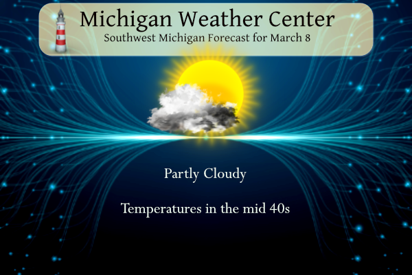
We have been blessed with many sunny days as of late and have another one in store. Looking westward we see a change coming for Thursday night with all the winter weather advisories and watches in place (see forecast discussion).

Grand Rapids Forecast
3 8Weather History for SW Michigan
March 5
1948: Arctic high pressure dominates the first half of the month of March with record lows this morning of 8 below zero at Grand Rapids and 5 below at Muskegon.
1976: Thunderstorms move over cold air near the ground to produce one of the worst ice storms in history across Wisconsin and Lower Michigan. From 2 to 5 inches of ice builds up on trees and power lines, resulting in hundreds of thousands of people without power, some for as long as ten days.
March 6
1956: Severe thunderstorms moved across Lower Michigan ahead of a strong cold front. A tornado destroyed five barns and unroofed homes in North Blendon and Bauer in Ottawa County.
March 7
1908: After heavy snow in February, heavy rains and warmer conditions set in, setting the stage for a disastrous flood. The Kalamazoo River flooded the town of Albion when the Homer Dam broke around 3 p.m. By midnight, the bridges surrounding the town were underwater. Six buildings in Albion collapsed.
1999: Arctic air and several inches of fresh snow on the ground combine to drop temperatures to a record low of 13 below zero at Lansing.
2000: Temperatures reach the 70s during a record early season warm spell. Grand Rapids hits 72 degrees and Lansing 74 degrees.
March 8
1943: Grand Rapids plummets to 13 below zero, the coldest ever recorded in March there. This caps a very cold period during the first ten days of the month, where four days had lows at or below zero at Grand Rapids.
2000: Temperatures soar into the upper 70s across Lower Michigan, with some places hitting 80 degrees. The 78 degrees at Grand Rapids is a record high for the date and for so early in the season.
2014: Severe and prolonged cold weather during the winter brought record ice coverage to Lake Michigan by early March. Ice coverage peaked at 93.29 percent on this date, just edging the record of 93.1 percent set in the winter of 1977.
2017: A powerful low-pressure center moving through southern Canada brings winds gusting over 60 mph across Lower Michigan for much of the day. Winds reach 64 mph at Grand Rapids. The winds cause millions of dollars in damage and large-scale power outages. Two people are killed when a tree falls on their vehicle while they were driving on M-115 in Clare County.
March 9
1996: Record subzero cold grips Lower Michigan with Grand Rapids and Lansing falling to 7 below zero and Muskegon hitting 6 below.
1998: Arctic air plunges across the Great Lakes after one of the warmest winters on record. The above-normal water temperatures contribute to heavy lake-effect snow squalls that produce blizzard conditions. From 8 to 12 inches of snow is piled into deep drifts by winds gusting over 40 mph.
March 10
1901: An ice storm across southwest Lower Michigan caused thousands of dollars in damage, and paralyzed telephone, telegraph, news wires, and railroads. Streams were swollen as rain fell onto frozen ground, resulting in many washouts and accidents. Similar conditions were also reported for St. Joseph, Grand Haven, Ionia, Coldwater, and Kalamazoo.
1993: A snowstorm drops 6 to 8 inches of snow across southwest Lower Michigan. Record daily snowfall includes 6.2 inches at Grand Rapids and 6.4 inches at Muskegon.
March 11
1948: Arctic air prevails with high temperatures in the teens and low temperatures near zero. Muskegon sets a record low of 2 degrees.
Weather History for SE Michigan
March 5
On March 5, 1900, a two-day snowstorm ended which dropped a total of 16.1 inches of snow in Detroit. This is the third heaviest snowstorm in Detroit since 1880! The storm was the last storm in a series of remarkable snowstorms which saw the 7th heaviest snowstorm on February 19, 1900, and then the 4th heaviest snowstorm on February 28-March 1, 1900. The March 1st and March 5th snowstorms helped to make it the snowiest March on record in Detroit, with 30.2″ of snowfall for the month. This is 23.2″ above average.
Also on March 5, 1948, there was an all-time high pressure observed at Detroit of 31.04 inches.
March 6
On March 6, 1960, the overnight temperature dropped to -6 degrees in Flint, which is the record low temperature for the day. Curiously enough, the very next year, in 1961, the daytime temperature rose to 64 degrees, setting the record high temperature for the day.
March 7
On March 7, 2000, the temperature rose to 75 degrees in Flint and 73 degrees in Saginaw. These are the earliest 70-degree days recorded in the cities of Flint and Saginaw.
March 8
On March 8, 2018, a long-duration accumulating snow came to an end as a slow-moving storm moved through the region. When it was finally over, accumulations approached one foot in Huron, Lapeer, and Sanilac Counties. A peak measurement of 14″ was taken in Cass City in Tuscola County.
Also on March 8, 2017, ideal high wind conditions took shape under perfectly sunny skies. Strong winds developed early Wednesday morning and intensified steadily into the afternoon. Widespread wind gusts in excess of 60 mph were recorded, including 68 mph in Detroit and Saginaw and 61 mph in Flint. The power outage footprint grew steadily through the day eventually leaving approximately 1,160,000 customers statewide without power. Final estimates indicate approximately half a billion dollars in damage.
Also on March 8, 2000, the temperature rose to 80 degrees in Flint, a record for the date and a tie for the 5th warmest maximum temperature for the month of March in Flint.
March 9
On March 9, 2002, A very strong cold front moved across southeast Michigan during the late afternoon hours of the 9th. A line of showers developed along the cold front. Very strong winds and brief heavy rain were associated with these showers. Behind the line of showers, powerful winds brought much colder air into the region. A low-pressure system, which moved across the northern Great Lakes during the afternoon of the 9th, strengthened during the evening as it moved northeast of the region. This allowed the strong winds to continue into the early morning hours of the 10th. In addition to the winds, temperatures dropped from readings in the 50s during the early afternoon of the 9th, to the 20s by late evening. Wind gusts measured between 60 and 70 MPH affected southeast Michigan during the passage of the cold front. Winds as high as 50 to 60 MPH continued into the night.
Hundreds of trees, power lines, and utility poles were blown down across southeast Michigan. Falling trees caused damage to several homes throughout the region. High winds also tore roofing material and siding off of many homes and businesses including Bentley High School in Burton and Ida Elementary in Monroe. A few cars were also struck by falling trees and branches. An estimated 180,000 homes and businesses across southeast Michigan lost power due to many power lines being blown down.
Also on March 9, 1987, the greatest 24-hour temperature drop occurred in Detroit. The temperature fell from 74 degrees on 3/8/87 at 3 pm in Detroit, to 23 degrees (a 51-degree drop) on 3/9/87 at 1 pm.
March 10
On March 10, 1992, 6.9 inches of snow fell with a winter storm that moved through Flint.
March 11
On March 11, 1946, the last snowfall of the 1946 season was recorded in Detroit and stands as the earliest date for the last snowfall in spring.
Forecast Discussion
--Late season snowfall expected Late Thursday through Early Friday

High pressure will continue to dominate the weather pattern
today and tomorrow.

The high pressure will slowly erode Thursday allowing for an
increase of cloudiness. A negatively tilted upper level trough
will dig through eastern Nebraska and become a closed low as it
enters the Great Lakes region. The biggest discrepancy with the
latest track of this system is that the NAM has the center of the
low in Michigan while the GFS and EC has it located in northern
Indiana. This disparity shifts the upper level air temps and the
QPF.

The models continue to trend the storm system quicker. The
precipitation arrival is now late Thursday night, early Friday.
Given 850mb temperatures remain around 0C to -2 C upon its arrival
and drop to -6C to -8C by 09Z Friday, there will be cold enough
temperatures for a strong Dendritic Growth Zone or DGZ.
 Snow forecast continue to trend upward with a solid 5 inches
right now across the southern half of lower Michigan. There are
some models that have higher amounts. However, compaction, time
of year and melting will dampen totals.
 The biggest concern is that snowfall will be heaviest just before
the morning commute so there could be some impacts to roads,
especially the I 94 corridor. Areas that received heavy snow last
Friday, could see another round.

-- More snow possible Sunday night into Monday --

More late season snowfall is on its way. An upper level low is
set to track through the upper mid west and through the Great
Lakes region late Sunday night into Monday. A mid level low is
shown to track in from the west northwest Sunday night into
Monday. Models are spread out on the timing and strength of this
feature however 850mb temps are in the -5C range. So mainly snow
is expected. There is deep moisture currently with this system
with the EC ensembles showing high mean specific humidity through
500 hPa. As that moisture should couple with lake enhancement,
lower Michigan should once again see more March snowfall though it
is a little early to beware the ides of March.
Nice storm track! Skiing here I come!
Get ready for the mid March snowstorm! Winter is still cranking up and the latest RDB model gives GR 4 to 8 inches of snow! Wow just wow! What a winter and we are heading toward a top 10 seasonal snowfall for GR! Incredible! And some said winter is dead! How wrong can they be?
Currently at 4pm Cape Coral Florida 91 degrees with our poool temp of 94 now thats some march warmth not sure how people can live down here year around no thanks!! INDY
I would live in that Hell hole, hot spot!
“Never”
Hey, I just turned on the noon news on ch 6 WLNS and Blake Harms is on. He transferred back to GR months ago. Anyone know if this is just temporary or a permanent move? The selfish me hopes it’s permanent. Blake is an outstanding TV meteorologist.
Okay, Blake said he’s only here today and tomorrow. FWIW – Blake said at this point, it looks like 3-6” for I-96 southward.
He’s from West MI. I think he grew up in Hudsonville. I agree that he is good. I really enjoy the addition of Sara Flynn on Storm Team 8. She covered the Iowa Derecho in 2020 I believe at a Cedar Rapids station and I think received an Award. She’s is good as well. Storm Team 8 has a solid team.
Nope, we aren’t giving Blake away to another station. He belongs here in west Michigan. I have known Blake since he was in high school – he used to be here on the blog back then. This young man is very smart and is a good fit for WOOD.
I remember when he was in high school. I thought (and still think) his school closure prediction was a unique, clever idea.
The latest graphic from NWS GR gives Grand Rapids nearly an 80% chance of exceeding 4” of snow
Sounds about right and preliminary RDB gives GR 4 to 8 inches! Stay tuned!!
Today is the “anniversary” of the March 8, 2017 wind storm. One of the more recent non-thunderstorm big wind events.
And yes, I am enjoying the sunshine!
I remember that day well. Very powerful winds that day with widespread power outages.
We now have 7 days of March in the record books. The first week of March has been a mild and at some locations snowy one. The mean so far at Grand Rapids is 36.3 that is +4.9 above average. The warmest so far this month at GR is 51 on the 5th and the coldest so far will be today with 24. There has been 0.54” of precipitation of that 3.0” of snow fall. At Muskegon the mean so far is 38.1 and that is a departure of +6.3. There has been 3.0” of precipitation and just 0.3” of… Read more »
Wow check out the Wimter storm coming already Wimter storm watches across the pond who would of thought for mid March a Wimter storm in GR the snow and cold just keep coming…INDY
The snow just keeps coming and coming! Epic winter even though some are saying winter is dead! lol!
We HAVE been blessed with the sunshine lately. I also enjoy it being light at 6:30 am and pm. Spring the clocks ahead this weekend, right? We had four young deer in our backyard this morning. That was a nice treat.
Have a great day and make someone smile 😁
Yes.. Spring ahead this weekend.