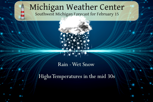
 We have a winter weather advisory until 11 am this morning. This quick-moving system will dump some heavy wet snow in the advisory area north of the I96 corridor where 2 to 8 inches will fall.
Temperatures will warm to 35 to 40 this afternoon with breezy conditions. Farther south along I-94, brief freezing rain will be possible before changing over to mostly rain. Temperatures this weekend will be notably colder.

NWS Forecast for Grand Rapids
Weather History
1954: A two-day surge of warm air into Lower Michigan peaks with record highs of 61 degrees at Grand Rapids and 60 at Lansing.
On February 15, 2015, Amid an intense cold outbreak during one of the coldest months in the climate record for Southeast Michigan, Detroit, Flint, and Saginaw all recorded daily records for the lowest average temperatures of -1, -7, and -5 degrees respectively. In addition, Flint and Saginaw recorded record low high temperatures of 2 degrees to go along with record lows of -17 and -13 degrees respectively.
Also on February 15, 1954, the daytime temperature soared to 66 degrees in Detroit, which is 32 degrees above average!
1852: In 1852, the long, cold winter froze the Susquehanna River in Maryland to a depth of 2 to 3 feet, preventing all ferry service. Railroad officials overcame this perplexing situation by laying tracks across the ice, with trestles for either bank’s inclines. During the several weeks from January 15 to February 29, approximately 1,300 cars with a total weight of 10,000 tons were hauled across the river from Havre de Grace, Maryland, to Perryville, Maryland.
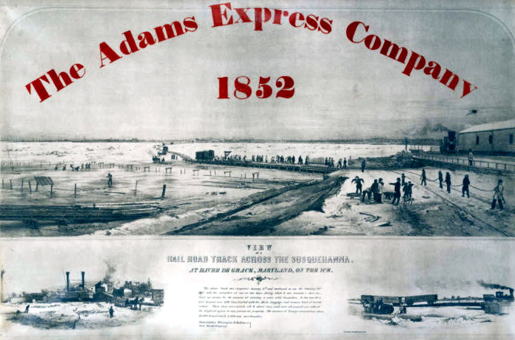
Railroad tracks on ice across the Susquehanna at Havre de Grace. Image Courtesy from Enoch Pratt Free Library.
1967: The Green Bay Packers beat the Kansas City Chiefs, 35-10, in Super Bowl I at the Memorial Coliseum in Los Angeles. From the weather station at the USC campus in downtown LA, the high temperature was 79 degrees, and the low was 51. There was a light west wind.
1972: In Flint, Michigan, the daytime temperature rose to only -3 degrees. This is the second coldest maximum temperature recorded in the city of Flint since 1921. Detroit’s high temperature was zero.
Forecast Discussion
- Impactful snow for the morning commute

Main change this update was to raise snowfall amounts along the
I-96 corridor and to introduce a brief period of freezing rain
farther south towards I-94 in the Jackson County region. The
freezing rain threat would be mainly between 8 and 10 am prior
to the onset of heavier precipitation. While it`s a brief time
window, this nonetheless introduces a sneaky additional risk
component with the initial onset of precipitation. Surface
dewpoints across most of southwest Lower MI currently are only
around 20F and radar indicates that reflectivities aloft are
constrained to above 7000-8000 ft AGL. So, there remains plenty
of dry air to overcome and this supports an initial period of
freezing rain with accumulations generally on the order of a few
hundredths of an inch prior to changing over to rain as
precipitation intensity increases.

The atmospheric moistening process should be hastened with the
approach of activity currently over northern IL that is
characterized by substantial forced ascent resulting from lower
tropospheric frontogenesis, mid-level instability (negative EPV),
and higher reflectivities. Maximum snowfall intensity for the Grand
Rapids metro area now looks to be in the 6am to 8am timeframe,
which unfortunately aligns nearly perfectly with the morning
commute. Timing farther east in the Lansing area will probably
be shifted about an hour later (or less). Snow intensities
farther north look impressive. For example, the Mount Pleasant
area may see rates approaching 2" per hour in the 7-8 am
timeframe.

As noted previously, this event will be a quick hitter with
snow ending before noon.

- Colder with lake effect snow showers this weekend

Arrival of -18C air at 850 mb will generate lake effect snow showers
Friday night into Saturday. Inversion heights briefly jump to 7-10K
feet Friday night with steep low level lapse rates, which should
result in locally heavier snow showers in the favored northwest flow
snow belts near and west of Highway 131. Some travel impacts appear
likely as temps fall into the teens.

Inversion heights are shown to eventually fall below 5K ft on
Saturday and snow shower coverage and intensity should dwindle
accordingly by afternoon. Cyclonic flow continues Saturday night
into Sunday as a sfc low tracks by to our north, but moisture
profiles look quite shallow during this time so mainly just flurries
anticipated at this time.

- Moderating temperatures early next week

The cold air doesn`t stick around long as familiar El Nino split
flow jet configuration returns next week. Guidance high temps are
back up near 50 again by Tues-Wed with rain being the favored p-type
with the next system which arrives on Wednesday.
If you love snow, it will be around all weekend with mid winter temps!
GR had record snowfall today! I picked up 6.5 inches of snow today! What a monster snowstorm! Incredible snowstorm!
40+ mph wind gusts – borderline wind advisory criteria. A couple of power outages over here.
What a storm! Tons of snow!!!!!
37 and warm ground. The snow is melting quickly. The streets are clear and I bet half the snow that fell this morning has melted already.
Yeah, grass is poking through the snow here too.
Lansing is a different World! We got pounded with snow and still have a solid 4 inches on the ground! More snowshoeing tomorrow after a record breaking snowfall! Nothing better! Winter rocks!
Snow is done here. Roads are in rough shape – sloppy and greasy. We rec’d two, maybe three inches.
If you love snow get outside early today, it ain’t gonna stick around long!!!!!!!!!!!!! Glad I’m inside and warm!!!!
https://weather.com/weather/tenday/l/52aab230ef88e4f2bb12857231a5dd58392e78a71b90e01d57a11d827658eb55
Hmmmm…..looking through yesterday’s posts don’t think anyone said today was going to be a non event????????????????????? Just some wondering where the rain snow line was going to fall……………
What a storm! So much for a non event like some on here said yesterday! Snowshoeing here I come!!!!!! I love it!!!!!!!!!!!!
I will enjoy the beauty for now, but I am doubtful it will stick around. Sun is already melting all of it on cars and stuff. The next few days look to be seasonal, for a change, but then we go right back up to these persistent warm temps.
4” at my house and still snowing hard! I absolutely love it!
Snow is done here – we received 1.5 inches. This brings us to 28.5 inches for the winter.
Wow that was a heavy snowfall rate from about 6-8am. Still snowing… but looks to tapper off soon. I can’t complain, this is essentially the first snowfall of the month. But I was enjoying clear sidewalks and streets
Yep, VERY mild and easy winter so far, don’t mind this little blip of snow.
Here is the good news though….
The cold air doesn`t stick around long as familiar El Nino split flow jet configuration returns next week. Guidance high temps are back up near 50 again by Tues-Wed with rain being the favored p-type with the next system which arrives on Wednesday.
Whew! That is some heavy snow out there! Glad I’m in my office working! Luckily this thing is a quick hitter!
Man, I wish we were getting that. It just started here in the past 30 minutes. Not much yet.
Yeah it was snowing like 2 inches per hour here when I was heading into work. Drive wasn’t too bad, just took it slow. Just glad it was snow and not the freezing precip.
Wow what an event! Take it easy folks. Roads are in horrible shape.
At the current time there is snow falling and the temperature is 31. I now have just over 3” of snow on the ground.
Slim
The official H/L yesterday at Grand Rapids was 42/22 there was no rain/snow before midnight. The sun was out 56% of the possible time. For today the average H/L is now up to 34/19 the record high of 61 was set in 1954 the record low of -8 was set in 2015. The most rainfall of 0.43” was in 1992 the most snowfall of 4.8” was in 1990. The most snow on the ground was 21” in 1985,1936 in 2014 there was 20” on the ground. Last year the H/L was 52/37 and there was 0.32” of rainfall.
Slim
The average high is finally starting to climb at a faster rate. Should be approaching 40 in about 2-3 weeks
Incredible
Snow
Rates!
So much for the warm weather nuts predictions! Throw them out the window!
Wow , what a storm! All snow baby- up to 3 inches and counting! Incredible snowfall rates! Wow, just wow, WOW!
Sheesh, you can tell that the salt trucks haven’t been needed in a month. They’re out dropping tons of salt.