Michigan, a Cold State?
Did you know that we live in one of the coldest states in the country? It looks like our state is around the 10th or 11th coldest state. Here are some statements and links to some sites list states to how hot or cold they are.
The United States of America is a vast country, spanning from the warm climates of Florida and Hawaii to the freezing temperatures of Alaska and Maine. The differences between states in terms of temperature can be immense, with some areas seeing temperatures ranging from below 0 degrees Celsius in winter to sweltering heat waves during summer months. In the northern states such as Minnesota, Wisconsin and Michigan, temperatures can drop to -30 degrees Celsius during the coldest months of year while states located further down south like Louisiana and Mississippi may only experience temperatures around 5-10 degrees Celsius at their coldest. Many states also experience varying amounts Read more.
There weren’t exactly any shockers on the list; every state is situated in the upper half of the country. More interesting, perhaps, is the differences between neighbors. North Dakota is nearly five degrees colder than South Dakota, and Vermont is a single degree colder than New Hampshire. Washington edged out Oregon by just 0.6 degrees. Read more.
https://www.mentalfloss.com/posts/coldest-states-in-us
Michigan is the tenth coldest state in America. The winters are brutal, and the weather is characterized by ice, snow, wind, and freezing temperatures. The annual Annual average temperature in Michigan is 44.4°F (6.9°C). Winter starts in December and lasts until mid-March. Read more: https://www.legit.ng/ask-legit/top/1526806-10-coldest-states-record-lowest-temperatures/
And one more. With a mean temperature of 44.4°F, Michigan is tied for the ninth coldest state in the United States. Michigan’s climate is influenced largely by its closeness to the Great Lakes and its position in the Midwest. In the winter, the northern regions of Michigan see night temperatures below 0°F.Read more
https://usabynumbers.com/coldest-states-in-the-us/
While there were showers in the area yesterday here in MBY I only had a few sprinkles. Officially at Grand Rapids 0.02” was reported. The official H/L yesterday was 68/50 and only 5% of possible sunshine was reported. The overnight low in MBY so far has been 46. For today the average H/L is 71/50 the record high of 92 was set in 1977 and the record low of 30 was set in 2002. The most rain fall of 3.39” fell in 1996.
AREA FORECAST DISCUSSION
NATIONAL WEATHER SERVICE GRAND RAPIDS MI
334 AM EDT SAT MAY 20 2023
LATEST UPDATE…
DISCUSSION/MARINE
DISCUSSION
(TODAY THROUGH NEXT FRIDAY)
ISSUED AT 332 AM EDT SAT MAY 20 2023
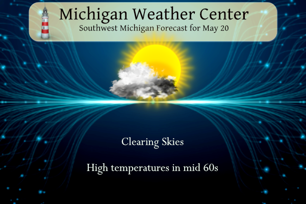
– LOW CLOUDS THROUGH MIDDAY, THEN CLEARING
A REGION OF STRATUS ACROSS NORTHERN LOWER MICHIGAN WILL PROPAGATE
S/SE INTO THE MORNING HOURS AS WRAPAROUND LOW LEVEL MOISTURE,
ASSOCIATED WITH THE DEPARTING CLOSED UPPER LOW, ADVECTS INTO THE
AREA. HOWEVER, LOW CLOUD COVER IS NOT EXPECTED TO LAST LONG AS
MOISTURE QUICKLY PEELS AWAY. BY MID TO LATE AFTERNOON, MOST AREAS
WILL BEGIN CLEARING OUT. HIGHS WON’T GET OUT OF THE 60S TODAY GIVEN
850 MB TEMPS BOTTOM OUT AROUND 0C BETWEEN 09Z-12Z AND GRADUALLY
MODERATE FROM THERE.
– EXTENDED PERIOD OF DRY WEATHER LIKELY…BUT HOW WARM?
THERE CONTINUES TO BE VERY LITTLE RISK FOR ANY PRECIPITATION THROUGH
THE UPCOMING WEEK, BASED ON ENSEMBLE GUIDANCE AND THE OVERALL
SYNOPTIC PATTERN. DETERMINISTIC MODELS SUCH AS THE GFS AND CMC ARE
TRYING TO DEPICT A FEW SPRINKLES OR LIGHT SHOWERS DEVELOPING ALONG A
LAKE-INDUCED SURFACE BOUNDARY (WEAK CONVERGENCE JUST INLAND OF LAKE
MICHIGAN) ON MONDAY. HOWEVER, MODEL DEWPOINTS ARE PROBABLY TOO HIGH
AND IN REALITY THE LCLS WILL PROBABLY BE HIGHER AND SUB-CLOUD RH
WILL BE LOWER THAN THESE MODELS ARE ADVERTISING. AS A RESULT, WE’RE
FAVORING DRY CONDITIONS BUT CAN’T RULE OUT SOME POSSIBLE SPRINKLES
ON MONDAY (OR JUST SOME VIRGA FROM HIGH-BASED CUMULUS).
UPPER LEVEL PATTERN UNCERTAINTIES ARE NOW BEING INTRODUCED FOR THE
MIDWEEK PERIOD, LEADING TO SOMEWHAT LOWER CONFIDENCE IN THE DEGREE
OF WARMTH FROM WEDNESDAY INTO FRIDAY. THE ECE GUIDANCE SHOWS A FAIR
AMOUNT OF SPREAD IN MAX TEMPERATURES FOR WEDNESDAY. THE 18Z RUN FOR
GRAND RAPIDS SHOWS THE 25TH PERCENTILE MAX TEMPERATURE AT 65
DEGREES, WHILE THE 75TH PERCENTILE IS 82. HAVING A 17 DEGREE SPREAD
MEANS THE ECE MEMBERS ARE SHOWING A VARIETY OF OUTCOMES, WHICH IS
DUE TO HOW DEEP UPPER TROUGHING ACROSS ONTARIO WILL BE MID WEEK AND
HOW MUCH OUR UPPER HEIGHTS MAY BE SQUASHED. THE 00Z ECMWF, GFS, AND
GEM ARE ALL SUGGESTING A BACK DOOR COLD FRONT MAY SWING THROUGH
WEDNESDAY. IF THIS OCCURS, OUR CURRENT FORECAST OF HIGHS AROUND 80
DURING THAT PERIOD WILL BE TOO WARM. WHILE STILL THE MOST LIKELY
OUTCOME AT THIS POINT, IT IS CERTAINLY NOT THE ONLY OUTCOME, AND WE
WILL HAVE TO SEE IF MODELS TREND COOLER DURING THE MID TO LATE WEEK
PERIOD OR BACK OFF ON THE BACK DOOR COLD FRONT SCENARIO (LIKE THEY
DID FOR MONDAY BASED ON EARLIER RUNS).
WITH PROLONGED DRY CONDITIONS LIKELY THROUGH THE WEEK AND ABOVE
NORMAL TEMPERATURES ANTICIPATED, MINIMUM RH VALUES COULD EASILY DIP
BELOW 30% AT TIMES. WE WILL HAVE TO MONITOR FOR ELEVATED FIRE RISK
GIVEN THE ANTECEDENT CONDITIONS (DRIED OUT FINE FUELS ACROSS
CENTRAL/WEST CENTRAL LOWER MI AND BELOW NORMAL PRECIPITATION THIS
MONTH).
Detailed Forecast For Grand Rapids
Today
Mostly cloudy, then gradually becoming sunny, with a high near 67. Northwest wind 10 to 17 mph, with gusts as high as 26 mph.
Tonight
Mostly clear, with a low around 46. Northwest wind 6 to 13 mph becoming southwest after midnight.
Sunday
Sunny, with a high near 75. West northwest wind 6 to 13 mph, with gusts as high as 21 mph.
Sunday Night
Mostly clear, with a low around 50. West wind 5 to 9 mph becoming light and variable.
Monday
Sunny, with a high near 78. East wind 6 to 8 mph.
Monday Night
Partly cloudy, with a low around 54.
Tuesday
Sunny, with a high near 82.
Tuesday Night
Mostly clear, with a low around 58.
Detailed Forecast For Lansing
Today
Increasing clouds, with a high near 65. West northwest wind 8 to 14 mph, with gusts as high as 22 mph.
Tonight
Mostly clear, with a low around 47. West wind 8 to 13 mph.
Sunday
Sunny, with a high near 76. West northwest wind 7 to 10 mph.
Sunday Night
Mostly clear, with a low around 49. West northwest wind 6 to 8 mph becoming northeast after midnight.
Monday
Sunny, with a high near 76. East northeast wind 6 to 8 mph.
Monday Night
Mostly clear, with a low around 52.
Tuesday
Sunny, with a high near 82.
Tuesday Night
Mostly clear, with a low around 58.
Just another typical cloudy, breezy, below normal temp Spring day! The beat goes on and on and on! Wow, just wow, WOW!
Gonna be nice to not have to read this copy and pasted post starting Monday!! Warmer than normal temps coming with no end in sight!! Wow to the wow wow wow wow wow wow wow wow wow wow wow wow wow WOW WOW WOW WOW WOW WOW!!!
Well if it’s a high of 80 in July it is technically below average, so you might not be done 😂
Wow, just wow, WOW!
As we enter the last third of May here is a brief update as to where several locations stand. At Grand Rapids the mean is now at 56.4 that is a departure of -0.9 the high for May so far is 81 and the low is 36 at Lansing the mean is 56.9 for a departure of +0.5 their high so far is 82 and the low is 36. At Muskegon the mean is 57.2 for a departure of +1.3 the high so far there is 83 and the low 36. At Holland the mean is 55.9 for a departure… Read more »
Around the state Detroit -0.9, Flint -0.4, Saginaw -1.1, Alpena -0.8 Houghton Lake -0.3 are all below average. While The Sault, Marquette and Houghton are above average most of Michigan is below average in rain fall..
Slim
I’ve thought it’s been a rather cool May so far. Today feels like mid-fall. I’m looking forward to the warm up that starts tomorrow!
Well its May 20th up in Houghton the grass is now green and the leaves are starting to finally emerge. In most of the UP spring is a very short season.
https://www.mtu.edu/webcams/walker/
That would be a great place for any “true snow bird” to retire.
Slim
Take out the UP and I bet Michigan moves way down the list. How can you scientifically rank entire states in terms of temperature? That’s so silly.
The UP on its own would be much higher on the list. But Lower Michigan on its own would be in line with Iowa and New York. Not way down the list but still in the top 15 or so.
Slim
Mookie with his typical warm weather bias and propaganda! Incredible!
But its always so hot in Detroit Michigan lol…INDY
Yes, Detroit and Flint are usually 10 degrees warmer than GR! How is that possible! Absolutely incredible!
You know there is a small town with kind of a history north of Detroit. Think Oxford.
Slim
Rock on Slim!
I see GR picked up a whopping .02 inches of rain! What a joke!
Yup. Terrible. We probably got near that. It wasn’t measurable on my rain gauge.
Who wouldn’t want to live in one of the coldest states? Get ready for yet another below normal temp day! What a stretch of cool weather! Rock n roll will never die!!!
I would think that most people give a chance would like to live in a state a little warmer with less snow fall. Today is a rather cool late May day most areas here at the 1:30 PM time are in the 50’s
Slim
Who would want all that heat and humidity in the southern states? Crazy!